CA PCT 2018

Between Sections-San Diego

It felt good to take a break from the PCT and get ready for the next 1000 miles. Our original plan had us taking a week break and then heading to Northern CA where we would begin our trek south. Not sure how it happened but the week turned into three.  After a couple days of rest we started the prep work. It involved making more meals, drying them and packaging them. Then there was the task of determining our resupply strategy.  It is always a guess, but at least a calculated one. We ended up with 13 resupply locations. Beth, our trail angel on the home front, has agreed to send them to the appropriate places when notified.

P1010441.jpg
Doing resupplies in this way takes a lot of effort on the front end, but we have found for us, it simplifies our time in town. We also don't seem to tire of the food we eat each day.

Doing resupplies in this way takes a lot of effort on the front end, but we have found for us, it simplifies our time in town. We also don't seem to tire of the food we eat each day.

Other fun activities for the time we spent here was watching Ryan and Beth build a picnic table.

P1010449.jpg
And adding plants to the raised garden beds in the back garden.

And adding plants to the raised garden beds in the back garden.

P1010433.jpg

The time in San Diego has come to an end we leave in the morning to continue our journey on the CA PCT.

San Diego to Seiad Valley and back to Seiad Valley

We left San Diego on May 15th and headed north. It was like going down memory lane as we passed several locations where we had previously been walking the PCT. Vivid images came to mind as we gazed on the dry hillsides and wondered how the hikers were dealing with the heat and water.   Our destination for the night was Lone Pine where we planned to camp and get a close up view of the Sierras. When we pulled into the market at Lone Pine, the first hiker that we saw was a woman from Switzerland that we had met in early April. She and a friend had just hiked thru the snow in the southern Sierras. It did not sound like much fun. She had gotten the name Street Fighter as her hands were badly burned and she had kept them under wraps. They were headed off to find a place to rest for several days. We were headed off to find a campsite with the Sierras as a backdrop.

Not much snow on this side of the range, but we are assured that there is plenty when one heads deep into the range.  If our plan holds we will be back to hike the Sierras early July and do not anticipate much snow at that time.

Not much snow on this side of the range, but we are assured that there is plenty when one heads deep into the range.  If our plan holds we will be back to hike the Sierras early July and do not anticipate much snow at that time.

Looking towards Mt. Whitney. Our goal when we hike thru the sie is to summit Mt. Whitney, the highest peak in the lower 48.May 16

Looking towards Mt. Whitney. Our goal when we hike thru the sie is to summit Mt. Whitney, the highest peak in the lower 48.

May 16

We leave Lone Pine in the morning and head North once again. This time stopping at some of the towns along the way.  Bishop, a small town on the way, is home to the famous Schats Bakery, which is quite full of hikers and tourists when we check it out. We notice a familiar hiker whom we have met before, almost a month earlier. It is Snowwhite.  She is hiking straight thru, no flipping for her! Her hike sounds somewhat epic, we wish her well and continue on our journey northward. The final stop for the day is at Carson City, Nevada. Donna's cousins from PA live here and we are excited to catch up on their lives. We tell them about trail angels and they are anointed into the group. They will be helping us with some of our logistics.

Thanks Bob and Marsha!

Thanks Bob and Marsha!

May 17

After a delicious breakfast, the road beckons us once again. Since we are driving past some of the places that we will be hiking by, we have decided to drop off some of our resupply packages. The first stop is Burney Guest Ranch where the owner shows us where to put our box and tells us that only a few hikers have stopped here. It is still quite early for hikers, however the rumor mill is telling of many hikers who plan to skip the Sierras and flip to the North and then head south. Our next stop is in Castella where we give our resupply boxes to Amarettis market. Only a few boxes are on the shelves. Our final destination is Seiad Valley where we hope to begin our hike tomorrow. Seiad Valley is where we ended our hike when we did the Oregon PCT in 2014. It is quite the windy road to the town and when we finally arrive to Seiad Valley, we are greeted by closed signs in the only three buildings there, a PO, a store and a restaurant. Fortunately a man sees us and asks if there is anything that he can help with. When we say that we are looking for a place to park our car for a month, he tells us to follow him and he will introduce us to Debbie. Sure enough Debbie has a place for us to park our car.  The plan is for us to go camp at the trail head tonight and then Don will drive the car back to the storage location in the morning, hike back to the trailhead and we will begin our hike. All the details begin falling in place. On the way to the campground, the man who introduced us to Debbie drives by on his four wheeler. He stops to talk and we learn about the economy of the valley and perhaps more important that the Morels are popping up. He also mentions that we are early and that there most likely will be snow on the the North slopes. With that information in mind we head off to find the campground. A sign lying in the weeds let us know that we have arrived. There are also signs alerting us to the fact that sometime during the year hikers are on the road.

At least there was a sign!

At least there was a sign!

I think they mean us.

I think they mean us.

We unload the car and begin organizing our packs for the hike tomorrow.

P1010478.jpg

May 18

Up early and pack our packs, Don heads off with the car to put it in storage for the month. He returns several hours later having had to walk 6 miles on pavement. There wasn't much traffic this early in the morning.The excitement builds as we look for the trail and see the familiar sign.

It is somewhat buried and the trail is overgrown. It doesn't appear to have had many recent hikers, if any at all. Before we start our hike we take notice of this sign.

It is somewhat buried and the trail is overgrown. It doesn't appear to have had many recent hikers, if any at all. Before we start our hike we take notice of this sign.

This could make hiking interesting.

This could make hiking interesting.

No worries as we take the selfie to note the start of the hike.

IMG_4564.jpg

The trail is  overgrown and we often have to check what is beneath the plants to make sure we are on the trail.

The flowers are out of control as the variety amazes us.  We stop many times to snap photos and admire their beauty.

The flowers are out of control as the variety amazes us.  We stop many times to snap photos and admire their beauty.

IMG_4570.jpg
IMG_4572.jpg
IMG_4568.jpg
P1010485.jpg
P1010486.jpg
IMG_4601.jpg

Unlike the desert, water at the beginning of this hike is not lacking. The sound of flowing water is music to our ears.

We appreciate the several bridges that span the creek as we head up the valley.

We appreciate the several bridges that span the creek as we head up the valley.

IMG_4575.jpg

Eventually the bridges stop and we have to do a water crossing.

We put our water shoes to good use.

We put our water shoes to good use.

An interesting lizard stopped to investigate us. They seem to be quite plentiful in all the different environments of CA.

P1010492.jpg

Even a snail shared the trail.

IMG_4561.jpg

Water at the beginning of the trail was quite plentiful, but when the time came for wanting to camp, it seemed to be lacking. We had enough for dinner so we stopped, made dinner and then decided we would hike till we found a water source. Our map app gave us confidence that water should be found in the next several miles.  We saw a sign that advised us that we were entering the Marble Mountain Wilderness area. Don's brother worked here in the 80's and spoke highly of the area.

Shortly after the sign the first morel of the day was spotted.

Shortly after the sign the first morel of the day was spotted.

The dilemma began! We really did not have a way to cook the morels and therefore could not justify picking them. So it was a photo we took and smiles on our faces that we left the mushrooms alone. As we climbed higher and began to wonder if water wa…

The dilemma began! We really did not have a way to cook the morels and therefore could not justify picking them. So it was a photo we took and smiles on our faces that we left the mushrooms alone. As we climbed higher and began to wonder if water was going to appear, we heard the faint sound of water running. Soon we were setting up our tent and filling our water bottles. Our new motto for the trip is "Find the Good." We may have to remind ourselves of that occasionally.  It was a good day and we are happy to be back on the trail.

miles hiked Donna 17 Don 23(6 miles of road walking)

May 19

As the vistas opened up, the mountains made their appearance. 

And so did more flowers. We may call our hike the wildflower tour! It seemed like we had enjoyed the flowers in the desert and now we were enjoying them in their prime in the mountains.

And so did more flowers. We may call our hike the wildflower tour! It seemed like we had enjoyed the flowers in the desert and now we were enjoying them in their prime in the mountains.

Shooting Stars

Shooting Stars

Larkspur

Larkspur

We hadn't had to hike thru any snow yet, but as we looked ahead this was about to change.

At first it was just lingering snow patches in the forest.

At first it was just lingering snow patches in the forest.

P1010512.jpg

Fresh bear tracks kept our senses alert

IMG_4610.jpg

Flowers were interspersed between the snow fields. They were ready to push thru the earth as soon as the snow had melted.

IMG_4615.jpg

At first we were walking on relatively flat ground on top of the snow. This,however, was about to change. We still had hopes that we would be able to progress forward.

IMG_4617.jpg

This was especially true when the trail was completely lacking of any snow!

IMG_4618.jpg
P1010517.jpg
IMG_4621.jpg
We continue on and then the snow completely covers the trail.

We continue on and then the snow completely covers the trail.

IMG_4634.jpg
A snow bridge over a stream collapses and Don thankfully is able to get out before getting wet. We lose the trail and then find it after quite a search. The slopes are getting steeper and we have to be diligent of foot placement.  We kick steps…

A snow bridge over a stream collapses and Don thankfully is able to get out before getting wet. We lose the trail and then find it after quite a search. The slopes are getting steeper and we have to be diligent of foot placement.  We kick steps to the top of the ridge and find it free of snow. There is the trail, but as we look ahead the cliffs are snow covered and the trail buried.  It is time to have a serious conversation of how we want to go forward. That is if we want to go forward. We know what is involved retracing our steps. The unknown lies ahead and from what we see, it could be challenging.


IMG_4639.jpg
Not shown in this photo is the run out. If one slips, one would find themselves in a free fall over a cliff. Deciding that this is one risk we are not willing to take, we decide to eat dinner and hike back 5 miles to Paradise Lake. The snow has soft…

Not shown in this photo is the run out. If one slips, one would find themselves in a free fall over a cliff. Deciding that this is one risk we are not willing to take, we decide to eat dinner and hike back 5 miles to Paradise Lake. The snow has softened quite a bit in the late afternoon and we are able to slide down some of the slopes. This day has not gone as planned, but we are thankful that we have a mostly downhill hike out.

Flowers are again everywhere!

Flowers are again everywhere!

Find a place to set up the tent on snow free ground and are ready for a good night sleep.

Find a place to set up the tent on snow free ground and are ready for a good night sleep.

Miles hiked 20

May 20

We slept in, waiting for the sun to warm the air. When we did get up Paradise Lake was a photo to behold!

We felt good about our decision to return to Seiad Valley. It was time to retrace our steps and head back. The snow had melted from yesterday and in a lot of places our foot prints were gone. 

We felt good about our decision to return to Seiad Valley. It was time to retrace our steps and head back. The snow had melted from yesterday and in a lot of places our foot prints were gone. 

Some of the plants even seemed to have grown overnight!

Some of the plants even seemed to have grown overnight!

False Hellebore, a plant toxic to humans and animals

False Hellebore, a plant toxic to humans and animals

IMG_4655.jpg
Trillium

Trillium

IMG_4660.jpg

And then came a very exciting moment! Morels were popping up along the trail! The question was no longer should we pick them, but how many can we take safely back to the car.

Everywhere we looked, morels could be spotted!

Everywhere we looked, morels could be spotted!

And soon we had the pot filled with very fresh morels.

And soon we had the pot filled with very fresh morels.

It was easy to find the good in today!

It was easy to find the good in today!

I even started drying some when we reached our camp for the night.

The last couple of days, Donna has had a tooth beginning to hurt. We most likely will need to see a dentist when we get to Etna. Meanwhile though we are camped near a beautiful stream and have visions of frying up morels tomorrow. 

The last couple of days, Donna has had a tooth beginning to hurt. We most likely will need to see a dentist when we get to Etna. Meanwhile though we are camped near a beautiful stream and have visions of frying up morels tomorrow.


P1010534.jpg

Miles hiked 15

May 21,22,23

We arrived back to the trailhead that we had started on the 18th. Of course we saw more flowers that were worthy of a photo.

P1010538.jpg
Dogwood

Dogwood

We felt a selfie of our defeat was appropriate, but in reality we were super psyched to go buy a fry pan and eat morels, and then there was the dentist..... 

Don started the 6.2 mile walk back to get our car. He was hoping for a ride, but alas it was totally walking. Soon though he was back and we were driving to Etna. Arriving in Etna, we found the Hiker Hut to fit our needs. A trip to the grocery store…

Don started the 6.2 mile walk back to get our car. He was hoping for a ride, but alas it was totally walking. Soon though he was back and we were driving to Etna. Arriving in Etna, we found the Hiker Hut to fit our needs. A trip to the grocery store for a fry pan, butter and flour was productive. Soon the smell of morels cooking filled the air. 

P1010542.jpg
P1010543.jpg

We made ourselves at home in the Hiker Hut and felt grateful that no one else showed up while we were here.

P1010545.jpg
Lots of international hikers have stayed here and sent flags from their country.

Lots of international hikers have stayed here and sent flags from their country.

Donna was able to get a dentist appointment for the 22nd. It was determined that she probably would need a root canal done, but would need a specialist to do it. Most likely it would be at least a week or two before she could be seen.  Before I left the office  the receptionist said I don't believe it but there was a cancellation today and the specialist can see you at 2 in Medford. So off we went and she found herself getting another tooth exam.  This time though the specialist said that the roots were not visible and the course of action would be just to pull the tooth. His advise was to take Advil for pain and pull it when I got back to Portland. For what ever reason the pain has subsided so we bought more Advil and will continue with our hiking plan. If the tooth gives her more problems we will be looking for a dentist to extract it. On the 23 we took a rest and recovery day as well as a planning day.  Looks like we will drive to Dunsmuir, park our car there and once again start heading South. We will return to the Marbles and Trinities after we finish the hike to Sonora Pass. While Donna took the day easy on the 23rd, Don helped Dave, our host do some work around the property. Dave took him on a tour of the surrounding area. In the afternoon, the rains came pouring down. It was quite nice being in the hut and feeling quite cozy.

Dunsmuir to Burney Mountain Guest Ranch

May 24

 Up by 6 and ready to be back on the trail. We cleaned up HIKER HUT and said goodby to Dave and Vickie. She is in her mid 70's and he is 80. They keep quite active and enjoy entertaining their bed and breakfast clients. Their house is full of antiques that they have collected over the years. We felt quite blessed to have spent the last 3 nights here. It rained again during the night and we fell asleep listening to the rain on the roof. We are headed to Castella where we will pick up our food resupply at the market. We have changed our route some, but the food will still work out nicely. We will be returning to Etna to do the two sections that we missed due to snow after we get to Sonora Pass. It is a flip and flop maneuver, but feel that it is best for us to hike these two sections with not much snow. We arrive to Ammirati's Market around 10 and retrieve our food box from the market. We go into repack mode which just gets easier. We also keep trying to eliminate any thing that we don't think is necessary . Can't say we are ultralight, but our packs feel so much better than the older days of backpacking!

Packing up for a 100 mile section

Packing up for a 100 mile section

It is getting close to noon so off we head to the Burger Barn and fill up with a cheeseburger and shake. The joys of hiking lets one eat as much as possible. We need the calories! Our next stop is Crossroads in Dunsmuir where we have contacted the owner about parking our car for the month. She is just leaving to go to a weekend event, but decides that she can drop us off at the road head and take her dog for a short walk. Great! We park our car and hop into hers. We start out on a gentle uphill path lined with older trees. It is like a walk in a cathedral. We often reach out to touch the bark of the trees and are in awe of how long they have been here.

This was one of the smaller ones.

This was one of the smaller ones.

A plant that we do not touch that seems to be quite abundant is poison oak. We have been warned that this plant will cover a lot of the trail going south. It is almost impossible to miss, but we have long pants and long sleeve shirts so that should help.

IMG_4692.jpg

Poison Oak

A mountain feature that stands out in this area is Castle Crags. We often see it thru the trees as we gain elevation.

Castle Crags.

Castle Crags.

A fun app that we put on the I phone is plant snap. Since we have cell service during todays hike, we are able to identify two plants. 

IMG_4694.jpg
Pussy Toes

Pussy Toes

Pacific Bleeding Heart

Pacific Bleeding Heart

A baby rattlesnake crossed the trail in front of us. Guess it was warning us that we are sharing the forests. Hard to believe that we are back on the trail with 1000 miles to hike. Just taking one step at a time. Find a nice campsite near the trail and have spaghetti with dried morels for dinner. It is a good day for finding the good!

Miles hiked 7

May 25

When we woke up this morning, the first thing we saw outside our tent was a giant pine tree. So far we have not encountered many burned forests in CA. We hope that this will continue. We still remember the many miles of trail that we hiked thru the burned forests of Oregon. We see our first glimpse of Mt. Shasta from the trail.

MT. Shasta

MT. Shasta

The day is overcast and there is rain forecast. We hope it holds off for awhile. Meanwhile we notice a pine tree that is new to us. Later we learn it is called Knob pine. The cones are attached to the trunk and only open when exposed to heat.

Knob pine

Knob pine

Also hiking the trail today were 4 hikers going northbound.  Two were just hiking a section going north and then south to avoid any snow. Caveman and Hot Lips were getting their legs in shape to hike thru the Sierras mid June.  When we dropped off a box of food at Burney Mountain Guest Ranch, the owner had told us about this couple. It is always fun to put names with faces. The other two were older man who had skipped the Sierras and were hoping to head North. We told them what we had experienced in the northern mountains.  Today the trail was relatively gentle going up and down on a  tree lined trail.

Peaceful trail today

Peaceful trail today

Several bridges spanned creeks today. We always give thanks to the folks that maintain these trails.

P1010557.jpg

Plenty of dogwood brightened the trail today. The flowers were definitely in their peak.

P1010560.jpg

About 3, the overcast clouds opened up and rain began to fall. Out came the rain jackets and umbrellas. Unfortunately we encountered an overgrown trail and the bushes were quite soaking. We decided to call it quits for the day around 4 and luckily had a break in the rain and quickly put up the tent. Donna cooked dinner under her umbrella and the shelter of some pine trees. We were glad to be snugly in our tent when the the rain started pounding.

Miles hiked 16

May 26

By morning, the rain of last night had stopped and moisture was only dropping from the branches. We put on our rain gear including our water proof socks as the trail continues to be quite overgrown. The forest was quite lush and moss was growing on the trees. It appears that this section of the forest gets a good amount of rain.

Glad to see some blue sky!

Glad to see some blue sky!

The moss added another shade of green

The moss added another shade of green

As we worked our way down to the McCloud River a plant with intricate leaf designs caught our eye.

Wild Ginger

Wild Ginger

And of course more wild flowers

Along with the plant we are trying to avoid.

Along with the plant we are trying to avoid.

More poison oak!

More poison oak!

We heard the McCloud river long before we saw it. It was a beautiful blue color that poured over numerous rocks. We were glad to see that a bridge spanned its width.

McCloud River

McCloud River

It was Memorial weekend and numerous fishermen were here. We quickly passed by the parking lot and soon were surrounded by the quiet gentle giants of the forest back on the trail.

P1010588.jpg
looking up into the canopy

looking up into the canopy

Other plants that were also along the path included a variety of mushrooms. It is amazing how they are able to push the dirt away as they surface.

IMG_4712.jpg
IMG_4714.jpg

A movement on the ground caught our eyes. Not sure what we interrupted. but the grip on the one lizard  stayed as they moved off of the path.

P1010586.jpg

This slug looked like it was enjoying its meal.

P1010575.jpg

We met a couple who were trying to hike as much of the PCT as they can doing day hikes. They print off maps with dirt roads and then one will start hiking while the other one drives to another road, parks the vehicle and hikes to where they plan on meeting.  It is fun to learn all the different ways one hikes this trail. This was a good day to practice sauntering. gentle ups and downs with a good hiking temps. A sign near a trail head gave good advice.

P1010570.jpg

Miles hiked 21

May 27

Today, instead of mostly forested trails we also hike by very rugged terrain. A couple that we had met hiking the trail last night wanted to make sure that we looked out for a yellow non chlorophyll plant that they had protected with rocks. It was the first yellow one that they had seen.

Near it was a red flower with intricate leaves.

Near it was a red flower with intricate leaves.

So many colorful plants!

So many colorful plants!

Mt Shasta appears as a great backdrop. Still plenty of snow on its summit.

P1010606.jpg

This would be a great hike for those interested in geology.

P1010610.jpg
Even though we didn't know the geological event that occurred here, it made for a unique hike.

Even though we didn't know the geological event that occurred here, it made for a unique hike.

And of course there were more new flowers and a mushroom with a design.

IMG_4733.jpg
P1010615.jpg
P1010613.jpg

We thought that this was going to be the day that we did not meet anyone on the trail. Then we smelled a campfire and when we came out into a clearing we say a man cooking over a fire.  When he said "hello", Donna said," I know that voice" Sure enough it was the voice of Sid. We had met Sid the first day of our hike on March 24th. We had given him some water, which he now thanked us for. We exchanged stories of our hikes. He had some snow and storm stories that reinforced our plan to skip those areas for now. His home is on the trail and he is ready for a change.  One could tell he had been doing some serious thinking of his next steps. We wished him well and headed towards Clark Spring which proved to be a great campsite with a good spring. As usual we are thankful for the hike today!

Miles hike 21

May 28

We left Clark Spring after eating a hot breakfast. It was another day of gentle hiking with the trend being mostly down. The first plant that we saw was a purple version of the yellow one we saw yesterday.

it is a non chlorophyll plant that gets its nourishment from the roots of usually trees.

it is a non chlorophyll plant that gets its nourishment from the roots of usually trees.

Today was no exception for seeing new flowers.

IMG_4748.jpg
P1010625.jpg
This plant had an amazing leaf structure. We later leaned that it emits a strong odor which deters it from being eaten. It was called the Misery Plant.

This plant had an amazing leaf structure. We later leaned that it emits a strong odor which deters it from being eaten. It was called the Misery Plant.

We also managed to see a couple of colorful caterpillar types. We spend a lot of time looking down at the trail. When we don't we often find ourselves tripping on rocks or roots. Due to this we got to see these:

 likely a centipede

 likely a centipede

Not sure which is the front end

Not sure which is the front end

Don takes advantage of the sun to charge our batteries while hiking.

P1010631.jpg

We pass a waterfall that had been suggested as a great swimming hole. The approach was more than a scramble so it was just a photo op for us.

P1010632.jpg

We still see Mt Shasta to the North of us.

P1010623.jpg

And Mt. Lassen is coming into view to the south.

Our destination tonight is Burney Falls State Park. A campground for hikers has bathrooms and water. On the way we pass power lines.

Our destination tonight is Burney Falls State Park. A campground for hikers has bathrooms and water. On the way we pass power lines.

It is an indicator of the dam we will be walking over.

It is an indicator of the dam we will be walking over.

Then comes the bridge over the dam 

And last but not least the dam

And last but not least the dam

It is a hot day and the water looks so refreshing, but it is late afternoon and we still have several miles before the camp ground.

It is a hot day and the water looks so refreshing, but it is late afternoon and we still have several miles before the camp ground.

We see a sign indicating the falls, but decided we will do the tourist walk tomorrow. We find the campground and are the only ones as occupants. About an hour later a man close to our age walks into camp. His name is Lickety Split and spent last summer hiking the trail and is back to do some more this year. We talk for awhile then he decided to hike more in the evening when it was cooler. He saw the falls last year and highly recommends them.

Lickety Split lives near San Francisco

Lickety Split lives near San Francisco

Looks like it is going to be an early to bed night. We are planning on taking a nero tomorrow. Meaning that we will only be walking a short distance tomorrow.

Miles hiked 16

May 29

One of the tasks that Don did last night was to find where his sleeping pad was leaking. For the last several nights he has woke up to a flat mattress. That also means I get to wake up and hear him blowing up his mattress.  After 3 times it gets to be annoying. Happy to report that the leaks were found and we both had a good nights sleep. We were in slow mode this morning as we ate breakfast and packed up our packs. We plan to spend most of the day here enjoying the falls and relaxing under the shade.  There is a store here that sells ice cream and plan to take advantage of that as well.  Off to visit the falls, they did not disappoint.  Some of the water is from snow run off, but there is also water that seeps thru the limestone. One of the nicest things at the falls is the cool air that surrounds the falls. Apparently in the hot summer months the temps around the falls are noticeable lower.  We meet a group of PCT hikers that all skipped the Sierras and are hiking South. Norway is from Czech Republic, Out of the Blue is from Quebec, Ninja Fabric is from Germany, Holmes and Watson are from England. One thing that we have enjoyed on this hike is meeting hikers from all over the world.  I will let the photos speak for themselves.

IMG_4754.jpg
P1010639.jpg
IMG_4761.jpg

After a dinner cooked at the picnic tables followed by more ice cream, we take a stroll down a very flat trail to our campsite for the night. Tomorrow is another short day as we are getting our resupply box, doing laundry and taking a shower at Burney Mountain Guest Ranch.

Miles hiked 5

Burney Mountain Guest Ranch to Belden

May 30th

It almost seems like we are on a short vacation. Yesterday couldn't have been more mellow and today it is only a short hike to where we will spend the night. The terrain continues to be flat which make for easy hiking.

P1010644.jpg
The trees show evidence of a previous fire. We are hoping to get thru CA before the fire season.

The trees show evidence of a previous fire. We are hoping to get thru CA before the fire season.

We hear a familiar bird sound and soon see the Osprey with a nest perched high on a dead tree. Reminds us of our home in Alaska.

P1010648.jpg

By mid morning we have arrived to the Guest Ranch which has been hosting PCT hikers for the last several years. We had dropped off our food resupply here several weeks earlier so picked it up and repacked our food bags. We also took showers and did our laundry. It is like a fresh start every time we get a new food resupply. The next section that we will be hiking thru is called the hat rim and is known for the potential of being quite hot. There is no shade and the trail is made up of volcanic rocks. It is best to hike this early in the morning so we will spend the rest of the day here and prepare for an early morning departure. As the day progresses more hikers pass thru. Most will spend the night while others pick up some food and continue hiking.  We meet Out of the Blue once again. He is not sure that he is going to continue. He really wants to see the Sierras, but turned around this year due to the snow condition. This is his second attempt as he did not make it thru them last year either. Other hikers are Wendy of the Lost Boys, Rabid Rabbit, Lady Bruce, Cribbage, Hobbit, Gandolf ,Four Eyes and Riva. Since my name is Peter Pan it is fun to talk to Wendy of the Lost Boys from Australia. Don and I had seen her name on the trail registers so it is fun to finally meet her. The guest ranch has a meal plan and most of us opt for having our dinner cooked for us. It is great to sit around the table and hear the adventures of other hikers, since we have hiked most of the same trail, we can relate to their stories.

Home for the night.

Home for the night.

The owners are both retired and have been working on getting the ranch into good shape. Seems like there will be a lot of hikers using the facility this summer. After a hot day of hiking, one is greeted by a bowl of ice cream.

Serving people is their mission

Serving people is their mission

Miles hiked 4

May 31

Knowing that we wanted to get as much of today's hike done early, we were up at 4 and actually started hiking with the headlamps. Out of the Blue also was up and left right before we did. It seems like we may not see him again as he was on the edge of leaving the trail. Before we actually climbed up to the rim the trail was flat and quite green. In another month or so the grass will have died and the fire danger will be quite high. We passed by a fish hatchery which made sense why the Osprey was there yesterday.

IMG_4765.jpg

We are feeling fortunate that there is a lot of cloud cover today, making the temperature stay lower.

IMG_4767.jpg
Since the trail is so flat we are able to make good time hiking today .

Since the trail is so flat we are able to make good time hiking today .

The climb up to the rim began and we were soon looking over the valley below.

IMG_4783.jpg
P1010664.jpg

An interesting collection of satellite dishes are set up in the middle of the valley. There are a lot of them listening in on something?

P1010661.jpg

Our focus, however, is on the trail and its close surroundings. Pine cones are always interesting.

As well as two new flowers

As well as two new flowers

Flax

Flax

Salsify

Salsify

We have been warned about the mountain lions in the area. There is a lot of scat on the trail and when we saw butterflies attracted by the moisture in the scat, we knew it was relatively fresh.

P1010667.jpg

There are a lot of butterflies today and I feel fortunate when I am able to get a photo of one on a flower.

P1010670.jpg

A colorful insect is also enjoying the nectar of the flower.

P1010658.jpg

This stretch of trail is 30 miles of no natural water. The last couple of years though a water tank has been  installed half way thru. Near Burney Falls State Park, we met a man who was doing some trail work and he assured us that he had just checked the tank and we should be good.  We still carried a good amount of water, but were able to top our bottles with the water found there. A sign there also recommended getting water at Lost Creek so one should only take some water from the cache. We followed those directions and made Lost Creek our destination for the night. There was a good tent site near the creek.

P1010672.jpg
There was a sign pointing the direction to the creek, so after setting up our tent we went to look for the water.  There was water, but in order to obtain it, one had to go down a very steep path. Numerous switchbacks led one to the bottom. It …

There was a sign pointing the direction to the creek, so after setting up our tent we went to look for the water.  There was water, but in order to obtain it, one had to go down a very steep path. Numerous switchbacks led one to the bottom. It was a 30 minute walk to get the water. By the time we returned we were ready to go to bed. We could understand why it was called lost creek! We did not see any other hikers today.

Miles hiked 24

June 1

We woke up about 5 and felt fortunate that we had hiked Hat Rim yesterday during a cool overcast day. It appears that today is going to be beautiful, but hot as no clouds are in the sky.

IMG_4790.jpg

Today we should be hiking closer to Mt. Lassen. It is the white mountain in the distance. We have disturbed a nesting pair of swallows. They dive bomb us and we move quickly by the tree.

P1010677.jpg

A hummingbird bird takes a short break.

P1010680.jpg

We see a sign that points to a trail going to Subway Cave. We decide to go check it out. We are now near Mt. Lassen national park and there are quite a few informational signs. One tells of the volcano exploding in 1914 and the devastation that occurred from the lava flow. The cave is a lava tube and one can imagine the forces that took place for it to occur. We need our flashlights to walk thru the cave.

P1010685.jpg

A  lizard matches its surroundings.

P1010681.jpg

We get a good view of Mt Lassen.

P1010678.jpg

Mt. Lassen National Park requires bear canisters if you camp inside the park boundaries so our plan is to get close to the boundary tonight and then hike thru the park to a campsite tomorrow which has a bear box, since we are not carrying our bear vaults. The hike parallels a paved road which had some road construction being done. I could not believe my good fortunate when I needed to go to the bathroom and there right next to the trail was a porta potty. I made good use of it and thanked the traffic control person. Late afternoon finds us near a beautiful stream. A decision is made to take a long break and make dinner. As we are enjoying our meal, Out of the Blue walks by our campsite. He stops to talk and tells us that he decided to continue hiking, at least for a little while. We are glad to see him and make plans to meet up tomorrow. Norway also passes by and says hi. One can tell that he is enjoying this hike. They are the only hikers we have seen today. 

Miles hiked 19

June 2

We are at a higher elevation and we are not surprised when the temperature drops during the night. After we had packed up and were walking towards the trail we noticed a snake that was not moving due to the cold.

P1010688.jpg

The hike started out with great views of Mt. Lassen.

And a sign letting us know that we were in the Park.

And a sign letting us know that we were in the Park.

We need to hike 15 miles to get to Warner Valley Campground.

We need to hike 15 miles to get to Warner Valley Campground.

We have planned to meet Out of The Blue at Twin Lakes.  Unfortunately Don and I took a trail to South Twin Lakes and realized our mistake about an hour into the wrong trail. When we started walking on a faint traill thru a cinder area, we knew we were not on the PCT and cut cross country to the correct trail. Meanwhile Out of the Blue met a couple going North and they stated that they had not seen us. He realized what we had done and waited for us to get back on the correct trail. 

Out of the Blue

Out of the Blue

When we reconnected, it was time for lunch. The Twin Lakes offered a great setting for eating.

P1010691.jpg

There was a lot of flat trail walking today.

IMG_4797.jpg

As well as logs across streams.

P1010693.jpg

Our plan for the night was to check out Drakesbad Resort. They had not opened yet, but staff were there getting ready for the summer guests.  This place is hiker friendly and when not overly busy with clients will welcome hikers. We thought that it would be worth a shot to see what our chances were to get a meal.

As we hike down the trail, we see the resort in the valley.

P1010694.jpg

It is our lucky day. They will indeed make us dinner and give us a towel to go shower and check out their thermal hot pool. Out of the Blue and Norway join Don and I for dinner. It comes complete with drinks and dessert. Delicious! A little later Four Eyes, Gandolf,  and River hike into the resort. They have missed dinner, but will take the offer to enjoy the pool. Next week, guests will arrive and the low key atmosphere of tonight will be on a different level. Feeling well fed and clean we walk back to the nearby forest service campground, put up our tent and snuggle into our sleeping bags. The mosquitoes have come out tonight so we are glad to have a tent with netting

Miles hiked 18

June 3

We are up early and start hiking about 5:15. We plan to take a couple of side trips to see some geological features of the park. The first one is the boiling lake which indeed is boiling.

One could hear the bubbles as they came to the surface.

One could hear the bubbles as they came to the surface.

On the way to the terminal geyser, our path leads us through giant fields of sunflowers.

P1010698.jpg
P1010699.jpg

The terminal geyser was a mile off trail, but was worth the extra mile.

IMG_4801.jpg

Always fun to see nature at work.

Another non chlorophyll plant catches our eye.

Now we have seen types of this plant in colors of red, yellow and purple

Now we have seen types of this plant in colors of red, yellow and purple

Mt. Lassen begins to fade to the north.

IMG_4804.jpg

We were glad to see this water source. A spring feeds this pond.

P1010710.jpg

A butterfly enjoys the moisture.

P1010713.jpg

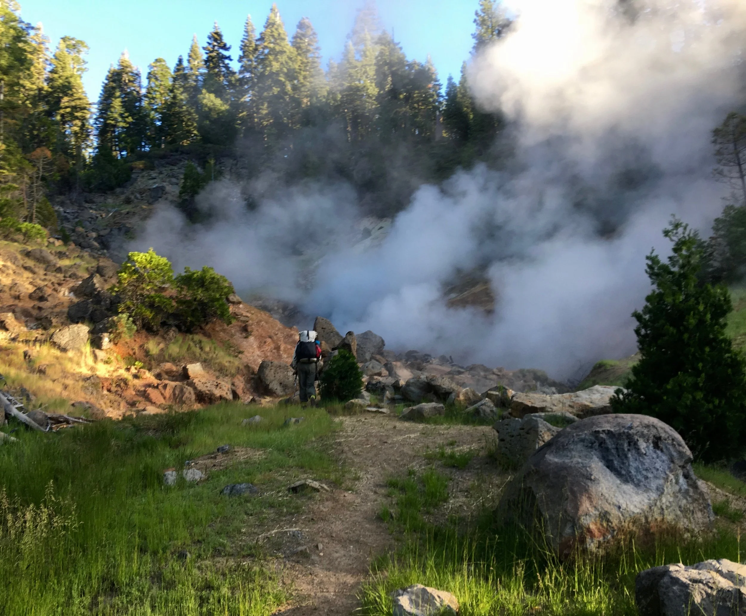
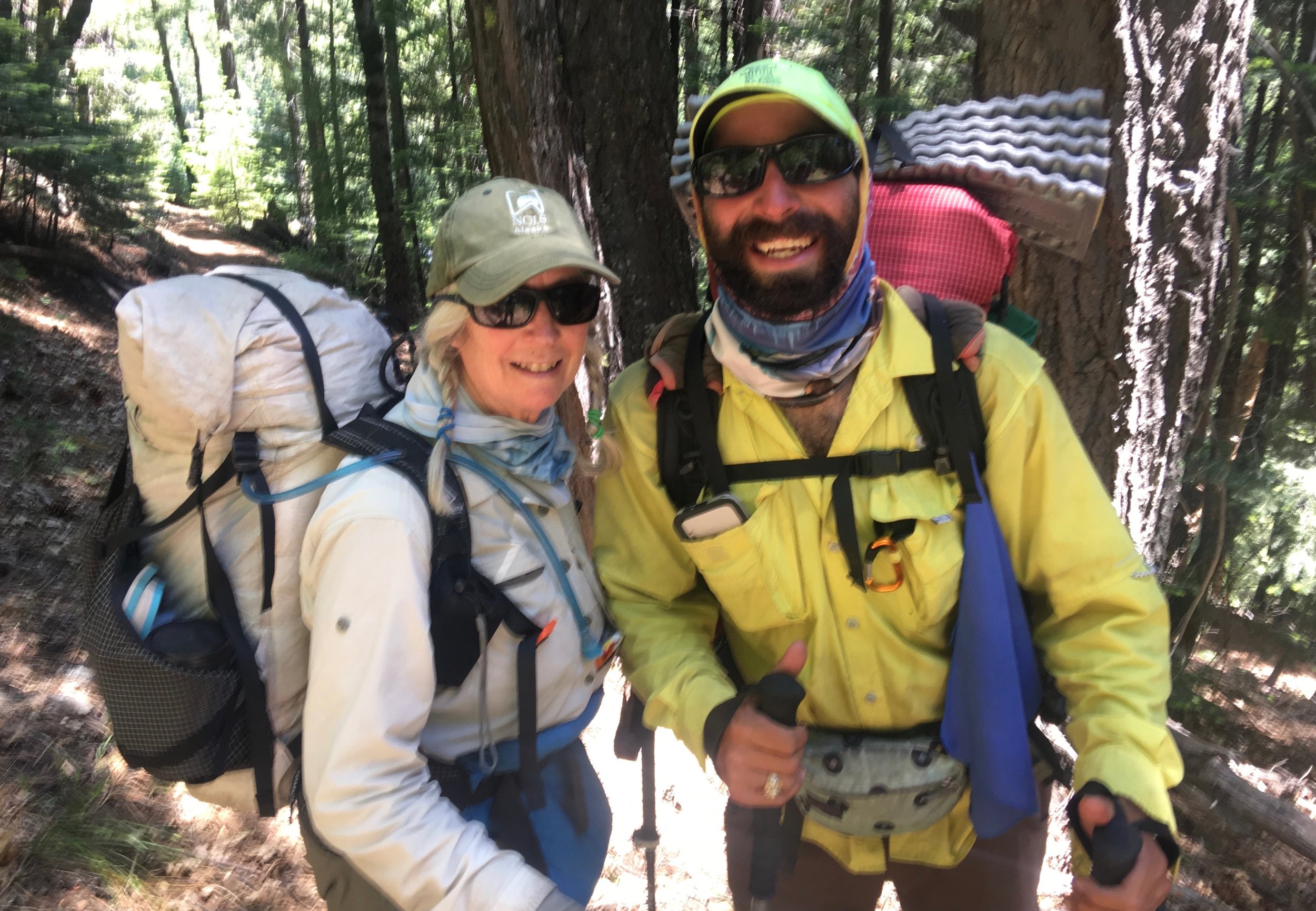
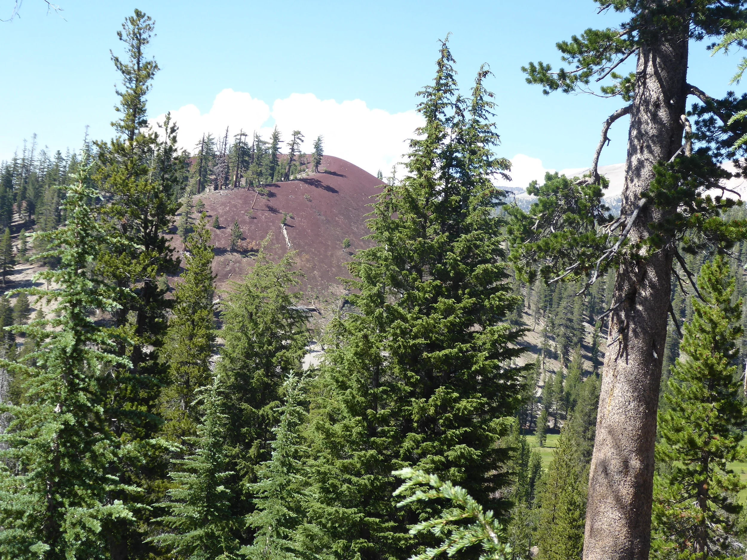
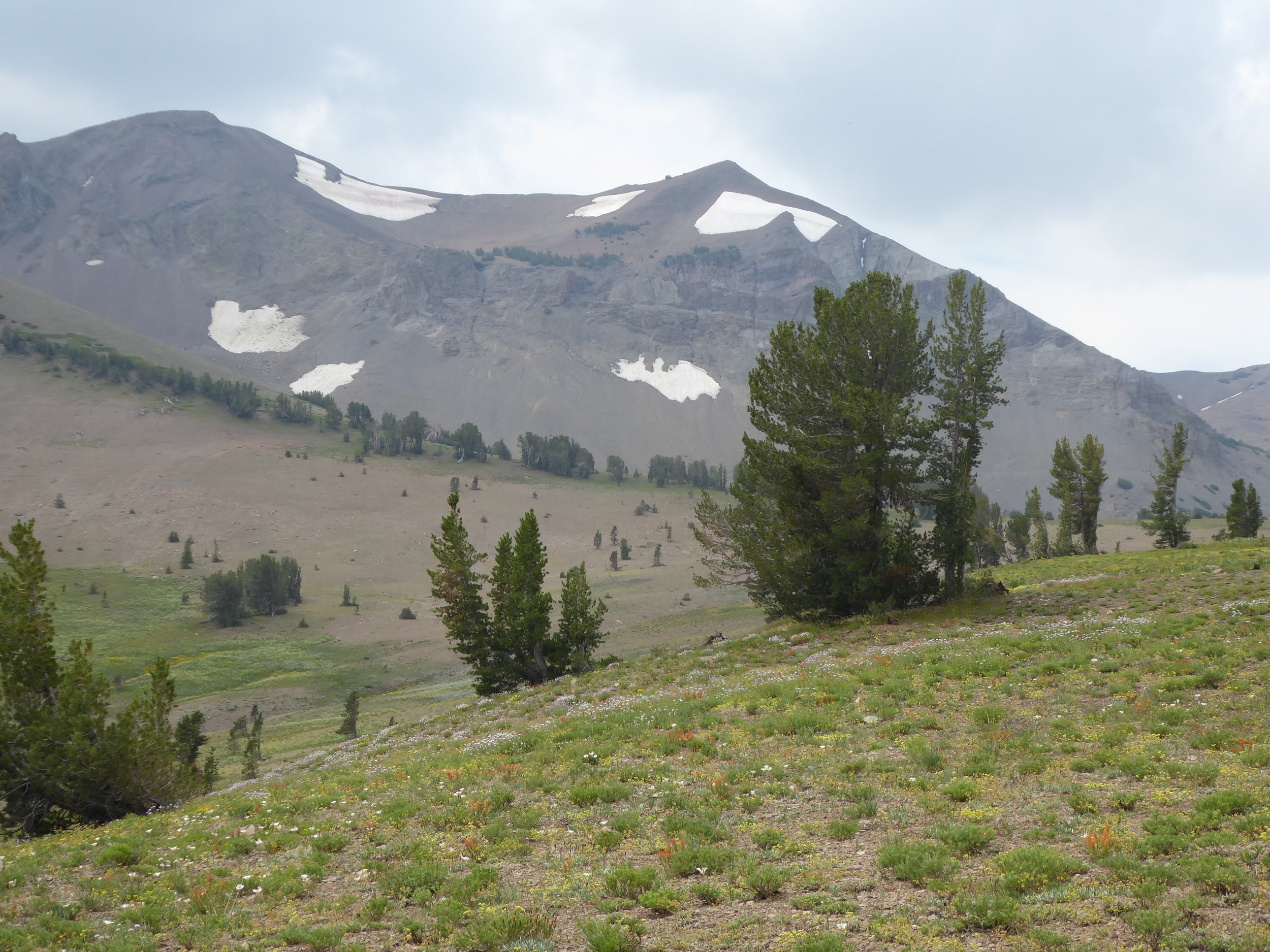
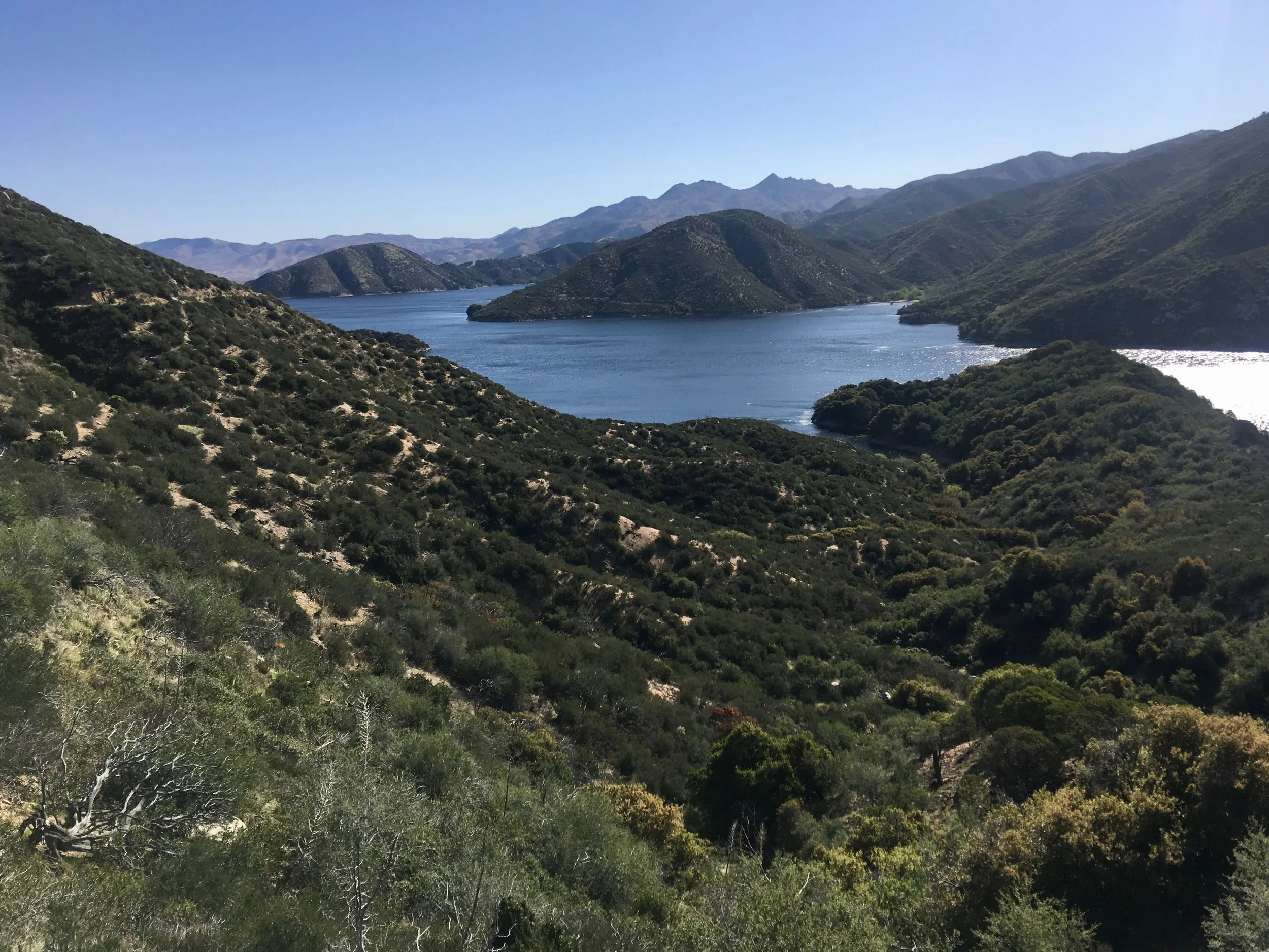
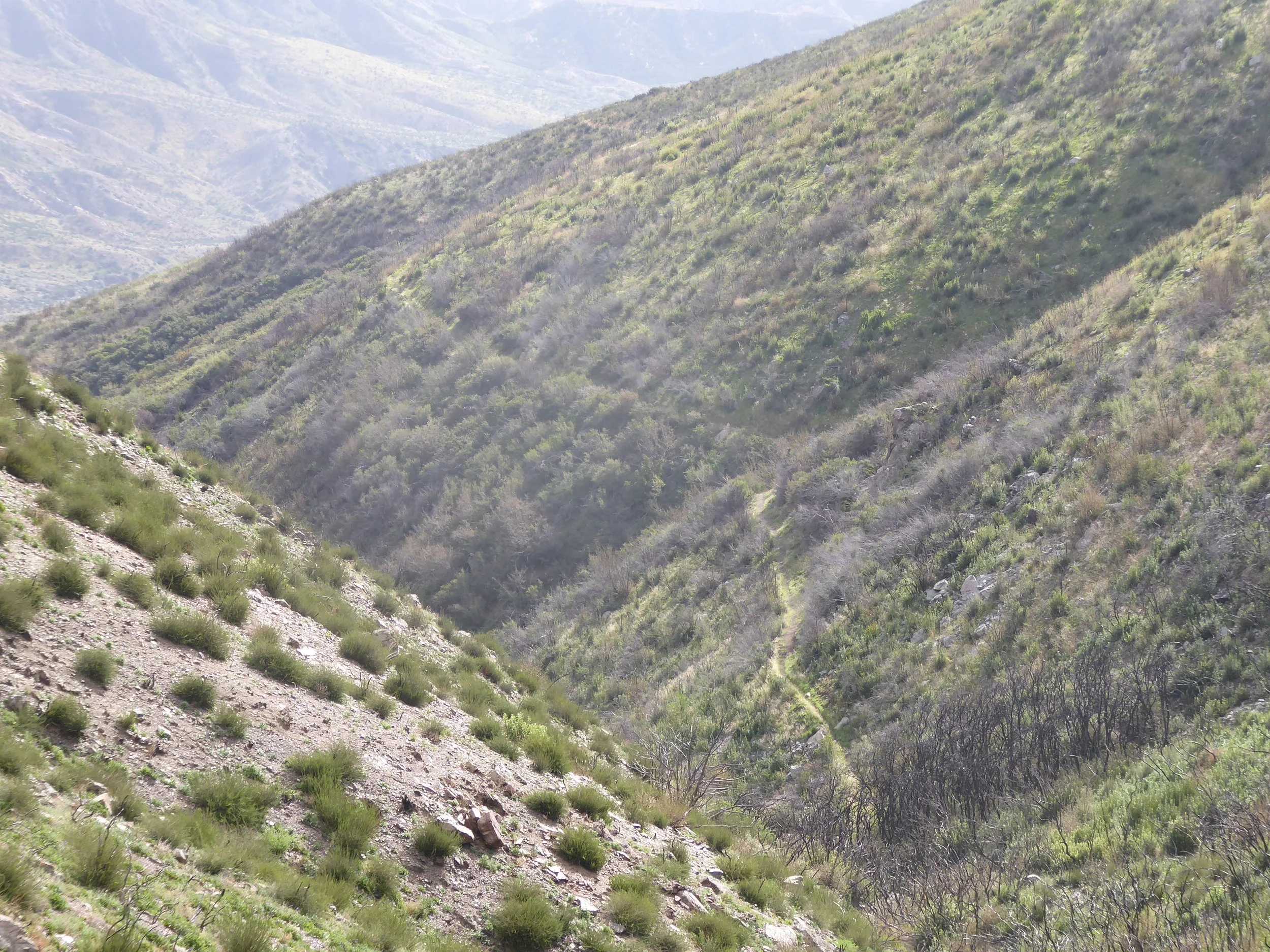
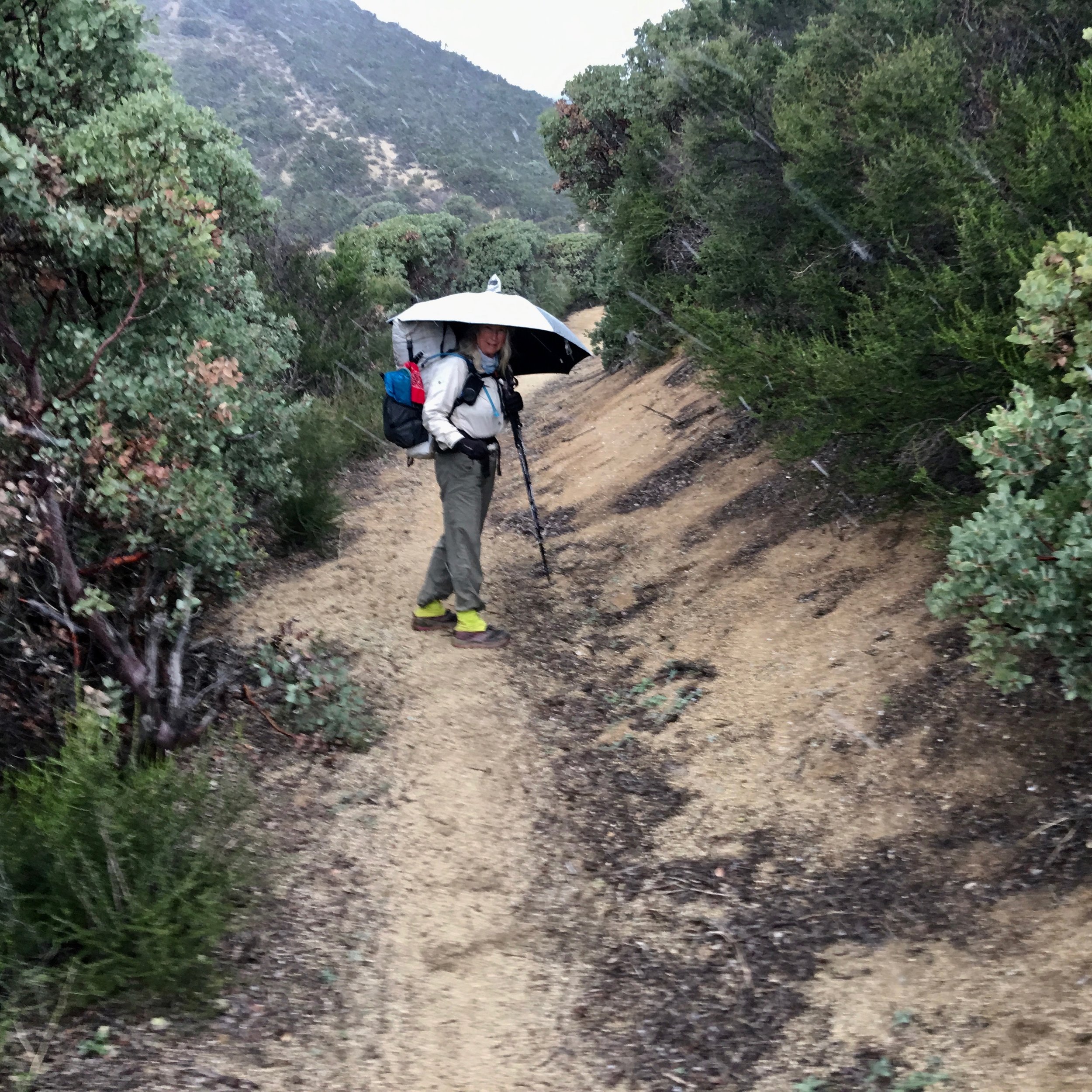
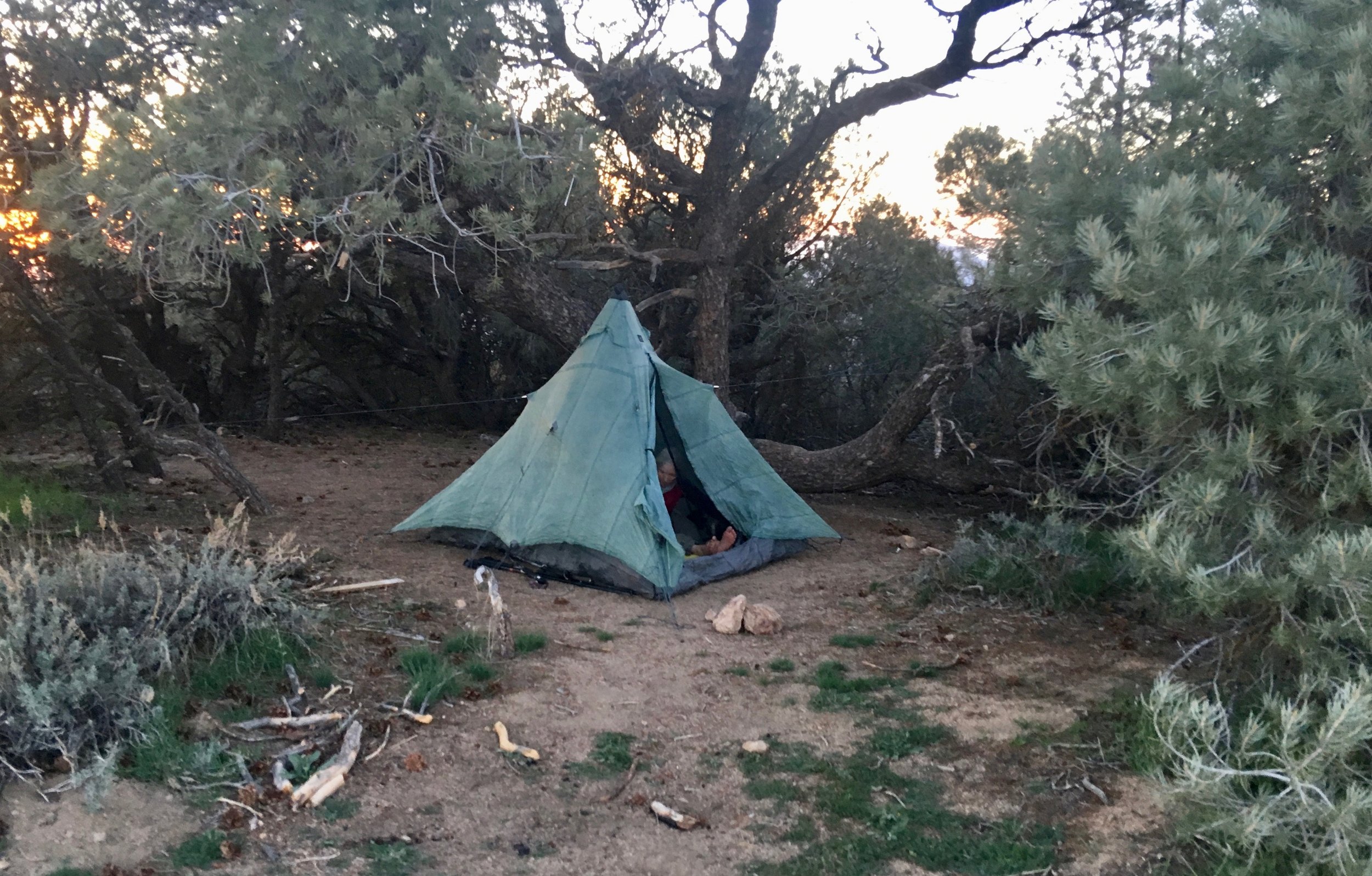
We are making good time today as the elevation gain is minimal. We decide to get to the trailhead and hitch to Chester. Tomorrow we can go to the post office and pick up our resupply. Plus tonight we can do showers and laundry. With those incentives our pace quickness and soon we hear cars traveling on the highway. We are hiking with Out Of the Blue so when we arrive to the road we quickly try our luck at hitching. Shortly an older couple makes room in their car to take us the 8 miles to Chester. Don and I head off to the Lutheran Church while Out of the Blue opts for a hotel. The church is quite friendly, letting hikers set up their tents in their back yard. They also provide snacks and power strips for charging electronics. A member of the congregation stops by to check to see if anything is needed. It is a great service that they provide! After setting up our tent, it is off to find dinner with Norway and Out of the Blue. A lot of the restaurants are closed, but we are told of a pizza restaurant just down the street, We make our way there and Don is excited not only about the food, but an opportunity to watch the Golden State Basketball players on TV. Hiker hunger has set in as we watch Norway down a large pizza that we were told can serve four. Back at the church we  meet a woman from Germany that we had met the third day of our hike. Her name is now Ninja Fabric. She has a swollen ankle and is planning on taking several days of rest. We also meet Prince from England and Hollywood from the states. Hollywood is nursing a sore knee. Don and I are grateful for not having any major or minor injuries. River, Four Eyes and Gandolf arrive later in the evening. Tomorrow our plan is to have breakfast at Cravings then hitch back to the trail and resume hiking.

Miles hiked 16

June 4

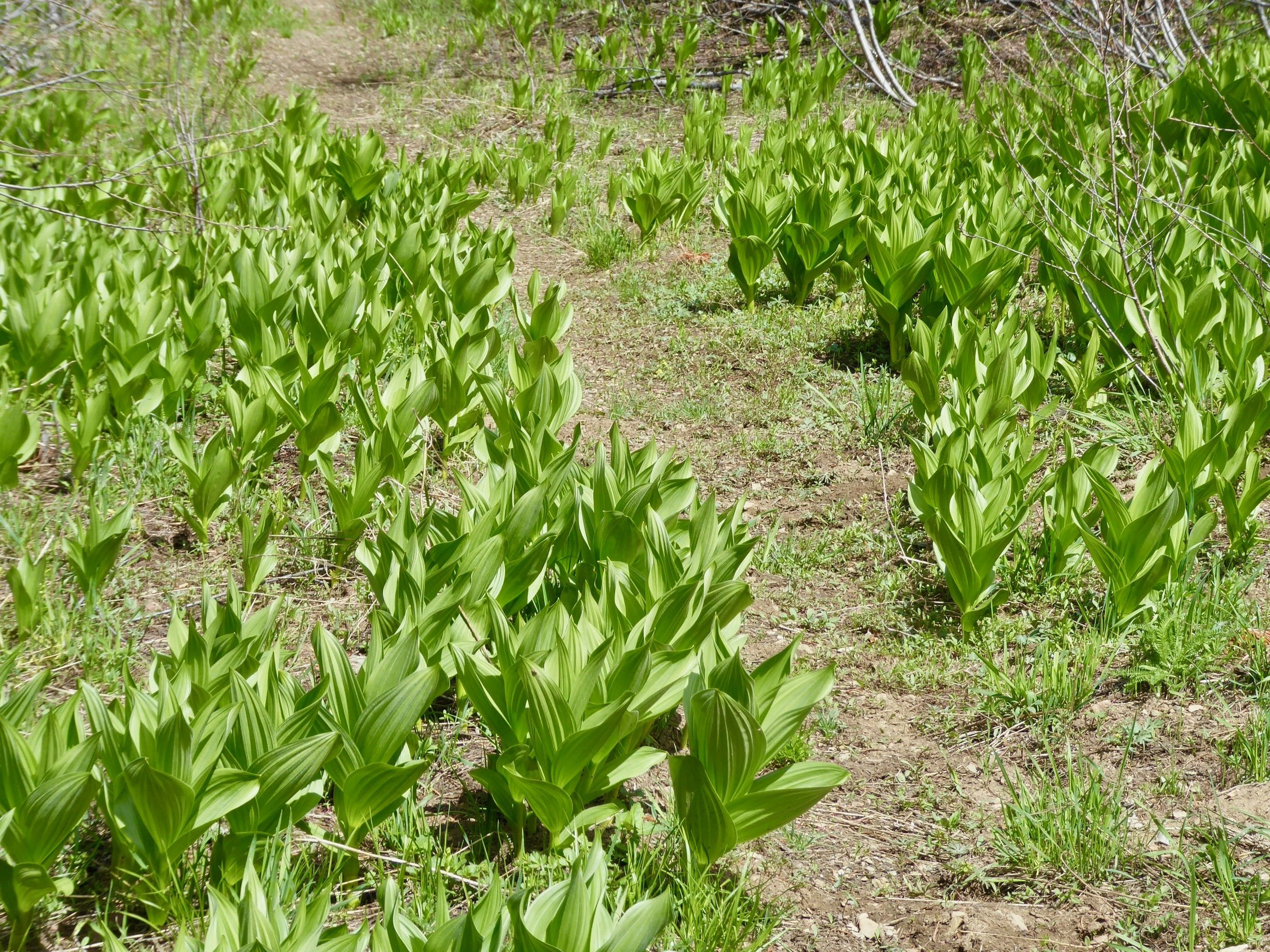
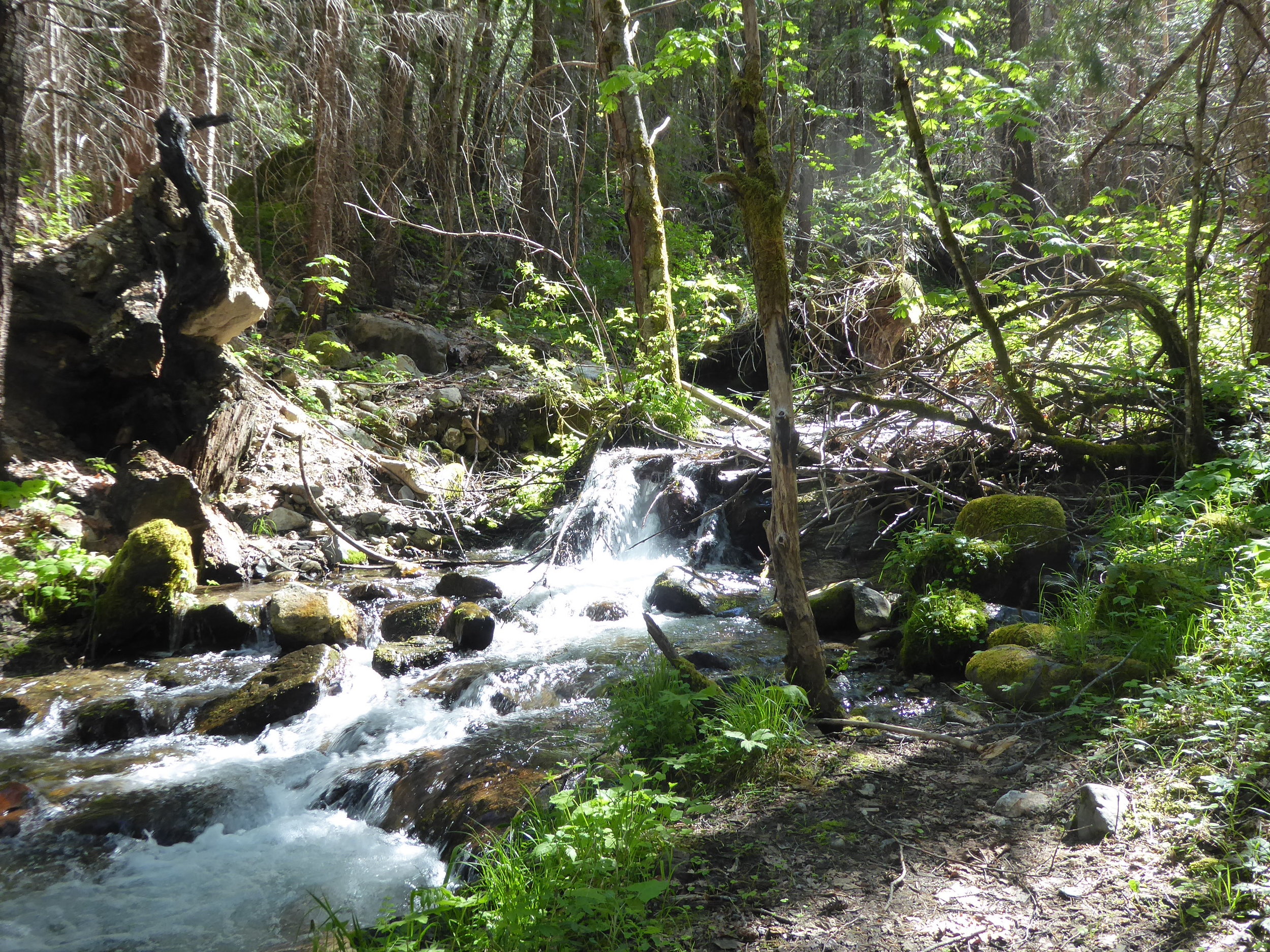
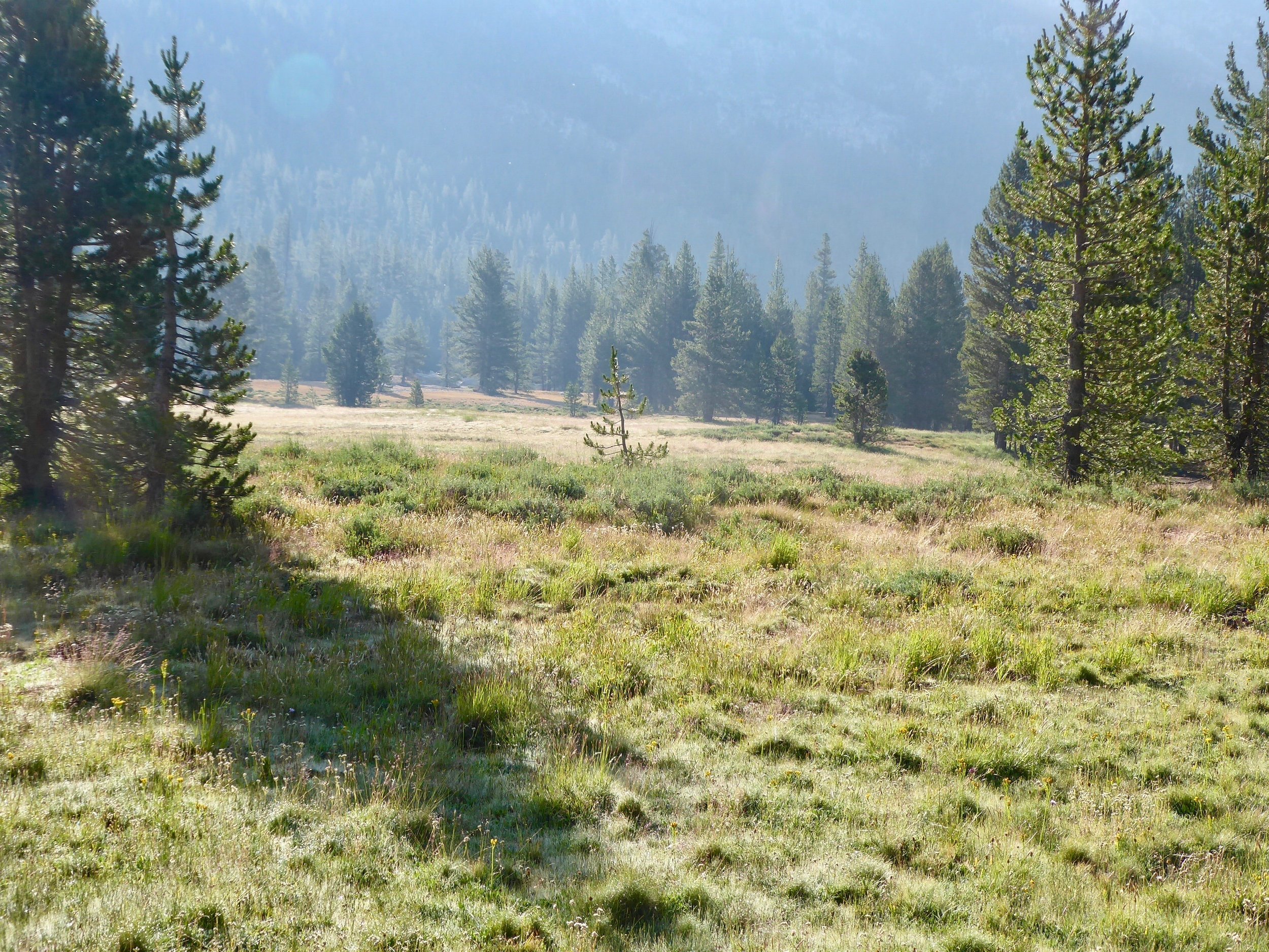
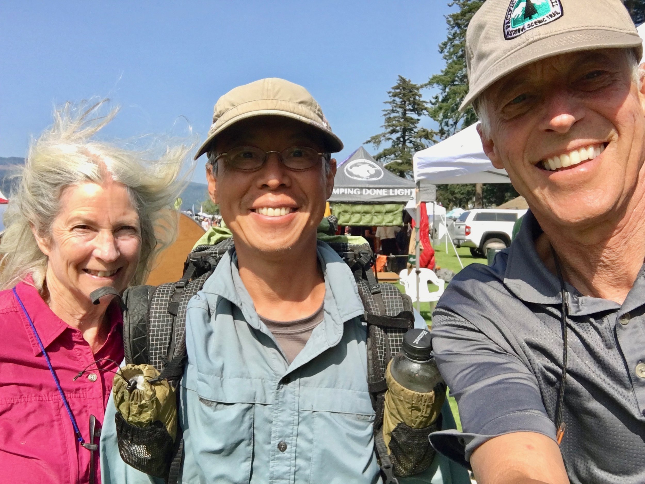
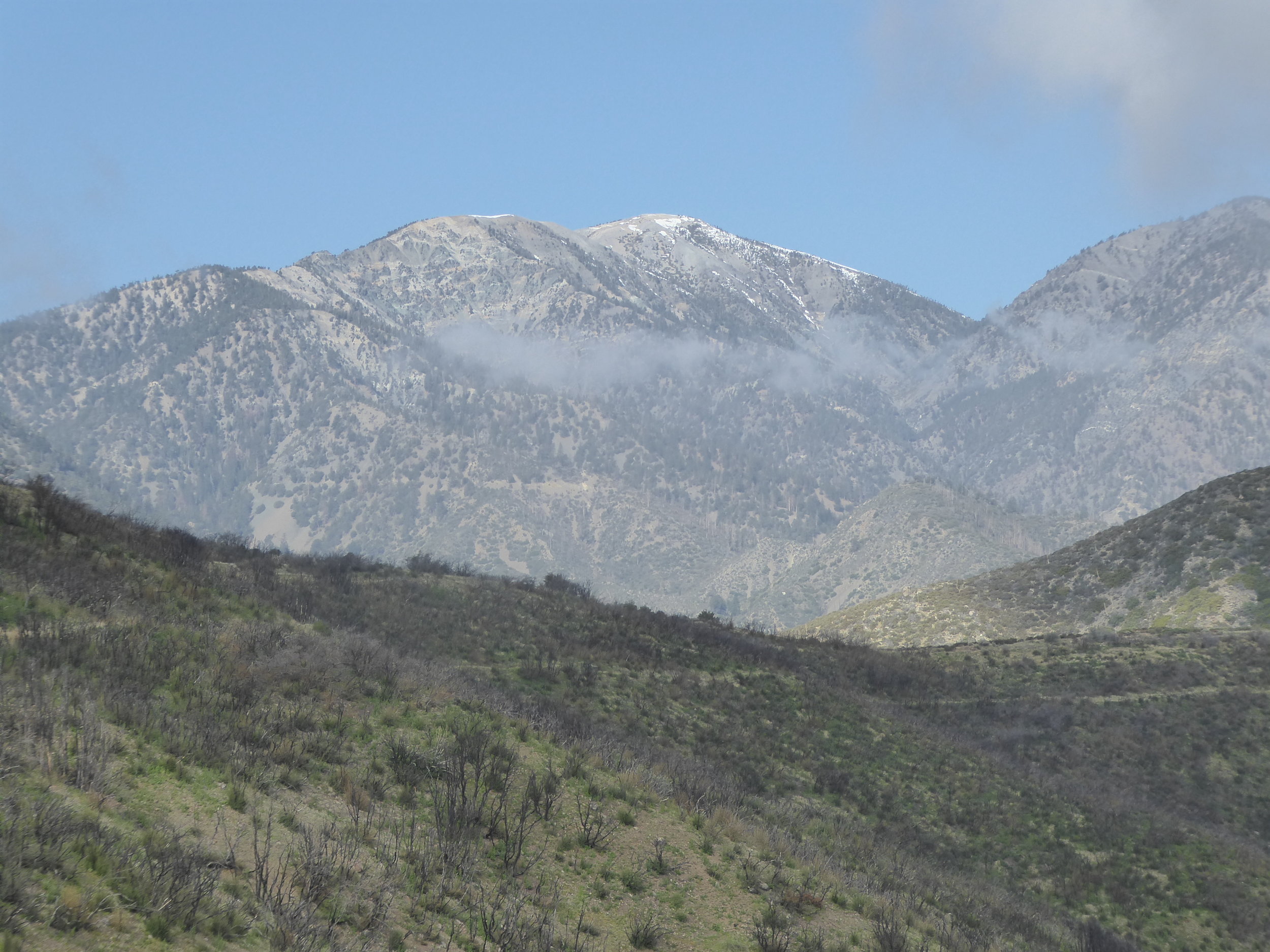
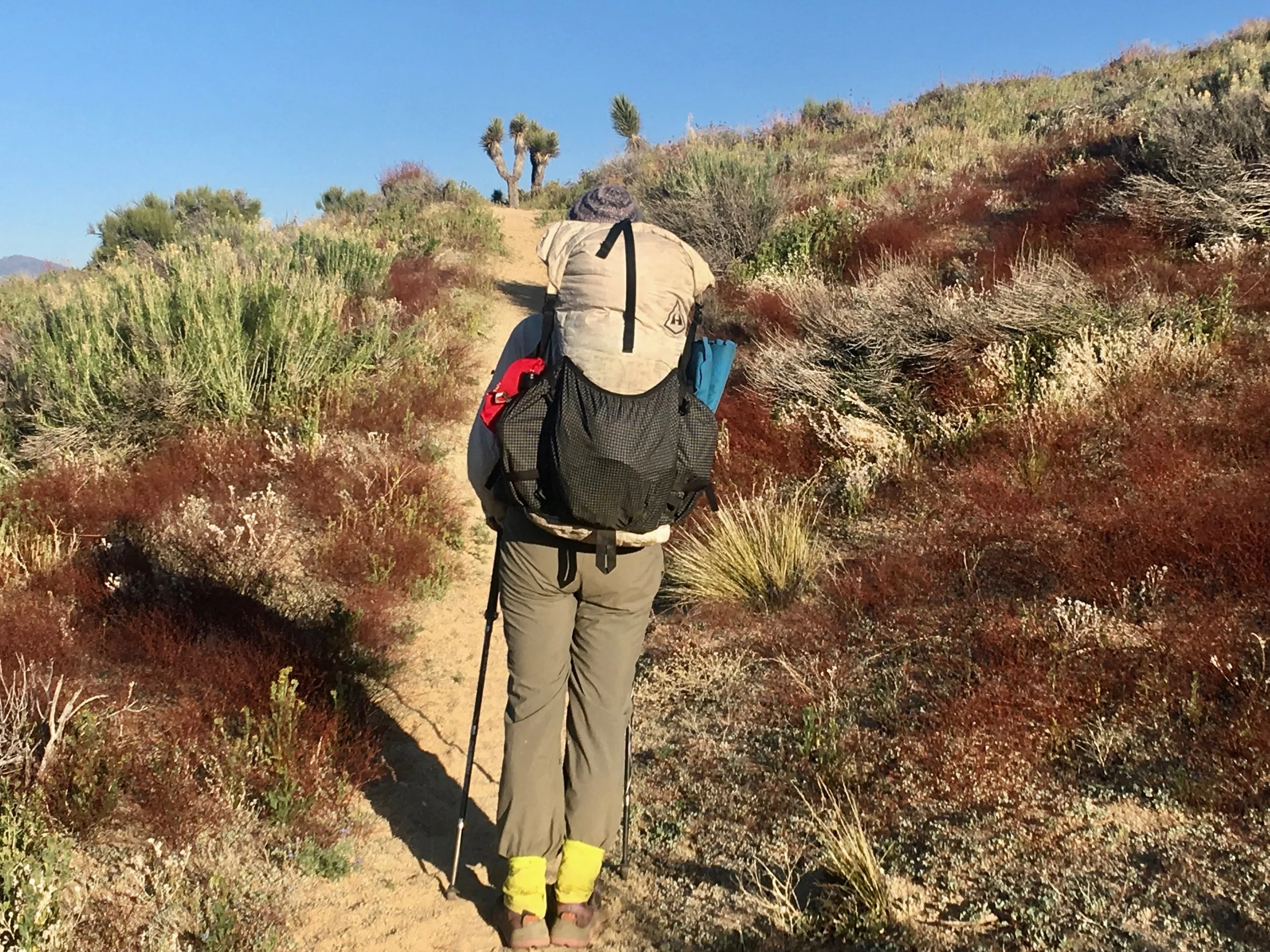
We are up at 6 and meet Out of the Blue at Cravings for breakfast. We give this restaurant a 5 star rating. Don thought that it was the best corn beef hash he had ever eaten. My Belgian waffle covered with fresh fruit and whipped cream was amazing. With our stomachs full we go back to pack up our gear, get our resupply box and head down the trail. First though it is time to stick out the thumbs, we get a ride. The driver needs some gas to fill his tank, we agree and soon are back to hiking the trail. The trail is a steady up hill, but since we started at noon, we are only hiking a 10 mile day. 

a unique fungus growing on a tree

a unique fungus growing on a tree

We stop at the midpoint of the PCT which is between the CA./ Mexico border and Washington/Canada border. Since we are not doing the whole trail it is more just a fyi.

IMG_4812.jpg

We camp on a beautiful ridge tonight and have a great supper of beans and rice wrapped in a tortilla.

Miles hiked 10

June 5

It is a day of hiking on ridges, dropping down into forests and being surrounded by signs of volcanic activity. We like usual are impressed by new species of wild flowers. This one is definitely in the onion family.

P1010716.jpg
wild onion

wild onion

Always glad to see one of my favorites.

Forget-me-not

Forget-me-not

A butterfly adds color to the trail

P1010719.jpg

A deer is not bothered by our presence.

P1010720.jpg

Even when it sees a human with strange looking ears.

IMG_4809.jpg

The signs of volcanic activity surround the path.

P1010722.jpg

We are impressed with the flowers that take root here.

IMG_4817.jpg

In one day we encounter many different kinds of terrain.

IMG_4819.jpg

We also start encountering the hikers who have gone thru the Sierras when it was buried in snow. Some stop to talk and tell us tales of dealing with the snow and cold. Several of the hikers we had met in April when we were doing the desert section. One woman we had met previously is called  Road Runner.  She is known as a 40 mile a day hiker when the conditions are good. Her pace slowed way down in the Sierras. She is probably the first woman thru the Sierras and most likely will be one of the first to reach Canada. She pauses to chat and we catch up on some of the hikers we know. We also meet Kit who we have heard about and not met. In the desert we found a pair of sunglasses and thought they might be hers. As she was a day ahead of us, we were never able to catch her. She was hiking with Pusher in the desert who we had met. He had hurt his ankle in the Sierras and had returned to Germany to recover. They were hoping to meet up later further down the trail when he returns. She tells us that we are going to encounter some snow, but that it is melting fast. We are heading towards cold spring, a well known spring used by the locals.

Nice cold water was pouring out of the pipe.

Nice cold water was pouring out of the pipe.

Not all deadfall is removed from the trail, but a lot of work has been done to make the hiking easier. We were impressed by this tree that had been cut.

IMG_4822.jpg

We meet up with Out of the Blue and find another spring that has a great flow. A decision is made to camp here for the night.

Miles hiked 21

June 6

After climbing mostly uphill yesterday. today is going in the opposite direction. We have a lot of descending to do to get to Belden. We head down rocky ridges crossing numerous streams. Fortunately we are able to either rock hop across them or find a log that we can use.

P1010726.jpg

We meet a woman who is out for the week. We say hello and continue on our way. She turns around and comes back to us. She has seen a group of tiger lilies at a spring and she wanted to make sure that we see them. We keep a lookout for Rattlesnake spring.

And sure enough there are the tiger lilies that she told us abouit

And sure enough there are the tiger lilies that she told us abouit

IMG_4824.jpg

More new flowers appear and we are taken back by their beauty.

The colors of the flowers are so vivid

The colors of the flowers are so vivid

This plant covered both sides of the trail for over a mile

This plant covered both sides of the trail for over a mile

IMG_4835.jpg
It has a runway to its nectar!

It has a runway to its nectar!

We are passing going in the opposite direction NOBO hikers who were some of the first to go thru the sierras. They have mixed reactions to what they experienced. Most are relieved that they made it thru, but not sure they would want to repeat the experience. Finally we see the river that we are hiking down to.

As usual we see it then still have to walk several more miles to get to it.

As usual we see it then still have to walk several more miles to get to it.

When we arrive to Belden, we discover that it is a resort. One that has seen better days. It still offers free camping for hikers, a place to take a shower and do laundry. There is also a restaurant that we plan on getting a meal later. Out of the Blue has decided that he is going to continue on and is able to order more food to be sent to the next couple of towns. Don and I head to Quincy which is a 30 mile hitch. We make a sign and are helped by the fact that there is road construction and cars have to stop close to where we are hitching. The second car picks us up and soon we are in Quincy and picking up our food resupply at the Post office. Don meets a hiker called Peer Pressure outside of the grocery store. He is heading back to Belden as well so now there are 3 of us hitching.

A car stops to pick us up and Peer Pressure gets in the front. Soon the driver and Peer Pressure are exchanging stories. Some of them are hard to believe. In fact some are way out there. (we later find out that Peer Pressure does not hike, but hitch…

A car stops to pick us up and Peer Pressure gets in the front. Soon the driver and Peer Pressure are exchanging stories. Some of them are hard to believe. In fact some are way out there. (we later find out that Peer Pressure does not hike, but hitches from town to town and unfortunately takes advantage of the trail angels. He has been doing this for several years, but social media has exposed him. ) Once we get back to Belden, we organize our food and head to the restaurant. When we were gone to Quincy hikers began to show up at Belden. It was almost like a mini reunion as hikers met folks that they met over a month ago. They were also hikers that were meeting for the first time. and hikers that were blogging that we had read about on facebook. We even met a hiker from Alaska.  As there were quite a few hikers going in both directions, it was a forum of passing on information. We had been eating outside, when Don noticed another familiar face, It was Red Flower, a hiker from Germany that we had met the first 100 miles. I had given him his trail name so it was fun to hear how his hike had been going.

Red Flower

Red Flower

The bond of PCT hikers is a strong one. Often meetings are short, but when one meets again, it is like reconnecting with a good friend! 

Miles hiked 13

Belden to Sierra City

June 7

Looking at our map and talking to NOBO hikers we knew that our hike today was going to be a steep uphill with about a 5000 foot elevation gain over 7 miles. It was also going to be on the warm side.  With that in mind we knew that an early morning start was necessary.  Up at 4:30 and on the trail by 5:30. The trail true to form was steadily up with no water. Our packs with full water and a full supply of food were heavy. Using a steady pace we eventually hiked out of the forests and were greeted with spectacular views. 

At one point of the trail we could look down towards the valley that we had climbed out of. It never ceases to amaze us of how quickly it seems that we get to the top.

At one point of the trail we could look down towards the valley that we had climbed out of. It never ceases to amaze us of how quickly it seems that we get to the top.

P1010740.jpg

This spring was a welcomed sight and we quickly filled our drinking bottles with cold good tasting water.

P1010737.jpg

After our initial long upward climb, the trail seemed to be that of many ups followed by many downs. We again pass by flowers in their peak. We are naming this trip the wildflower tour.

One of may favorites Forget-Me-Nots

One of may favorites Forget-Me-Nots

Phlox

Phlox

We catch up to Out of The Blue and after a break at a stream, we make a plan to meet at a campsite that someone has commented on. This is a site with an amazing view! (so they say) The trail continues on with view of lakes and trails thru the forests.

P1010743.jpg

Since we have a planned destination, today is more of a saunter as we enjoy the trail.  We meet several hikers and learn of their adventures. When we get to our planned destination, the view is lacking.  It is just a site among trees for about 5 tents. In fact Out of the Blue who arrived before us had gone further to see if there was a better place to set up camp. There wasn't any nearby so he had returned and waited for us. Meanwhile Hollywood who we had met at Chester showed up. His knee was feeling a little better, but he had dropped his mileage. After we had dinner and had gotten into our tent, another hiker showed up at the camp. It was Uphill who we had met over a month earlier. He was going NOBO and told us of the challenges he had faced with the snow to the south of us.  He was quite animated with his stories. We would not be hiking in that area for another 10 days so were pretty sure that we would have less snow to deal with, but we have learned to go with the flow.

Miles hiked 17

June 8

Since we had gained so much elevation yesterday, it would have been nice to stay high, but that was not the case. The views up high did not disappoint.

But....

But....

Soon the trail was a gradual downhill and then parts of it were rather steep. This is the first time that my legs and knees rebelled! By the time we finally made it to the bottom. I was glad that there was a stream to soak them in. On the way to camp we met several hikers who had gone thru the  sierras. As usual it was good to talk about their experience. 

An elephant tree

An elephant tree

As we were hiking thru the woods, we saw  Out of The Blue pointing at the trail. As we approached we saw what he was pointing to. A young fawn was lying in the middle of the trail.

IMG_4847.jpg

He said that there were two fawns in the middle of the trail, the one lying there just fell down and the other one had gone over the edge. The one that had gone over the edge was not able to get back up. Don took off his pack and stepped down to see if he could assist the fawn. He literally had to pick it up and put it on the trail.

P1010750.jpg

Once it was on the trail, it wobbled down the trail. The one on the trail stayed there. The doe was never seen. Not wanting to disturb them anymore we departed.

P1010751.jpg

Later when we were camped several more hikers showed up. They had not seen the fawns so we hoped that they had reunited with their mother and were not any worse for the human encounter. We have seen numerous deer in this section and they do not appear to be wary of humans. We ended up camping with Hollywood, River, Four eyes and Prince. It seems that our mileage is similar.  They start later, hike faster, and take more breaks, but in the end our steady pace seems to equal their mileage, Just as it was getting dark, another hiker that we had met in the dessert section walked into camp. It was Soda. We had not seen him for over a month. He looked at least 20 pounds lighter and was quite tired. His stories of the hike thru the Sierras kept us on edge for quite sometime. We are quite glad that we are chasing wild flowers and not snow stories. The saying on the trail goes HYOY. Hike Your Own Hike!

Miles hiked 20

June 9

I was glad to wake up with my body mostly recovered from the downhill hike yesterday. We spotted these two centipedes in an embrace. There was lots of intertwining of their legs.

P1010752.jpg

Today was mostly a walk thru forests. Often touching the bark of giants!

IMG_4849.jpg
IMG_4855.jpg

We are often amazed at the terrain we hike thru. It has been so varied.

IMG_4858.jpg

Today our discussion was about the height of the moss on the trees.

IMG_4859.jpg

Coming towards us today was a familiar hiker. SuperVegan. We had met him in the dessert section and had camped together. He takes a selfie every mile. We happened to be at a mile mark so did a selfie with him. He is only hiking NOBO miles. He has skipped some snow sections, but will return and hike them in a north direction. After exchanging beta about the trail encountered, we said our good byes not knowing if our paths will cross again.  Four Eyes and River were having lunch at a spring so we stopped to get water and take a break. As we were eating along comes Spikes and Snacks. We had hiked with Spikes for several days in April so once again it was fun to reconnect. She has a deadline to get to Canada so they have been pushing the miles. They also had some epic stories of the Sierras. Our decision to hike the sierras in July looks great to us. We have been hiking with River for several miles and when we cross a paved road together, a woman runs towards us saying Trail Magic, Trail Magic! Hearing those words finds us quickly moving towards  a parked car. This was quite unexpected as the herd of hikers is far behind us. Most folks doing trail magic try to time magic for when they can serve more hikers.

This couple whose son is hiking the trail this year had brought their grandsons to this trailhead in hopes of seeing some hikers. In their car was soda, chips, fruit and warm banana bread. They plan on returning here over the 4th of July and cooking…

This couple whose son is hiking the trail this year had brought their grandsons to this trailhead in hopes of seeing some hikers. In their car was soda, chips, fruit and warm banana bread. They plan on returning here over the 4th of July and cooking breakfast for any hikers who are passing thru.

Even a forest service personal stopped by to say Hi. It was a nice break with good conversation. I have a feeling that we were the only hikers that day, but we sure appreciated their hospitality.

Even a forest service personal stopped by to say Hi. It was a nice break with good conversation. I have a feeling that we were the only hikers that day, but we sure appreciated their hospitality.

With temperatures dropping and the wind picking up we needed to be back on the trail. There was even a threat of rain. We came out of the forests and hiked towards a very windy ridge.

P1010754.jpg

This would have been a great opportunity to stop for a view break, but the weather did not allow. Don had put on most of his warm clothes. We were glad when the trail turned downward and we were back into the woods.

P1010756.jpg

If possible we like to camp near water, but often we find ourselves dry camping. Tonight, however, we plan to meet Out of the Blue at a water source. Since we stopped for Trail Magic we are hiking later than usual and got to camp right before dusk. Four Eyes, River, Hollywood and Prince are there. We have brought some banana bread to our friends and smiles abound. The great sound of running water lulls us to sleep.

Miles hiked 23

June 11

Our day began early, before the sunrise. After cooking breakfast in the dark, we left camp with Out of the Blue. Our other hiking friends were sleeping soundly in their tents. The trail started off with a gentle climb. That didn't last long as the trail steepened and we were soon making our way up a rocky path.

P1010758.jpg

As we reached the top we were greeted with mountain views.

P1010760.jpg

There was still snow along the trail, so the flowers hadn't made themselves known. Our eyes appreciated seeing several cup fungus along the path.

P1010762.jpg

Even though the air was cool, hiking uphill provided warmth for the body.

IMG_4865.jpg

We started hiking thru snow as we got closer to the top. Fortunately we were able to make our way around most of the snow slopes. Several weeks earlier thought the snow would have slowed us down considerably.  Eventually we made it to more southern exposed slopes and were glad to see the flowers starting to shoot upwards.

IMG_4868.jpg
It won't be long till this path will be surrounded with sunflowers.

It won't be long till this path will be surrounded with sunflowers.

It was time to stop for lunch at a scenic overlook. River joined us as we fueled our bodies with food. Our other hiker friends had passed us earlier as they easily out pace us.

This area is living up to its reputation as being quite scenic.

This area is living up to its reputation as being quite scenic.

IMG_4876.jpg

After lunch the trail took on a new character. There was a major re route that hadn't been exactly maintained. Part of the trail was down a rocky stream bed. In fact several times we were not sure that we were on trail. Eventually though we did make it to a more obvious trail. a hiker going NOBO passed on a message that Out of the Blue was hoping to meet us at Tamarack Lake. The last couple of miles seemed to go on and on. A new path around a lake was barely visible as we worked our way to the lake.  A sign's description said trail work in progress so someday it will be a hardened trail. The destination was worth the effort. It was a beautiful lake surrounded by mountains with waterfalls. It was a quick dinner followed by quickly getting into our sleeping bags and enjoying being lulled to sleep with the sound of water. Tomorrow our destination is Sierra City where we are hoping our next food resupply box will be waiting for us.

Miles hiked 21

June 11

Yesterday had seemed to be more of a physical challenge so knowing that our destination was only 10 miles away, we decided that getting up an hour later than usual seemed appropriate. The sunrise did not disappoint as over breakfast we watched the sun rays hit the lake where we were camped.

IMG_4882.jpg

Here comes the sun!

IMG_4878.jpg

Going to Sierra City today would involve a climb up from where we were camped then down to the valley where the town was located. Reaching the top we could make out where we will be headed.

P1010763.jpg

We can also see snow covered peaks in the distance. From talking to hikers it sounds like we will be encountering snow covered trails. No need to think of that now as we are heading down and down to a mouth watering gut buster hamburger. Food is often a topic of discussion as we meet other hikers that encourage us to check out certain food venues. The trail is quite obvious as we head down the mountain.

We appreciate the trail building!

We appreciate the trail building!

As is customary the views don't disappoint.

P1010765.jpg

A fair bit of the trail is quite rocky and one has to watch foot placement. This would not be a good spot to turn an ankle.

IMG_4884.jpg

The hills are alive with spring colors and then in the distance we can make out our destination.

IMG_4885.jpg

It is far below us and by zooming in the camera we can make out the buildings.

P1010766.jpg

We had been told by a NOBO hiker that we would see the town, but would still have about 5 miles to hike before reaching it. Knowing that, we enjoyed the hike going mostly down hill. On one of the switchbacks, we were happy to see Yogi Bae.

We had hiked with him for several days in the dessert section and had also overlapped in a town, where he had to take several days off for an injury. He was from a southern state and had never been in snow. Hiking thru the sierras had given him many…

We had hiked with him for several days in the dessert section and had also overlapped in a town, where he had to take several days off for an injury. He was from a southern state and had never been in snow. Hiking thru the sierras had given him many stories to share.  He highly recommended the gut buster!

Eventually we found ourselves on the road to Sierra City. It was less than a two mile hike to town on the pavement. We tried hitching, but to no avail. The town appeared and we headed off to a church that lets hikers stay in their backyard.

P1010768.jpg

We put up our tent and headed to the store where the gut buster is created. It was just about our only choice of where to eat. This is a small town that mainly caters to tourists on the weekends. This being a Monday, most of the stores and restaurants were closed. We were glad that the Sierra  Country Store was opened 7 days a week.

IMG_4888.jpg

They provide a great service for hikers, receiving resupply boxes and are home of the gut buster hamburger. This hamburger is a one pounder that lives up to its reputation. Don and I decided to split one which turned out to be a good decision. We also ordered a couple of chocolate milkshakes which got a 10! Our stomachs were smiling. Out of the Blue had gotten there a little before us and had decided to go the hotel route. Unfortunately his food resupply had not arrived so he was going to spend a couple of days there. We plan to have breakfast with him in the morning and then depart our different ways. we may try to meet up later. Meanwhile back at the store we catch up with River, Four Eyes, Prince and Hollywood. They have eaten the burger and decided to hike down the trail a little further. We say good by to them as well not knowing if we will see them again.

Four Eyes and River

Four Eyes and River

Four Eyes and River met on the first day of their hike and have been hiking together since then. They skipped the Sierras similar to us and plan to hike them when the snow will be a lot lower.

We headed back to the church to take a cold shower, wash some clothes in a sink and re pack our food bags. Our box had arrived! Back at the church, several hikers, Hulk,Litebrite and Norway were there. Our paths had crossed several times so there was some catching up to do. Hulk and Litebrite had some challenging snow stories to tell. Norway was quite happy to be in the mountains with lakes. Since we wee quite full from our hamburger there was no need to cook dinner tonight. We plan to eat breakfast with Out of the Blue tomorrow morning and then start walking.

Miles hiked 10

Sierra City to South Lake Tahoe

June 12

We got up around 6 and packed up our packs. After breakfast with Out of the Blue we plan to start the trek to South Lake Tahoe. Out of the Blue is not sure when his package will arrive so we will stay in touch, but it is not looking likely that we will see each other on this hike. Returning to the church after breakfast, only Norway is still here. The rest of the crew has started down the trail. We had to walk the two miles back to the trail head and did not hold out much hope for a hitch, but stuck the thumb out anyway. A small truck pulled up with an older women, who lives here in the summer.  She said I saw you walking by and wanted to give you a ride of which we were thankful. Once back on the trail we enjoyed seeing numerous streams with bridges.

P1010769.jpg

Yesterday we had lost a lot of elevation, today we are going to gain it back. Fortunately it was gradual for the most part. Flowers are always an enjoyable part of the hike.

We love how this flower adapts, when there is no vegetation around it. It grows close to the ground, however when it is in a more bushy area, the stem can be quite long.

We love how this flower adapts, when there is no vegetation around it. It grows close to the ground, however when it is in a more bushy area, the stem can be quite long.

We meet a younger hiker who is resting along side of the trail. His shoes are off and his feet look sore. He made it thru the Sierras, and also said that here was quite a bit of snow afterwards as well. It is melting fast, but we will most likely encounter snowy conditions. That is food for thought, but today we have miles to cover. He also says that we are almost to the top of the climb! That statement was accurate as we have some great views.

P1010770.jpg

During a break, it was fun to look up at the branches of a large tree. The sky was so blue today with not a cloud in the sky.

P1010772.jpg

We heard a wood pecker and were fortunate enough to catch a glimpse of it.

P1010773.jpg

Once again after gaining lots of elevation today, we headed back down to a beautiful flowing spring. We found a flat spot made for our tent and after a hot meal crawled into our sleeping bags. Tomorrow we are planning for a longer hiking day.

Miles hiked 10

June 13

We were on the trail by 6 even though we could've spent the day at this campsite.. It is hard to take days off between towns as we need to average just under 20 miles to make sure we have the right amount of food. We had been told by a hiker yesterday that we will probably be seeing a lot of NOBO hikers today. We had seen the front runners before Belden. They were around ten in number. Now the herd as hiker terminology is known will be passing. The first hiker that we saw in the morning was Thom from Germany.

IMG_4891.jpg

We had met him briefly at Hiker Heaven. He had ended up going thru the Sierras with another hiker that we had met and I had named called Red Flower, also from Germany. We exchanged details about the town and trails that we will both encounter. Wishing him safe travels we continue on.

Sunlight hits this plant that gets its nourishment from the roots of other plants.

IMG_4892.jpg

This plant growing alongside the trail is known as a wild Onion

IMG_4894.jpg

The views today did not disappoint. We did notice snow on the mountainsides, and wondered about the future conditions. 

IMG_4895.jpg
P1010776.jpg
P1010778.jpg
P1010780.jpg

We started hitting patches of snow, but nothing to be concerned about other than getting wet feet. Hikers that we met going north were glad to hear that their encounters with snow were coming to an end, at least for the hike thru the rest of CA.  Not so for us, nothing sounded too difficult, but a fair bit of snow. We met two hikers from the Czech Republic that we had met in April. They were using bamboo trekking poles that they had gotten in Japan.

They had skipped some of the Sierras due to having to go so slowly thru the snow. 

They had skipped some of the Sierras due to having to go so slowly thru the snow. 

Another hiker that came towards us was Pusher. He had just gotten back on the trail at South Lake Tahoe. In the Sierras he had injured his ankle and had gone back to Germany to recover. 

It was cheaper to do that than stay in the states. He was trying to catch up to Kit who he had hiked with until his injury. We passed on the information that we had seen Kit several days ago. Not sure if he will catch up to her, but with a name like Pusher he just might. True to form the trail takes us back down again, past a really neat looking tree.

Trees and flowers are always enjoyable! We often reach out to touch the bark of the ancient trees, wondering what stories they would share with us.

Trees and flowers are always enjoyable! We often reach out to touch the bark of the ancient trees, wondering what stories they would share with us.

As we continue down the trail, streams are filled to their banks due to the melting snow. We are glad that there is a bridge over this one.

As we get closer though we see that there is a guard!

As we get closer though we see that there is a guard!

The marmot seemed friendly enough and we were able to pass with no confrontation.

The marmot seemed friendly enough and we were able to pass with no confrontation.

Upon reaching the other side we were able to find a spot that the snow had recently melted. It was damp, but would definitely work. Looks like we may be hiking thru some snow tomorrow. We were in our tents when we heard a man's voice asking if he could chat with us. His name was Broken Arrow and he wanted to tell us his story. He had two, one involved going thru a section of the Sierras and the other one was about a book that he was writing. The sierras sounded quite epic. He had gotten lost and fallen into a stream when crossing a snow bridge. Eventually he was able to make his way to a road. The other story was about a book he was writing about a man who was hunting wolves in the 1800's. This man's diary had been found in the walls of an old house. Broken Arrow wanted to experience some of the challenges that this hunter perhaps had faced in the wilderness. He thought that by hiking he would have more experience in telling the hunter's story. Broken Arrow's pack was obvious very heavy. Perhaps he was relating to the size of the pack that the wolf hunter carried. We watched him slowly walk off, glad our packs were a lot lighter. Today was the most hikers that we have seen. Glad that we are not going to be in Sierra City when they all show up.

Miles hiked 21

June 14

It was a chilly morning as we ate a hot breakfast enjoying the beautiful sunrise. Today found us hiking in and out of snow patches. There had been enough hikers ahead of us that we were able to follow the footprints. Some of the trails were like a stream as the snow was melting.

Looks like it will be another day of wet feet.

Looks like it will be another day of wet feet.

Early on we crossed paths with Murillo who we had met early. He was all smiles as he told us about his journey thru the Sierras. He also told us that we should plan on lots of snow near Sonora Pass.

Murillo

Murillo

Once we got out of the forests and headed up toward ridges we were walking on snow free trails.

Guess this is how the Pacific Crest gets its name

Guess this is how the Pacific Crest gets its name

One goes up, one goes down. After hiking up and over Castle Pass we headed down to interstate 80. The trail goes right by a rest area so thought it appropriate to take a break and even get some ice cream at a vending machine. We were also able to check out our email before heading off to walk under the highway and head up to Donner Pass.  More beautiful flowers graced the trail.

P1010784.jpg
P1010785.jpg

It was the weekend so there were a lot of folks out for day hikes, enjoying the trails near the pass. One hiker warned us of a steep snowfield that they had turned back from. We have our micro spikes if needed. It was a beautiful trail with lots of ridge walking.

IMG_4914.jpg
We pass below a ski resort.

We pass below a ski resort.

Looks like there is still quite a bit of snow up high.

Looks like there is still quite a bit of snow up high.

We came to the snow slope that we had been told about. Fortunately it was later in the afternoon and the snow was soft enough for us to kick steps. On the other side of the snow we met some Boy Scouts, one of whom had taken a fall down the slope but was not injured. The wind is picking up and camping is looking bleak. We are hiking on an exposed ridge and will need to keep walking until we can find some protection.

P1010789.jpg
P1010791.jpg
P1010792.jpg

After several hours of hiking on the ridge, we are glad to see some trees that we hope will have a flat area for a tent and give us some wind protection. When we get to the trees, there is indeed a place for us. Some trees give a wind break and we are able to pitch the tent. We anchor it well and after dinner crawl into our sleeping bags listening to the wind howl thru the mountains. If it stays this windy we may have to stay here longer. We didn't see many PCT hikers today. Guess the front pack of the herd has moved thru.

Miles hiked 18

June 15

The wind blew all night, but all of our anchors held. We decided that leaving before first light would be a mistake. We packed our packs as much as possible inside the tent then ventured outside to make a decision of go or stay.  It sounded worse than it felt so we took down the tent and prepared to leave.


The sun rises over our campsite.

The sun rises over our campsite.

We head down the trail, glad that the wind has quieted down.

We head down the trail, glad that the wind has quieted down.

Again there was a lot of ridge walking today.

P1010794.jpg

Looking at our maps, we knew that we would be hiking up two ski runs. We started running into snow as we approached Squaw Valley. At least the area was closed, some of the earlier hikers had skiers using the runs as they were hiking them.

There were many foot prints so we tried to follow the ones that looked used the most. We even pulled out the micro spikes for one rather steep hill. They worked great.

There were many foot prints so we tried to follow the ones that looked used the most. We even pulled out the micro spikes for one rather steep hill. They worked great.

By using micro spikes we went straight up the slopes.

By using micro spikes we went straight up the slopes.

Down below was the parking lot for Squaw Valley.

This place will be a beehive of activity come winter, now it is quite peaceful with just an occasional hiker.

This place will be a beehive of activity come winter, now it is quite peaceful with just an occasional hiker.

By mid afternoon the wind had returned and we found ourselves walking quickly on the exposed ridges.

IMG_4927.jpg
IMG_4929.jpg

Eventually we lost some elevation and got some relief from the wind. The trail took us thru some interesting volcanic formations. We sure love the variety of this trail.

P1010801.jpg
IMG_4931.jpg

Todays trail was quite varied with windy ridges, lots of snow, and volcanic formations. We even hiked with Lickety Split for a short while. A man we had met at Burney Falls State Park. Love how paths cross out here. The end of the day found us going down gradual switch backs and then back up to find a water source. It was a good day!

Miles hiked 20

June 16

It was an early departure today. We had climbed most of the elevation last night so the morning was a cruise on the ridges.

We had followed a heavily used trail, but quickly found that it went to a view point. Glad that it was a short detour..

We had followed a heavily used trail, but quickly found that it went to a view point. Glad that it was a short detour..

For  the hike today the PCT overlaps the Tahoe Rim trail which goes around Lake Tahoe. Several times during the day we catch views of the lake.

IMG_4934.jpg

During a break Don catches a glimpse of a colorful song bird in a tree.

Western Tanager It was a first for both of us to see this bird.

Western Tanager It was a first for both of us to see this bird.

Mid morning found us greeting Street fighter. This is the third time that we have seen her on the trail. She did most of the Sierras but then the rivers were flooding and she chose to skip about 70 miles.

IMG_4936.jpg

We are hiking in a region with lots of lakes. We can understand why this area is well known. We meet three hikers who are doing a section hike. They are friends from college and try to do a hike each year. One of them has quit their job and is going to continue on to hike the PCT. It is fun to share stories.

This would be a good place to return someday.

This would be a good place to return someday.

The trail changes between dirt and quite rocky.

The rocky trail

The rocky trail

We knew that we would have to do a river crossing today. In previous weeks it had been quite a bit higher. There is still snow melting, but it was just shin deep. We had brought along wet shoes for such occasions and were glad that we did. The sun was still out so decided to have dinner on the other side of the stream and enjoy the lakeside view.

Not deep, just cold

Not deep, just cold

As we eat dinner, we check out the pass that we will be going over tomorrow.

We will be in snow tomorrow!

We will be in snow tomorrow!

It is just late afternoon and we discuss the possibility of doing it today.  It seems that using better judgement would have us going tomorrow. So it looks like we will have a leisurely evening. We hike another mile to a campsite next to the lake.

P1010813.jpg

Miles hiked 20

June 17

Today we head over Dick's Pass which is around 9000 feet. There has been afternoon build up so the plan was to get up early and get over the pass early. Early means getting up in the dark and heading out with headlamps. We knew there was going to be snow so the trade off is icy conditions when one hikes early. Hikers have told us that one should follow the foot steps and all will be good. As we make our way around the lake the sun rises.

Definitely some weather in the area.

Definitely some weather in the area.

Glad we are getting an early start.

Glad we are getting an early start.

We start running into snow in about a mile.

There isn't just one set of footprints, but many. We choose ones that seem to take us in the direction we want to go. The snow is hard but we are able to get to the top without putting on our microspikes. It is not as steep as the ski slopes we had …

There isn't just one set of footprints, but many. We choose ones that seem to take us in the direction we want to go. The snow is hard but we are able to get to the top without putting on our microspikes. It is not as steep as the ski slopes we had gone up earlier.

When we get closer to the top the trail becomes quite obvious.

When we get closer to the top the trail becomes quite obvious.

This is the most snow we have had to hike thru and we know that as soon as we head down we will be out of the snow. The decision to not go thru the sierras May has been as good one for us.

This is the most snow we have had to hike thru and we know that as soon as we head down we will be out of the snow. The decision to not go thru the sierras May has been as good one for us.

We made it to the top!

We made it to the top!

Perhaps if the weather looked good we could have taken this side trail to the top of this peak but today it is in our best interest to head down to the valley.

P1010820.jpg

There is very little sign of snow on this side so down we go.

P1010821.jpg

We pass by two giant junipers by the trail.

P1010824.jpg

This stream crossing has well placed rocks.

P1010825.jpg

The trail takes us by many lakes.

P1010828.jpg
P1010829.jpg

And the twisted bark of the Lodgepole Pine

P1010830.jpg

It is a 360 degree view day. 

P1010831.jpg
Aloha lake 

Aloha lake 

The weather is deteriorating and the wind is quite cold coming off of the lake. It would be nice to stop for a lunch break here, but decide to continue onward. This lake is a half day hike from a trailhead. We will be back!

The trail takes us  along the rocky shore of the lake. We are glad for the stone markers.

P1010836.jpg
The storm moves in and we move down.

The storm moves in and we move down.

Our destination for the night is the town of South Lake Tahoe. One can see the rain falling around us, we are fortunate to just get some sprinkles. It looks like hikers going over the pass now are in for some inclement weather. The trail becomes quite rocky and our pace slows as to avoid turned ankles. It is the weekend and as we approach Echo Lake we pass many day hikers. There is a boat ferry on the lake so one can even get closer to Aloha Lake with out doing parts of the rocky trail. Eventually we approach  the resort of Echo Lake. Several hikers are there waiting for the storm to pass. We take advantage of the small store and treat ourselves to ice cream and a scone. Next  stop is the road leading to South Lake Tahoe where we hope a vehicle will take us to town. It is a short wait and soon we are in town determining our night's lodging. We check out a motel that has been recommended on a App and soon are showering and removing the week's accumulated dirt. Laundry is on the agenda for the evening. As well as formulating a plan for the next section. One of the NOBO hikers that we met gave us a heads up that there is still a lot of snow on Sonora Pass and he found it to be quite difficult. Our original plan had been to hike another 74 miles to Sonora Pass and get off there. Now we are looking at different options and when I find a cheap rental car to get back to Dunsmuir we opt for that option. We will hike the next section to Sonora Pass when we hike north thru the Sierras. If all goes as planned our final hike of CA PCT will end once again at South Lake Tahoe.

Hiked 20 miles

June 18

It feels good to sleep in a bed and we have a leisurely morning. We clean the rest of our gear, get our resupply box from the PO. and enjoy a day of non hiking.It is a full zero day!

June 19

Take the bus to Stateline where we get our rental car. The bus is only a dollar since we are senior citizens! Decide to have breakfast at a casino before returning to the hotel to get our gear, Leave South Lake Tahoe and head to Dunsmuir where our car is parked. Take a short detour to check out a view of the section of trail that we just hiked. Pick up our car and drive the rental car to Redding Ca. On the way the car gives us the reading of 99 degrees for the outside temp. No fires are burning yet which we are thankful. Make it to Etna and head to the City Park where we spend the night camping. It has been a month since we were last here and the snow is mostly gone in the mountains. Tomorrow we will try to find a ride to Etna Summit and start a 100 mile hike to Dunsmuir and then flip back to Etna and hike the section that we had to turn back when we got into snow. It is a flip and flop hike!

Miles hiked 0

Etna to Castella to Etna to Etna

June 20th

We spent last night at Etna City Park which caters to PCT hikers. They have showers and lockers for hikers passing thru their town. After breakfast we headed over to the Hiker Hut hoping that Dave would be able to give us a ride to Etna Summit and if we could leave our car there. Shortly after arriving at the hut, Dave drove  us back up to the mountain  and soon we were hiking the trail leading us into the Trinity Mountain Range. 

It was a good trail leading us up in elevation

It was a good trail leading us up in elevation

IMG_4959.jpg

The views of the Trinity Alps were stunning as well as this colorful flower that were abundant along the trail.

P1010843.jpg

Coming towards us was Kit who we have now seen three times. We told her that we had seen Pusher and she said they are hoping to meet somewhere on the trail. She was so glad to be out of the snow.

The Trinitys are quite rocky with lots of ups and down.

P1010844.jpg

Another familiar face on the trail was Michael. This is also the third time that we have seen him. He has gained some of the weight that he lost going thru the sierras and looks like he also caught up on some sleep. He had more stories to tell of other hikers that we had met.

P1010846.jpg

This trail today has taken us over several passes. In the distance we can see the results of a major fire that burned here last year.

Check out the trail heading down the mountain.

Check out the trail heading down the mountain.

Hard to believe that it has been a month since we were hiking here. The snow is gone and the wildflowers abound.

Miles hiked 14

June 21

We were up at 6 and on the trail shortly afterwards. A unique flower greeted us this morning.

There beauty is much appreciated.

There beauty is much appreciated.

We get views of the Alps, and meet hikers that we have meant before as well as new hikers.Sharing stories is smooch a part of the trail.

Glad the snow is on top of the mountain and not on the trail.

Glad the snow is on top of the mountain and not on the trail.

A rocky section of the trail makes us marvel at the work that has gone into the making of this trail.

IMG_4971.jpg
P1010852.jpg

Occasionally there is a large tree that has fallen across the trail. Fortunately this is rare.

P1010851.jpg

The day continues with more awesome views.

P1010854.jpg
P1010855.jpg

Mt. Shasta

We are loving the variety of this section of trail.

P1010856.jpg

It has been a mostly sunny hiking day and we are glad to find a place for our tent tonight. We have pitched our tent every night and glad that the bugs can’t get thru the netting tonight. Overall the insects have been at a minimum so far.

Miles hiked 21

June 22

Todays hike began with another new flower gracing the trail. First there was one white tuft and then they were on both sides of the trail.

P1010859.jpg
P1010860.jpg

Several lakes are in the view point today along with our Mountain friend MT. Shasta.

P1010862.jpg
Never tire of this mountain,

Never tire of this mountain,

It was a make time on the trail today, however Don’s feet and body were not in sync. Our pace slowed and we decided to make camp early.

P1010867.jpg

Our umbrellas were put in use today.

After a light dinner, Don headed off to the tent while I enjoyed the field of Shooting stars surrounding our camp.

Shooting star

Shooting star

A small clear creek added to the peacefulness of the evening.

P1010871.jpg

Even with making camp early tonight we still managed to hike over 20 miles. We also visited with Uphill, a man we have met twice before.

Miles hiked 21

June 23

Don woke up feeling much better and ready to start hiking. The trail continued to be a cruise and well maintained.

IMG_4977.jpg
We often make a comment about thanking the trail builders.

We often make a comment about thanking the trail builders.

IMG_4978.jpg

This morning as we were hiking we met Ridge Route and Short Cut hiking in the opposite direction. They are an older couple from San Diego that we have met several times. They have skipped the Sierras as well due to snow. Stopping at a spring alongside the trail we meet Golden. As we continue our conversation we determine that Golden and Donna worked at a state park in PA the same year. Our paths crossed there as well. As we are enjoying the water from the spring, a group of local hikers stop by to also get some water. They often hike this trail just to fill their water bottles from this spring. One of the hikers tells us of a campsite near a lake that he recommends. The next stretch is 10 miles between water sources so we are glad that we got this advice. During this hike as we are thinking about how we are going to get back to our car we realize that Ryan will be heading to Oregon and perhaps going by the town that we will end this section of trail. When we get cell service on a ridge we make a connection with Ryan. It looks feasible for this to happen. We hike to the lake that was recommended and have dinner there. The campsite on the lake is taken so we decide to hike another 4 miles to a campsite with a view. We are not disappointed.

The setting sun shines on Castle Crags.

The setting sun shines on Castle Crags.

We are thankful for long days!

We are thankful for long days!

The evening has gusty winds, but we are able to reinforce our tent with rocks over the stakes and feel confident that we can withstand the gusts. Before we head to bed we take in the views, In one direction is MT.Shasta.

The other direction is the Castle Crags.

The other direction is the Castle Crags.

P1010879.jpg

The weather forecast for tomorrows is for one of high temps. Knowing that, we plan to have a pre dawn start and hopefully get some early morning miles in before the heat of the day. We are also hoping that the plan to meet Ryan will be successful.

June 24

Miles hiked 24

The wind blew with some intensity last night , but the stakes all held! We were up before sun rise and headed down the trail.

IMG_4984.jpg

With temperatures predicted to be around 100 degrees today we want to get the exposed section of this trail done as quickly as possible. A factor in our favor is that we are going mostly down hill today.

The sun rises over the Castle Crags.

The sun rises over the Castle Crags.

Soon we are hiking into an area with little shade on the trail. So glad that we started early this morning. As we approached more towards the bottom of the hike we see Pusher. He has just started the accent and the sweat is pouring off of him. It is going to be hot today!

P1010880.jpg

Finally we reach the shade and take a break by a small stream. Water is so refreshing, a butterfly lands on Don’s knee.

IMG_4989.jpg
This area has such a different contrast than what we hiked thru this morning.

This area has such a different contrast than what we hiked thru this morning.

If it all works out, we will be at the location in Castella where Ryan plans to meet us this evening. We arrive to the market around 3 and are able to find some shade. Don heads over to the market to buy some drinks. A lot of drinks, we are amazed at how much we can drink, We meet several hikers going north and are glad that we took this section south bound. Ryan texts us and plans to be there a little after 8. We don’t mind the wait and enjoy just relaxing in the shade and drinking fluid. Then we see our trail angel Ryan and happily get into the van to head to Etna, where we plan to hike the section that we had turned around due to snow. We arrive to the city park after dark, set up camp and fall quickly asleep. Thankful that our rendezvous with Ryan was successful.

Miles hiked 17

June 25

Etna does a fantastic job of being welcoming to hikers. The city park has a shower, clean restrooms and a shaded picnic area for camping. When we woke up there set the van with trail angel Ryan getting ready to go kiteboarding.

P1010887.jpg
Another day of being thankful for getting to our destination with ease!

Another day of being thankful for getting to our destination with ease!

Ryan drops us off at Hiker Hut where our Car is parked and heads north to the wind. We pick up the car and make arrangements for Dave to take us to the trailhead later in the day. Meanwhile we head back to the park to clean our gear, repack our food for the next section and do laundry. We also enjoy eating at Dotties. A local restaurant that has organic beef, organic salads and great milkshakes. We have no problem finishing a large meal. Afternoon finds us back at Hiker Hut saying good by to Dave and Vicky.

It has been a pleasure to meet them.

It has been a pleasure to meet them.

We get in Dave’s truck and back up the mountain we go to Etna summit. If all goes as planned we will be back here in 3 days after a 50 mile hike to complete the last section of trail that we missed in May. Dave drops us off and we head down the trail.

Or I should say up the trail!

Or I should say up the trail!

We begin our climb up into the Marble Mountains. The views are quite scenic!

This should be an enjoyable hike

This should be an enjoyable hike

Then however, we are saddened as we begin to see the results of last years fire. Large stands of trees are burned.

P1010893.jpg

Camping may be challenging tonight. Our options are to camp in a burned out area or hike another 5 mikes. Since we got a late start we begin looking for a marked camp in the burned area. It is not scenic, but will do. The quietness of the forest is eerie. We are glad that here is no wind so the danger of trees falling is minimal. We are careful not to touch the sooty area around us. We have been told of this fire but the realities are now made real. Lots of activities got done today so we quickly fall asleep.

Miles hiked 4

June 26

This is the first time in our CA section hike that we are surrounded by burnt trees. As we look out of our tent in the morning there is a feeling of sadness seeing a lack of green.

This fire occurred last summer.

This fire occurred last summer.

Not wanting to linger in the area, we eat a quick breakfast of cold cereal and start hiking. Movement far below us catches our eye.

it is a large black bear that fortunately has no interest in us.

it is a large black bear that fortunately has no interest in us.

Several grouse are hanging out near the trail as well.

P1010902.jpg

We can see why the Marbles are noted for their beauty.

P1010903.jpg

There is a lot of variety in this short section of trail that we are hiking and since we are doing a round trip we will get views going in both directions.

IMG_4994.jpg

On the map we notice that there is a lake and decide to have lunch there.

With fish rising and the sun shining, it is a good destination for lunch.

With fish rising and the sun shining, it is a good destination for lunch.

We are tempted to linger here, but the trail calls us once again.

IMG_4999.jpg
We are hiking up in elevation and getting great views of the valleys.

We are hiking up in elevation and getting great views of the valleys.

Once again we see Mt Shasta in the distance.

Once again we see Mt Shasta in the distance.

Wild flowers are again coloring the trail.

P1010909.jpg
We stop and check out one that is new to us.

We stop and check out one that is new to us.

We never tire of seeing the lakes below us.

Perhaps someday we will return to just hang out.

Perhaps someday we will return to just hang out.

Today though we must hike on, we meet Truckee who is a teacher out for a week and Wanderer a 75 year old man who is celebrating his 75th year by planning on hiking for 1000 miles. The deer in this area have a reputation of being quite curious. They do not seem to mind us getting close to them.

P1010917.jpg

When we finally reach our destination, we are greeted by a doe that just wants to hang out near the tent. We have been warned that deer have been known to take trekking poles so everything goes in our tent tonight. She is joined by several other deer and we can hear them walking around our tent before we go to sleep.

P1010920.jpg

Miles hiked 20

June 27

Today we hope to see the terrain that we had opted out of and turned around the middle of May. We start out early and see a doe and her new born fawn. The trail takes us up and around the mountain that had been covered in snow. For the most part the trail is clear

The sun’s rays have done a good job of melting the snow.

The sun’s rays have done a good job of melting the snow.

There are some snow patches which gives an indication of how deep the snow was over a month ago.

IMG_5003.jpg

In places the trail is still covered.

Southern exposures are completely bare

Southern exposures are completely bare

While northern exposures still have remaining snow patchers.

P1010921.jpg

We take note of the cliff that made our decision of turning around easy. The trail is carved in the rock right above a cliff. When we were here in May it was impossible to figure our the exact location of the trail. if we had slipped we would have been in free fall.

P1010922.jpg

We feel good about our earlier decision and turn around to head back to Etna summit. We should be back to where we were dropped off in a day and a half. We hike back to where we camped and see the doe and fawn again. A colorful toad hops across the trail in front of us.

IMG_5006.jpg
Swift

Swift

The first PCT hiker that we see today is Swift. This is the third time we have seen him and he laughs as he wonders how we are hiking this trail. We explain what we are doing and assure him that we should not pass paths again, As usual it is fun to hear stories of the other hikers. Taking a break for lunch, Wanderer approaches. We talk some more with him and find how about his blog and the book he has written.

IMG_5012.jpg

Wanderer is 75 and has made hiking a career. We hope our paths cross again.

We retrace our steps and enjoy the view going in the opposite direction.

IMG_5014.jpg
More colorful flowers makes us pause.

More colorful flowers makes us pause.

Then we walk thru the burnt out forest where not a green color is spotted. The fire was so hot going thru this section that the soil was sterilized. It will take a while for growth to return here.

IMG_5018.jpg

Coming toward us is Shortcut and Ridge Route. The older couple from San Diego that we have met several times before. They are as well, flipping certain sections due to snow.

IMG_5019.jpg

Then right before setting up camp here comes Pusher.

P1010927.jpg

We were glad to hear that he had finally met back up with Kit. She ,however, had to return to France so he was hoping to connect up with other hikers to head north to Canada. We wished him well knowing that we would not see him again. Found a scenic campsite overlooking a valley. Tomorrow we will try our luck at hitchhiking back to Etna to get our car and begin our drive south towards the Sierras.

Miles hiked 20

June 28

We get on the trail early today, knowing that we hope to hitch a road that does not get much traffic. Some hikers have waited several hours before getting a ride. The trail greets us with great views. We start out with hiking thru partially burned forests, but eventually get past these areas.

P1010928.jpg
We have always enjoyed hiking in opposite directions as the views are so different.

We have always enjoyed hiking in opposite directions as the views are so different.

P1010930.jpg
Returning to the Marbles to do more of a saunter is appealing.

Returning to the Marbles to do more of a saunter is appealing.

At the trail register someone has left a painted rock for the hikers to read,

We like the message.

We like the message.

After a several hour hike we reach the road and notice the lack of traffic.

P1010935.jpg

Don settles in for a long wait!

P1010934.jpg

Fortunately for us, a local is on her way to work and picks us up. The wait was only minutes. Don scurries to get out of his comfortable wait awhile seat. We enjoy the conversation with her as she gives her opinion on the fires and the local economy. She drops us off to our car and we head to City Park to take showers, clean our gear and do laundry.

Etna City Parkl

Etna City Parkl

Don decides that his shoes need to be retired, We are hoping that we can find a similar pair before starting our trek in the Sierras.

IMG_5023.jpg

We decide to try out two of the restaurants that have become highly recommended. For lunch we ate at Patstreak and for desert we checked out Denny’s. we were not disappointed with either. Before heading out of town, we drove by a local campground where Wanderer and his wife Peggy had planned to camp. She is driving a support vehicle meeting him at trailheads. After a short conversation we started heading towards the Sierras. It was a good day for getting lots of errands done and we are excited to hike the remaining miles of the CA PCT!

Miles hiked 8

Walker Pass to South Lake Tahoe-Sierras

June 29-July 1

Transitions between locations- We left Etna and headed toward Carson city in Nevada, stopping to camp at a forest service campground near Hat Rim. It was fun to see signs for the PCT crossing the highway. When we got up in the morning to start the car it was sluggish. We attributed it to the fact that the car had been sitting for awhile and hoped that driving it would charge the battery. Alas when we stopped to get a fuel canister at a nearby town it would not start. A friendly local saw our predicament and gave us a jump. Guess we need to have it evaluated so looked up a Toyota dealer and found one in Reno. When we pulled into service we noted that there was a Costco and REI all in walking distance. Leaving the car there we headed to Costco for some food and then to REI to check out shoes for Don. Both places had what we needed. Back to the Toyota dealer where we were told that a new battery had solved the problem of the car not starting. Our destination for the evening was back to our cousins Bob and Marsha. We enjoyed an evening meal with them and got a tour of Carson City. The next day was spent organizing for the Sierras and more visiting. We left the morning of the first and headed to Lake Isabella where we had made arrangements to leave our car there for a month. We were somewhat dismayed when the outside temperature in the car read 105 degrees. On the way we saw a hiker hitching. When we stopped to pick him up, we realized that it was Peer Pressure, a man we had previously met. Recently we had read about this man on Facebook and realized that he was a PCT imposter. He did very little hiking and would hitch to towns instead of hiking to them. His stories had changed since we saw him. Leaving him off at the next town we wished him well. It has almost been two months since we left this area. The hills that were a verdant green in late April have turned quite dry and brown. One can feel the heat the instant one steps out of the car. Glad we have our shade umbrellas. We check out the trailhead at Walker Pass that will lead us into the Sierras. Then it is off to Happy Haven RV park where our car will get parked for the month. In the morning we will catch a bus that will take us to the trailhead. Meanwhile at the RV park we meet Little Feet who just arrived from the trail. We exchange stories and head off to a local eatery. The night is quite warm and we are glad when it is time to walk to the bus station at 4:30am. The bus arrives and heads up to Walker Pass. This is a great service for hikers.

July 2

We were glad to feel some coolness in the air and hoped that we would get some hiking done before the sun rose in the sky. At the trail head we read the sign of how Walker Pass became named.

IMG_5026.jpg

There is also a sign warning of the need to take water. From the water report we will need to hike 17 miles before we come to a reliable water source.

P1010937.jpg

We are only carrying 3 days of food, but the weight of all the water makes our packs feel heavy. The trail leads us upward thru the very dry surroundings.

IMG_5027.jpg

A purple flower adds color to the trail.

P1010938.jpg

The trail is well worn and mostly up. It is a marked contrast in vegetation from the hiking we have done in previous weeks.

P1010940.jpg
IMG_5029.jpg
In the distance we can see the foothills of the Sierras.

In the distance we can see the foothills of the Sierras.

Our lunch break finds us sharing the shade with a lonely tree, It is not much coverage but we appreciate it. When we arrive at the 17 mile water source, we hear voices and meet a father/daughter team that had left yesterday. They have spent most of the day here waiting to hike when it is cooler. They are amazed that we have hiked thru the mid part of the day. We give our umbrellas credit for that. We decide to eat dinner here and to hike up a steep climb afterwards. They plan on doing the same.

We are glad to top out at the summit just as the sun is going down. We are also glad to have this section of the hike completed. We find a protected spot nestled into some trees and pitch the tent.Miles hiked 20

We are glad to top out at the summit just as the sun is going down. We are also glad to have this section of the hike completed. We find a protected spot nestled into some trees and pitch the tent.

Miles hiked 20

July 3

Knowing that it is going to be another hot day of hiking we begin our trek early loosing most of the elevation that we gained yesterday. Our umbrellas come out as soon the the sun hits the trail.

P1010946.jpg

We have another 8000 foot pass to do today and assume that we will be in trees once we reach the top. That was a wrong assumption! Once we head over the pass we are back in treeless terrain. An old forest fire has killed any of the scattered trees. There are some flowers to add color to the landscape.

P1010949.jpg
P1010950.jpg

We meet a man drying his socks in the sun. He is only doing a short section to Kennedy Meadows. We exchange stories and hear about his website and books that he has written. Once again we enjoy the stories of the hikers we meet. We have lunch under a lone pine trees and head down the mountain side once again.

P1010951.jpg

We appreciate the added color to the trail.

P1010952.jpg

The trail winds down and the wind picks up. We alternate putting up the umbrella and then taking it down as the trail changes direction. It is a very dry section and we are hoping that the water report is accurate for the next water source.

P1010955.jpg

Tomorrow we should be closing in on the Sierras and water should be much more plentiful. Now, however, we are are on the hunt for water. A greener area suggests that water is nearby and after a search we see a spring with flowing water. We decide to have dinner here and perhaps camp. The decision to not camp here is made easy when we are attacked by numerous ants. They are everywhere. We move once while eating dinner and after completing our meal we quickly pack up and move on. We hike for several more miles and come upon a forested area. Once a flat spot is found minus ants we are ready to call it good for the day. Tomorrow we will be at Kennedy Meadows and picking up our resupply box for the Sierras.

Miles hiked 20

July 4

We have about 8 miles to hike this morning before reaching Kennedy Meadows. The trail is mostly flat following the Kern River Valley, It feels good to be walking along water except for the cows that are also enjoying the water. We decide to wait before filling our water bottles. We make our way out to the road which will lead us to the town of Kennedy Meadows

IMG_5045.jpg

We have been told that in the winter the population drops to 60.

P1010958.jpg

The country store is hopping with activity. We are able to take showers , do laundry and eat plenty of ice cream. Our resupply box, however is about 3 miles away at a restaurant called Grumpys. Grumpys offers a free shuttle so after a call to them they show up and shuttle us to their restaurant. Before organizing our gear we have what is becoming our usual meal of a hamburger and milkshake. We have a 7 day ration period so our packs are full. The big difference is that water is more plentiful so we won’t have to carry as much. After a visit to Yogi’s store, a resupply store, we head back to the country store. It is still plenty warm so sitting in the shade at a picnic table and eating one more ice-cream bar seems appropriate. Around 5 we head back down the trail and find a camping spot near some water. Don realizes that his hat is missing and decides to see if he can find it where it might have dropped off of his pack. I set up camp and enjoy the sound of running water. Shortly afterwards he returns with hat in hand. we are looking forward to the Sierras! Great way to celebrate the Fourth.

Miles hiked 9

July 5

After a restful night by the stream, we are excited to begin our hike into the mountains. Looks like we will be seeing new flowers as this one blooms by the trail.

P1010960.jpg

The coolness of the air feels good compared to the last several days of having temps in the 90’s. Todays hike finds us mostly going up in elevation with lot of views.

P1010961.jpg
P1010962.jpg

This area has herds of cattle grazing in the green meadows. We imagine that they are quite content here and ignore our presence. In the distance we see a bridge crossing the Kern River. Information about this water source warns of cow patties and swallows polluting the water source. When we get close to the bridge we see plenty of swallows helping to reduce the insect population.

P1010970.jpg

A couple of swallows use the sides of the bridge to take a rest from flying.

P1010966.jpg
P1010967.jpg

We are glad that we still have water and don’t need to share it with the swallows and cows. Today we headed over a 10,000 foot pass. The snow that had covered this area in May is gone and the hiking goes quickly. We notice a variation of the PCT trail sign.

P1010974.jpg

Miles hiked 22

July 7

We camped in a magical spot last night surrounded by Sequoia trees. The moon was almost full and cast unique shadows around the tent. With the moon being so bright we awoke early and headed down the trail with our headlamps on. When the sun rose we appreciated the views and also the light on the bark of the sequoia trees.

IMG_5049.jpg
IMG_5050.jpg
P1010977.jpg
IMG_5052.jpg

We are enjoying the views and marveling at the trees. The sky is a perfect blue color. We stop for a break at a view point.

Still snow on the summits, but none where we are hiking.

Still snow on the summits, but none where we are hiking.

The trail continues to climb in elevation. Tonight we we will be camped at over 11,000 feet.

The trail alternates between going up and then there are some flat sections.

The trail alternates between going up and then there are some flat sections.

This was a different section of trail

This was a different section of trail

Then it was back to the trees.

Then it was back to the trees.

We passed a trail junction and immediately noticed that the trail had become heavily used by horses. The dirt on the trail was about 3 inches deep, which made difficult walking. We were not enjoying hiking thru here. Decided to take a break on a fallen tree for lunch.

IMG_5064.jpg

While sitting here we heard the footsteps of a large pack train. Soon we could see them kicking up the dust of the trail. We quickly understood why the trail was in a very dusty condition.

IMG_5068.jpg

Fortunately they turned off at a close trail junction and there was immediate improvement in the trail surface.

We left the sequoia forests behind and headed up to a large meadow.

IMG_5071.jpg

Our destination tonight is Chicken Little Lake at 11,000 feet. As we get closer to the lake we begin to see more hikers. We are near one of the trailheads for the John Muir Trail. This is the most people we have seen on trail. We hope that there will be room for us at the lake. When we arrive we find a site and watch more folks arrive. Balloonz who we met yesterday has dinner with us as well as Walnut. She had hiked the PCT last year, but had not climbed MT. Whitney so she had gotten a JMT permit which enabled her to climb the mountain. Several JMT hikers stop by and are quite tired after their first day hike. We have hiked over a 1000 miles now and our bodies are feeling strong. We give them words of encouragement, but tell them to HYOH.

Miles hiked 22

July 7

We wake up early and after having breakfast we are among the first ones out of camp. The sun is just beginning to rise over the mountain.

IMG_5073.jpg

We catch a glimpse of Chicken Little Lake as we climb to higher elevations.

IMG_5075.jpg

Several hikers that we talked to yesterday that had just started their hike were experiencing some altitude problems. We are glad that our bodies have acclimatized. We pass Walnut who we met yesterday, she is taking a break by some water and not feeling 100 percent. The trail leads us thru some rocky areas.

IMG_5076.jpg
IMG_5079.jpg

Needless to say we are enjoying the beauty of today’s hike. At an overlook we see the meadows far below us.

IMG_5081.jpg

A sign confirms that we are in National parks and the elevation is high.

IMG_5082.jpg

Scenes from the trail

IMG_5083.jpg
IMG_5085.jpg
IMG_5086.jpg

Today our destination is Crab Tree Meadows. If all goes as planned we will be attempting to Climb Mt. Whitney tomorrow, which is over 14,000 feet. Before we get to the meadow we our greeted by a large Marmot. This must be a good habitat for them as they are quite numerous.

P1010988.jpg

Movement among some rocks catches our eyes and we see a young marmot checking us out.

IMG_5094.jpg

Just a bit further is Mom and her nursing baby.

P1010992.jpg

We could have stayed here awhile watching the antics of the marmots, but eventually we had to move on and set up camp. We want to leave about 3:30 in the morning to begin the climb. Camp is made near Balloonz and Walnut. We have all dried meals for this trip so we decide to have a potluck meal which is quite delicious. Walnut has made the decision to climb Whitney tomorrow, but not to hike further. She will exit the trail at the Whitney Portal.

IMG_5096.jpg

Knowing that time for sleeping tonight will be short, heading to the tent early is a good idea.

Miles hiked 20

July 8

The alarm went of at 3 am and by 3;30 we were hiking towards Whitney. The first obstacle was a stream crossing, that fortunately we had success doing. It was a 7 mile hike to the top so knew that we were not going to make it for sunrise. We did see headlamps making their way up the trail, they must have left at midnight. As the sun shed some light we were excited to see blue sky and quite scenic views.

IMG_5097.jpg
IMG_5098.jpg

It was difficult to tell exactly where the trail was going to go as it worked its way up the mountain side.

IMG_5101.jpg

Flowers took opportunities to grow in protected places.

IMG_5104.jpg

As we continued up we could look down and see the lakes that we had hiked by before it was light.

IMG_5105.jpg

We appreciate the trail builders as the trail is cut out in some steep terrain.

P1010995.jpg

At a trail junction with a trail going down in the opposite direction, hikers have left their packs so they don’t have to carry them to the top. The local marmots are aware of this and have taken advantage of food left in the packs..

IMG_5108.jpg

At this point we still have about 3 miles to go to the top. Hikers that made it to the top for sunrise are now making their way back down. At our pace we should be at the top in about an hour. More colorful flowers poke their heads out among the rocks.

IMG_5109.jpg

We take a short break where the path widens slightly.

IMG_5113.jpg

In the distance we can see the flat area that will lead us to the summit.

IMG_5116.jpg

Finally 5 hours later we are at the top!

IMG_5117.jpg

Time for the selfie!

IMG_5122.jpg

Time to look around in all directions.

P1010998.jpg

Our friend Baloonz arrives an hour later. He was surprised to find our tent empty when he left.

IMG_5134.jpg

A survey marker is placed at the summit.

IMG_5136.jpg

There is also a hut here, but snow and ice still fill one of the rooms, a warning outside states that if the weather is turning stormy one should quickly head down. The clouds are building so we take that advice and begin our descent.

P1010999.jpg

Going downhill is always easier and our pace quickens. Many hikers are going up and some need encouragement. Once we pass the junction the number of of the hikers on the trail is quite minimal.

This lake has the obvious name of Guitar Lake.

This lake has the obvious name of Guitar Lake.

Just as we are getting to our campsite, we meet Wendy of the Lost Boys. We saw her almost a month ago. It is fun to catch up with her and make tentative plans to hopefully meet again.

She is from Australia

She is from Australia

Once getting back to our tent, we decide to have dinner and hike afterwards. There is some thunder and lightning in the area, but the storm is short lived. we are glad to be down off of the mountain. The forecast for tomorrow is calling for unsettled weather.

We are hiking mostly in woods after dinner, but begin to smell smoke and when we get a view of the mountains we see a large billowing cloud of smoke

IMG_5145.jpg

. Lightning has make a hit and the forest is on fire. We are safe where we are located, but hear later that hikers were rerouted around Mt. Whitney. We are hoping that we can get thru the rest of the hike without trail closures due to fire. It has been a great day and are thankful that we had good weather for the climb today.

Miles hiked 17 which included the 14 mile trip to the summit of Mt. Whitney

July 9

We camped near a beautiful stream last night. Hiking thru the dessert really makes us so appreciative of water. Upon awaking we smell smoke and there is a covering of ash on our bear canisters. We can see smoke clouds and are glad that they look like they are on the other side of the mountain. We have several stream crossings to do today, but we are past the high water time and are able to find logs or rocks to cross the water. When the sun hits the mountains we are in awe!

Welcome to the Sierras!

Welcome to the Sierras!

IMG_5149.jpg

Today we are making our way to Forester Pass. which is the highest pass in the Sierras.

The trail weaves thru the rocks and past numerous small lakes.

P1020006.jpg

In the distance we see the pass that we will be hiking over. The description of it being a notch is accurate.

P1020007.jpg

The trail is carved out of the sides of the mountain. We marvel at the amount of time that was taken to build this trail.

A lot of rock work was done at switch backs.

A lot of rock work was done at switch backs.

We can only imagine what it was like for the hikers to hike over this pass in early May. We are enjoying not seeing a trail covered with snow.

P1020008.jpg

Near the top is the crux move of the pass. Earlier in the year this is a 30 foot snow chute. Careful steps cut in the snow are used to cross the chute. Today, however, we are able to walk on the rock.

The snow is above the trail.

The snow is above the trail.

Looking back down the trail from the chute.

Looking back down the trail from the chute.

Almost to the top.

Almost to the top.

The top

Now it is down the other side.

Now it is down the other side.

First though we take a break to admire the flowers.

P1020013.jpg

Looks like we have a big descent ahead of us and the weather is coming in.

We meet several hikers heading up the pass on this side, glad we are heading down.

We meet several hikers heading up the pass on this side, glad we are heading down.

We have gotten an early start and are thinking that if the weather holds we may try to go over Kersage Pass today as well. If we can make it, we will be able to perhaps get our resupply box tomorrow at Independence. On the way towards the pass we encounter a park ranger who is warning hikers of the fire near Mt. Whitney. It is not contained and if the wind shifts we may not be able to proceed. We are hoping that is not the case and head towards the pass. It is over 7 miles to hike to the road head. We go by way of the Bull Frog Lakes. No camping is permitted by them and they are undisturbed.

IMG_5160.jpg

We stop for dinner and have this as our view.

P1020016.jpg

After dinner we head up and over the pass. At the top of the pass we meet a women who asks us if we are Peter Pan and Big Foot. When we say yes, she tells us that Walnut had given her a lift and asked her to give us some tuna fish if she met us. We were glad to know that Walnut had made it down and was not affected by the fire. Heading down we notice the smoke clouds, but it does not seem that we will be stopped. Making it to a lake by dark we quickly pitch the tent and are glad to be here. Tomorrow it will only be a short hike to the roadhead.

Mies hiked 17

July 10

We are up early and on the trail at first light. We only have a couple of miles to put in before we reach the trailhead. The parking lot is full of vehicles due to the fire closure of the trail to Mt. Whitney. With all these cars here we are hoping that at least one is leaving and will be our ride to town. We find a sign that was abandoned by a previous hiker.

IMG_5161.jpg

Alas the first two cars and the only two cars we see this morning are full. We are wondering what will be our next step when a shuttle arrives dropping off hikers, we flag it down and soon are on our way to Independence with two other JMT hikers. The shuttle drops us off at the Courthouse Motel where we have sent out next resupply. Not wanting to spend a night here we arrange to just spend a day here doing our errands. The hotel has a room for hikers and for a small fee we are able to use it. Taking showers, doing laundry in the sink and reorganizing our food is all that we need. The room has AC which feels great considering the outside temp is close to 100. After several pints of ice cream we are ready to return to the trail by late afternoon. We get a ride with the same shuttle company and by 6 we are hiking back to the lake where we camped the previous night.

Tomorrow we will be heading back up to Kersage Pass.

Tomorrow we will be heading back up to Kersage Pass.

Miles hiked 4

July 11

We awake to a cooler morning, glad to be away from the heat of yesterday. The climb up to the top of the pass goes quickly.

IMG_5163.jpg

We are thankful for the mostly smoke free vistas. On the way down from the Pass we meet Windy of the Lost Boys once again. She has been effected by the smoke and is planning to take several days off in town. Our plan of hiking together may not happen this time. We are hoping to go over Glenn Pass today. We pass by a dome which has good climbing routes.

P1020020.jpg

On several of the trail signs a ranger has posted warnings of fires in the area and of unsettled weather. Going over passes in lightning storms is a bad idea. We are hoping that the weather holds till we get over the pass. Once again the trail work is amazing.

P1020021.jpg

We keep a steady pace and see hikers at the top pf the pass. Weather is still a go as we make our way upwards.

P1020022.jpg

Then we are at the top and soon heading down.

IMG_5164.jpg

The trail winds its way down the mountain. We are as usual impressed with the rock steps that are cut into the rock.

P1020024.jpg

So glad that we have a trail to follow. Having hiked so many years off trail, it seems to be easier to just appreciate the scenery and not always figuring out your next move.

Rae Lakes are far below us.

Rae Lakes are far below us.

Mountains surround us.

P1020030.jpg

There is definitely potential for rain today. Just hoping that there won’t be much thunder with it.

IMG_5170.jpg

We managed to take a wrong turn, but thankfully it was only a mile out or our way and we got to see the lakes from a different angle. The rain was on and off so the umbrellas got some use today.

IMG_5172.jpg

The trail continues going down hill to a river with a suspension bridge.

IMG_5173.jpg
P1020034.jpg

Looks like a great place to have dinner. With still some daylight, we pack up after eating and decide to hike several miles further.

Bridges make crossings so easy.

Bridges make crossings so easy.

The storm that has been threatning all day decides to actually produce rain, lightning and thunder, We quicken our pace till we find a place to pitch the tent. Three other hikers that have been behind us stop in the same area. We head to bed while they build a fire. Several hours later I am wakened by a light which turns out to the fire. They have gone to bed and left a rather large fire burning. It is somewhat contained, but does not seem to be the safest. Don gets up and does some preventative fire work. We keep an eye on it till it slowly burns down. Glad that the wind did not pick up. We are now in fire season and are hoping that we can complete the trail before any fire closures.

Miles Hiked 17 which included two passes!

July 12

We were glad to get on the trail early today and leave the campfire of last night behind. The hikers of the campfire are still sleeping as we head out. Today the pass that we will hike over is called Pinchot Pass. The trail up to the pass is quite gradual.

And quite scenic

And quite scenic

P1020037.jpg

The last stretch goes up a rocky pathway.

P1020038.jpg

And at the top we get to see where the trail leads down the other side.

IMG_5181.jpg

We also look back to see where we have just hiked.

Each pass is quite unique. It is such a beautiful area to hike. We understand why it is so popular.

Each pass is quite unique. It is such a beautiful area to hike. We understand why it is so popular.

We will be heading down past these lakes and we are hoping to make it over Mather Pass today as well. It will all depend on the weather. We did this pass early in the day which is the best timing. Will be at Mather Pass early afternoon, so hiking onward. We pass a small area with snow that gives off a bluish color. Perhaps the remnants of an old glacier.

P1020042.jpg

We head towards Mather as the clouds move in. There is some thunder and our attempt to go over this pass may not happen. There is some on and off rain. The terrain is quite rocky and the camping looks slim. Our choice may be just to hunker down and hope that the storm will pass and we can get to the other side of the pass. Then we see the perfect site, It was obvious that it had been used before so we decided to pitch the tent, have a afternoon rest and see if the weather changes. If not we are in a good spot with a small lake near by. It seems that as soon as we got the tent pitched the rain and wind came on strong. We feel good about stopping. Soon both of us were taking an afternoon nap with the sound of rain hitting the tent. We awoke several hours later and looked out of the tent. Fog had surrounded the area and covered up the mountains and the pass. The rain and wind had stopped so took the break in the weather to have dinner. We thought if the weather cleared we could get up and over the pass, but that was not to be. As soon as we finished dinner the rain and wind returned. Back into the tent we went with an easy decision made that we are spending the night here.

Miles hiked 14

July 13

We were up by 4, quite rested from all the sleep of yesterday. The wind and rain had stopped so we were ready to pack up and head to the top of the pass. Using our headlights we made our way thru the rocky trail to the top.

P1020043.jpg

By 6:45 we were at the top of the pass and it was light enough to see the other side. Mather Pass going north is steep with rocky steps cut into the side of the mountain. We could hardly imagine how the folks that went over this pass in May dealt with the snow and steepness.

P1020047.jpg

A yellow columbine decorated the rocky trail.

P1020048.jpg

As we descended the trail, numerous streams flowed down the mountain side.

P1020049.jpg

Soon we were passing the Paradise Lakes. Numerous hikers were trying to dry out their very wet camping gear. We were quite happy with our decision to stop when we did yesterday or we would have been drying out wet gear as well.

P1020050.jpg
Not a bad place to be surrounded by beauty,

Not a bad place to be surrounded by beauty,

As we continued down, more steps were carved into the rock.

P1020054.jpg

A white crown sparrow serenaded us with song.

P1020058.jpg

More water falls and rushing streams were a major part of the trail today.

IMG_5189.jpg
P1020062.jpg

A pika finally poses for a photo!

One of our favorite small mammals!

One of our favorite small mammals!

P1020069.jpg

Today the trail took us down a steep section known as the golden staircase. We were glad to be going down and also that there was no snow on the trail. Navigating a snow covered trail thru here would have been difficult.

IMG_5191.jpg

Don heads down the steps. I can’t imagine doing this section very quickly without a trail.

P1020070.jpg

But with a trail, we keep up a good pace. In fact we are even contemplating whether we might be able to go over Muir Pass today.

P1020076.jpg

However, as the afternoon progresses the clouds lower and rain begins to fall. We decide that finding a place to camp might be the better decision. When we have to do a water crossing, the decision to camp is made easier .

P1020079.jpg

The rain takes a long enough break for us to have dinner. We are glad for our meals that take a short time to prepare. Soon we are falling asleep with rain hitting the tent.

Miles hiked 20

July 14

We had gotten lots of sleep last night so when the watch said 4 we were ready to get up. With our headlamps on we started the trail up towards the pass. We had about 4 miles to hike which due to the rocky trail with lots of water crossings took us several hours. The decision to stop where we did last night was a good one.

The trail took us up between streams.

The trail took us up between streams.

It was a chilly morning with some of the puddles having an ice covering.

It was a chilly morning with some of the puddles having an ice covering.

There was even patches of snow that we hiked thru.

There was even patches of snow that we hiked thru.

Finally we made it to the top of the pass where a sign and hut were located.

IMG_5193.jpg
The hut is a shelter for inclement weather.

The hut is a shelter for inclement weather.

IMG_5200.jpg

Several hikers had stayed here last night during a hard rain storm.

Views in all directions were admired.

P1020093.jpg
P1020094.jpg

Close to the top we came upon a mother ptarmigan and her chicks. They were darting in and out of rocks while she stood quite still and gave quiet clucking sounds.

P1020102.jpg

The scenery was non stop spectacular as we headed down the valley.

P1020108.jpg
P1020109.jpg
P1020110.jpg
P1020111.jpg
We passed several lakes, but decided not to go swimming. The water temp. was quite cold.

We passed several lakes, but decided not to go swimming. The water temp. was quite cold.

P1020116.jpg
IMG_5207.jpg

The trail was eventually going to take us to Evolution Ck. A hiker had drowned there last year during high water. We were glad to hear about the water crossing from hikers going south. It seemed that the water would only be above my knees. On the way to the stream we met Caroline who we had met before going to Independence to get our resupply. It was fun to catch up with her.

Lots of water was heading towards the creek.

Lots of water was heading towards the creek.

We were relieved when the crossing was indeed knee deep.

P1020120.jpg

We met Aziz again today. Last time we saw him was early April at the Easter feast. He was heading south bound to Mt. Whitney and then flipping north to Oregon to finish his hike. We stopped to have dinner with Caroline and then hiked for several more hours.

Miles hiked 26

July 15

We slept in till first light this morning. The scenery continued to be spectacular.

P1020122.jpg
One can almost imagine how euphoric John Muir must have felt when he walked thru these mountains.

One can almost imagine how euphoric John Muir must have felt when he walked thru these mountains.

There were quite a few stream crossings today. We always try to keep our feet dry so scouting out for rocks or logs is a must.

If non are present, the option is to put on wet shoes and go wading. We have been fortunate that none are real deep or have a strong current. A month ago when the snow was melting some streams were almost impossible to ford.

If non are present, the option is to put on wet shoes and go wading. We have been fortunate that none are real deep or have a strong current. A month ago when the snow was melting some streams were almost impossible to ford.

Don checks out a log

Don checks out a log

and inches his way across.

and inches his way across.

We meet a couple of girls from the Czech Republic. They are enjoying taking photos of the wildflowers as much as we do.

P1020133.jpg

The trail seems to have lots of ups and downs today. There are no major passes, but we have made lots of elevation changes. One downhill went on for ever.

IMG_5214.jpg

During our resupply strategy we decided to avoid VVR and the Muir Ranch. It made for heavier packs, but it was quite doable. Right before VVR we saw the two girls from the Czech Republic. One of them had sprained her ankle and were pondering their next step. They either had to hike over 20 miles with a major pass or take the ferry to VVR and be able to rest for awhile. We thought that catching the ferry was a good option since they would be able to get food there. We gave them some money for the ferry and continued on. We stopped for dinner before heading up toward a pass. We were able to find a flat spot nestled between some pines.

P1020134.jpg

We met Vadim Dor again. He is a hiker from Israel with an interest in art. Our interactions are always interesting. Don was having a not so good day! His solar panel fell off somewhere and he fell into the water when doing a crossing. Glad to have this day over,

Miles hiked 21

July

The campsite was peaceful and so glad that we had stopped there, further on by a water source there were numerous hikers. Stopped to get water at a meadow and were quickly surrounded by mosquitoes. Pulled out the thermacell and were able to fill our water bottles in peace. We had done half of the elevation that we needed to do for this pass last evening but here was still climbing to do before we reached the pass. The sun was just starting to light up the surrounding mountain peaks.


IMG_5216.jpg
P1020136.jpg
P1020139.jpg

The trail wound around several lakes before heading up to the pass.

P1020144.jpg
P1020145.jpg

Every turn has a new view.

Silver Lake

Silver Lake

Several hikers were on the pass enjoying the sunrise. After the pass it was a lot of down hill. Our destination tonight was Red Meadows where we hoped to camp and then get a shuttle to Mammoth. On the way we had stopped for lunch and here comes Balloonz. It had been a week since we had last seen him. He is heading to Red Meadows today as well so will catch up there. The Lupine were at peak.

P1020151.jpg
P1020152.jpg

As we got close to Red Meadows we saw the remains of a fire that had devastated the area. Fortunately the buildings around Red Meadows were saved.

P1020153.jpg
Even though the fire occurred in the 90’s the burned trees were still standing.

Even though the fire occurred in the 90’s the burned trees were still standing.

We were at Red Meadows by 5 and waiting for us at the store was Ballonz. He handed us two cold beers and we caught up on how our hikes had gone. We had today’s special at the restaurant and headed to the campsite for all the hikers. In the morning we will do our laundry take showers and get the shuttle to Mammoth. There is smoke in the area and we learn that a fire has broken out near Yosemite. Not good news, hope that we will be able to continue our hike.

Miles hiked 25

July 17

We woke early to the smell of smoke, unfortunately it was not a local campfire. The fire burning near Yosemite is not contained. At this point there are no trail closures, but it is something that we will have to pay attention to. The plan for the morning is to take showers and do laundry before catching rides to Mammoth where we are hoping our resupply will be at the Post office. The transportation to Mammoth takes over an hour. First we catch a bus from Red Meadows that takes us to the Mammoth ski Resort. We are the only passengers on a full sized bus. The driver mentions that meeting so many different individuals makes his drives quite interesting. This bus drops us off at the bustling resort. Mountain bikers are everywhere. They are carried to to the top of the ski slopes by Gondola lifts.

P1020159.jpg

We are somewhat overwhelmed by all the activity here and are glad to see the bus that will take us down town. We are dropped off at a trolley stop which will then take us near the post office.

The bus from the resort and the trolley around town is all provided for free.

The bus from the resort and the trolley around town is all provided for free.

Don heads to the post office and returns with our two boxes of rations. So far all of our boxes have made it to their destination. As we are organizing our food, here comes Vadim. This is the third time that we have seen him. He says that if we see him again, we will need to buy him ice cream! Or vise versa if he see us. Just a little later we were buying Vadim ice cream!

IMG_5223.jpg
IMG_5224.jpg

We sit under the shade trees and have an engaging conversation as we learn about his life. It would be interesting to catch up with him in some other part of the world. After the hike he will be returning to home in Israel. We text Baloonz and plan on meeting him at a small Mexican restaurant for lunch. There are around 10 other hikers here who are planning to get a room in town to spend the night. Don and I have had enough of Mammoth and after ice cream are ready to head back to Red Meadows. The busses are much fuller on the return trip. but our timing is great and we go from one bus to the next. Back at Red Meadows, we decide to put on the packs and head out.

Our packs are heavy with a 7 day food resupply.

Our packs are heavy with a 7 day food resupply.

We pass these signs and smile at the mandatory one.

P1020162.jpg

The sign above the showers points to the Devils Postpile. It is a unique geological formation. We stop for awhile to check it out.

Devil’s Postpile

Devil’s Postpile

P1020168.jpg
IMG_5233.jpg

We pass several small lakes which seem to have a good share of insects.

The smoke from the fire is evident as well.

The smoke from the fire is evident as well.

Not wanting to share their space we head up to a higher elevation and feel fortunate to find a flat spot for our The smoke is not as bad at a higher elevation as well.. It was a short hiking day, but considering we had spent most of the day either on a bus or in town, we were satisfied.

Miles hiked 3

July 18

W.e were up at 5:30 and on the trail by first light. This section is known for its high mountain lakes and it did not disappoint. We were tempted to go for a swim, but the early morning chill kept us from that experience.

P1020172.jpg
P1020175.jpg
It would have been easy to just hang out here for the day….

It would have been easy to just hang out here for the day….

But the trail was calling and the temperature was rising. Perhaps the next lake would be the one for a swim. The warm rocks on the shore of Thousand Island were calling us. It did not take long for us to strip down and do the plunge. It was a delightful experience! The water was actually warm enough to swim without getting a headache.

Easy to see how this lake got its name of Thousand Island. Our swimming area was just off of the rocks.

Easy to see how this lake got its name of Thousand Island. Our swimming area was just off of the rocks.

We easily could have stayed here, but we have been having afternoon build up and are going to try to get over two passes today.

We easily could have stayed here, but we have been having afternoon build up and are going to try to get over two passes today.

The first pass is called Island Pass and is almost a no pass. We only knew that we were up and over it when we looked at our maps. A flower and deer shared the trail with us on the way down.

IMG_5243.jpg
P1020184.jpg

Then it was on to Donahue Pass. This was a pass that went on and on. At the beginning we were treated to a ray of red along the trail.

Felt quite patriotic with the red, blue and white flowers.

Felt quite patriotic with the red, blue and white flowers.

As we approached the top, the wind picked up and severals rolls of thunder sounded. No time to enjoy the pass we just wanted to head down.

Heading up to the pass with clouds and smoke on the horizon.

Heading up to the pass with clouds and smoke on the horizon.

Lots of smoke aloft!

Lots of smoke aloft!

We stopped by a stream to have dinner and then decided to head down the trail. Once again we were amazed at the trail. Many of the downhill sections had stone steps.

P1020191.jpg

Tomorrow we hope to be in Tuolume Meadows and pick up our next to last resupply box. But first we need to find a campsite. The terrain is rather steep and since we don’t want to pitch our tent on a hill we continue heading down. It was worth the longer hike as a good site was finally found. As we were hiking down the valley was filled with smoke. Hopefully we should be able to get an update about the fire tomorrow. Hikers heading south said at this point all trails were open.

Miles hiked 24

July 19

After a good nights sleep we were ready to be on the trail and head into the small resort located in Tuolume Meadows. We welcomed the blue skies that at least showed some of the smoke has dissipated. As we continued down the trail there were many deer. A couple of fawns looked almost new born.

Their mom didn’t seem to mind that we were close by.

Their mom didn’t seem to mind that we were close by.

More meadows and more deer made for a peaceful morning.

There is still some smoke in the air

There is still some smoke in the air

The deer were enjoying the grass.

The deer were enjoying the grass.

As we approached the resort area, we were thankful for the bridge going over the stream.

P1020199.jpg

Before reaching the resort, we passed an impressive dome. Not as impressive as Yosemite Valley, but not bad either.

P1020200.jpg

Finally we were at the temporary post office which functions during the summer. The post master told Don that it gets more resupply packages than any other post office along the trail. It services not only the PCT hikers but also the JMT hikers.

Probably the most organized for distributing hiker boxes.

Probably the most organized for distributing hiker boxes.

After our usual hamburger and milkshake lunch we repacked and headed down the trail. We passed many day hikers. We were told that Yosemite Valley on the west side of the Sierras was closed due to the fires and that this area was the only one open in the park. We quickly passed the hikers except for one that we came up from behind. When we got closer he looked vaguely familiar. We stopped for a chat and found out that he was attempting to do as much of the PCT that he could. When we asked him when he started he gave us the same date that we had started. It was Robbie! A much thinner Robbie, but his heavy pack with the blue tarp made us remember him. The last time we saw him was about 3 miles from the start of the trail. He was sitting beside the trail questioning himself about what he had just started. It was great to see that he had persisted. We were glad that the trail was well marked thru this area. It would have been easy to get off trail as the trail went through just rock slabs.

Somewhere here is the trail

Somewhere here is the trail

Bridges are always nice.

P1020208.jpg

Then came the thunder and lightning followed by rain and hail. There wasn’t a good place to take shelter so we hoped that it would be short lived. We put up our umbrellas and tried to make ourselves as small as possible. The day hikers that passed us going back to the trail head were soaked. They seemed to be envious of our umbrellas!

P1020211.jpg

At least the rain pouring down increased the size of the waterfalls that we hiked by after the rain stopped.

P1020213.jpg
There was a bridge across this water source, but this woman had found a much better way to cross

There was a bridge across this water source, but this woman had found a much better way to cross

The rock faces were magnificent and we were awed with their beauty.

P1020214.jpg

It was a good day and as the sun was setting we found a nice place to pitch our tent.

Miles hiked 22

July 20

We left our campsite about 5:30 this morning with our headlamps on. We are heading down to Virginia Creek that has a reputation for being difficult to cross. We are hoping that we are way past the flood stage and that it will just be a wade. Yesterday at a trail junction we said goodby to the JMT hikers. They are now heading to Yosemite Valley where the fires are burning. we are heading to Sonora Pass to get our last food resupply.

Every section of trail is so different. It hardly ever gets boring.

Every section of trail is so different. It hardly ever gets boring.

We passed numerous lakes today, none were like the ones we passed a few days ago. These were lower and tended to have vegetation growing right to the edges. We finally gave into the urge to go swimming anyway and discovered if we just stayed on the surface we didn’t stir up the mud too bad.

P1020219.jpg

After drying off we packed back up and headed down the trail, being treated to numerous mountain views.

P1020220.jpg
P1020221.jpg
A great day for hiking!

A great day for hiking!

The rain was treating all afternoon. There would be an occasional sound of thunder. We were glad to get off of a mountain pass and head back down again.

P1020225.jpg
P1020227.jpg

We stopped to have dinner hoping to get some more miles in before we made camp. The weather though had different ideas. The sky darkened and the clouds rolled in. When a campsite became obvious we decided that perhaps we should make camp. It was a good decision as we had just put our gear into our tent when the rain came down and the storm was overhead.

Heading toward camp!

Heading toward camp!

Miles hiked 20

July 21

The rain and wind during the night made for a restless sleep so when we looked at our watches and saw the time of 6, we knew that we had slept in. The trail was one of ups and downs today. We met a southbound hiker who commented that this was one of the worst trails that he had hiked. The other factor that made the hike today challenging was the smoke. This was the worse day that we had encountering smoke. One could tell that the vistas would have been outstanding. We took advantage of looking down and enjoying some of the flora that was beside the trail.

P1020232.jpg
P1020233.jpg

There were numerous stream crossings today. Always thankful for the log crossings to avoid getting our feet wet.

P1020234.jpg
Our balance continues to improve!

Our balance continues to improve!

Since we are hiking in Yosemite National Park, there are numerous trails, we are thankful for the many trail signs,

P1020236.jpg

Sometimes though route finding can be a bit more challenging when the trail goes over rocky terrain and one can’t tell if someone put rocks to mark the trail or they were there naturally.

P1020237.jpg

The smoke seemed to dissipate some today and we are hoping that tomorrow will be better. It just really depends which way the wind is blowing as there are now more fires in the area that are burning. In fact we have been told that Yosemite Valley has been closed. We pass a small steam and take notice of the smoke filled suns reflection in the water.

P1020239.jpg

We stop and have dinner beside a beautiful flowing stream. A dragonfly has gotten stuck in a eddie and we watch it circle around numerous times. We try to assist it, but it is just our of our reach. We repack our packs and take off. Several hours later as it begins to darken we were able to find a flat spot near a lake to call home.

Miles hiked 22

July 22

It is always enjoyable to sleep next to a lake and hear the sound of water lapping the shore line. We even decided to to do a leisurely morning. Tomorrow we plan to get our last resupply from Sonoran Resupply. They should be at the trail head sometime after 8 so we will plan to be near the trail head tonight. Meanwhile we start out on a trail that is lined with stones. No problem with route finding here.

P1020240.jpg

We stop to check out this flower.

This hike has truly been a wild flower tour!

This hike has truly been a wild flower tour!

Today the pass we headed over is called Sonoran Pass. There seems to be little written about this pass and when we hiked out of the forest and saw the pass we were struck by how different it was than most of the passes we had hiked over to the south of us.

P1020243.jpg
Wildflowers are abundant along the trail

Wildflowers are abundant along the trail

Soon we are making our way upwards and upon reaching what we thought was the pass, the trail just continues upward.

P1020247.jpg

We look back at the trail which we just hiked.

P1020251.jpg

We also check out the trees along the way that are testament to the strong winds that must scour this area. We are thankful for the relative calm this morning. There is quite a bit of smoke in the valley.

P1020250.jpg

We check out the sign pointing in the direction we are headed.

P1020253.jpg

As usual a clump of yellow flowers catches our eye.

P1020256.jpg

As the trail continues to go up we begin to wonder if there is really a pass.

P1020258.jpg

Eventually we reach the pass where a group of hikers are taking protection behind some rocks to get out of the wind which is increasing. Dark clouds in the distance are quite storm like. Not wanting to linger we pass some information about the trail and hurry on. We pass a snowfield on the way down.

IMG_5247.jpg

About a month ago we met a hiker who had just come thru this area and thought it was the hardest section of trail that he had hiked. Seeing the amount of snow that is still left, we imagine what it would have been like.

Now we are headed toward more scenic vistas minus snow.

IMG_5250.jpg
IMG_5255.jpg

And of course more flowers.

P1020267.jpg
IMG_5259.jpg
IMG_5261.jpg

We have been keeping a steady pace, but stopping often to take in the views. This pace come to a stop when Donna stops to talk to a couple of hikers. They ask where we were planning to camp tonight and when she said near the road head because we plan to pick up our resupply tomorrow. They mentioned that Casey the owner of Sonoran Resupply would be there till 4:00 today and that he most likely had our box in his van. We look at each other and say perhaps we can get to the trailhead before 4. It is mostly downhill now and our packs are light. We kick into fast mode and start the trek downward. Only taking one plant photo.

IMG_5262.jpg

The trail is dirt with small rocks that are unstable. Donna’s shoes are treadless and this kind of trail is hazardous. Even being somewhat cautious she slips three times. It is time to retire her shoes. The other factor in moving down quickly is a storm with plenty of lightning and thunder is approaching. There is no place to take shelter so we want to move quickly downward. Then to our surprise we see a bolt of lightning below us. This is going to be an interesting storm. Fortunately it is moving rapidly and after a couple more strikes it has moved from the area. We make our way to the road and find the area where the white van is parked. Sure enough Casey has our box of food plus fresh water. This is a great service to the PCT hikers. Since the weather seems to be quite unsettled we pitch our fly and organize our food. Casey pulls out and then stops to warn us that he has just gotten a text saying severe weather is in the area and that flash flooding and hail is likely. I think we will stay put! Before we can move our tent to a better spot the rain begins followed by lots of hail. We have streams running close to the tent. We pile all our gear and are able to keep relatively dry.

Glad we had the fly pitched before the storm started.

Glad we had the fly pitched before the storm started.

After several hours of heavy rain, the sun reappeared.

Still lots of smoke in the atmosphere.

Still lots of smoke in the atmosphere.

The mountains to the north had plenty of hail on their slopes.

P1020276.jpg

We are staying here for the night. We scouted out a better place for our tent and soon were eating dinner. One of the hikers that had stayed here during the storm was Mountain Gold. we had met him in April at Hiker Heaven where he had been volunteering. He was calling it quits here and heading back East. It will be interesting to see how the hikers fared that were leaving when we arrived. Perhaps we will see them tomorrow, but for now it is time to get into our warm sleeping bags.

Miles hiked 18

July 23

After a relatively rain free night, we were ready to continue our journey northward. We would be climbing a steep trail out of Sonoran Pass. Along the trail we saw hail that had been left behind from the storm.

Glad we had stayed put last night!

Glad we had stayed put last night!

The rain from last night seemed to clear the air from some of the smoke.

IMG_5278.jpg

The trail had been washed out in several places due to the heavy rainfall. Once again we were happy for our decision to stay put. Later in the morning we passed a group of hikers that had been caught in the storm as they hiked up the trail. They commented that the trail had been a river of water and that they had gotten completely soaked. Thankfully the sun shone warmly in the morning and it was drying out their gear.

Smoke to the south of us doesn’t look good.

Smoke to the south of us doesn’t look good.

But the direction we are heading looks a lot better. This could change if the wind shifts.

It is a beautiful trail filled with unique rock formations.

It is a beautiful trail filled with unique rock formations.

The trail as we head down a valley become lush with wildflowers blooming on both sides.

P1020288.jpg

On the other side of the valley were granite mountains. Not a bad setting for enjoying the morning.

P1020289.jpg

Another thing that is making us enjoy the morning are the old cedar trees. We enjoy touching their bark as we head down the trail.

A tree has to be tough to grow old in this environment.

A tree has to be tough to grow old in this environment.

P1020291.jpg

As usual we stop to admire more flowers.

P1020294.jpg
P1020295.jpg

In May we were walking past the green leaves of the False Hellebore. Today we are walking past the flowering plant.

P1020296.jpg

It has been a good hiking day. Met some PCT hikers as well as several hikers who were out for a week. After talking to the week long hikers we discovered that we had mutual friends. Towards the end of the day we came to gates that were shut with signs asking us to make sure they were closed. We soon found out that we were sharing the trail with herds of cattle. It seemed that each little group had a cow with a bell around its neck. It was almost musical with the different rhythms of ringing.

Fortunately the cows weren’t interested in us.

Fortunately the cows weren’t interested in us.

We found a nice flat campsite and went to sleep with cow bells ringing in the distance and coyotes howling.

Miles hiked 24

July 24

We were on the trail by 6, hopefully leaving our musical cows behind. As we look towards the south the smoke looks quite thick.

P1020298.jpg

But fortunately to the North the skies are blue.

P1020300.jpg

We are hiking thru old volcanic terrain.

P1020301.jpg

Once again we are amazed at how trees can grow here. We wish they could talk and tell us stories of what they have experienced.

P1020302.jpg

We pass a small stream and the flowers multiply. The joys of water!

IMG_5280.jpg

We look down…we look up…we look around….it is a beautiful hike

P1020307.jpg
P1020309.jpg
P1020312.jpg
P1020316.jpg
P1020320.jpg

There is afternoon build up to the south of us and we hear thunder, but it is far away.

P1020322.jpg

Don heads up one more hill as we continue the hike of the gentle up and downs.

P1020323.jpg

We are beginning to feel that the end of this journey is coming to a close. Our feelings are mixed of happy to be ending to ones of sadness. We find a spot to cook dinner before hiking on several more miles.

Miles hiked 24

July 25

This could be our final hiking day or we could camp close to the trail head and get a ride into South Lake Tahoe tomorrow. Either way we have some hiking to do today. We have fun playing with our shadows.

I think my pack looks a lot bigger than Don’s ummmm.

I think my pack looks a lot bigger than Don’s ummmm.

If our legs were this long we would have an amazing hiking pace.

If our legs were this long we would have an amazing hiking pace.

Flowers, beautiful lakes and scenic vistas make our morning hike go quickly.

IMG_5307.jpg
IMG_5305.jpg
P1020329.jpg
IMG_5299.jpg
IMG_5300.jpg

After a food break, we are back on the trail heading for Ebetts Pass.

IMG_5308.jpg

Today we went over two passes, the first one was Ebbets. At the road after the pass a man on a bike stopped to talk for quite a while. He mentioned that we had missed a man who had done trail magic for the last three weeks at this location. I guess we are behind the bubble of hikers. The next pass we headed to was Carson. It was another one of those passes that keeps going up and up.

P1020332.jpg
P1020335.jpg
P1020336.jpg

A flower adds color to the trail.

IMG_5312.jpg

And finally there is the marker that we have been looking for.

Now it is downhill (mostly) to a trailhead and road crossing.

Now it is downhill (mostly) to a trailhead and road crossing.

At the road there is a forest service building and to our surprise and gratitude trail magic. The building is staffed by volunteers who take turns bringing in treats for the hikers. Today there was fruit. chips and soda. They were excited to see us as we were to see them.

IMG_5315.jpg

Many day hikers were on the trail today enjoying the peak of the wildflowers. A wild Iris was one of the flowers.

P1020338.jpg

As we topped a hill, in the distance we saw Lake Tahoe.

P1020344.jpg

On the shores of this lake is the town of South Lake Tahoe where our hike will come to an end. Depending on the trail which currently was quite nice, perhaps just perhaps we could make it into town tonight. The trail has been dry and dusty and we are in need of a shower. With that in mind we pick up our pace but still taking time to admire our surroundings. The clouds are quite beautiful today.

P1020341.jpg

My pants are so stiff with dirt that when we come to a lake that has swimming possibilities, we both jump in with our clothes on and do our best to get rid of some of the dust. It was successful at least for a little while. We felt the cleanest we have felt for several days. The trail continues to be mostly downhill which helps to set a fast pace. At the last flat spot for camping we decide to go for it and try to make it to the road before dark. The trail which had been a cruise, turns rocky and our pace slows. I have to stop though and take a photo of Fireweed which reminds me of Alaska.

P1020343.jpg

We think that we might have made a bad decision in hiking to the road. When we do get to the road it is getting dark and we are at a location that encourages drivers to be on the move. We are not having any luck of getting a ride. I mention Uber and Don has an ap on the iPhone. He gives it a try and soon we have a uber icon moving our way. We are on our way to town with visions of clean sheets and a shower. The driver says good luck on that one. we have hit one of the busiest weekends in the town. All of the hotels are full at least any that are in our price range. Our last option is a campground which was near downtown. The driver drops us there and it is unbelievable but we have gotten the last available site. There are over 400 sites at this campground and we are talking close quarters. We are ok with that we just want to eat, sleep and take a shower in the morning. It is by far the most expensive tent site that we have ever had.

Our camp the next morning

Our camp the next morning

Last night was quite the event. Sometime after midnight we were wakened by car alarms going off and people banging pots and yelling. We were clueless to what was going on so we just got deeper into our bags. In the morning we found out that bears which often visit this campground were out looking for food.

Miles hiked 24

July 26 and Beyond

Needless to say when we checked out and were asked if we wanted to stay another night we politely declined. We had reserved a rental car and felt fortunate when we were told we had gotten the last one. Back to Lake Isabella we went to hopefully find a car that would turn on after sitting for a month in 100 degree weather. The car started right up, but four warning lights remained on. After checking the manual, we decided to stop at a Toyota dealer in Bakersfield CA. They gave us an analysis of a sensor gone bad. They first thought that a rodent had chewed one of the wires, but did not see any evidence of that. For only 1200 dollars they could have it fixed by tomorrow. They also thought that we could probably drive to San Diego and get it fixed there. We chose that option, but first checked out an all you can eat home cooked buffet. We had hiker hunger to the max and probably over did it. When the main courses were completed we headed over to the desert section.

We enjoyed each bite!

We enjoyed each bite!

Now it was back into the car and return to San Diego where we got to spend the week cleaning gear and visiting with Ryan and Beth. Just a short note about the car. We had Ryan’s mechanic give it a check out and he found where a rodent had chewed the wire. It was less than a 200 dollar fix. Getting a second opinion was worth a lot of money.

At Ryan’s and Beth’s house we were treated to a celebratory end of trip dinner. It was served on the picnic table made by Beth and Ryan.

IMG_5324.jpg

We also thought that our calves were worthy of a photo. Not sure if they will ever be this developed.

Donna’s

Donna’s

Don’s

Don’s

And of course on an early morning walk in San Diego we were awed by the Queen of Night Cactus in Bloom. A plant that only blooms once a year at night.

IMG_5328.jpg

We headed north to Portland to visit our younger son Jeff and his girlfriend Emily. They surprised Don with a birthday cake.

IMG_5368.jpg

And a delicious home cooked meal.

IMG_5371.jpg

Our drive north happened to coincide with the Pacific Crest Trail Days held at Cascade Locks in Oregon.

IMG_5365 2.jpg

It is a celebration of the trail where vendors show off their latest gear and hikers get to spend time with other hikers. We were excited to see other hikers that we had met on the trail sometimes months before.

Aziz also known as Ramen Shaman

Aziz also known as Ramen Shaman

Super Vegan

Super Vegan

Spiceman who we met the very first day of ur hike.

Spiceman who we met the very first day of ur hike.

It was really fun to feel the enthusiasm here from all of the hikers.

It was really fun to feel the enthusiasm here from all of the hikers.

This event brought some closure to our hike. We have now hiked the trail from the Mexican Border to the Canadian border. When we had completed the CA section this year, we were ready to be off trail. Now however, it would be pretty easy to repack the pack and head down the trail once again! The Pacific Crest Trail has been quite the adventure.

Pre PCT

In October we left our home in Alaska and headed towards the lower 48 to visit family, pick up a Sprinter Van, help Beth and Ryan do projects on a house that they had purchased, do a first aid recertification, run a marathon and half marathon in New Orleans and prepare for the last section of the PCT. 

We had been thinking of a vehicle that would make traveling in the off seasons easier and when our friends in Colorado listed their Sprinter Van for sale, we quickly made the decision to make a purchase.

It did not take us long to feel at home on the road!

It did not take us long to feel at home on the road!

We had a nice visit in Portland with Jeff, Emily and the two cats, Ruby and Jasper.

IMG_3713.jpg

We headed North to Washington to visit our friends George and Mary Jo Newbury. We wanted to do some modifications of our couch in the Sprinter and wanted to get George's opinion. Before we knew it George had a plan and the tools to do the project. Several days later the project ws completed!

IMG_0635.jpg

Since we were in the area we gave our friend Kurt a call and he immediately invited us for Thanksgiving dinner. It is always fun to catch up with Kurt and Becca and learn about their new projects.

IMG_3698.jpg


Then it was off to California to help Ryan and Beth move into their new house. A toast was in order.

The fun of home ownership began!

The fun of home ownership began!

The house built in the 30's has plenty of character and plenty of projects.

The house built in the 30's has plenty of character and plenty of projects.

Two months quickly passed with the list of things to do growing smaller. Knowing that we were hiking the PCT starting end of March, we decided to train by running. Don decided to run his first marathon and Donna the half. Each day we would check the training program and head out to do a run. We quickly realized why people love the weather in San Diego.

In Feb. we headed off to the Grand Canyon where Don had signed up to do a Wilderness First Aid Recert. The first day was beautiful and we enjoyed a walk down into the canyon.

This weather was short lived as the next day brought the coldest temps of the year. It was the first time in many years that we got to experience a snow fall.

This weather was short lived as the next day brought the coldest temps of the year. It was the first time in many years that we got to experience a snow fall.

So happy to have a warm vehicle to hang out.

So happy to have a warm vehicle to hang out.

At one time we had thought that we might spend some more time here, but with more snow coming we quickly changed plans and headed towards New Orleans. First though we stopped and enjoyed an overnight in one of Texas's many state parks.

First there was snow and now there is flooding. We are off to New Orleans.

First there was snow and now there is flooding. We are off to New Orleans.

Don was born in New Orleans and hadn't been back there since.  So when he decided to run a marathon in early March, it seemed appropriate to sign up for one there.

Soon we were there and picking up our bibs.

IMG_3948.jpg

We spent the day before the race, checking out the French quarter and trying some of the delicious food that New Orleans is famous for.

Quite a lot of history in the town considering they were celebrating 300 years! A lot of the buildings still had the beads left over from the Mardi Gras. 

Quite a lot of history in the town considering they were celebrating 300 years! A lot of the buildings still had the beads left over from the Mardi Gras.


P1010001.jpg

Since we were in the area, a quick visit to Don's childhood  town seemed appropriate.

Our stay in New Orleans was made so enjoyable due to our hosts Ralph and Liz Gisclair. They are the parents of our friend Kurt who we worked with many years in Alaska. We couldn't have felt more welcome. 

Our stay in New Orleans was made so enjoyable due to our hosts Ralph and Liz Gisclair. They are the parents of our friend Kurt who we worked with many years in Alaska. We couldn't have felt more welcome.


The day of the Marathon had the best weather for running that one could have wished for. It was a successful day for both of us!

The day of the Marathon had the best weather for running that one could have wished for. It was a successful day for both of us!

IMG_3986.jpg

Heading west back towards California, we made a couple of short stops. The first was at another state park in Texas where we were entertained by a group of javelinas 

The second stop was at one of our favorite National Monuments, the Chiricahuas. Always glad to see that the balanced rock is still balanced. 

The second stop was at one of our favorite National Monuments, the Chiricahuas. Always glad to see that the balanced rock is still balanced.


We spent the day hiking thru the maze of trails and once again appreciated the work of the CCC! 

We spent the day hiking thru the maze of trails and once again appreciated the work of the CCC!


IMG_4108.jpg

Upon our return to San Diego, Jeff and Emily were here from Oregon and we all headed to the wine country of Baja where we got to experience a nine course experimental dinner along with some fine wine tasting.

Three hours later we left the restaurant feeling quite contented!

Three hours later we left the restaurant feeling quite contented!

On the way back to the states, we stopped at a roadside store to pick up several pots for the house.

On the way back to the states, we stopped at a roadside store to pick up several pots for the house.

Several days later, we visited with our friends that we had met 30 years ago in Baja, Bonnie and Joe Sedavic.

Several days later, we visited with our friends that we had met 30 years ago in Baja, Bonnie and Joe Sedavic.

Now it is time to get serious about hiking the trail! Our permit is for March 24TH!

Now it is time to get serious about hiking the trail! Our permit is for March 24TH!


Campo to Warner Springs

March 21

Today was a busy day as we organized all of the food that we are going to be eating for the next 6 weeks on the trail or around 650 miles. We decided to hike the southern part of California when the temperatures in the desert should be a little cooler. By going early, however, we are at risk of getting some late winter storms. Our plan is to hike this section and then return to San Diego where we will prepare for the remaining 1000 miles. This should give some time for the mountain snows to do some melting. As usual there are lots of unknowns so we pack our packs and get the food ready for Beth to mail to towns as we approach them.

And then there is breakfast and dinners!

And then there is breakfast and dinners!

We guesstimate how long it will take us to hike the various sections and put the food into boxes.

We guesstimate how long it will take us to hike the various sections and put the food into boxes.

P1010047.jpg

MARCH 24

This is the day that we got our permit for starting the trail. We leave the San Diego house by 5 and head towards Campo. Ryan has agreed to be our driver and Beth will hike the first 20 miles with us today. The plan is for Ryan to meet us at Lake Moreno where we will all spend the night at a campground. The great thing about this arrangement is that we will hike the first 20 miles doing what is know as slack packing. The only thing that we will be carrying is water, food and some clothing. There is no water available for at least 16 miles so we quickly learn about the weight of water.

Our puffy jackets feel good this morning, but as soon as the sun comes up, off they will go. 

Our puffy jackets feel good this morning, but as soon as the sun comes up, off they will go.


We are greeted by a PCT volunteer who asks us about our permit and is happy to answer any questions that we have. As we start heading down the trail more hikers arrive to begin their journey. 

We are greeted by a PCT volunteer who asks us about our permit and is happy to answer any questions that we have. As we start heading down the trail more hikers arrive to begin their journey. 

We see our first sign indicating that this is a long trail!

In case we are overwhelmed, Don points us in the right direction. Since we have already hiked Oregon and Washington, our mileage will only be 1650. That still seems to be a pretty good distance.

In case we are overwhelmed, Don points us in the right direction. Since we have already hiked Oregon and Washington, our mileage will only be 1650. That still seems to be a pretty good distance.

As the day warms up, the jackets have come off and now we are in sun protection mode. We are quite thankful that our packs are light. We pass several hikers who started yesterday and are being challenged.

As the day warms up, the jackets have come off and now we are in sun protection mode. We are quite thankful that our packs are light. We pass several hikers who started yesterday and are being challenged.

Two hikers that we meet that started today are Jason from Kansas and Spiceman who got his trail name from hiking the Appalachian trail. They are both excited and quickly pass us by.This year has been very dry so water may be challenging to find. &nb…

Two hikers that we meet that started today are Jason from Kansas and Spiceman who got his trail name from hiking the Appalachian trail. They are both excited and quickly pass us by.

This year has been very dry so water may be challenging to find.  We are hoping that enough water has fallen for some of the plants to bloom. We pass by an agave that must have had enough water stored to send out its flowers.


By 5 we are at the campground and thankful that we were able to slack pack. We head into the small town of Campo and enjoy a Mexican dinner. Since our van is here we are able to spend the night in our bed while Ryan and Beth  camp. By morning i…

By 5 we are at the campground and thankful that we were able to slack pack. We head into the small town of Campo and enjoy a Mexican dinner. Since our van is here we are able to spend the night in our bed while Ryan and Beth  camp. By morning it is quite chilly and we take advantage of having breakfast inside.

Miles hiked 20

MARCH 25

We convince Ryan that there is a location that we can meet him in a couple of hours. This will give us another partial slack pack day and Beth another opportunity to go for a hike. Off we go with light packs once again. A sign reminds us of the significance of the trail.

Soon we see our parked van and realize that our day of slack packing has come to an end. We add the gear, food and water to our packs and are satisfied that with 3 liters of water, our packs are in the low 30's. Backpacking is so more enjoyable with…

Soon we see our parked van and realize that our day of slack packing has come to an end. We add the gear, food and water to our packs and are satisfied that with 3 liters of water, our packs are in the low 30's. Backpacking is so more enjoyable with lighter packs. We soon leave the desert environment as we head up to Mount Laguna. The wind has picked up and the temperature is dropping. We find a level spot to pitch the tent and quickly eat dinner before retreating to the tent.


We have gone from full on Spring 10 miles back to feeling that winter is not quite over yet. 

We have gone from full on Spring 10 miles back to feeling that winter is not quite over yet.


We put our extra layers on and snuggled into our sleeping bags.Miles hiked 19

We put our extra layers on and snuggled into our sleeping bags.

Miles hiked 19

MARCH 26

It didn't take long for us to realize that the temps were below freezing this morning. The wind was still blowing making it feel even colder. It was an easy decision to just pack up and start hiking. We shook the ice off of our tent and quickly packed our packs. The leaves were coated in ice making for some beautiful photo opportunities.

As we were hiking, the water in our bottles froze. As long as we kept moving our bodies stayed warm.. 

As we were hiking, the water in our bottles froze. As long as we kept moving our bodies stayed warm..


P1010061.jpg

Glad for all our warm clothes, especially the hats that our son Jeff knit for us. We hiked till the sun was up and found a spot to stop and have some food. As we were eating Jason and Spiceman hiked by. They had also spent a chilly night and were heading to a cafe nearby to have a hot breakfast.

The PCT sends out a daily water report for most of southern Ca. It is a great service as one can determine how much water one must carry. The report mentioned a water faucet next to the trail that was on.  Sure enough there was a sign telling us about the faucet.

The water was indeed on. We filled our water containers full, knowing that we would be dry camping tonight. 

The water was indeed on. We filled our water containers full, knowing that we would be dry camping tonight.


Another sign let us know that we had some hiking to do!

Another sign let us know that we had some hiking to do!

At least Mexico is farther away!

At least Mexico is farther away!

The mountain views are beautiful and one can see the Salton Sea in the distance.

P1010067.jpg
It feels good to be just walking!An interesting sighting today was a tree that was filled with acorns. We had previous learned about the acorn woodpecker. The woodpeckers were not around but they had obviously been quite busy. 

It feels good to be just walking!

An interesting sighting today was a tree that was filled with acorns. We had previous learned about the acorn woodpecker. The woodpeckers were not around but they had obviously been quite busy.


IMG_4179.jpg

We received our first trail magic today when two hikers going in the opposite direction handed us two oranges. Trail magic often happens when you least expect it. Another interesting sighting was a row of memorials. There were numerous plaques attached to a rock wall. As one can imagine the views were outstanding.

As the sun went down, the temperatures again began to drop. We hiked further than planned, but were rewarded with a tent site that provided views of the surrounding area. We also became aware of the lights of the nearby cities. 

As the sun went down, the temperatures again began to drop. We hiked further than planned, but were rewarded with a tent site that provided views of the surrounding area. We also became aware of the lights of the nearby cities. 

Miles hiked 20.

Miles hiked 20.

MARCH 27

Our getting up routine began about 5. We needed to hike about 4 miles to the next water source which is where we plan to have breakfast. Before we got to the Sunrise trail head, we noticed a cooler with the words PCT Hikers on it. Inside was fruit and drinks. We opted for a grapefruit which was a great addition to our breakfast. Soon we were at the next water sourse, a large water tank used for watering horses and thirsty hikers.

So glad for water sources what ever they may be!

So glad for water sources what ever they may be!

The rumor had been that the faucet was not functioning, but with some investigation Don found the valve that had been turned off. We purified the water and were soon enjoying a hot breakfast in the sun. With our water bottles filled we headed down the trail.

IMG_4188.jpg

The trails for the day were quite rocky and we had lots of elevation gain and loss. Most of the trail is horse grade which is a gentle grade. Parts of the trail today, however,  were an abandoned road which was quite steep.

We were headed to the valley below. Glad when this part of the trail was over.

We were headed to the valley below. Glad when this part of the trail was over.

When the sun was overhead, we pulled out the umbrellas for some shade while hiking. The umbrella for hiking in the desert has become essential for us.

Once again we marvel at the trail construction thru the desert. During a break under the shade of a rock, we share it with several other hikers including Spiceman and Jason. Most of the hikers in the group are going to Julian for a resupply and a co…

Once again we marvel at the trail construction thru the desert. During a break under the shade of a rock, we share it with several other hikers including Spiceman and Jason. Most of the hikers in the group are going to Julian for a resupply and a cooked meal. They will be heading that way in about 10 miles where the trail crosses the road. There is a high probability that we will not see most of these hikers again.


When we reach the road, more trail magic is here. There is plenty of water and treats. We wave good-by to the other hikers and continue to a campsite near the road with Jason and Spiceman who opted not to go to town. 

When we reach the road, more trail magic is here. There is plenty of water and treats. We wave good-by to the other hikers and continue to a campsite near the road with Jason and Spiceman who opted not to go to town.


Trail magic is a huge encouragement for the hikers who are on the trail!Miles hiked 17

Trail magic is a huge encouragement for the hikers who are on the trail!

Miles hiked 17

MARCH 28

We awoke to the news of Jason having a fairly serious allergic reaction to an unknown substance during the night. He has decided to return to San Diego to see if what happened can have a cause. He has been in contact with a trail angel who is on the way to pick him up. Spiceman takes off and we wish Jason well. Our hike today takes us on the perimeter of Anza Borrego State Park. Last year we were here during the super bloom.

IMG_1187.jpg
Above photos from March 2107

Above photos from March 2107

This year rain has been scarce and the plants are not in bloom. The colors are more subtle. As we look up we see the trail that we will soon be hiking. There will be a lot of elevation gain today!

If you look closely one can see the outlines of the trail as it ascends the mountain. We spent the majority of the day zig zagging up the mountain. 

If you look closely one can see the outlines of the trail as it ascends the mountain. We spent the majority of the day zig zagging up the mountain.


Always surrounded by the beauty of the desert landscape!

Always surrounded by the beauty of the desert landscape!

IMG_4207.jpg

Depending upon our direction we were either cool in the shade or hot in the sun.

Looking forward to eventually getting to the top.

Looking forward to eventually getting to the top.

One plant that seemed to be doing quite well was the Juniper that was overloaded with blue fruit. Unfortunately it is not a choice fruit to eat. 

One plant that seemed to be doing quite well was the Juniper that was overloaded with blue fruit. Unfortunately it is not a choice fruit to eat. 

As we were continuing on our path, I quickly backed up as a large reptile was enjoying the sun on the trail. The snake slowly moved out of our way as we could hear it breathing deeply and using its tongue to sense its surroundings. 

As we were continuing on our path, I quickly backed up as a large reptile was enjoying the sun on the trail. The snake slowly moved out of our way as we could hear it breathing deeply and using its tongue to sense its surroundings.


And now the tail with rattles. 

And now the tail with rattles.


Seeing the snake has increased our awareness. We are in their environment and with that comes respect. Another animal of the desert that keeps us entertained is the lizard. They seem to come in all sizes and colors as they dart in all directions.

Seeing the snake has increased our awareness. We are in their environment and with that comes respect. Another animal of the desert that keeps us entertained is the lizard. They seem to come in all sizes and colors as they dart in all directions.

They are the most numerous animal that we see.

They are the most numerous animal that we see.

Today we are planning on getting water from third gate cache. It is a permanent cache that is maintained by trail angels in the area. At the start of the hiking season close to a 1000 gallons of water is brought in. Gallons of water sit on pallets covered with tarps. Bible and Red Flower were there filling up their water containers.

IMG_4217.jpg
Once again we are filled with gratitude for the Trail Angels!

Once again we are filled with gratitude for the Trail Angels!

We decided to stop early and make camp by 4:30. It is as usual a scenic spot that gives a great view of the valley. It is our warmest night yet. Several section hikers share our campsite.  One is Clark who had planned to do the entire trail, but after the first few days was missing his wife and decided to return home. He will be leaving at Warner Springs.  Tomorrow our plan is to make it to Warner Springs where we will get our next supply of food and take a shower.

These numerous plants give color to the trail.Miles hiked 17

These numerous plants give color to the trail.

Miles hiked 17

MARCH 29

We were up early this morning and had our cold breakfast in bed. No need to worry about bear protocols in the desert. With headlamps on we started down the trail, which was mostly  a gentle down hill. We passed Bible and Red Flower who had camped just a little farther than us. It was exciting to see theses stones marking the first 100 miles of trail.

IMG_4224.jpg

The terrain changes again as we walk thru wide open fields

Easy walking thru this section.

Easy walking thru this section.

A large number of hikers are camped by a spring that we pass. One young man is from Saudi Arabia and as far as he knows is the first man from that country to hike the trail. We see our first California poppy and pause to take a photo.

IMG_4230.jpg
Spring is here!

Spring is here!

A famous landmark before getting to the town of Warner Springs is Eagle Rocks. It is a must stop for a photo shoot.

P1010105.jpg
We easily see how the rocks got their name!

We easily see how the rocks got their name!

As we get close to Warner Springs we meet a volunteer doing trail work. He  hiked the trail several years ago and since he lives in nearby San Diego, he comes out when he can to do some work. He is also handing out apples to thru hikers. Another person who is passing it forward!

Soon we are at the Warner Springs community center. This is quite the welcoming center for hikers. They have a small store, an inside area for cooling off and charging your electronics. In the back is a bucket shower and bucket laundry. There are around 20 tents when we arrive. Spiceman arrived early this morning and is taking off. He relays the message that Jason has returned home and most likely will not return. The first 100 miles of trail has also convinced other hikers that they were not as prepared and are calling it quits. We spend a relaxing afternoon talking to other hikers and reading. Red flower from Germany is camped next to us. We spend some time talking to him and sharing about our lives in Alaska and Germany. In the afternoon the area around our tent fills up with other campers. We begin to think that it maybe a noisy night. That is soon put to ease though as the sun goes down, all the hikers go to bed and quiet reigns.  Tomorrow we are planning to meet Beth and her parents. They are bringing a picnic lunch and our food for the next section!

Miles hiked 15

MARCH 30-morning

It was a leisurely morning as there was no need to get miles in before the sun came up. Beth and her parents will be here around noon. Sure enough the blue car arrives filled with lots of good things. We pull a picnic table into the shade, unpack the food that Beth brought for our next ration and put it into our packs.

P1010108.jpg

The next items that Beth pulls out from her car brings big smiles to our faces. We are blessed with a large green salad with all kinds of vegetables and a fruit salad that is overflowing in colors. Between bites we relay our adventures of the week with Beth and her parents.

It is a great way to start our next section of hiking!

It is a great way to start our next section of hiking!


Warner Springs to Idyllwild

MARCH 30-afternoon

We  said good-by to Beth and her parents and headed North. For several miles we were actually hiking next to a small creek. It was the first one of any size that we had seen since we started in Campo. Feeling full and content from the lunch today, Donna was a bit complacent about foot placement. As she was walking down the trail, Don said"yo,didn't you see that snake that your foot just missed." Well, no actually I didn't! There right next to the trail was a small triangular shaped head. For a moment, as we looked at it, we thought it might be sick as it was not moving. Then it did its snake movement as it slithered into the grass. Glad that it had not connected to my foot!

Lesson learned...always be aware of your surroundings.!

Lesson learned...always be aware of your surroundings.!

We filled up our water containers at the point where the trail left the stream. There is another long stretch of no water tomorrow. We pitch our tent just as the sun is setting and the moon rising. 

Miles hiked 9

MARCH 31

The bright moon kept waking us up at night. Finally at 4:30 we were ready to have breakfast in bed and start hiking.

There was almost enough moonlight to hike without our headlamps.

There was almost enough moonlight to hike without our headlamps.

It was another day of hiking thru a variety of terrain.

We had two water choices today. The first one was at a water tank owned by Mike. He brings in water and stores it in a large tank for the hikers. One can also visit his ranch further down a road. It was early in the day so we opted not to head down.…

We had two water choices today. The first one was at a water tank owned by Mike. He brings in water and stores it in a large tank for the hikers. One can also visit his ranch further down a road. It was early in the day so we opted not to head down. We had enough water for the next 20 miles, but there was another source 10 miles away that we wanted to check out as well. On the way we were once again entertained by a curious lizard.


This lizard was doing push ups, which the scientist say is a way of showing that they are in prime physical condition. The more they do, the stronger they are!

This lizard was doing push ups, which the scientist say is a way of showing that they are in prime physical condition. The more they do, the stronger they are!

When we arrived to Thule Spring a couple was there from Britain. They gave us the info about the water. The faucet from the tank was off, but one could get water from the spring. In the midst of very red water was a small area of clear water that was flowing. The water report recommended to filter the water and then treat it with chemicals. Not only did we do that, we also boiled it before we had dinner. We decided to have dinner near the spring and then hike a bit further. On the way to our campsite we saw our first horned toad. Their way of protecting themselves is by blending into their surroundings.

This toad did a great job of blending.

This toad did a great job of blending.

Another tree that we have been enjoying on the trail is the Manzanita. The photo is the description .

Miles hiked today 23

Miles hiked today 23

APRIL 1

We were up at 4:30 as usual and had breakfast in our sleeping bags. Our plan was to hike to Paradise Cafe which we heard was closing at noon for Easter. We could make it, but we would be on the move. Paradise Cafe is known for its burgers and that seemed to be a good enough reason to get there. At mile 143 we came upon a cache that we were not expecting. We quickly dumped out the water from The Tule Spring and filled our bottles with the water in the cache. There were wet signs on the ground that other hikers had done this as well.

A trail register let us check to see who was ahead of us. Most of the hikers that we have met are behind us. With fresh water we are ready to be on the move. Then came mile 145 where Trail Angel Mary has set up an area for hikers. There was a sign s…

A trail register let us check to see who was ahead of us. Most of the hikers that we have met are behind us. With fresh water we are ready to be on the move. Then came mile 145 where Trail Angel Mary has set up an area for hikers. There was a sign saying Happy Easter and inviting all hikers to stop. It was only 8 and we had plenty of time to make it to the Cafe.


There were 3 cut outs of  Whitman, Muir and Thoreau.

Under each one of them was a quote:

Under each one of them was a quote:

P1010124.jpg
P1010125.jpg
P1010126.jpg

Under one of the shade tarps was this menu:

Our first thought that this must be a neighborhood dinner and thru hikers could join in. Then Renee arrived, she was here to help serve. She assured us that this was a meal for only thru hikers and encouraged us to stay.  Needless to say we did…

Our first thought that this must be a neighborhood dinner and thru hikers could join in. Then Renee arrived, she was here to help serve. She assured us that this was a meal for only thru hikers and encouraged us to stay.  Needless to say we did not need much encouragement. This is the third year that Mary has served an Easter dinner for the hikers. The only guidelines are that one can not help nor can any money be given. The rule of passing it forward applies.

The tables were set with white tablecloths and placemats.

P1010129.jpg

At 11:30 large fruit platters were brought out and set on each table. Hikers continued to filter in with smiles on their faces. A couple miles down the trail Mary had posted signs about the upcoming feast and hikers had quickly hiked the trail to here.

At 12:45 glasses were handed out and champagne was poured. We all toasted the new Muir John and shower that Mary had built for the hikers.

Mary leads the toast!

Mary leads the toast!

And then comes the meal. Renee is our French server!

And then comes the meal. Renee is our French server!

And Mary is the only Chef!

And Mary is the only Chef!

Great conversations occur among people who live in many different countries.

Great conversations occur among people who live in many different countries.

Then it is time to eat as Renee brings us our food!!!!

Then it is time to eat as Renee brings us our food!!!!

WOW

WOW

The salmon dish was just as big.

The salmon dish was just as big.

It was a great way to spend the day.

Then came dessert!

Then came dessert!

This is an Easter meal that we won't forget for a long time.

This is an Easter meal that we won't forget for a long time.

It was hard to leave, but we still had to do some hiking so 7 hours later we start down the trail. Wildflowers adorned both sides of the trail.

When we got to the road, trail magic and water were there. There was no need to go to the Cafe in the morning to get water so we continued for another mile until we found a site. Looks like we will be doing some climbing tomorrow.

When we got to the road, trail magic and water were there. There was no need to go to the Cafe in the morning to get water so we continued for another mile until we found a site. Looks like we will be doing some climbing tomorrow.

But now it is just time to set up the tent, enjoy the sunset and go to sleep.

But now it is just time to set up the tent, enjoy the sunset and go to sleep.

Miles hiked 15

Miles hiked 15

APRIL 2

We are in the routine of getting up early and today was the usual, breakfast in bed followed by hiking with the headlamps until first light. We passed A to Z, a younger couple who have a reputation for flying up the trails. They were just making breakfast as we walked by.

We spent a lot of time on ridges today, guess that is where this trail gets its name. We also spent a lot of time going up and down.

We spent a lot of time on ridges today, guess that is where this trail gets its name. We also spent a lot of time going up and down.

One sad reminder of the fires that periodically burn this area is the numerous grey and black trunks.

In the distance, today we saw lots of smoke coming from a mountain top. We were relieved to hear that it was a controlled burn. Look closely to the photo below and you can see the smoke rising.

In the distance, today we saw lots of smoke coming from a mountain top. We were relieved to hear that it was a controlled burn. Look closely to the photo below and you can see the smoke rising.

IMG_4282.jpg

Due to fires in the past the trail to Idyllwild is closed, but in November a new section that had been closed was just opened. It was quite the climb. We followed Charley Horse who at one time lived near us in Alaska. This is his second thru hike on the PCT.  Then it was a very long down hill that didn't seem to want to end. When we finally got to the bottom, it was impressive to look back up to see where we had come. 

We were standing on the top of this mountain several hours ago.

We were standing on the top of this mountain several hours ago.

When we got to the trailhead, our choices were to do an 8 mile road walk or try to hitch to Idyllwild. Just as we were deciding, here comes A to Z. Road walking if at all possible is nice to be avoided so with thumbs in the air, we were all able to get a ride in a pick up truck to Idyllwild. Soon we were headed to the hikers campsite at the local state park. We made a mental list of errands to do tomorrow and fell quickly a sleep.

Miles hiked 22

Idyllwild to Big Bear

APRIL 3

There was no need to get up early today since we needed for businesses to be opened. The morning activities would include showers, laundry, grocery shopping and going to the post office to pick up our resupply boxes. We found the town to be very hiker friendly. Even the laundromat had loaner clothes that one could wear while washing their trail clothes. Don went to the post office to get our boxes and while I organized the food, he did the laundry. A trip around the town led us to try the pastries at the bakery. We were not disappointed. We had originally planned to spend another night here, but with all the errands finished and the temperature dropping some we decided to pack up and head back on the trail. During the day we had met several hikers. One women had just gotten the trail name of Spikes. She was quite excited. Our packs were back to being full so we meandered up the trail  Grey Squirrels with big bush tails entertained us as they ran in front of us.

It was a beautiful trail with Mountain views and large trees. Once again we are amazed at how quickly the ecosystems are changing,

It was a beautiful trail with Mountain views and large trees. Once again we are amazed at how quickly the ecosystems are changing,

IMG_4297.jpg
Hugging a tree is always good for the soul. 

Hugging a tree is always good for the soul.


As we neared the top. we came upon the first snow patch. 

As we neared the top. we came upon the first snow patch. 

IMG_4301.jpg

As the sun set, the temperature quickly dropped below freezing. We found a site that needed a bit of work, but soon our tent was up. We put all our layers on and headed to bed, thankful to be back on the trail.

Miles hiked 7

APRIL 4

It was a cold morning as we packed up . The ground around us was frozen. We took a short hike to Deer Springs where we needed to fill our water bottles. It would be 20 miles before there would again be water. We had carried micro spikes for this section of trail, but we were able to avoid the icy section that would have required them. Several weeks earlier they would have been needed. It was a beautiful section of trail with Mountain San Jacinto often in view.

We opted not to climb to the summit this day, but will plan a trip here again to hike to the top.

We opted not to climb to the summit this day, but will plan a trip here again to hike to the top.

There was fresh snow on the top. In the other direction we looked down to the valley floor, There is going to be a big descent today.

There was fresh snow on the top. In the other direction we looked down to the valley floor, There is going to be a big descent today.

IMG_4303.jpg
Little did we know that this was going to be a very long day of hiking.

Little did we know that this was going to be a very long day of hiking.

It started off with a gentle decline and a trail covered in pine needles.

It started off with a gentle decline and a trail covered in pine needles.

Even a lizard was enjoying the morning.

Even a lizard was enjoying the morning.

Then the realities of the trail set in. Since this was a horse graded section, the trail made huge zig zags. Several times as we looked down the mountain and could see trails, we thought that there was no way that could be the trail we were on. It was and we spent many hours descending.

With no shade and too windy for umbrellas, we took it step by step. We had started before the sun was up and hoped to get to the bottom before the sun set.

With no shade and too windy for umbrellas, we took it step by step. We had started before the sun was up and hoped to get to the bottom before the sun set.

An encouraging sign reminded us that we were making progress!

There was also a bee hive near here, fortunately we were able to pass by with not getting stung. Other hikers told us of multiple stings that they had incurred. A beautiful cactus in bloom took our mind off of our tired feet and legs.

There was also a bee hive near here, fortunately we were able to pass by with not getting stung. Other hikers told us of multiple stings that they had incurred. A beautiful cactus in bloom took our mind off of our tired feet and legs.

P1010159.jpg

Just as the sun was setting, we made it to the bottom. A desert water utility has put in a water faucet for hikers. It was much appreciated. Several hikers were here, most of them had taken two days to do the descent. Not a bad idea, but we were here and it felt good to go to bed. A little later we heard voices around our tent and were greeted by Spikes and A to Z. They had left yesterday in the evening as well and were also glad to be done with that stretch of trail.

Miles hiked 22

APRIL 5

We were up by 4:30 and once again heading down the trail by flashlight. We are in the area of wind turbines and already the wind was blowing. Today we hope to spend the afternoon at the Whitewater Wilderness Preserve. We have been there several times before and even hiked parts of the PCT near there several years ago. It is quite the oasis with running water and shade trees. It will be a perfect spot to hang during the hotter parts of the day. But first we have to cross under  Interstate 10.

A train rumbles by next to the interstate,

A train rumbles by next to the interstate,

A datura bloom has just opened

A datura bloom has just opened

Underneath the interstate is the I 10 Oasis. Trail magic awaits the hiker!. There is water, sodas, fresh fruit and cookies. As we are partaking of some of the fruit, a trail angel delivers some more items. There are 3 or 4 folks that make sure this …

Underneath the interstate is the I 10 Oasis. Trail magic awaits the hiker!. There is water, sodas, fresh fruit and cookies. As we are partaking of some of the fruit, a trail angel delivers some more items. There are 3 or 4 folks that make sure this area is well stocked. He has been to Alaska and it was fun talking to him about places he has been.

Upon leaving the interstate, we shortly see this sign.

The entire PCT is divided into section and we are formally welcomed to section C. we also get this warning.

The entire PCT is divided into section and we are formally welcomed to section C. we also get this warning.

We will be traveling in the land of wind turbines today.

We will be traveling in the land of wind turbines today.

It is another beautiful section of trail with a new crop of wildflowers.

It is another beautiful section of trail with a new crop of wildflowers.

IMG_4332.jpg
IMG_4335.jpg
IMG_4338.jpg
We were pleasantly surprised by this trail. We had hiked several of the trails around the Preserve, but had never made it to this one. It was a gem!

We were pleasantly surprised by this trail. We had hiked several of the trails around the Preserve, but had never made it to this one. It was a gem!

Soon we were at the picnic area and found a nice shaded area to take a break.

What a great way to spend an afternoon!

What a great way to spend an afternoon!

P1010173.jpg

The afternoon passed quickly and soon it was time to head back out again. We passed this rock

and then we were back on the trail.

and then we were back on the trail.

IMG_4342.jpg

In less than a mile we saw A to Z and Spikes taking a break by the whitewater river. Spikes said,"glad to see you, we thought that something might have happened to you" She then explained that after we had left in the morning several police cars and a fire truck came to where we all had camped last night. They talked to three different tents and asked about an older couple who were in distress. The only older couple they knew were us and they only knew us by our trail names Peter Pan and Bigfoot.  They doubted that we were in distress since we had already left  but....When the police got the same response from all 3 tents they were heard saying. "that must be them..call the helicopter" Thankfully it was not us, we did hear later that a helicopter had rescued an older man from the mountain with kidney stones. It would have been fun to read the rescue report about a couple called Peter Pan and Bigfoot.

We were looking forward to hiking this section of trail, because we had hiked it previously when we spent time here with Don's parents. We had climbed to the top of a ridge and looked down to a valley. Later today we would get to discover where this trail went.  Today we had hiked down to the Whitewater valley, now we had to climb out of the valley over a ridge and down to Mission Creek. At the top of the ridge a tiny desert hare tried his best to blend in to the bush. It did a pretty good job.

With the sun setting we hurried down to find a camp next to Mission creek. It is the first time since we started that we are camped close to water.

With the sun setting we hurried down to find a camp next to Mission creek. It is the first time since we started that we are camped close to water.

Miles hiked 24

Miles hiked 24

APRIL 6

Today was going to be another big elevation gain. This has been a pattern, up and down. We start out early hoping to get some miles done before the sun gets overhead. We are in luck as the sun's rays don't hit till 10. It is a change of pace crossing mission creek several times as we walk up the valley. We even walk by some cattails.

P1010183.jpg
The trail has been washed out in places and we temporarily lose it. We use the Gut Hooks app which tells us the trail is to the right of us. Sure enough we scamper up the creek bank and see the trail. We leap frog Spikes and A to Z, taking breaks by…

The trail has been washed out in places and we temporarily lose it. We use the Gut Hooks app which tells us the trail is to the right of us. Sure enough we scamper up the creek bank and see the trail. We leap frog Spikes and A to Z, taking breaks by the water. It is nice not to have to carry excess water, but once we leave the valley we will once again need to load up. Further up the valley we are saddened by the large fire that burned thru the area several years ago. Some of the larger trees are burned all the way to to the top. The heat must have been intense.

P1010187.jpg
IMG_4344.jpg
Signs warn of falling trees and that no camping is allowed in the area. We are glad that at least we were able to walk thru here. The last water source is located near here and we stop to filter the water and fill our container.

Signs warn of falling trees and that no camping is allowed in the area. We are glad that at least we were able to walk thru here. The last water source is located near here and we stop to filter the water and fill our container.

More elevation gain and finally we are on the ridge, The wind has picked up significantly and when we see a somewhat protected area we take it.  We secure our tent well, have dinner and crawl into bed listening to the wind whip over our tent.

More elevation gain and finally we are on the ridge, The wind has picked up significantly and when we see a somewhat protected area we take it.  We secure our tent well, have dinner and crawl into bed listening to the wind whip over our tent.

Miles hiked 17

APRIL 7

We stayed in bed a little longer than usual, in fact we even took our tent down when it was light. We wanted to make sure that all of the tent stakes had stayed in during the wind storm. All were found and we headed towards Big Bear. 

The early morning light was spectacular as well as the fresh snow on the mountain in the distance.

The early morning light was spectacular as well as the fresh snow on the mountain in the distance.

Since we had done all of our elevation yesterday, it seemed fitting to go down hill today.The trail weaved through forests.

Since we had done all of our elevation yesterday, it seemed fitting to go down hill today.The trail weaved through forests.

P1010198.jpg
At one point we crossed a forest service road. Waiting for us was some trail magic. A man who had hiked the trail in 2015 had returned to bring magic to the hikers. He was handing out fruit and sodas. His plan for the summer was to head north and st…

At one point we crossed a forest service road. Waiting for us was some trail magic. A man who had hiked the trail in 2015 had returned to bring magic to the hikers. He was handing out fruit and sodas. His plan for the summer was to head north and stop periodically to do some magic. Just beyond the road someone had brought in a water cache. We used it to top up our bottles and continued downward. The trail was mostly down and gentle on the feet. We had a good pace going and began to think that we might be in Big Bear tonight.

We had sent our resupply box to a trail angel in Big Bear. On the way to the trailhead we noticed that they had a sign with a number saying to call and they would come pick one up. We had cell reception so we called the number, a man answered and sa…

We had sent our resupply box to a trail angel in Big Bear. On the way to the trailhead we noticed that they had a sign with a number saying to call and they would come pick one up. We had cell reception so we called the number, a man answered and said I will be there in 15 minutes. Sweet!

Spikes was at the roadbed waiting for her parents. They were coming to spend the weekend with her. We wished her well and took off with our ride. We were able to take showers and do laundry when we got to their house. We set up our tent in their yard and repacked our food for the next section. We made arrangements to go to the store in the morning and then get dropped off at the trail head. This was a very smooth town transition.

Milkes hiked 20

Big Bear to Wrightwood

APRIL 8

Spent the morning packing and going to the grocery store. Our trail angel dropped us off at the road head by 11:30 and we were soon hiking. We looked down on the town of Big Bear, 

A fire closure found us walking around it. Fortunately it wasn't a big detour and several hours later we were back on the trail. 

A fire closure found us walking around it. Fortunately it wasn't a big detour and several hours later we were back on the trail. 

We are hoping to get thru California before any major fires.

We are hoping to get thru California before any major fires.

We were able to get water from a seasonal stream that was flowing. Seems like being early this year in the dessert has advantages of still finding water in streams. Met a group of young folks who were hiking together. They all seemed excited about the journey they were on. Found a nice campsite in the woods surrounded by hooting owls.

Miles hiked 12

APRIL 9

We were hiking by 5:30 this morning and the first light was already showing. The daylight is increasing. A loud piece of wood snapping brought our attention to what we think was a black bear running in the opposite direction. Today was an easy hike with no major uphills or down.

There was even a log crossing we got to do.

There was even a log crossing we got to do.

Don found two of the largest pine cones he has ever seen. We wouldn't want to camp under these pine trees.

Don found two of the largest pine cones he has ever seen. We wouldn't want to camp under these pine trees.

A lizard showed off his physical strength by doing push ups for us.

A lizard showed off his physical strength by doing push ups for us.

Towards the end of the day we were in the Deep Creek drainage. We will be near water for the rest of the day and most of tomorrow.  The only challenge is that most of the time it is a steep down climb to get to it. In the beginning though there…

Towards the end of the day we were in the Deep Creek drainage. We will be near water for the rest of the day and most of tomorrow.  The only challenge is that most of the time it is a steep down climb to get to it. In the beginning though there is an easy access to it and we even take a moment to soak our feet.

P1010218.jpg

Miles hiked today 22

APRIL 10

We are looking forward to this day. As this is the day we get to experience the hot springs, which we have heard so much about. We even decide that we should sleep in so when we are hiking along the creek we will not miss any views. The trail hugs the cliffs and the water is far below.

Glad for the bridges that have been put in along the trail. It is a very steep canyon with beautiful pools and cascading falls. Occasionally a trail leads down to the water, but mostly it is views from up high.

Glad for the bridges that have been put in along the trail. It is a very steep canyon with beautiful pools and cascading falls. Occasionally a trail leads down to the water, but mostly it is views from up high.

IMG_4350.jpg
At one time this was a well known trout stream, but with the recent drought the water level has dropped considerably. Don notices an agave that is getting ready to shoot out its flower.

At one time this was a well known trout stream, but with the recent drought the water level has dropped considerably. Don notices an agave that is getting ready to shoot out its flower.

Yellow flowers also greet us!

Yellow flowers also greet us!

Crossing a side stream, we take the opportunity to fill our water container. 

Crossing a side stream, we take the opportunity to fill our water container. 

And then we see the hot springs!

And then we see the hot springs!

A few locals and a few PCT hikers are enjoying the pools. We quickly join them and enjoy going back and forth from the hot to cool pools.

A few locals and a few PCT hikers are enjoying the pools. We quickly join them and enjoy going back and forth from the hot to cool pools.

P1010229.jpg
After several hours of total relaxation we say our goodbyes and start hiking.

After several hours of total relaxation we say our goodbyes and start hiking.

The hottest part of the day is over which we are thankful for. The trail is quite exposed to the sun.

The hottest part of the day is over which we are thankful for. The trail is quite exposed to the sun.

We are intrigued by the strongest PCT sign that we have seen. It should last for quite awhile.

We are intrigued by the strongest PCT sign that we have seen. It should last for quite awhile.

We find another creek to camp. After so many night of dry camping this is quite enjoyable, Spikes and several other hikers join us for the night. Conversation is usually minimal as most hikers are ready to be in bed as soon as the sun goes down.

We find another creek to camp. After so many night of dry camping this is quite enjoyable, Spikes and several other hikers join us for the night. Conversation is usually minimal as most hikers are ready to be in bed as soon as the sun goes down.

Not a bad view for ending the day!

Not a bad view for ending the day!

Miles hiked 18

APRIL 11

Today started out doing a lot of contouring as we moved in and out of ravines. At one point we were hiking below a huge embankment. We had no idea that once we hiked up a hill that we would be above a huge recreational lake. This lake went on and on as we contoured around the perimeter.

It was great to see all this water. By late morning Spikes and Michael had caught up with us. We stopped to fill water at a small stream before moving on.

It was great to see all this water. By late morning Spikes and Michael had caught up with us. We stopped to fill water at a small stream before moving on.

We will only see one more hiker on the trail today. At this point in the hiking season, hikers are quite spread out. Some days of hiking we have seen no one. Our tentative plan is to stop several miles before Interstate 15. Then the next day we will…

We will only see one more hiker on the trail today. At this point in the hiking season, hikers are quite spread out. Some days of hiking we have seen no one. Our tentative plan is to stop several miles before Interstate 15. Then the next day we will stop at McDonalds to fill up with water for a 20 mile stretch of no water.  This plan changes when we come to an area that we wanted to spend the night. The wind is picking up and there are no protected areas. The trail takes us up to scenic view points, but it also exposes us to the strongest winds. We often have to brace ourselves when the strongest gusts hit us. Glad we have trekking poles and use the 4 points of contact frequently.

The trail is a bit of a tease. We have seen the interstate for quite a while, but the trail parallels it and it seems for ever to get there. Finally we do and see our first trail sign that points us to....

The trail is a bit of a tease. We have seen the interstate for quite a while, but the trail parallels it and it seems for ever to get there. Finally we do and see our first trail sign that points us to....

One needs to get water here and most people fill up their stomachs as well. We opt for milkshakes, sundaes and orange juice. This area seems to have an abundance of train traffic so we hope to be able to find an area to camp once we leave here. It i…

One needs to get water here and most people fill up their stomachs as well. We opt for milkshakes, sundaes and orange juice. This area seems to have an abundance of train traffic so we hope to be able to find an area to camp once we leave here. It is about 6 when we leave so we don't have a lot  of time before it gets dark. We walk under the interstate and then cross several RR tracks. It is still quite windy and we are relieved when we find a spot that will work. We put the stakes in as best we can and double stake the lines. This may be the windiest night yet.  Donna did have to get up once during the night to reset the stakes.

Mileage hiked 25

APRIL 12

With the wind still blowing, we break down camp and start down the trail about 5:15. Today is almost entirely up. Looks like we will be gaining over 5000 feet in the next 20 miles. There is a water cache which we are not depending on, but would top our containers if water was available in about 4 miles. When we arrive there is only about a half of liter left in one of the containers. It is good advice not to count on caches. Now the climb begins and we wind our way up the mountains.

The views are beautiful

The views are beautiful

P1010241.jpg
We pass a couple who are living in Japan using bamboo for their trekking poles. They speak broken English so our conversation is rather short. We have two options to get to Wrightwood. One would get us there this evening the other one tomorrow morni…

We pass a couple who are living in Japan using bamboo for their trekking poles. They speak broken English so our conversation is rather short. We have two options to get to Wrightwood. One would get us there this evening the other one tomorrow morning. Spikes and Michel want to get there tonight, we decide to get there tomorrow. This most likely means that we will not see them again.  We continue down the trail and stop at Gruffy's campground. The wind continues to blow and at 8000 feet it will soon be below freezing. We layer up and snuggle into our bags. Tomorrow will be in the town of Wrightwood.

Miles hiked 22

Wrightwood to Hiker Heaven

APRIL 13

We were cozy in our tent last night, but as soon as we unzipped the door this morning, the cold came rushing in. We had a hot meal to make so there would be no breakfast in our bed. As soon as we put our water bottle on the picnic table it quickly became ice.  We managed to eat our breakfast as we walked to stay warm. We left our campsite and quickly hiked the 5 miles to the road where we hoped to get a ride to Wrightwood.  This is the first time that we hiked with all our clothes on and it felt good. We had a short wait at the road. I guess we looked pretty cold. The driver took us right to the Mountain Hardware store where we had sent a resupply box.  This town gets a 5 star for being hiker friendly. Mountain Hardware is quite welcoming and encourages everyone to take advantage of trail angels who are wanting to host hikers. In fact while we were organizing our food a women drove up and said "I have room for six hikers" I will do your laundry while you shower and have plenty of food to make meals for you." Don and I had decided that we were going to a small campsite  to spend the rest of the day so we declined the offer. She then offered to take us to the trailhead 10 miles away. She has a house in Wrightwood that she comes up every other weekend from LA in the summer to host hikers. Her request is that you pass it forward. We ate a delicious lunch at the bakery before catching the ride to the trailhead. There was enough warmth in the sun to enjoy the afternoon. Volunteers supplied water at the campground and even came by later that evening to see if we needed anything.

P1010244.jpg
It felt good to just have no place to go to today!

It felt good to just have no place to go to today!

Miles hiked 7

August 14

After spending a most relaxing afternoon yesterday. We were excited about hiking to the summit of Mount Baden Powell today. The last several days have been one of enduring the winds and so when this morning greeted us with calm, we accepted it with thanks. If one could choose a perfect day to do a summit bid, this was it!  It was a slow and consistent rest step getting us to the top. The views were outstanding as we looked back to where we had been yesterday and recalled the cold, windy night of two days ago.  

P1010247.jpg

Close to the top we passed the Waldron tree and took a moment to appreciate its significance.

IMG_4371.jpg
The roots of the tree at the bottom are uncovered as the soil erodes away.

The roots of the tree at the bottom are uncovered as the soil erodes away.

We met several other hikers today(non PCT hikers) who hike this mountain every year just to touch this tree and appreciate its long life. There were quite a few hikers today as this trail is quite close to the large population centers of southern CA…

We met several other hikers today(non PCT hikers) who hike this mountain every year just to touch this tree and appreciate its long life. There were quite a few hikers today as this trail is quite close to the large population centers of southern CA. At the summit there is a plaque honoring Baden Powell who was a founder of the Boy Scouts.

The flag gave an indication of just how calm it is today,

The flag gave an indication of just how calm it is today,

One can not stay on the summit for ever, so off we went down, down and down,

One can not stay on the summit for ever, so off we went down, down and down,

P1010251.jpg
Most of the remaining day led us once again to a much lower elevation. A spring called Jimmy Spring was an amazing source of water. It was a great place to take a break and fill up our water bottles. Later we found out that many people from the citi…

Most of the remaining day led us once again to a much lower elevation. A spring called Jimmy Spring was an amazing source of water. It was a great place to take a break and fill up our water bottles. Later we found out that many people from the cities just hike to here to get this great tasting water.  When we made it to a highway, we thought that most of our climbing was over for the day. A check with the map gave us different information, we had another rather long hike up to near the summit of another mountain, Mt. Williamson. We could have camped near the road, but that did not seem appealing so off we went up. up. up and than a rather steep down as well. Just as the light was fading from the sky we found a place to camp and we were thankful that the wind was not part of the equation tonight.

Miles hiked 19

April 15

Today road walking is on the schedule. Due to the trail being closed for an endangered frog species we are being re routed by using the highway. There is another option to take a much longer trail, but everyone that we talked to said to avoid it. We wait for first light to start walking as we want to make sure we are well seen by drivers. 

I guess we did not really have to worry about cars. There were only a few that passed us while we hiked this 7 mile section.

I guess we did not really have to worry about cars. There were only a few that passed us while we hiked this 7 mile section.

Pinecones for breakfast!

Pinecones for breakfast!

Just before we got off the road to get back on the trail, a car stopped, put the window down and said,"You PCT hikers?" When we acknowledged by saying yes. He then asked us if we would like a can of crushed pineapple. He proceeded to tell us why it would be good for us. The offer sounded great and we were soon in possession of the can. It was a great treat for a mid morning snack.

When we jumped off the road to the trail we were greeted by this rock sign. 

When we jumped off the road to the trail we were greeted by this rock sign.


P1010261.jpg

The miles are adding up!

It has been an easy trail today, some forest service road and mostly mellow trails. We stop at Camp Glennwood which is not opened yet, but has picnic tables and bathrooms for hiker use. We decided to have some lunch here and just as we are finished eating several vehicles drive in.  Maxx  walks over and welcomes us to the camp. He drives up on weekends to provide trail magic for the hikers. He is on the board for the camp. Another neat thing he does is provide postcards and postage for the hikers to send. He offers to make us burgers, but since we have just eaten lunch and a full can of pineapple we decline. We do, however, accept the offer of freshly made brownies. Once again we experience the magic of trail magic!

Camp Glenwood, Don and MaxxMaxx relays the message that weather is moving in with high winds and cool temperatures. There is no indication that a storm is coming so add the information to nice to know.

Camp Glenwood, Don and Maxx

Maxx relays the message that weather is moving in with high winds and cool temperatures. There is no indication that a storm is coming so add the information to nice to know.

The trail has now changed its character, we are back to the mostly up terrain.

P1010264.jpg

We are also encountering the plant called poodle dog bush. Poodle dog bush grows quite frequently after fires. It can be quite the skin irritant if touched so we find ourselves weaving around the plants.

Poodle Dog Bush

Poodle Dog Bush

We stop at a small seasonal stream to filter water. Mantis and Pick up, folks we haven't met yet pass us. They look quite clean and tell us that at one of the earlier towns that they had stopped, they met a couple who wanted to give them a night out when they were close to here. They met them at a trail head, took them out to eat and then got them a hotel for the night. A fun story to hear. They moved on and we finished getting our water. As we climb upwards, the weather is deteriorating. Our original plan to camp up high does not look good. On a ridge top we see Mantis and Pick Up setting up their camp. The wind is whipping their tent. We tell them that we are heading down even though it is getting late. Camping up here does not seem like a good idea. Fortunately for us the trail is down and easy to travel. The sun has set and we put up our tent in the wind. We can only imagine what the temperature and the wind is like up on the ridge.

Miles hiked 30

April 16

The wind blew all night and we were thankful that all our stakes held. There were several other tents in the area and they did not hold up to the wind. One of the hikers curled up into some bushes when his tent blew down. Needless to say he did not sleep well. We were camped near a fire station that had a faucet for a water source. We had to load up with water once again, it is an 18 mile stretch with no water.  The day starts out cold and stays that way for most of the day. We wear our puff jackets all day and find protected places to take breaks.

The clouds whip overhead and we are hoping to find a protected place to camp. Up on a ridge we see this sign which confirms that not camping up high is a good idea.

The clouds whip overhead and we are hoping to find a protected place to camp. Up on a ridge we see this sign which confirms that not camping up high is a good idea.

P1010267.jpg

yikes!

This plant added some color to the surroundings.

This plant added some color to the surroundings.

Our destination tonight is the North Fork Ranger station. We were hoping that it would have some protection from the wind, but where the tent platforms were the wind was at full force. Several times today we had to use the brace and wait for the gus…

Our destination tonight is the North Fork Ranger station. We were hoping that it would have some protection from the wind, but where the tent platforms were the wind was at full force. Several times today we had to use the brace and wait for the gusts to pass. We scanned the area and found a small spot in a ravine that provided a small place out of the wind. It was another cold night as we had frost on our tent when we got up.

Miles hiked 18

April 17

We waited till the first rays of sun hit our tent before venturing out. It was below freezing, but fortunately the wind had died. The sun quickly warmed us up as we packed up and headed down the trail.

We met a women from Ca. who was doing a section hike, she told us the name of the plant that was blooming on both sides of the trail.

We met a women from Ca. who was doing a section hike, she told us the name of the plant that was blooming on both sides of the trail.

Yerba Buena

Yerba Buena

We are in hill country today. Small ups and down as we hike towards Aqua Dulce.

We are in hill country today. Small ups and down as we hike towards Aqua Dulce.

IMG_4394.jpg
We had been warned that todays hike could be brutal if the temperatures were high. We felt fortunate to have mild temps. today. The flowers were also a joy to observe,

We had been warned that todays hike could be brutal if the temperatures were high. We felt fortunate to have mild temps. today. The flowers were also a joy to observe,

We passed by some unique rock formations that we were told had been used for filming  Star Wars episodes.

We passed by some unique rock formations that we were told had been used for filming  Star Wars episodes.

P1010289.jpg
With a little imagination, we could visualize visitors from other worlds surrounding the rocks.

With a little imagination, we could visualize visitors from other worlds surrounding the rocks.

Soon we were on the approach to Aqua Dulce. First though we had to go under a roadway and follow the large sign with the arrow.

Glad we could see the other side!

Glad we could see the other side!

No chance of getting lost here,

No chance of getting lost here,

The trail led us through the Vasquez county park. We weave our way through many varied rock formations. Apparently these have also been used as backdrops for filming as well as a hideout for some earlier robbers.

IMG_4399.jpg
P1010293.jpg
The trail leads right thru the town of Aqua Dulce and when it passed by a restaurant with a Pizza sign in the window, we stopped! Pizza seemed like a fitting meal for the hike today. Soon we were on the road to Hiker Heaven.Hiker Heaven is a place c…

The trail leads right thru the town of Aqua Dulce and when it passed by a restaurant with a Pizza sign in the window, we stopped! Pizza seemed like a fitting meal for the hike today. Soon we were on the road to Hiker Heaven.

Hiker Heaven is a place catering to thru hikers. One enters the gate with the PCT sign and is quickly welcomed by either a volunteer or by another hiker who is staying there. Upwards of 50 hikers can be there during the peak hiking season. When we arrived there were probably about 20. There is a two night limit or otherwise one could probably get quite comfortable with the surroundings. Laundry is done for you, hot showers are available, charging stations are in many places and a trailer has a kitchen and tv for hikers to use. They also receive resupply boxes here. Donations are welcomed, but not required. We hand our laundry over to a volunteer, put on loaner clothes, converse with some of the other hikers and head to bed.

IMG_4400.jpg

Miles hiked 18

Hiker Heaven to Hiker Town

APRIL 18

We spend the morning at Hiker Heaven, finishing charging our electronics, giving Don a haircut and talking to the other hikers. Most left this morning after they had spent a zero here, (a day without hiking) and we are planning a nero (a day with only some hiking). Several plaques on the wall tell the story of the dedication of the owners to hikers!

Donna, one of the owners, is committed to serving hikers!

Donna, one of the owners, is committed to serving hikers!

A poem in the garage seems to represent this place well

A poem in the garage seems to represent this place well

Below is a photo of the pods that are set up for the campers.

Below is a photo of the pods that are set up for the campers.

The larger one has a sewing machine and other tools for repairing gear.

The larger one has a sewing machine and other tools for repairing gear.

Donna, the owner, loads up her truck with hikers to drive them a mile into town where they had exited the trail. We take off and a short road walk leads us back to the PCT trail. The wind has picked up again and the exposed ridges are windy.

We always marvel at the trail and are thankful for all the volunteers that maintain it. We meet one today out for a day hike. 

We always marvel at the trail and are thankful for all the volunteers that maintain it. We meet one today out for a day hike. 

Our plan is to hike to Bear Springs and fill up with water. The spring is intermittent and we are there when the flow has stopped. Our only solution is to dig out a hole where the water is seeping and scoop it out with a cup. Time consuming, but it …

Our plan is to hike to Bear Springs and fill up with water. The spring is intermittent and we are there when the flow has stopped. Our only solution is to dig out a hole where the water is seeping and scoop it out with a cup. Time consuming, but it works and eventually our water containers are filled.

The wind continues to blow so we decide to hike further as the trail starts to drop.  We find a spot that is fairly well protected from the wind and set up camp.

The wind continues to blow so we decide to hike further as the trail starts to drop.  We find a spot that is fairly well protected from the wind and set up camp.

Miles hiked 10

APRIL 19

It was another cold morning with frost on the tent. Since we knew we had a lot of elevation to lose we got on the trail about 5:30 and started walking. The lower we got the warmer the temps. This didn't last long as we were soon heading back up and the temperatures dropped. In the distance a dark cloud was covering all of the mountains and it soon was upon us with snow and wind.

We pulled out our umbrellas, not for shade but to keep dry from the falling precipitation.

We pulled out our umbrellas, not for shade but to keep dry from the falling precipitation.

The storm was short lived and soon we were hiking under blue skies.

The storm was short lived and soon we were hiking under blue skies.

Our destination for late morning is..

Our destination for late morning is..

This is another popular spot for thru hikers. Terri and Joe Anderson have been hosting hikers for over 20 years. Unlike Hiker Heaven where organization is in control, Casa de Luna is a time to.... If one does a dance one can receive their 2018 PCT b…

This is another popular spot for thru hikers. Terri and Joe Anderson have been hosting hikers for over 20 years. Unlike Hiker Heaven where organization is in control, Casa de Luna is a time to.... If one does a dance one can receive their 2018 PCT bandana.

IMG_4419.jpg

Every year a woman who hiked the PCT in the early 2000's makes up bandanas for all thru hikers which are given out at places like this. A row of Hawaiian shirts are available for hikers to put on and begin to party. Paints are available to decorate rocks with sayings of your choice. They were scattered around the property. Here are some examples.

IMG_4425.jpg
IMG_4428.jpg
IMG_4426.jpg
IMG_4422.jpg

Every evening Teri make taco salad for the hikers and in the morning Joe makes pancakes, Behind their house on public lands, they have carved out 60 tent sites in a magical forest. It is a place for making memories. We enjoyed our time here, but with it being so early in the day we decided to hike on. Going on meant a big up and then back down. By the evening we were down at a lower elevation and experiencing warm temperatures. No dull moments hiking the PCT.

Miles hiked 20

APRIL 20

By morning the wind had died and we were looking at a long climb up. The water report said that water was flowing from a spring near the top. Indeed it was and we were able to fill enough water to get to the next water 20 miles away. We are going to look forward to the Sierras, where we will not need to carry so much water.

Grateful for this spring.

Grateful for this spring.

Since we are hiking at a lower elevation, the main trees are oak and manzanita trees. We walk under a canopy of branches.

True to form the trail goes up and down for most of the day. A big moment today was the passing of the 500 mile marker.

True to form the trail goes up and down for most of the day. A big moment today was the passing of the 500 mile marker.

One of my favorite reptiles poses for a photo

One of my favorite reptiles poses for a photo

One area that we went thru today had a lot of fire prevention work done. A lot of branches were cut off and brush completely removed. So far there hasn't been any major fires.

One area that we went thru today had a lot of fire prevention work done. A lot of branches were cut off and brush completely removed. So far there hasn't been any major fires.

We are heading down to where the aqueduct begins tomorrow. An abandoned road was used for part of the trail  today so it was quite steep. When we saw a couple of tents at a place called Horse Camp, we asked if there was any water and when the r…

We are heading down to where the aqueduct begins tomorrow. An abandoned road was used for part of the trail  today so it was quite steep. When we saw a couple of tents at a place called Horse Camp, we asked if there was any water and when the reply was yes, we stopped.  Super Vegan, Snow White and Yoga Bae were here. It was a steep down climb to get to the water, but with no packs on, it was manageable. They were all hikers new to us so it was fun to hear about their adventures.

Tomorrow afternoon we will have the flattest walk of our hike as we walk on the CA aqueduct. We also will be walking among so many wind turbines.

Tomorrow afternoon we will have the flattest walk of our hike as we walk on the CA aqueduct. We also will be walking among so many wind turbines.

Miles hiked 23

APRIL 21

We left Horse camp with two other hikers this morning, Super Vegan and Yoga Bae,  This is the first time since we started hiking that we are actually hiking with others. We were all headed to Hiker Town, where we will have to make a decision of taking off later this afternoon or spending the night there and getting up really early to hike the aqueduct when the temps are cooler. Meanwhile we have a 10 mile hike to get to Hiker Town. In the distance we can see the area that we will be hiking. It will be the most flat area that we will have walked on.  

Super Vegan takes a selfie every mile of the trail.

Super Vegan takes a selfie every mile of the trail.

This way he will have proof that he has indeed hiked every mile.

This way he will have proof that he has indeed hiked every mile.

There were so many flowers in a variety of colors on this morning's hike.

IMG_4442.jpg
IMG_4444.jpg
IMG_4458.jpg
IMG_4453.jpg
We never tire of the beauty of flowers.

We never tire of the beauty of flowers.

We caught up with several more hikers who were also heading to Hikertown.

Then we just had to cross the road, open the gate and we had arrived at Hikertown,

Then we just had to cross the road, open the gate and we had arrived at Hikertown,

Hikertown is where hikers gather to determine the best strategy for hiking the aqueduct. For over 10 miles shade is at a minimum. During the hotter temperatures of the hiking season, some will do the hike entirely at night.

Hikertown is where hikers gather to determine the best strategy for hiking the aqueduct. For over 10 miles shade is at a minimum. During the hotter temperatures of the hiking season, some will do the hike entirely at night.

We also had a resupply box sent here. This place is also used to do photo shoots and we were not sure what else, but we appreciated its location. Don, Yoga Bae and I decided to take a break and then start hiking about 3:30 in the afternoon. Super Ve…

We also had a resupply box sent here. This place is also used to do photo shoots and we were not sure what else, but we appreciated its location. Don, Yoga Bae and I decided to take a break and then start hiking about 3:30 in the afternoon. Super Vegan opted to spend the night here and get up early to start hiking.

We were greeted by this sign as we walked thru the gate to start our hike.

There was some open water at the beginning, but then it gets a cement covering.

There was some open water at the beginning, but then it gets a cement covering.

We were glad to have our umbrellas and a little cloud cover helped.

We were glad to have our umbrellas and a little cloud cover helped.

This was our trail.  Cant say it was the most scenic, but it was unique. We walked into the night and when the concrete stopped and there were many dirt roads from which to choose we stopped to make camp. It would be easier to determine the tra…

This was our trail.  Cant say it was the most scenic, but it was unique. We walked into the night and when the concrete stopped and there were many dirt roads from which to choose we stopped to make camp. It would be easier to determine the trail with more light. We thought about not putting up our tent but there were so many kangaroo rats jumping about, we decided  to set it up.

Miles hiked 20

Hiker Town to Tehachapi

APRIL 22

Even though we had hiked late last night, we still decided to get up before first light and continue  on the trail. Soon we were surrounded by wind turbines as the trail weaved through the many structures.  At first it was a novelty, but soon we were missing the quiet of being out here.

The trail is still following the aqueduct, but we can see that it won't be long before we will be doing some climbing,

The trail is still following the aqueduct, but we can see that it won't be long before we will be doing some climbing,

The hills are covered with the turbines in every direction.

The hills are covered with the turbines in every direction.

It is a a 20 mile hike from Hiker Town to the next water source so our packs are heavily loaded with water. As we climb upwards, we can feel the heat of the day on us. There is no shade except for our umbrellas. The trail becomes washed out in places and foot placement becomes tricky as we make our way towards the spring. We are continually having one foot below the other as the trail gives way on the sandy hillside. When we finally reach the spring, a lonely tree provides us with some shade for a needed break. We have elevation to gain before dropping down to a small valley. The heat is draining and a very small area of shade next to a small hill is calling our name. We snuggle up to the shade and with our umbrellas up, we escape for a moment some of the heat. As we lose our shade, we decide to move on. We make a plan to head up the mountain once again, have dinner and then hike more as the evening cools. We still have a ways to go before we can obtain water. Our pace slows as the trail steepens.  Finally a flat spot enables us to cook our dinner. The rest feels good and we start hiking again.  In about a mile, we come upon unexpected trail magic set up at a campsite.  Our first reaction is that someone is using the site, but as we get closer we see a sign welcoming hikers. Chairs are set in a circle,

There are baskets of fruit, cookies and drinks.

There are baskets of fruit, cookies and drinks.

IMG_4473.jpg

There is also plenty of water.

Our plan to hike further is no longer needed. This is a great place to camp. We set up our tent and read the trail register. A note from Spiceman who we met the first day makes us smile.

Our plan to hike further is no longer needed. This is a great place to camp. We set up our tent and read the trail register. A note from Spiceman who we met the first day makes us smile.

Another sighting of our friend the horned toad happened today.

Another sighting of our friend the horned toad happened today.

With plenty of water, and a crunchy apple we head to bed. First though we take note of all the city lights below us and feel blessed to be at this spot.

With plenty of water, and a crunchy apple we head to bed. First though we take note of all the city lights below us and feel blessed to be at this spot.

Miles hiked 20

APRIL 23

Today our hike would be easy! It was only 17 miles to Tehachapi. We had plenty of water and it was downhill! First we were surrounded by yellow flowers.

P1010334.jpg
Then came the never ending wind turbines. This area has the second most wind turbines in the world. They were every where and in all sizes.

Then came the never ending wind turbines. This area has the second most wind turbines in the world. They were every where and in all sizes.

P1010338.jpg
The miles passed quickly and soon we were close to town. More trail magic was at a trail head with notes welcoming us to Tehachapi. We walked thru some Joshua trees and saw a rock that someone had painted.

The miles passed quickly and soon we were close to town. More trail magic was at a trail head with notes welcoming us to Tehachapi. We walked thru some Joshua trees and saw a rock that someone had painted.

P1010339.jpg
Several signs told about the trail and why this area was chosen to have so many turbines.

Several signs told about the trail and why this area was chosen to have so many turbines.

IMG_4482.jpg
As we hiked the last five miles, we encountered a group working on the trail. We did not envy them as the day was starting to heat up and they all wore hard hats. We gave them a big thanks and enjoyed the trail that they had already worked on. When …

As we hiked the last five miles, we encountered a group working on the trail. We did not envy them as the day was starting to heat up and they all wore hard hats. We gave them a big thanks and enjoyed the trail that they had already worked on. When we reached our trailhead, it was a very busy highway and not a good place to hitch. Fortunately we had the number for Wit's End. Wit's end is set up for hikers coming into Tehachapi. They will arrange rides, share information of camping/lodging options and other general information. When we called Dalton, one of the owners of Wit's End he said someone would be there in 15 minutes. In 5 minutes a woman, Rachel, who is also connected with Wit's end, pulled in. She was dropping off some water and did not know that we had called. A quick call to Dalton and we were able to drive the 10 miles to Tehachapi with Rachael. Soon Dalton had us in his truck and was giving us a tour of the town which included stopping at the post office to pick up our resupply box. This town is not walking friendly as stores are spread out for several miles. Dalton showed us the campground at the airport which is used mostly by hikers. With grass and shade trees , it looked like a great option.  

Miles hiked 17

Tehachapi to Walker Pass

APRIL  24

We could have slept in this morning, but we knew that the German bakery opened at 6 and since we were awake we decided to go and have breakfast. Over some delicious baked goods, we decided that most likely we would have all the "need to do" list crossed off by early afternoon. So, we plan to be on the trail by mid afternoon. Spending a couple of days in town sounds good when on the trail, but then when we reach town, we are always ready to return as soon as possible. We hitch a ride to the grocery store with an older man in a Sprinter who has just returned from a 6 month stay in Baja.  We then get a ride back to the campground

P1010341.jpg

where we pack up our packs and head to Wit's End.  Yoga Bae and Super Vegan are both there. Yoga Bae has a sore shin and needs to take another rest day. Super Vegan has just arrived and will be spending the night at a trail angels house. Both Dalton and Rachel have gone out of their way to be helpful.

IMG_4485.jpg

 Dalton tells us two hikers that we know are at the bakery eating lunch and that he plans on taking them to the trail head when they are finished. That would work for us as well, so we head to the bakery for the second time today and have a delicious lunch. Dalton picks us up after we have eaten and drops us off where we ended our hike yesterday. We hike along the highway for a while and then look up to see where this climb is going to take us. We have been warned that this section is the driest section of the entire PCT. Often there are water caches, but as the warning says. "Do not depend on them". So with full rations and full water, we slowly make our way up the mountain.  We are determined to make it to the top before camping and do!

Finally we are at the top

Finally we are at the top

In the valley below are the ever turning wind turbines.

P1010342.jpg

The campsite is perfect, it has some protection from the wind.

And the sunset is picture perfect.

And the sunset is picture perfect.

Miles Hiked 7

Miles Hiked 7

APRIL 25

We liked our camping spot last night. If we had water and time, it would have been a great place to linger longer. Alas we had neither so we were on the trail by 5:30. The trail today seemed to spend way too much time on a rocky dirt road.  This road was hard to walk on, because it was quite uneven and had numerous rocks that would roll under your feet. It was also quite steep so when the trail finally departed from it, we were glad. We met a couple of short section hikers today. They were out for the week and were heading southbound. They told us that there were two water caches  ahead with plenty of water.  That sure was good news! We still planned on carrying plenty of water, but could always top off at the caches. They were on the multi year plan to hike the PCT. Their trail names were Captain Crunch and Mr. Clean.

They were both 67 so we toasted to the 67 year old folks on the trail today.( That woulds be us also)

They were both 67 so we toasted to the 67 year old folks on the trail today.( That woulds be us also)

We also met an older gentleman called John Deer. He has been doing various section hikes for the last several years and was pretty sure that he had met us in OR or WA when we were hiking the PCT in those states. Our water source today came from Golden Oak Spring. It was flowing well and even had a resident rattlesnake which made us careful of where to sit.

P1010347.jpg

Once we were off the road and back on the trail it was quite enjoyable. A good grade with lots of wild flowers.

IMG_4499.jpg
The wind was lacking today, so we put our umbrellas to good use.

The wind was lacking today, so we put our umbrellas to good use.

Without wind and a hot sun, we decided an afternoon siesta was a necessity. We finally found a mostly shaded area and quickly closed our eyes. It was somewhat challenging to start moving again, but moving was the only way that we would get down the …

Without wind and a hot sun, we decided an afternoon siesta was a necessity. We finally found a mostly shaded area and quickly closed our eyes. It was somewhat challenging to start moving again, but moving was the only way that we would get down the trail. We passed John Deer who had found a small shade tree to put up his  tent. He was done for the day and would start hiking tomorrow morning. We stopped to have dinner and then continued on afterwards. Walking in the evening was so much better than in the heat of the day. We also got quite a bit of elevation gain completed.  Our choice for camping was not ideal.  Most of the trees were dead or dying and quite a few limbs had fallen down. The wind had not blown all day so we were hoping that it would stay calm all night, too. Great moon tonight!

APRIL 26

It was a good morning to have breakfast in bed and be on the trail by 5:30. No limbs fell during the night which is always a good thing. One advantage of being up on the trail this early is that one often gets to enjoy the sunrises.

This was a 5 star!

This was a 5 star!

First stop of the day was Robin Bird Spring. Several groups of hikers had camped here last night and were just leaving when we arrived. The spring was a good source of water and we treated what we needed. Another milestone occurred today when this mileage marker appeared.

For the first part of the day we found ourselves hiking on pine needle covered trails with lots of tall coniferous trees along the sides of the trail. We hiked for several miles along Lander creek which we even had to step across several times.

For the first part of the day we found ourselves hiking on pine needle covered trails with lots of tall coniferous trees along the sides of the trail. We hiked for several miles along Lander creek which we even had to step across several times.

We talked to another hiker going southbound and he confirmed that there should be water at the two caches coming up. Eventually we hiked out of the forest and into a more bouldery area.

We talked to another hiker going southbound and he confirmed that there should be water at the two caches coming up. Eventually we hiked out of the forest and into a more bouldery area.

The flowers again add color to the trail

The flowers again add color to the trail

Late afternoon we found the first water cache next to a dirt road. It definitely is a good feeling to see all that fresh water sitting there.

Late afternoon we found the first water cache next to a dirt road. It definitely is a good feeling to see all that fresh water sitting there.

We decide to make dinner here and then travel afterwards. We are now out of the trees again and are in the Mojave desert which is known for its Joshua trees. Just as we are finishing up dinner, we hear a loud buzzing sound and then see a large numbe…

We decide to make dinner here and then travel afterwards. We are now out of the trees again and are in the Mojave desert which is known for its Joshua trees. Just as we are finishing up dinner, we hear a loud buzzing sound and then see a large number of bees flying by. For at least a minute the multitude of bees pass right above our heads. We lay still hoping they will just pass by. One can tell that some are checking us out, but apparently and thankfully we didn't seem to be a threat. I try not to think of the consequences if theses bees had been aggressive. Once they all passed we packed up and continued on the trail. We were hoping that it would be somewhat cooler, but the heat from the sun was quite hot. Even when the sun went down, it really did not cool down. The landscape has changed quite a bit with groups of Joshua trees spread throughout. It makes for a great and varied landscape.

Good setting for our tent as the moon rises.

Good setting for our tent as the moon rises.

Miles hiked 22

Miles hiked 22

APRIL 27

The temperatures had cooled during the night so leaving early seemed like a good plan. It is a magical landscape of Joshua trees and boulders.

P1010366.jpg
P1010368.jpg
P1010372.jpg
The wildflowers also added color to the pathway.

The wildflowers also added color to the pathway.

IMG_4509.jpg
P1010369.jpg
We hike up and then we hike down, we hike up and then we hike down, etc. 

We hike up and then we hike down, we hike up and then we hike down, etc. 

P1010374.jpg
Finally at the bottom of a mountain is water cache number# 2. It has recently been replenished by volunteers.

Finally at the bottom of a mountain is water cache number# 2. It has recently been replenished by volunteers.

It is quite the welcoming oasis! We are at the front of many hikers to come. Since these caches are the only water for 30 miles they are quite appreciated.  There may be as much as 1000 gallons of water brought in over the summer. At the cache …

It is quite the welcoming oasis! We are at the front of many hikers to come. Since these caches are the only water for 30 miles they are quite appreciated.  There may be as much as 1000 gallons of water brought in over the summer. At the cache we meet 3 hikers in there 60's. Two of them are finishing up a four year journey of hiking the entire PCT in sections. They will be done at Walker Pass which is about 20 miles away. We camel up which means we drink a good amount of water and get psyched to climb back out of the valley. It is quite the up for the end of the day, but we take it step by step and enjoy the beauty of the wildflowers that hug the path.

We get to the top, take a break and then begin the descent to Walker Pass which we should reach tomorrow. We pass the three hikers setting up their tents which we had met at the cache. They invite us to share their site, but we decide to go a little…

We get to the top, take a break and then begin the descent to Walker Pass which we should reach tomorrow. We pass the three hikers setting up their tents which we had met at the cache. They invite us to share their site, but we decide to go a little bit further. We stop to make dinner and then continue on. We had planned on getting another hour of hiking in, until we meet a hiker out for the weekend. He tells us of a wind storm forecast for tonight and recommends that we find a place to camp soon in the trees. Those directions are easy to follow when we spot a flat spot in a drainage below the trail. We set up our tent and hear the wind whipping overhead. We are glad that we took the hiker's advice.

Miles hiked 21

APRIL 28

The temperature dropped during the night and was below freezing when we woke up. It seemed quite appropriate to have breakfast in bed. When Don looked out of the tent he saw 3 headlamps walking down the trail. It was the threesome that we had met yesterday. They were meeting a ride at the trailhead and wanted to be sure they were on time. We, on the other hand, were running thru different scenarios.  Our original plan was to hike another 50 miles and end this portion of our hike at Kennedy Meadows. The more that we talked to various hikers, getting a ride out of Kennedy Meadows this time of year could be difficult. Hiking back the 50 miles to Walker Pass did not see like a great option either. Walker Pass, where, we were hiking to today, had a bus stop and starting here later would be most efficient. There was also a storm coming that could start dumping snow at the higher elevations. We could handle that, but not sure if we really wanted to when later we could hike the trail in better conditions. So, we could try to rent a car in a nearby town and drive to San Diego tonight. The more we talked this idea over, the more it seemed that this plan had the most merit. Regardless, we needed to hike the 10 miles to Walker Pass and make the final decision there. First we decided to check out an old cabin. Had we been two days earlier the owners of the cabin would have been there, cooking for hikers and telling stories of the past. We had been told that four generations of one family were there.

It would have been fun to hear the stories, but it was still fun to see the cabin and see where they got their water. Such a necessary thing in this part of the country.

It would have been fun to hear the stories, but it was still fun to see the cabin and see where they got their water. Such a necessary thing in this part of the country.

P1010389.jpg

After we left the cabin, it was mostly down hill.

A neat rock cairn made sure we were on track.

A neat rock cairn made sure we were on track.

And the flowers added to our enjoyment.

And the flowers added to our enjoyment.

P1010395.jpg

Right before we got to the bottom Donna spotted her favorite toad and of course the toad posed while she got some great photos.

P1010407.jpg
Then we saw the parking lot and heard Rabid Rabbit, one of the threesome, calling, "Hey, Peter Pan, come over this way I got some trail magic." We found out that a ride was picking up two of the hikers and Rabid Rabbit was hiking to Kennedy Meadows …

Then we saw the parking lot and heard Rabid Rabbit, one of the threesome, calling, "Hey, Peter Pan, come over this way I got some trail magic." We found out that a ride was picking up two of the hikers and Rabid Rabbit was hiking to Kennedy Meadows in a couple of days to meet his wife. That schedule did not work for us so we went back to thinking of going to a nearby town to rent a car. We saw another hiker and thinking he was a PCT hiker, called him over for some goodies. 
Turned out he was just a day hiker and had a car here. He was out testing his gear for a hike planned for later in the Sierras. Turned out he was heading in the direction we needed to go to get a car.  We asked if he could drop us off and he agreed. We got a car, bought him dinner and  then headed back to San Diego. The drive took less than 4 hours. Now it is time to think about how we are going to hike the remaining 1000 miles. The plan we have come up with is to hike South Bound from Siead Valley to Sonoran Pass. Then take a bus to Walker Pass where we will hike north bound thru the Sierras. This should give the Sierras plenty of time to lose some snow cover. We are psyched to get back on the trail!!!!!