Arizona Trail 2023

The Arizona Trail

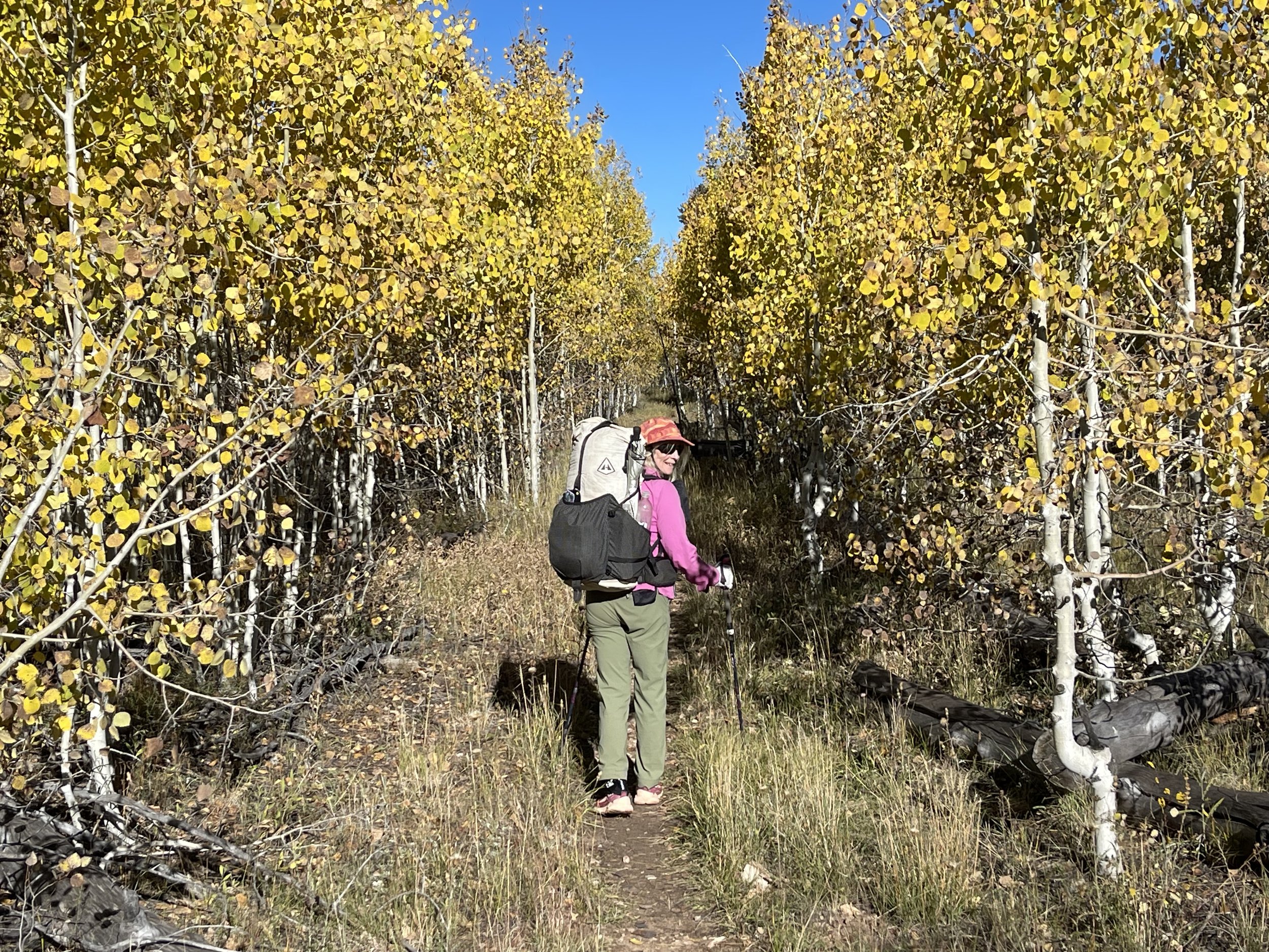
Our original plans of spending the winter of 22/23 skiing began to fade when Don needed to do some medical procedures. We began looking at different options and pulled out the Arizona Trail book which we had purchased several years ago thinking that someday this might be a good hike to try. After some preliminary research, we were ready to go hiking in Arizona! In normal weather years this probably wouldn’t seem to be so challenging, but the early months of 2023 were proving anything but normal. Snow falls were hitting records high not only in CA, but also in Arizona. Our first plan was to start at the Mexico border with Arizona and thru hike to the Arizona border with Utah. By mid Feb. we were looking at other options. The joys of not having a schedule allowed us the freedom to look at various options. The acronym of HYOY (hike your own hike) would become apparent as we looked at how hiking this year might be accomplished. Getting out of CA was our first obstacle, the day we had planned to leave was a day that roads were closed due to snow. We are talking southern CA! No worries there are always projects to do at Ryan’s and Beth’s house. Finally we were leaving San Diego and being awed by the snow at the first pass. As we made our way to Arizona, the weather check was a daily occurrence. There were several snow storms moving thru the areas that we had planned to start hiking, it was a constant reevaluating of hiking strategy.

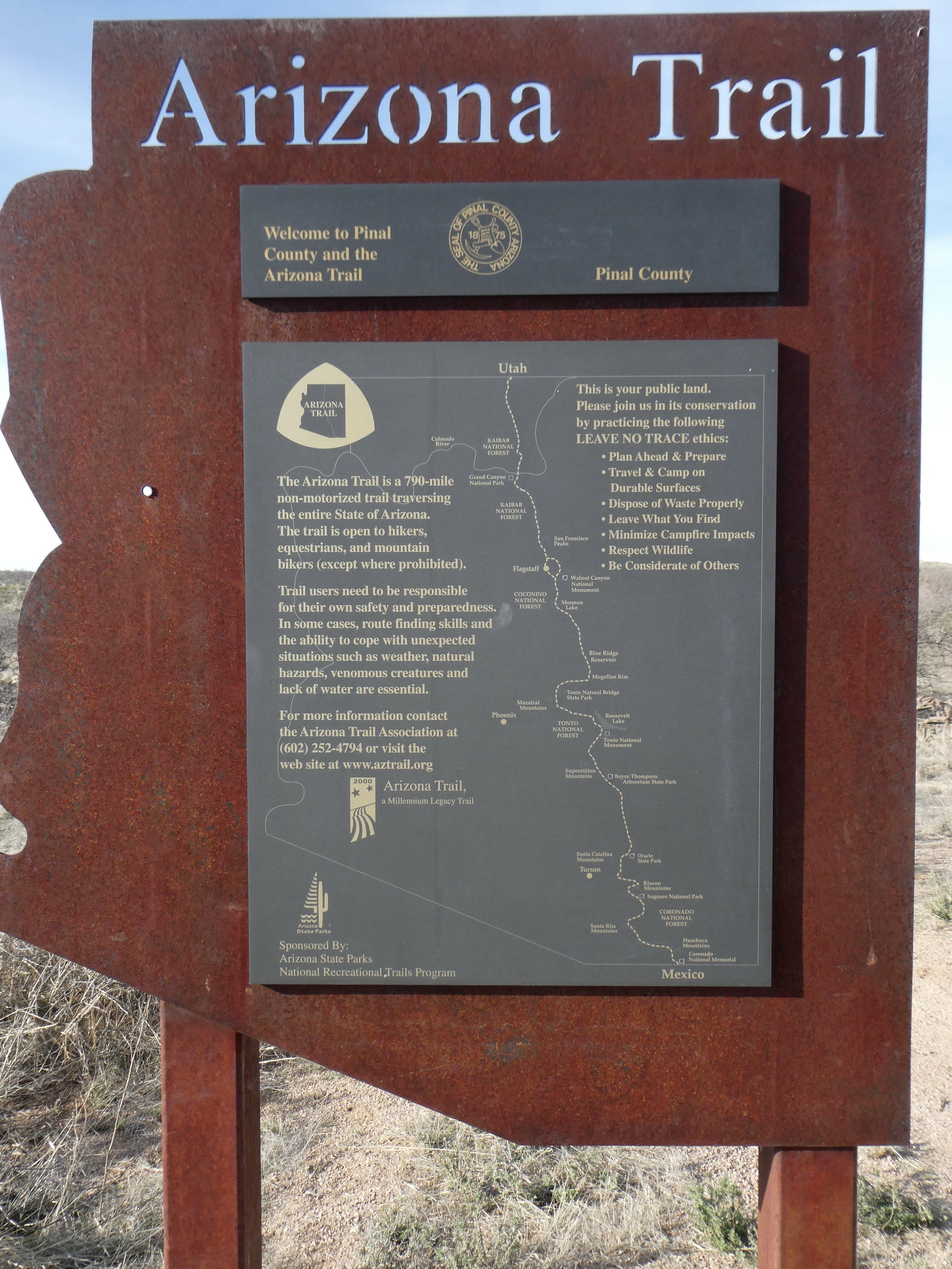
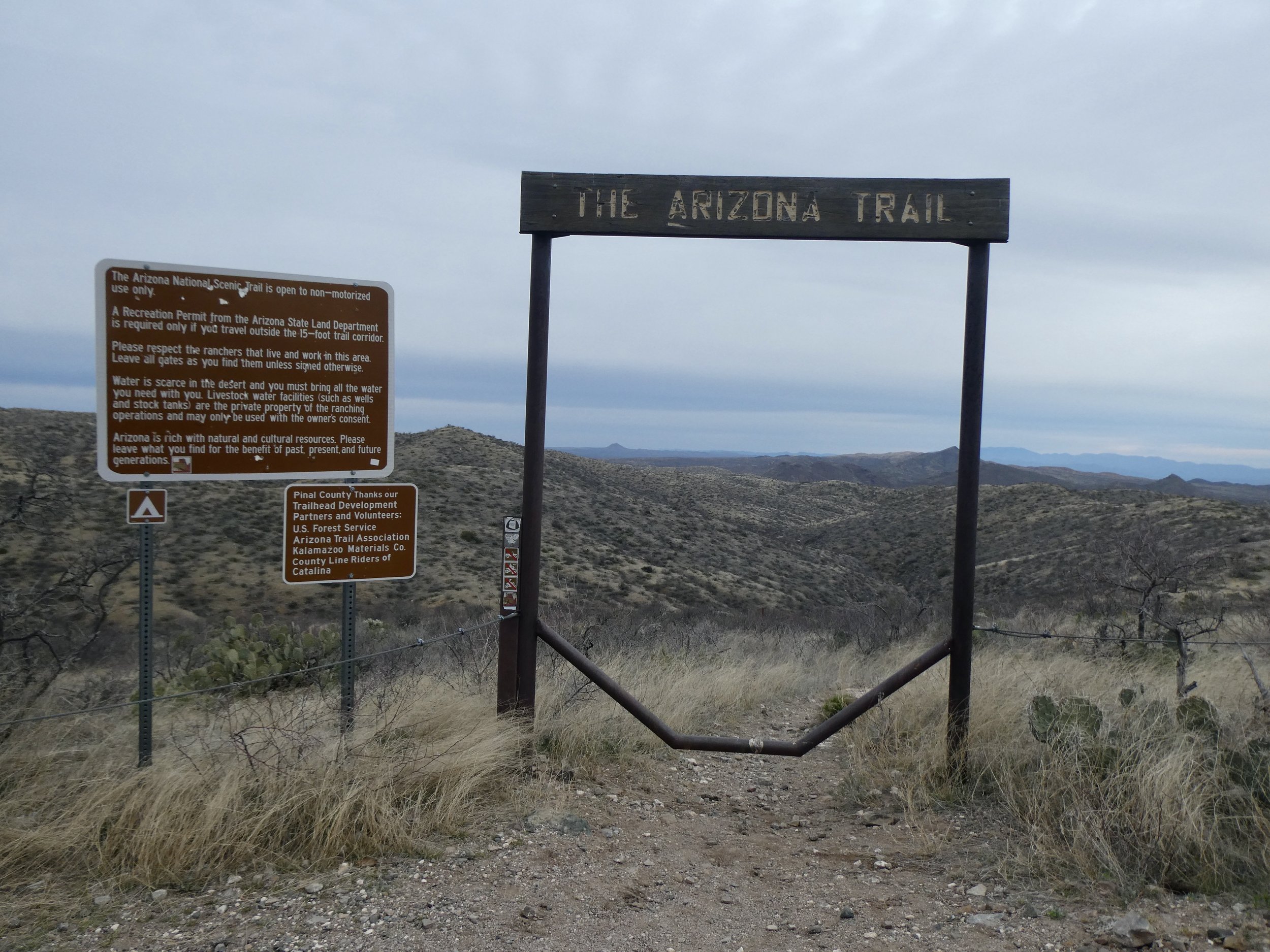
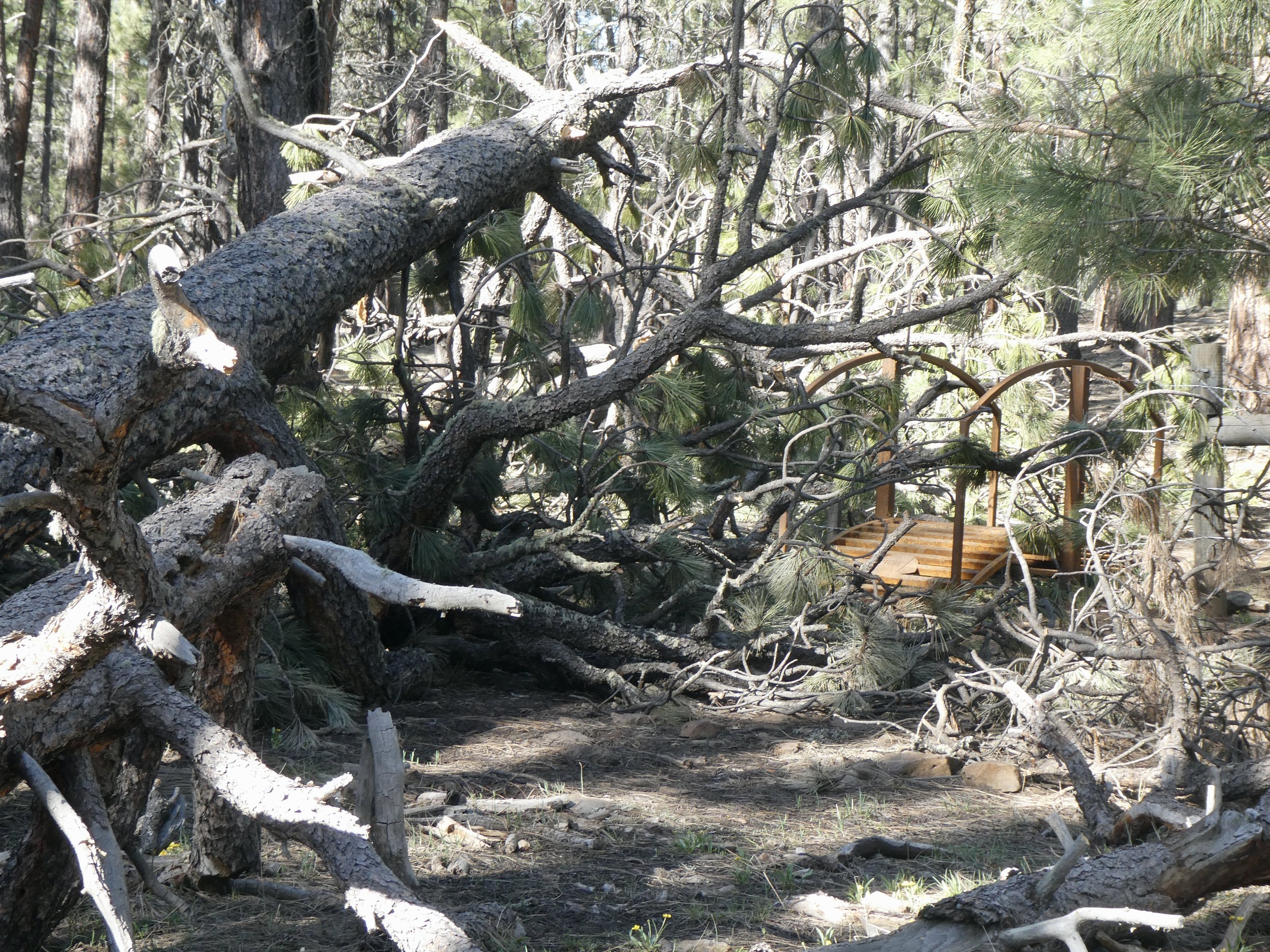
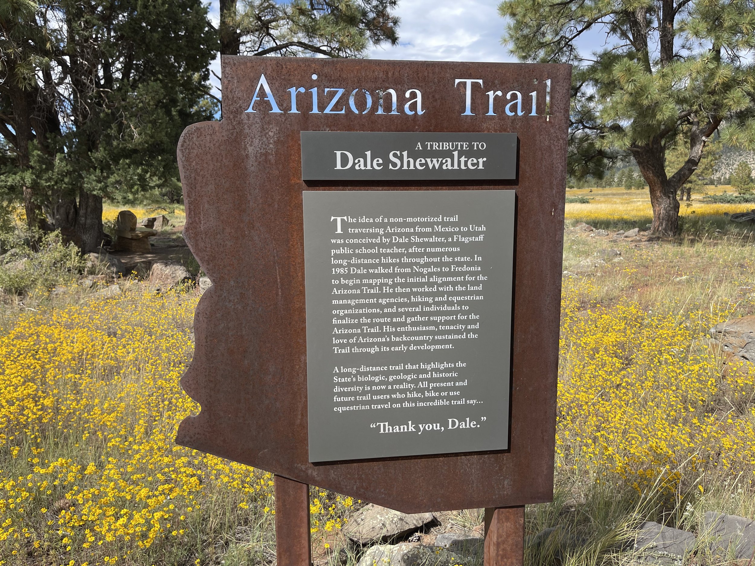
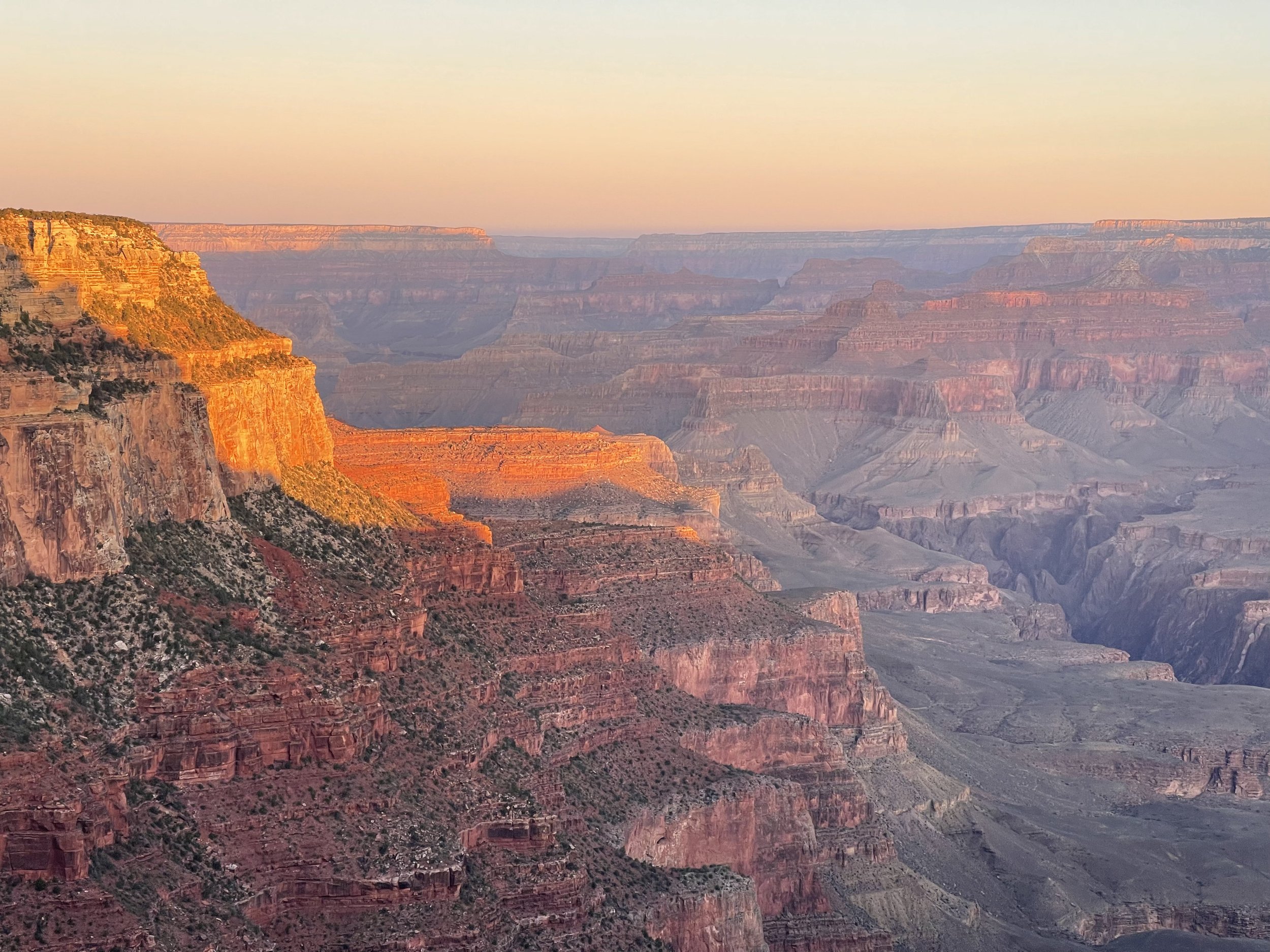
The Arizona trail was completed in 2011 and traverses 3 national parks, 1 state park, 6 wilderness areas, 4 national forests and 33 gateway communities. It is the only National Scenic Trail that crosses one of the Seven Natural Wonders of the World, the Grand Canyon. There are a lot of volunteers that keep the trail in good condition. Unfortunately after a winter that we have just experienced the trail will be needing a lot of work. The trail was a dream of Dale Shelter who with much perseverance turned his dream into a reality.

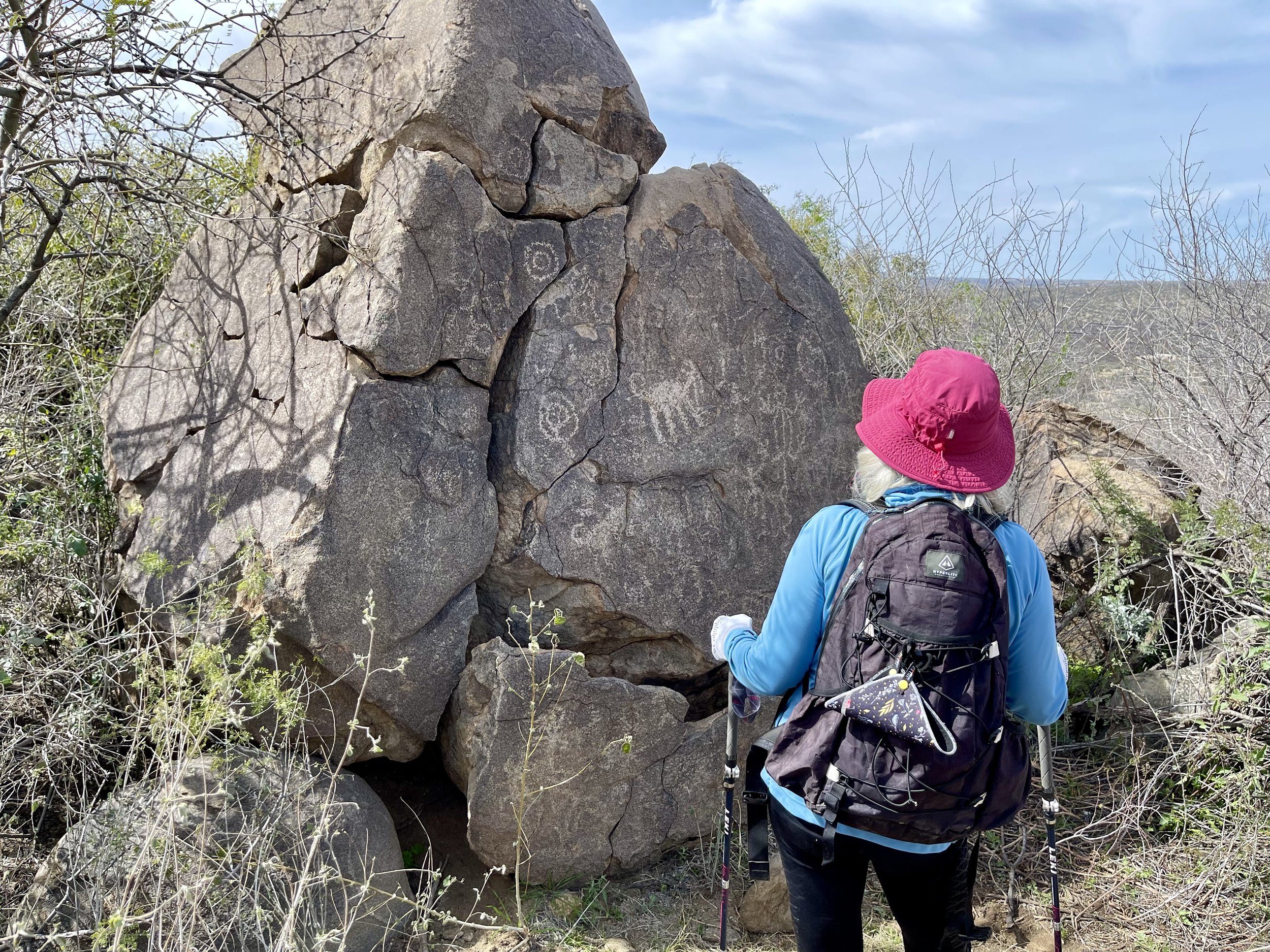
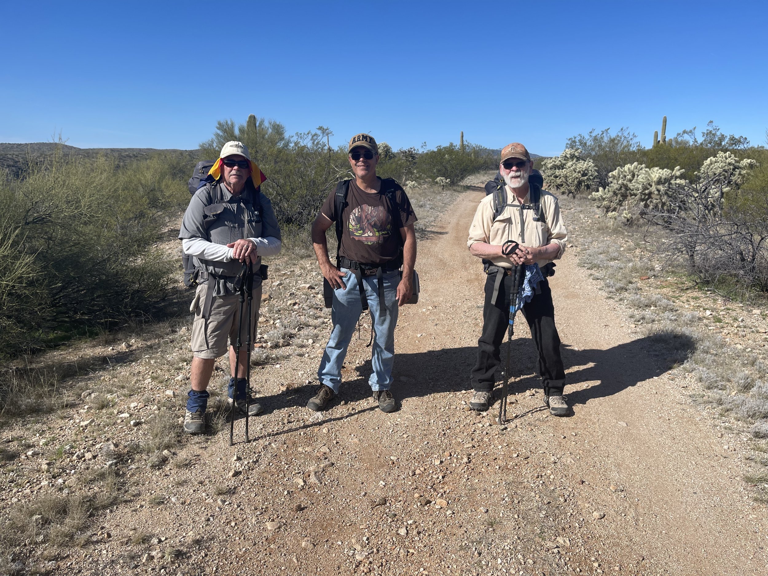
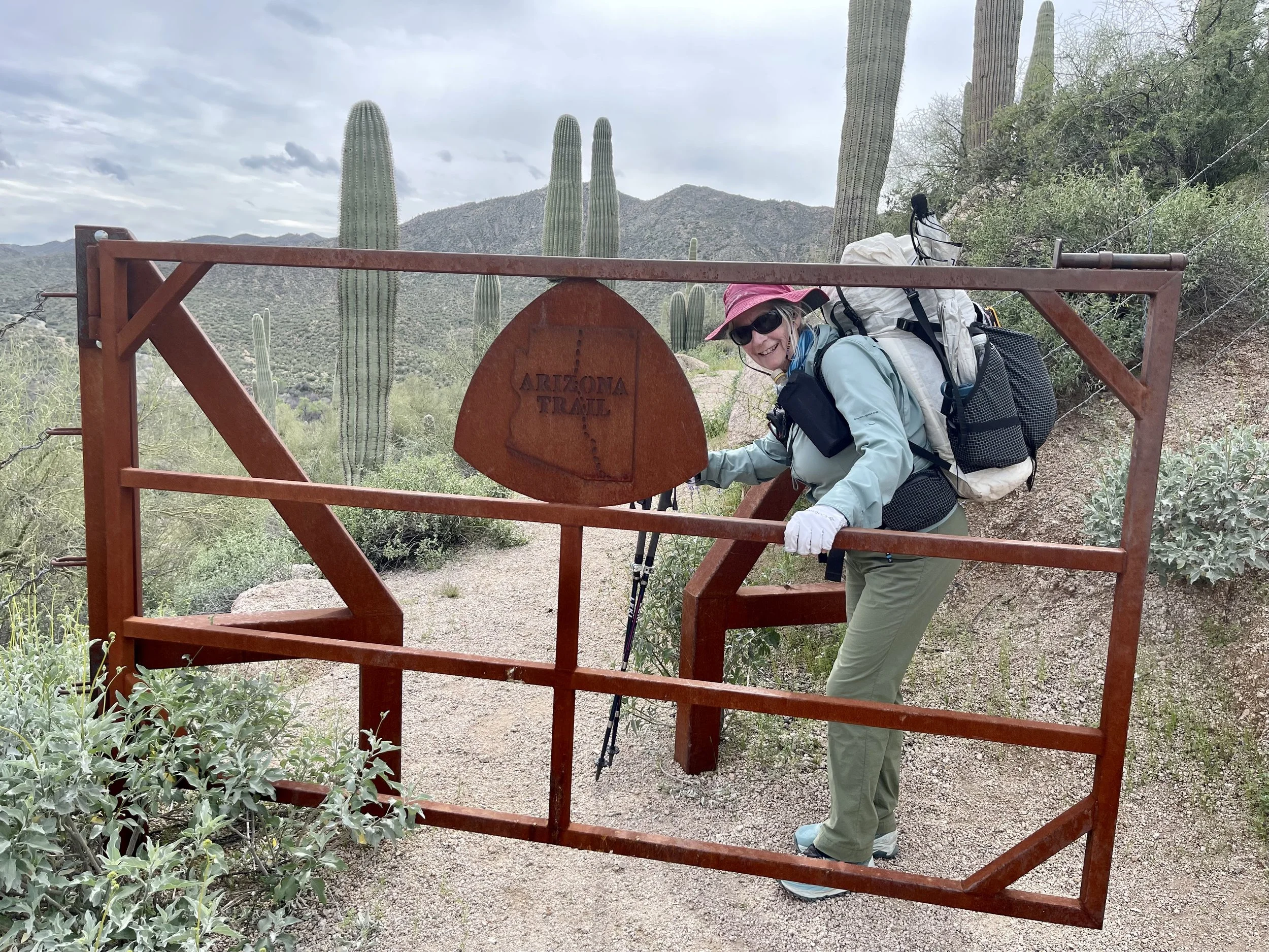
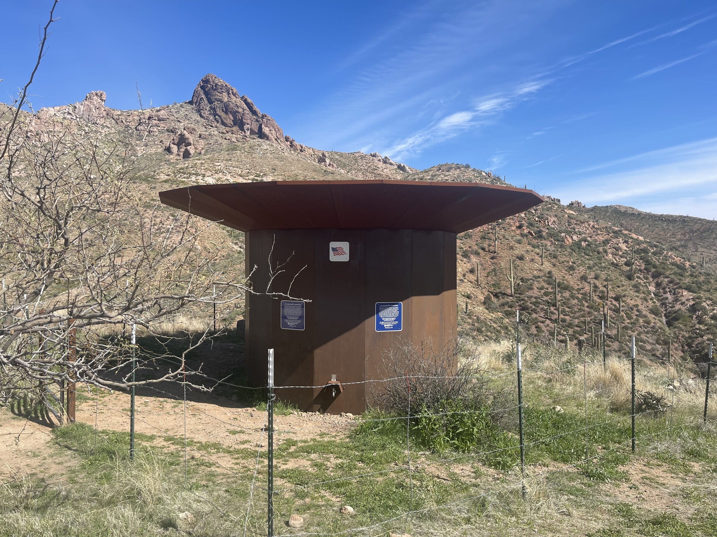
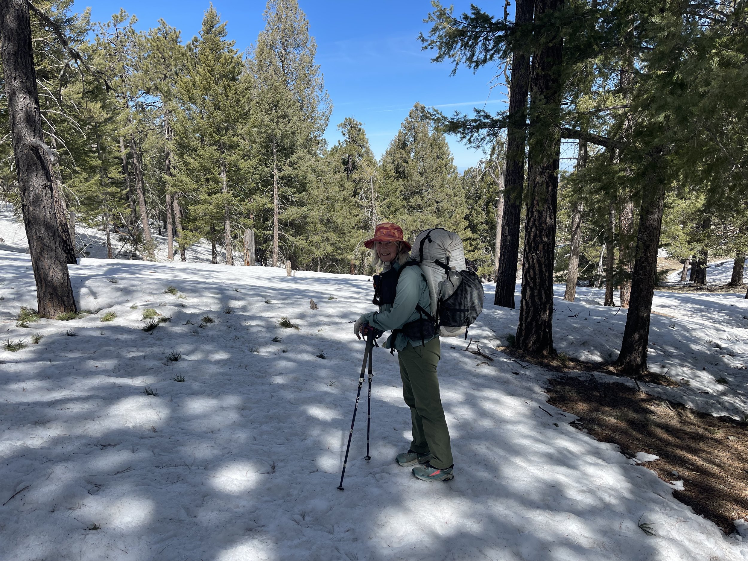
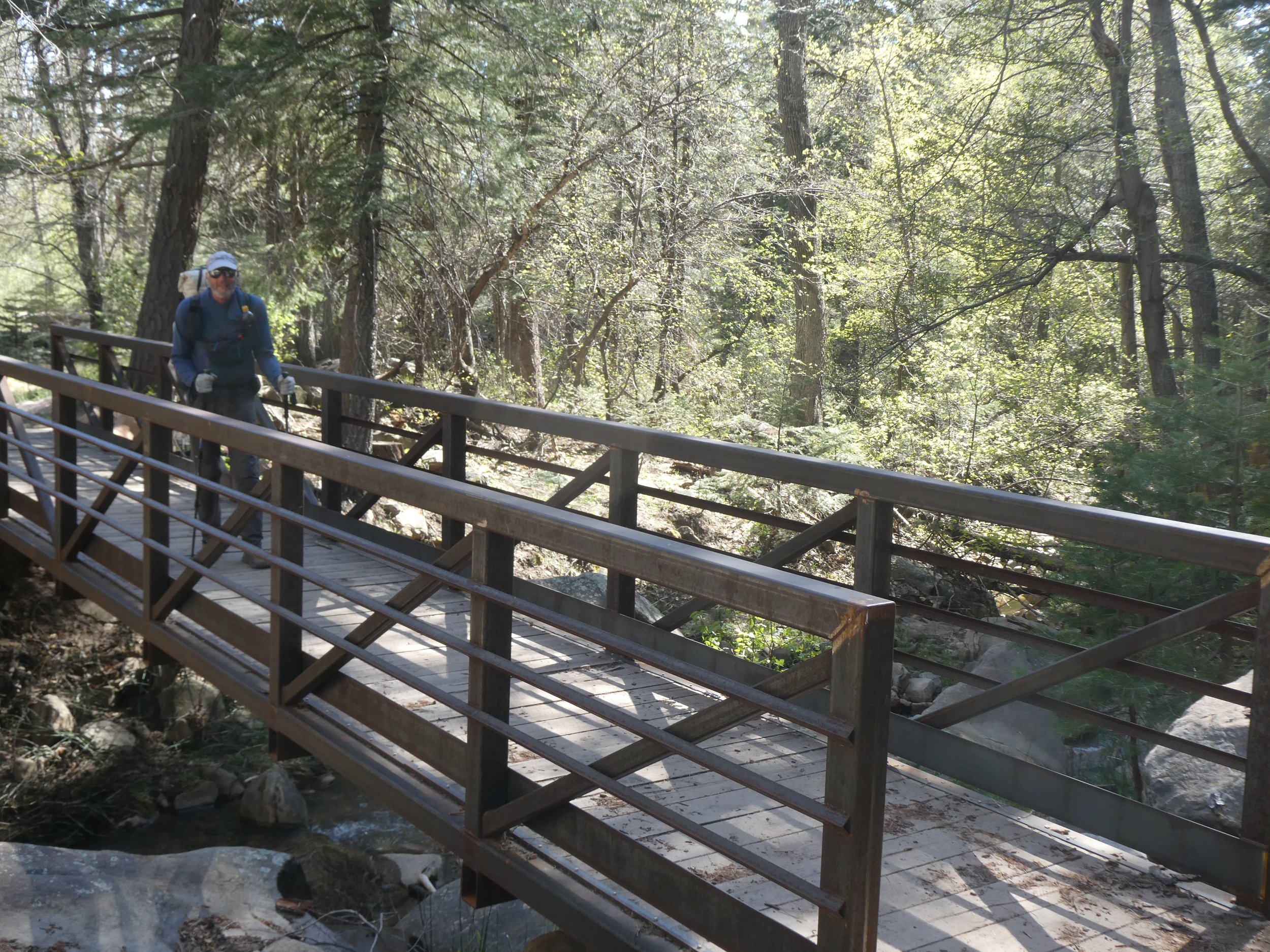
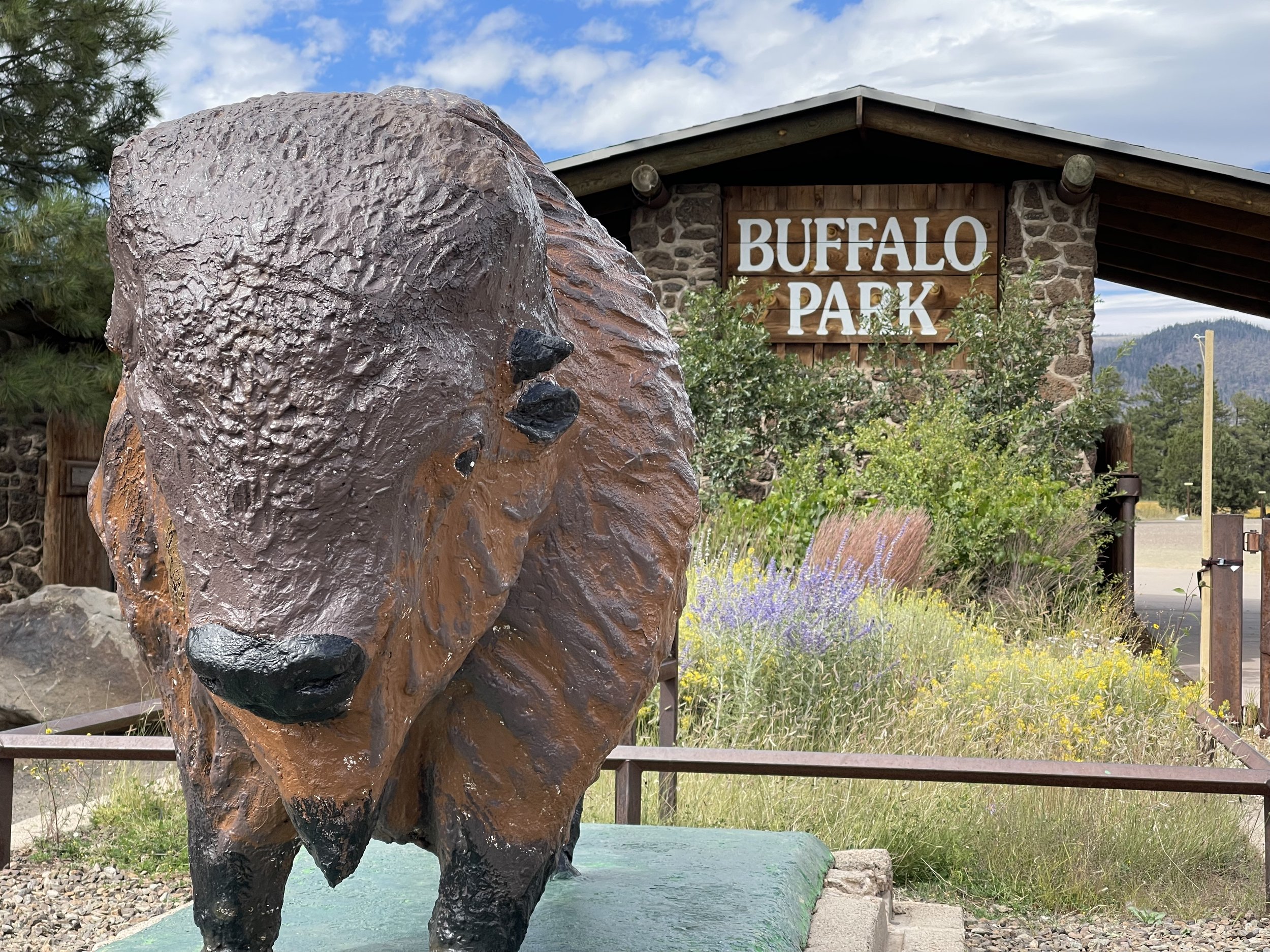
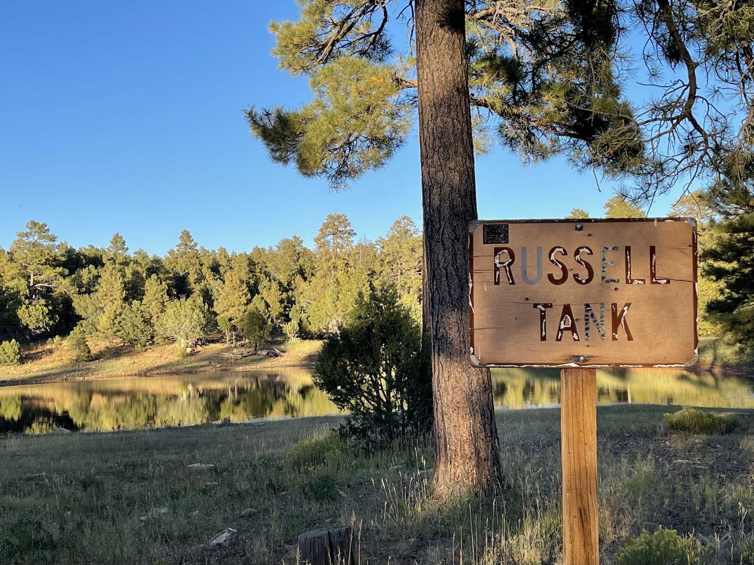
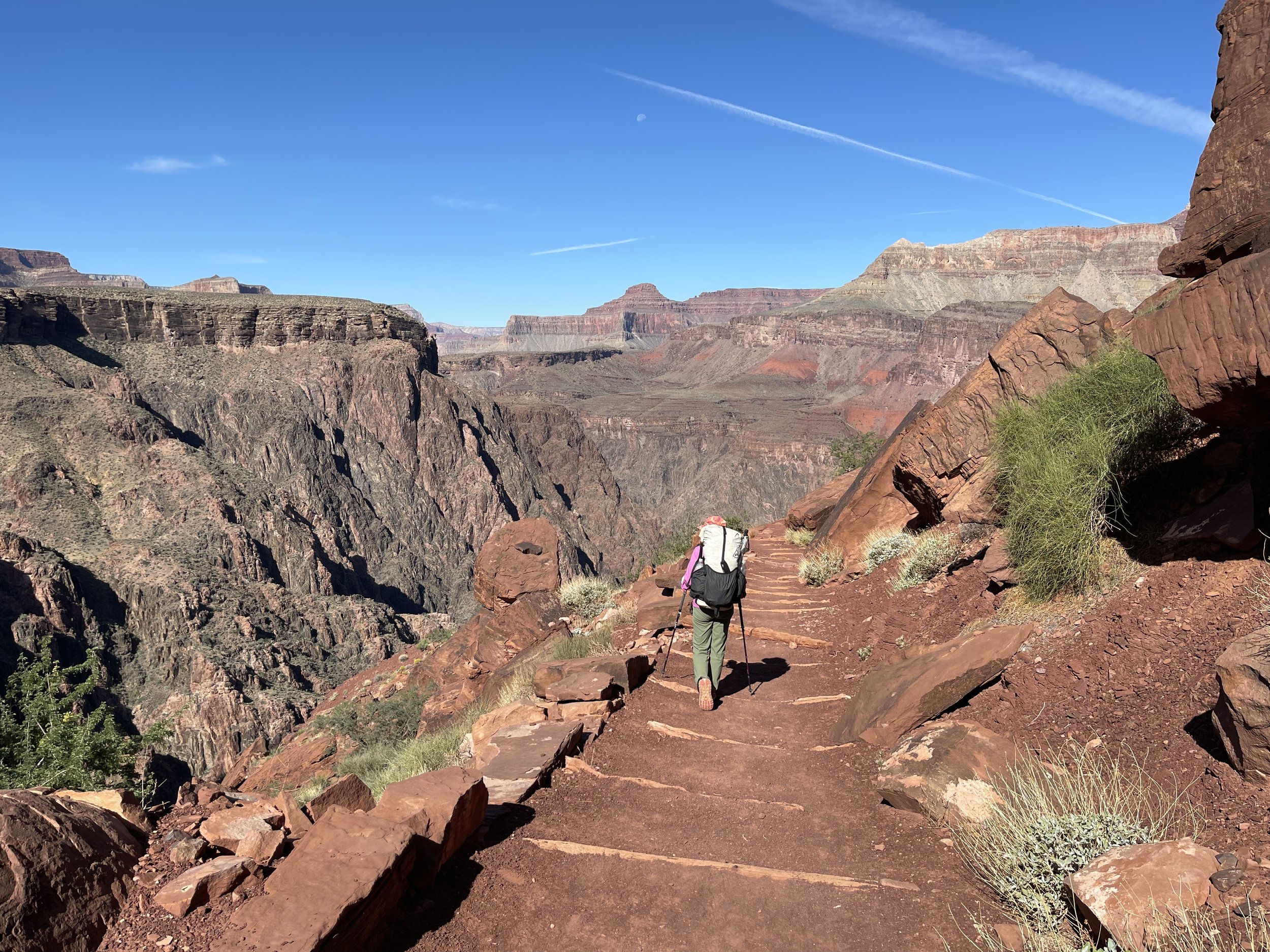
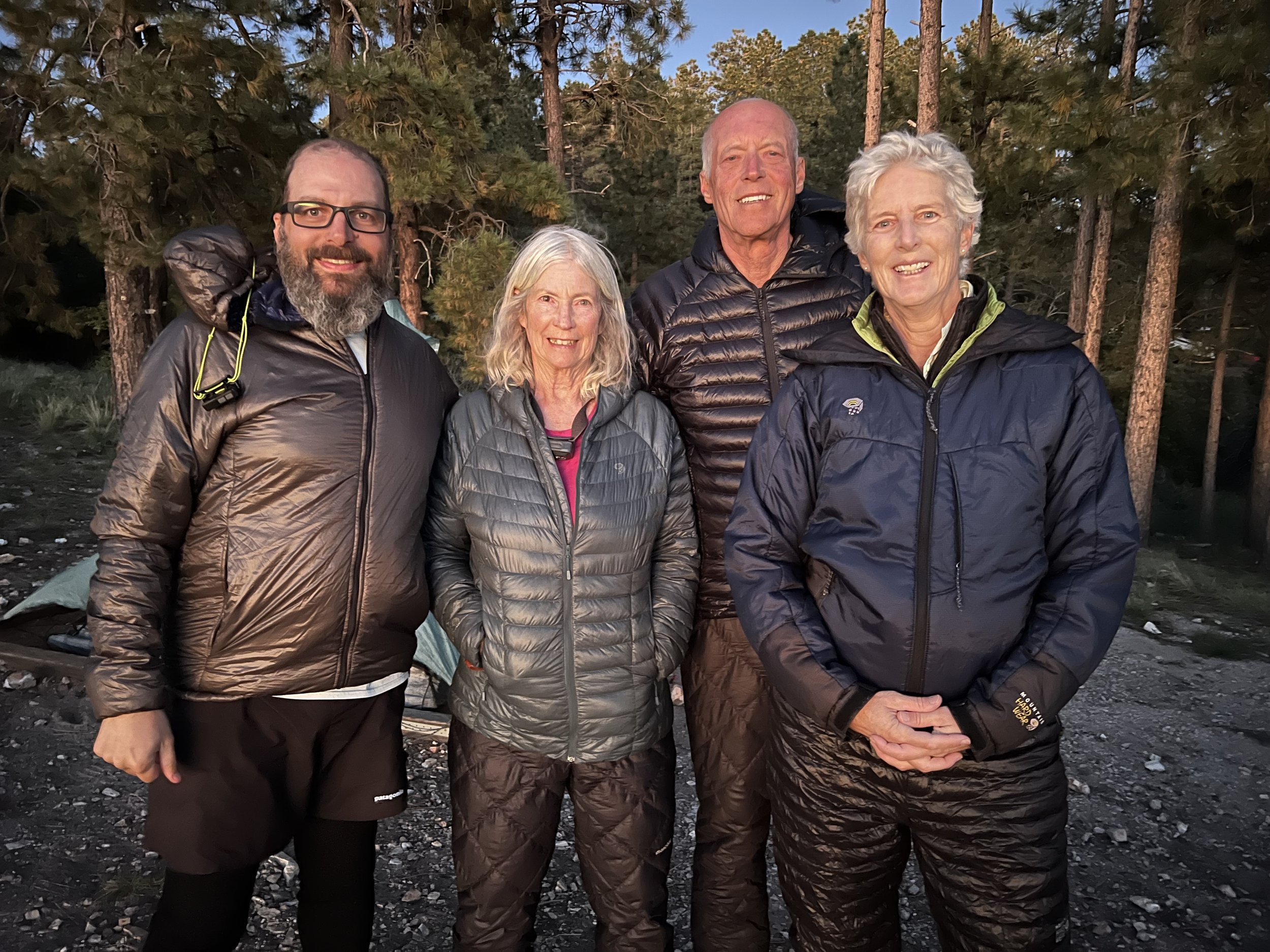
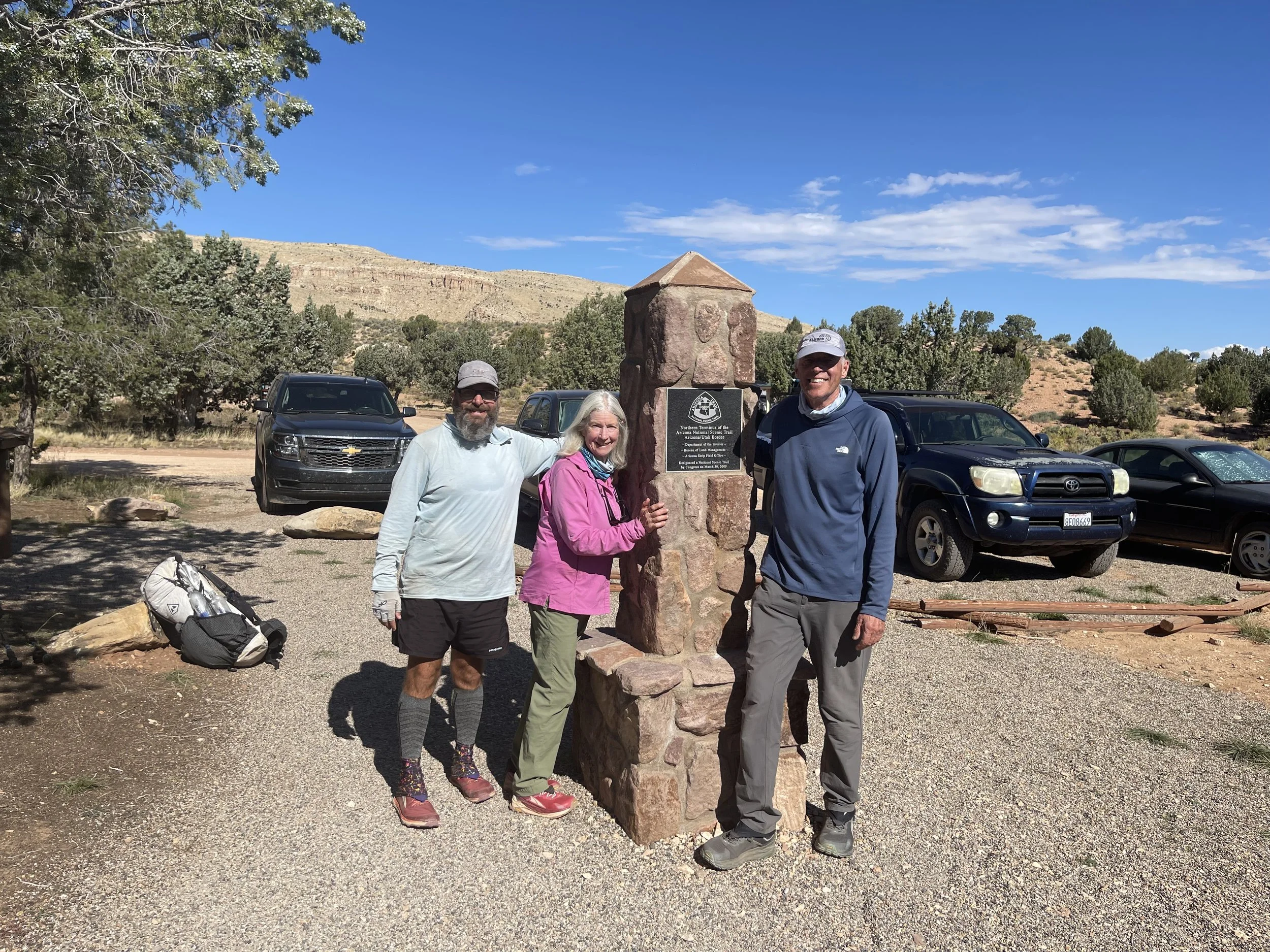
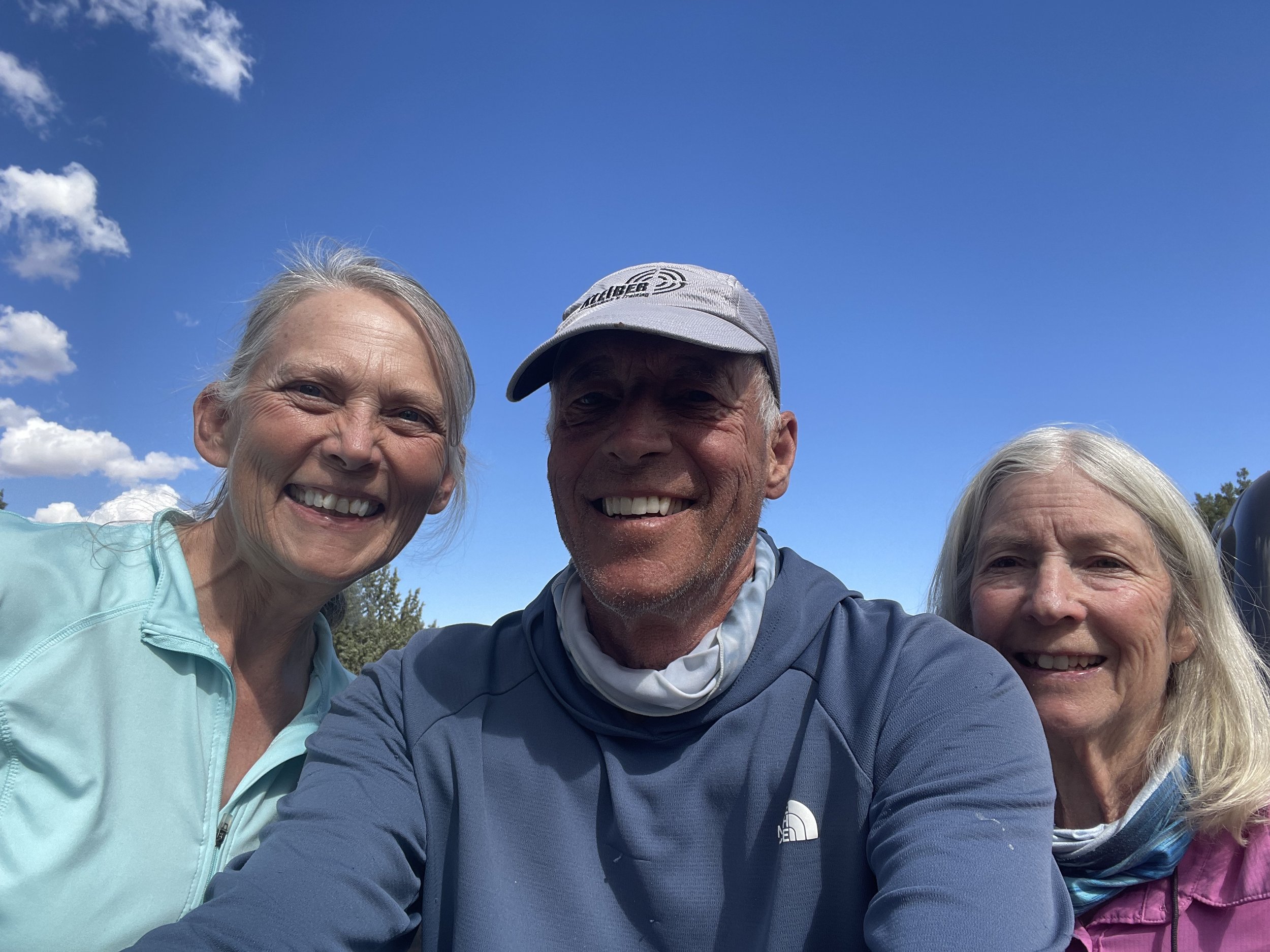
After arriving to Arizona and spending several days going over options, we have come up with a plan. It is quite different from our original plan, but we will be going hiking soon. Our friend Tracy lives north of Tuscon and has offered her house as a base to reorganize our hike. She has also been able to get some time off work and will hike the first section with us. She has a couple of commitments so our starting date will be March 7. We have a couple of days before this date so we decide to drop some resupply boxes off and snag the border section. This involves driving down to the border and hiking about 2 miles to the border and back. There is no road to the border so this section needs to be done if you want to get all the trail miles completed. Some hikers start at the trailhead and don’t walk down to the border monument, but since we have the time we decide to do it.

On the way to the border, we stop at Colossal Cave to drop off a resupply box. The women accepting the box makes the comment that your hiker will thank you for this. We then tell her that we are the hikers. I guess we didn’t quite fit her image of thru hikers. Sitting by the bathroom was a young man who had a backpack next to him. I asked him if he was thru hiking and he said yes, but he needed to get off the trail as there was too much snow and it was also colder than he expected. We offered to take him to the nearby town and he filled us in on the conditions of the first part of the trail. His comments were of the large amount of snow and the cold temperatures. We are liking our plan more and more. We head south to the town of Patagonia where we are also dropping a resupply box at the Stage Coach Inn. We camp nearby and are surprised to see a temperature of 20 degrees in the morning. Fortunately when the sun rises so does the temperature.

Our first stop this morning is the Coronado National Memorial. In 1540 Coronado set off to explore this area with 300 Europeans, 1000 Aztec/Mexica allies, a handful of Franciscan priests and scores of servants and enslaved people. It is hard to imagine the extent of this expedition as we view the landscape. The memorial does a good job of explaining this expedition.

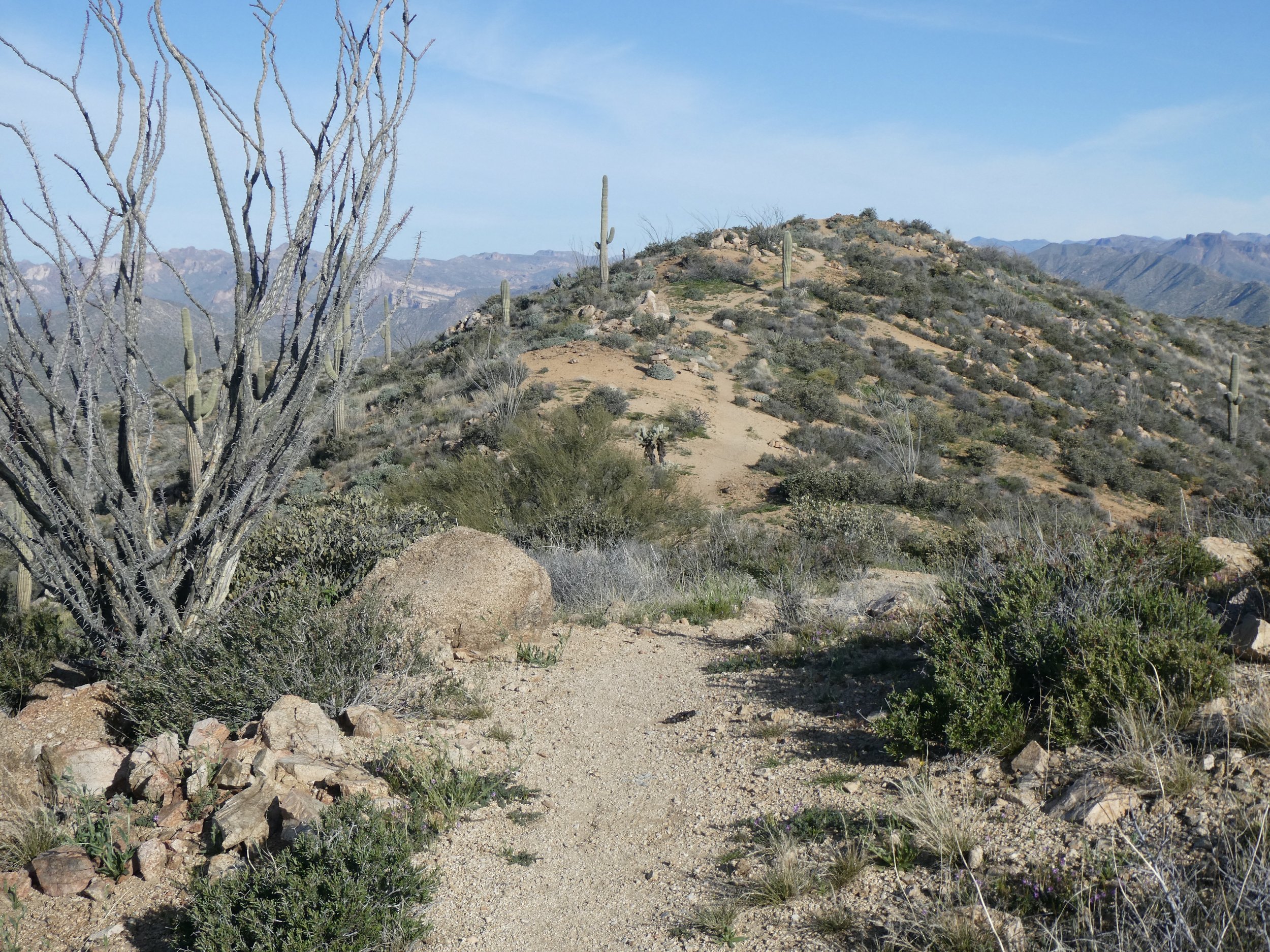
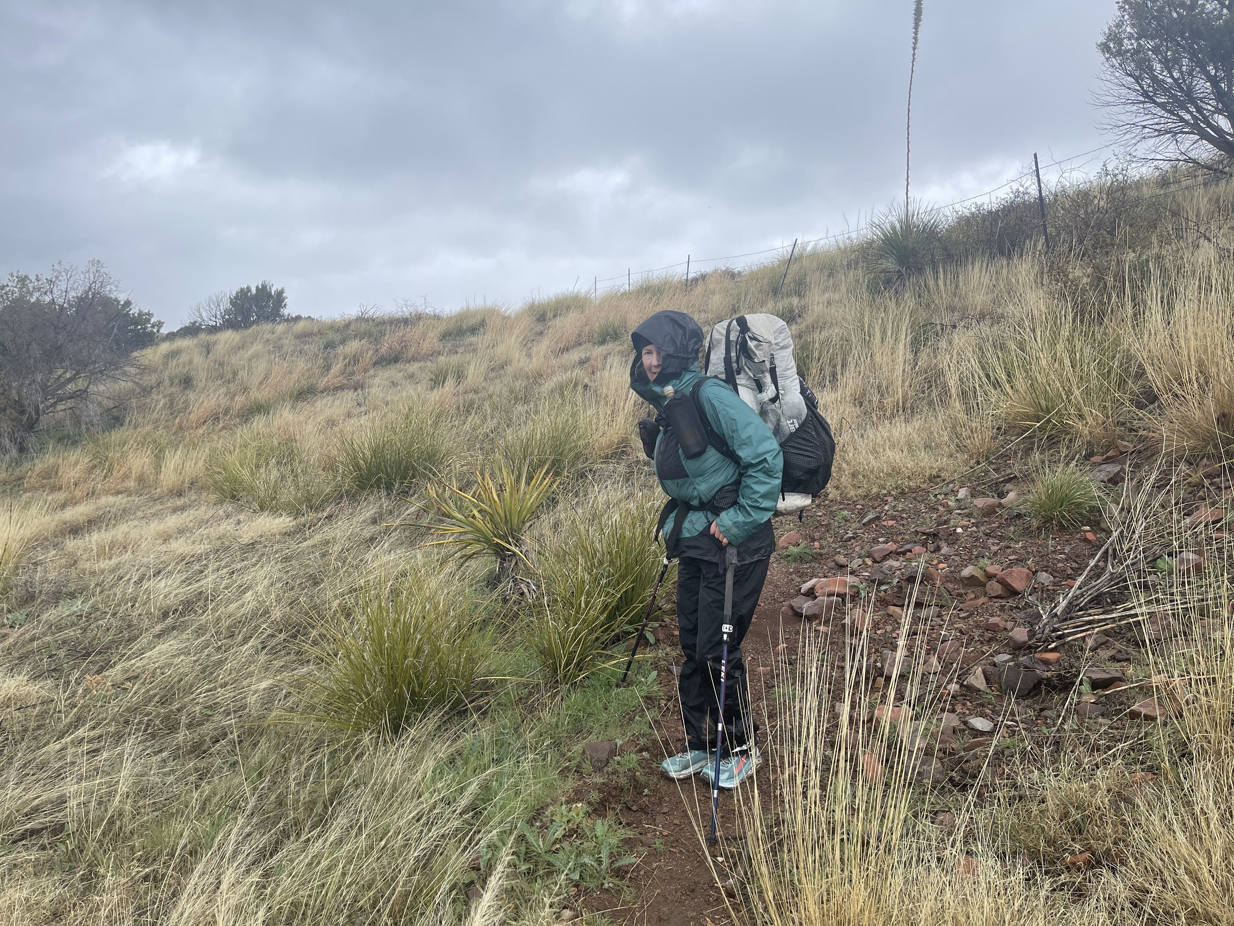
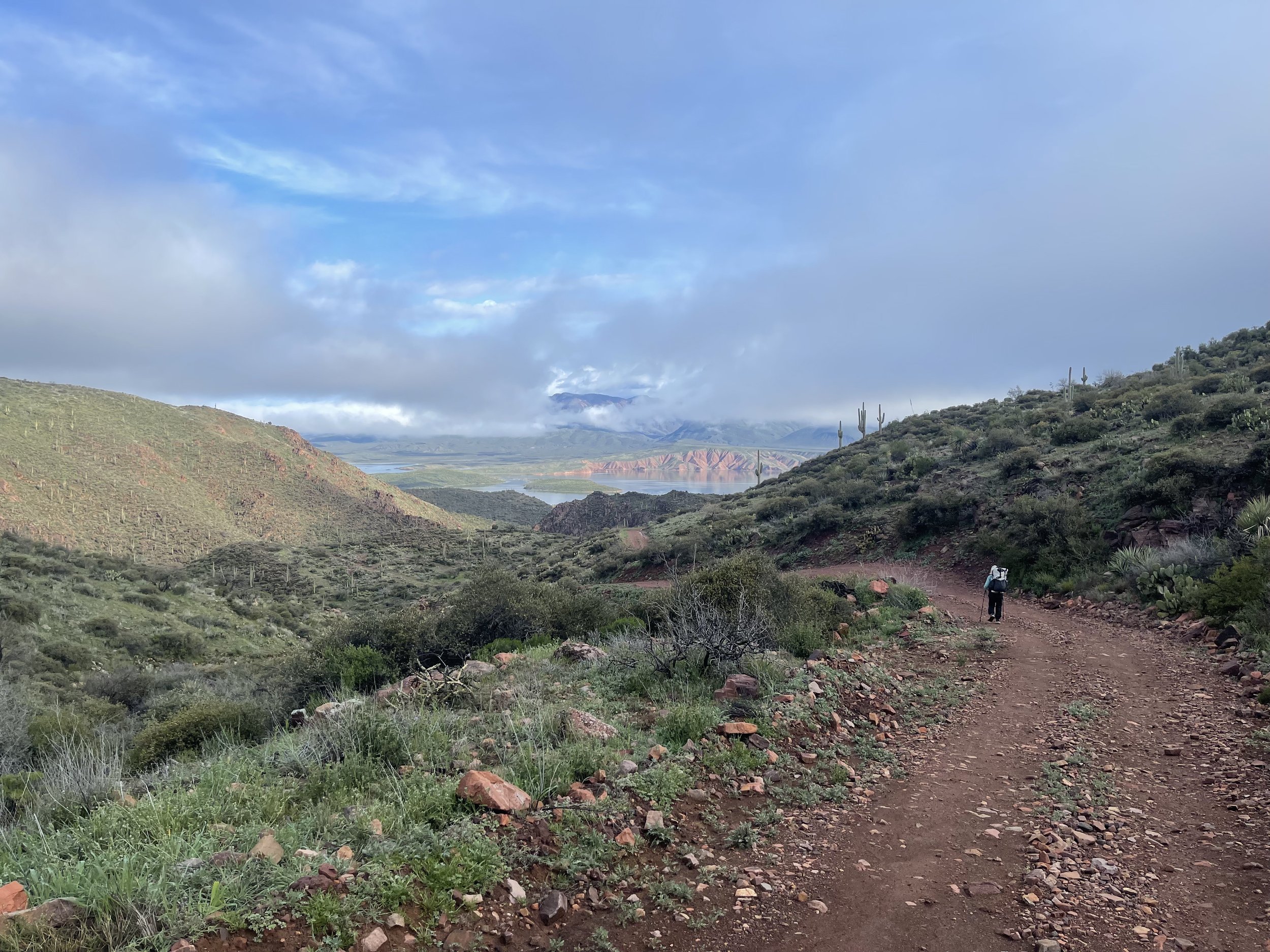
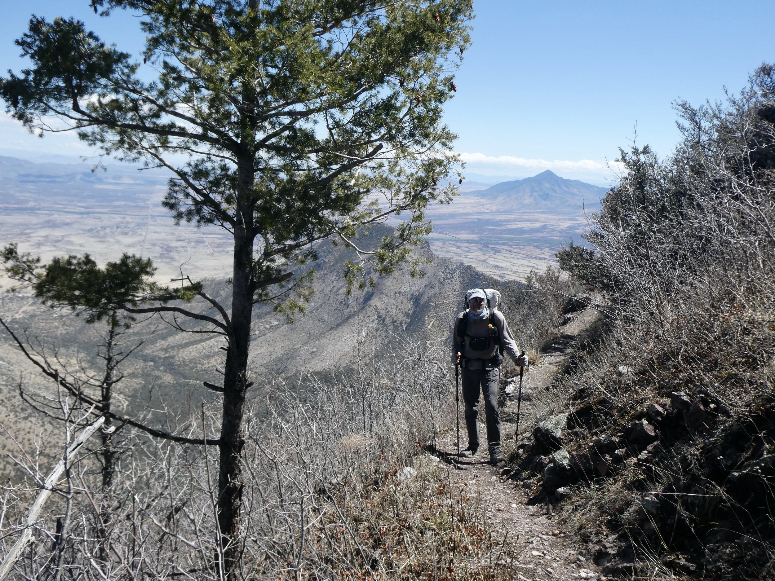
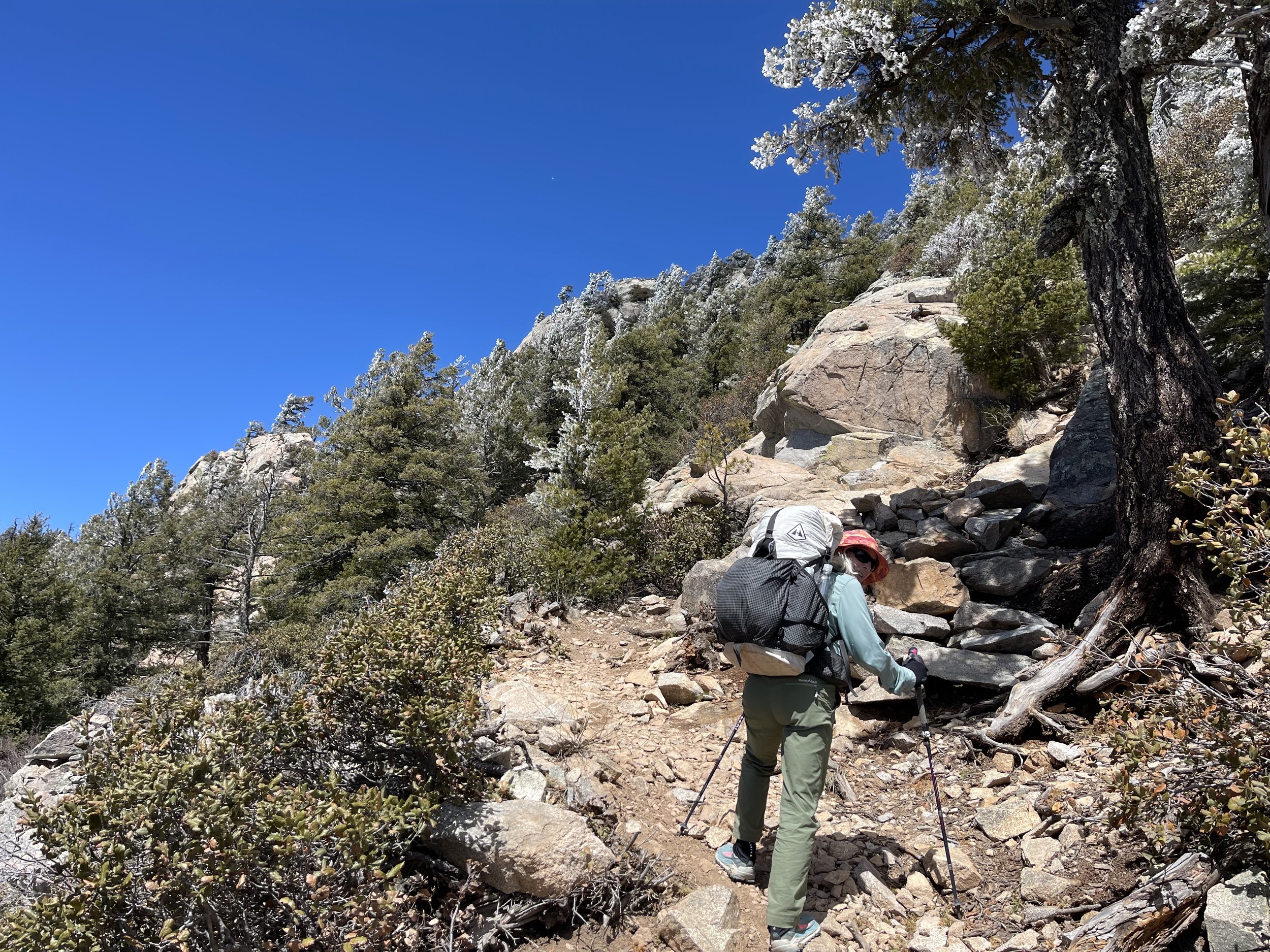
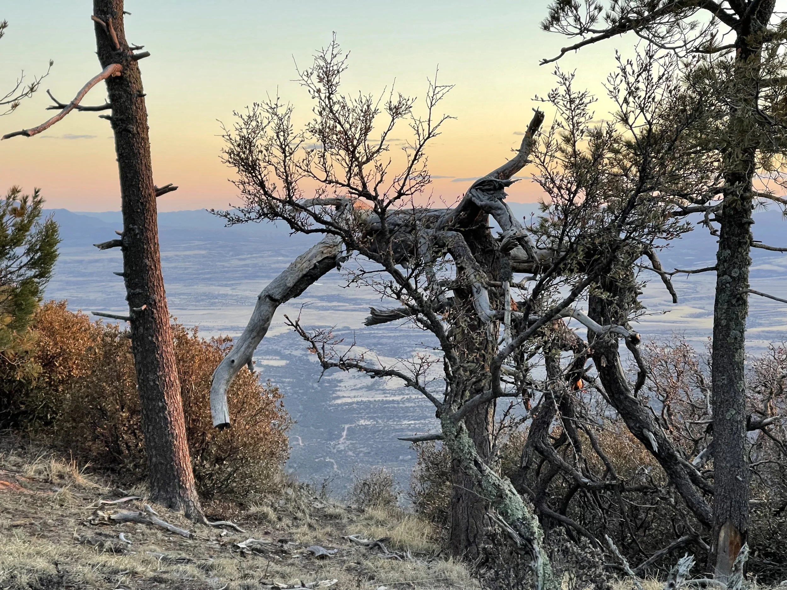
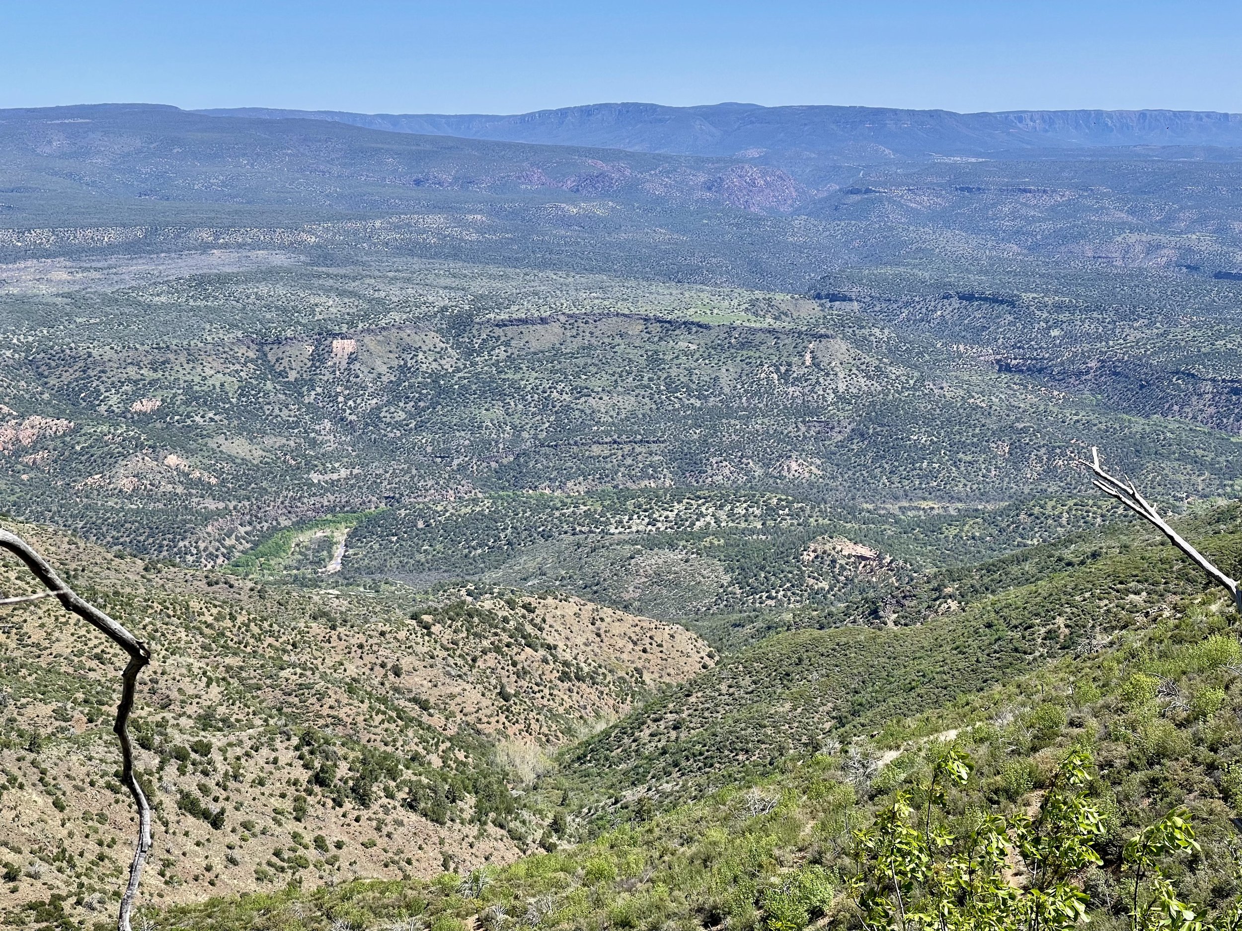
We are fortunate that we have arrived to the Memorial on a day that there is a shuttle that will take you to the top of the pass which is where the trail begins to the border and also to start the trail tothe north. It is a 3 mile drive on a steep and rough road. The winter rains and snows have not been kind to the road.When we arrive to the pass the driver points out the trail and says not to be fooled by this side of the mountain going north. There is plenty of snow out of sight and what he described as dangerous conditions. There have already been some rescues of hikers, one of which was a helicopter rescue.

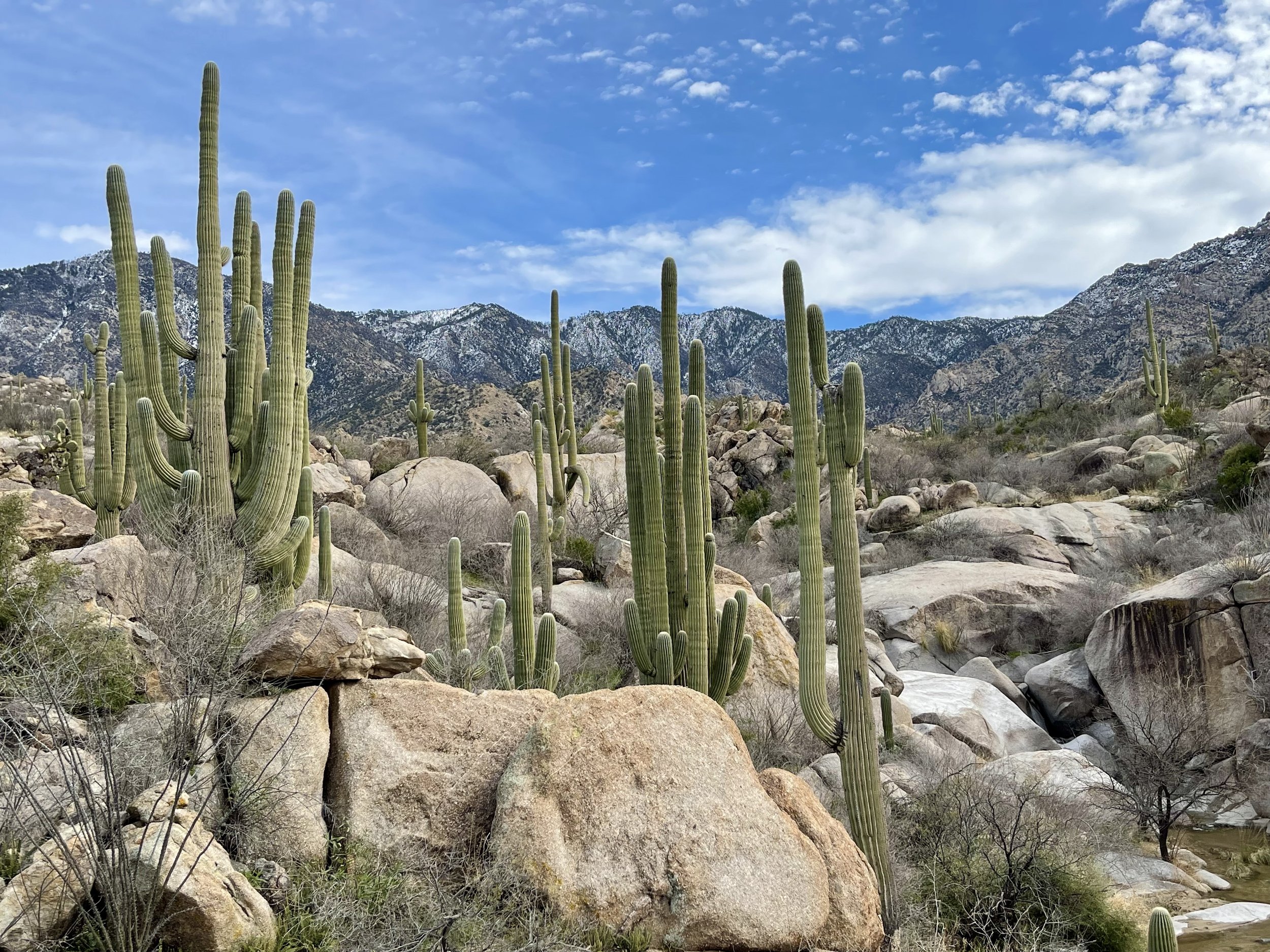
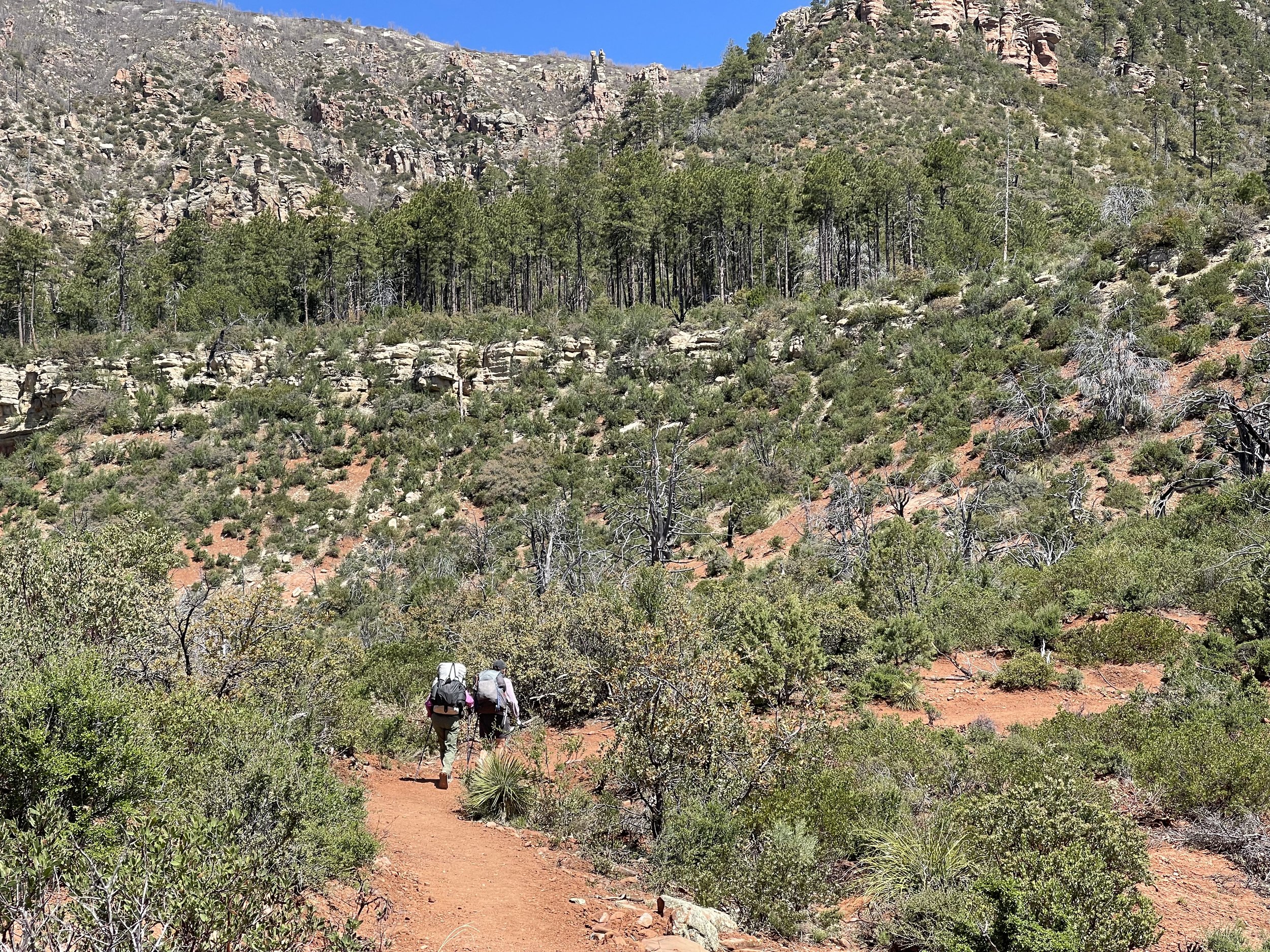
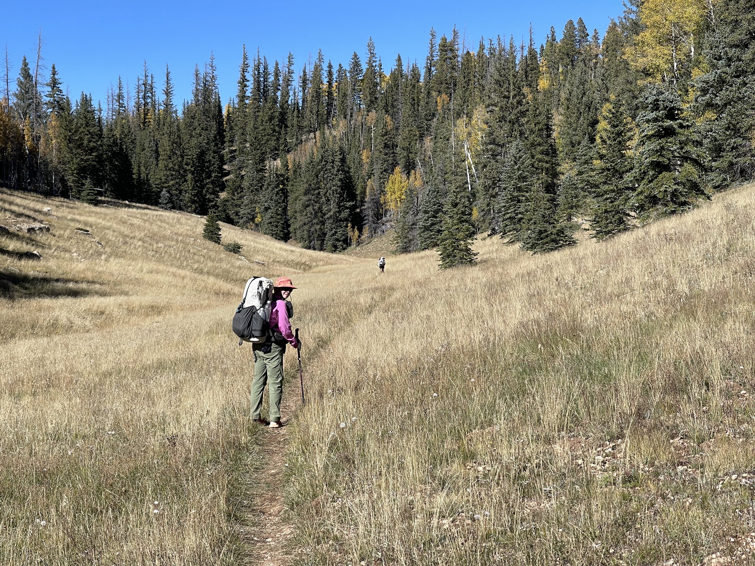
When we return in a couple of weeks we will be on a trail going up this mountain and will be hiking at an elevation of 9000 feet. Hopefully some of the snow will be melted by then.

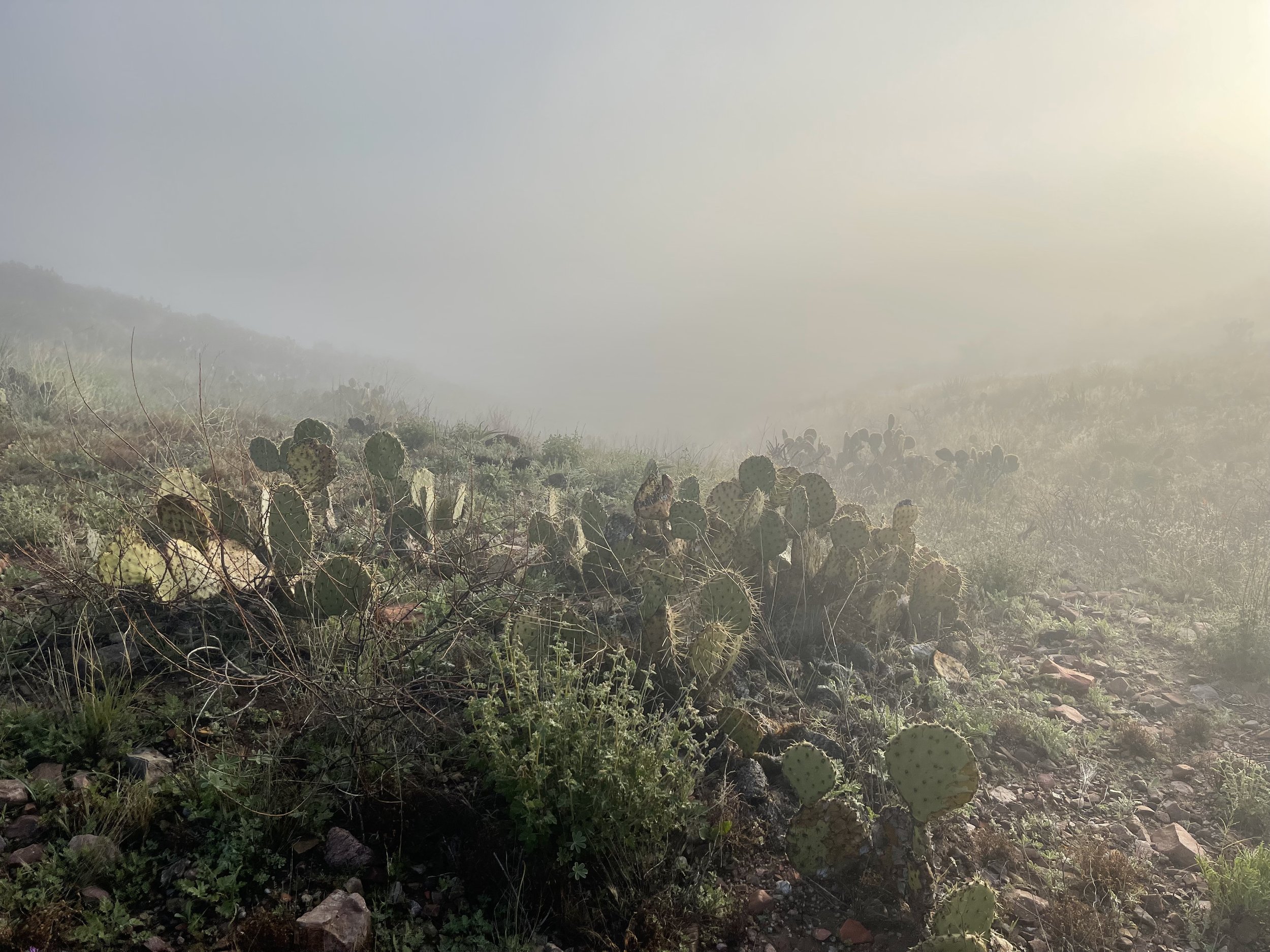
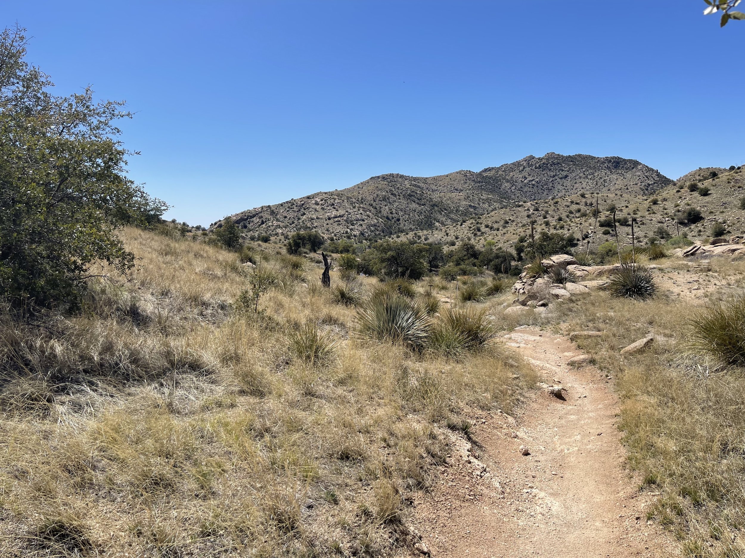
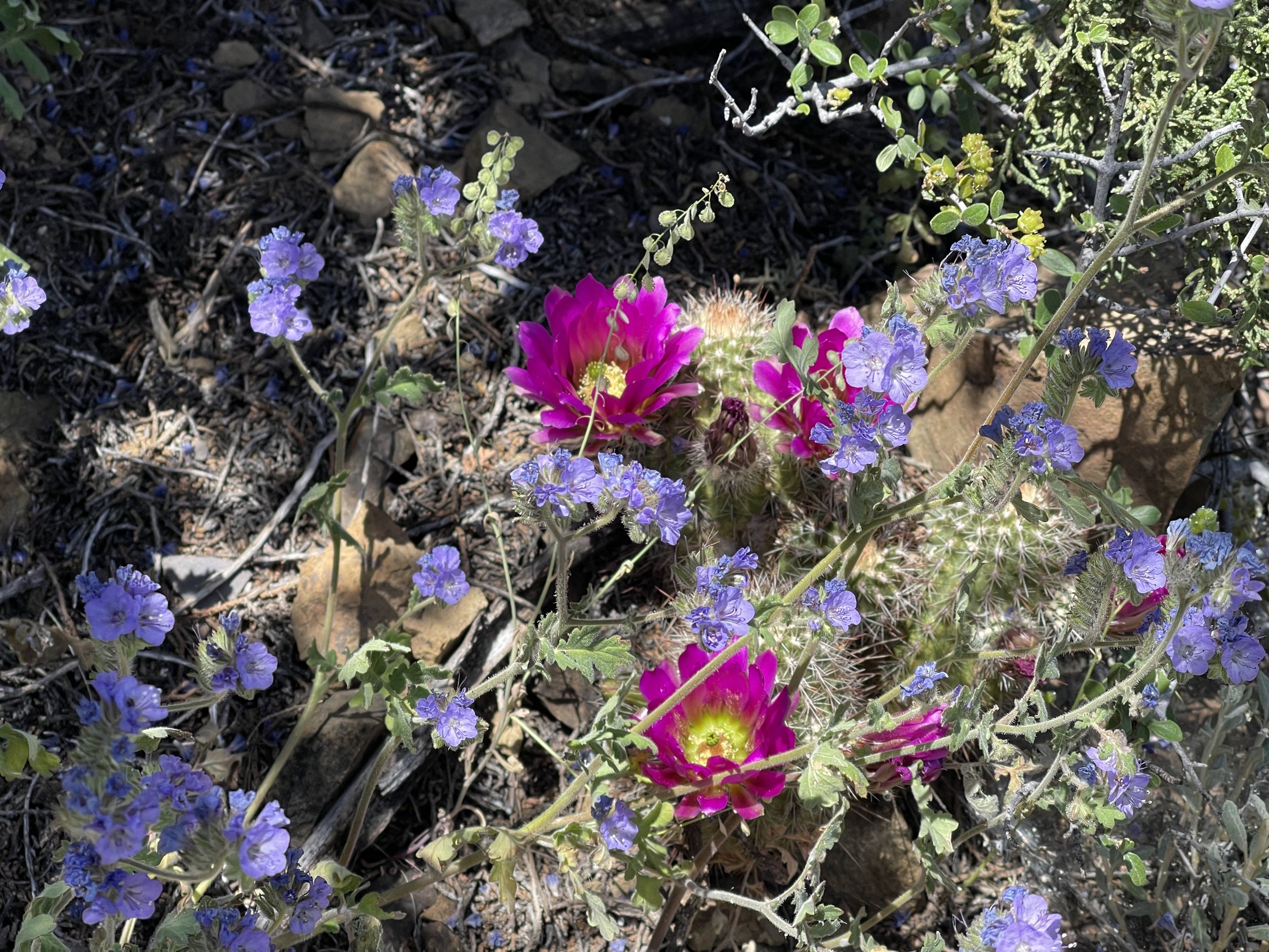
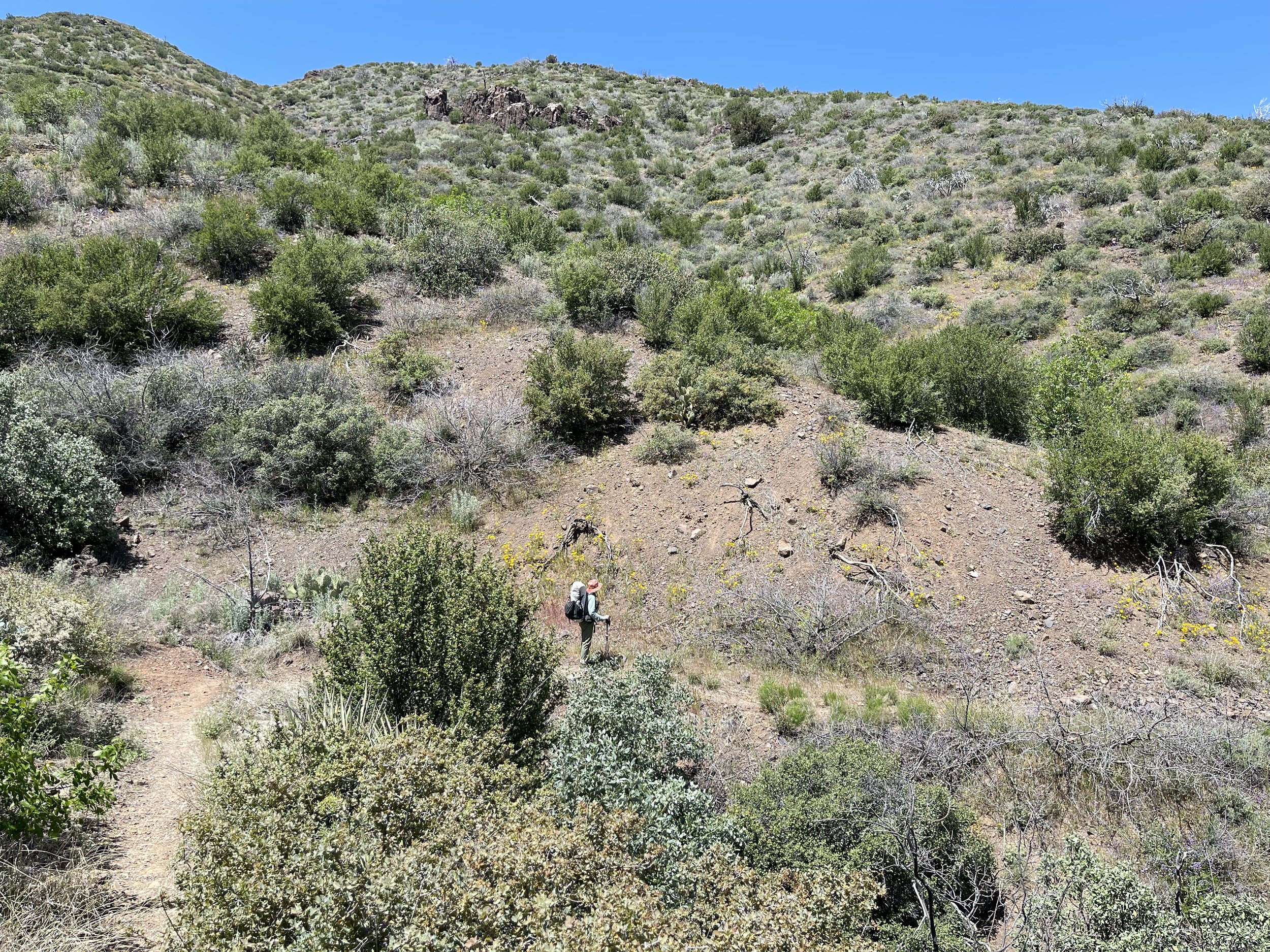
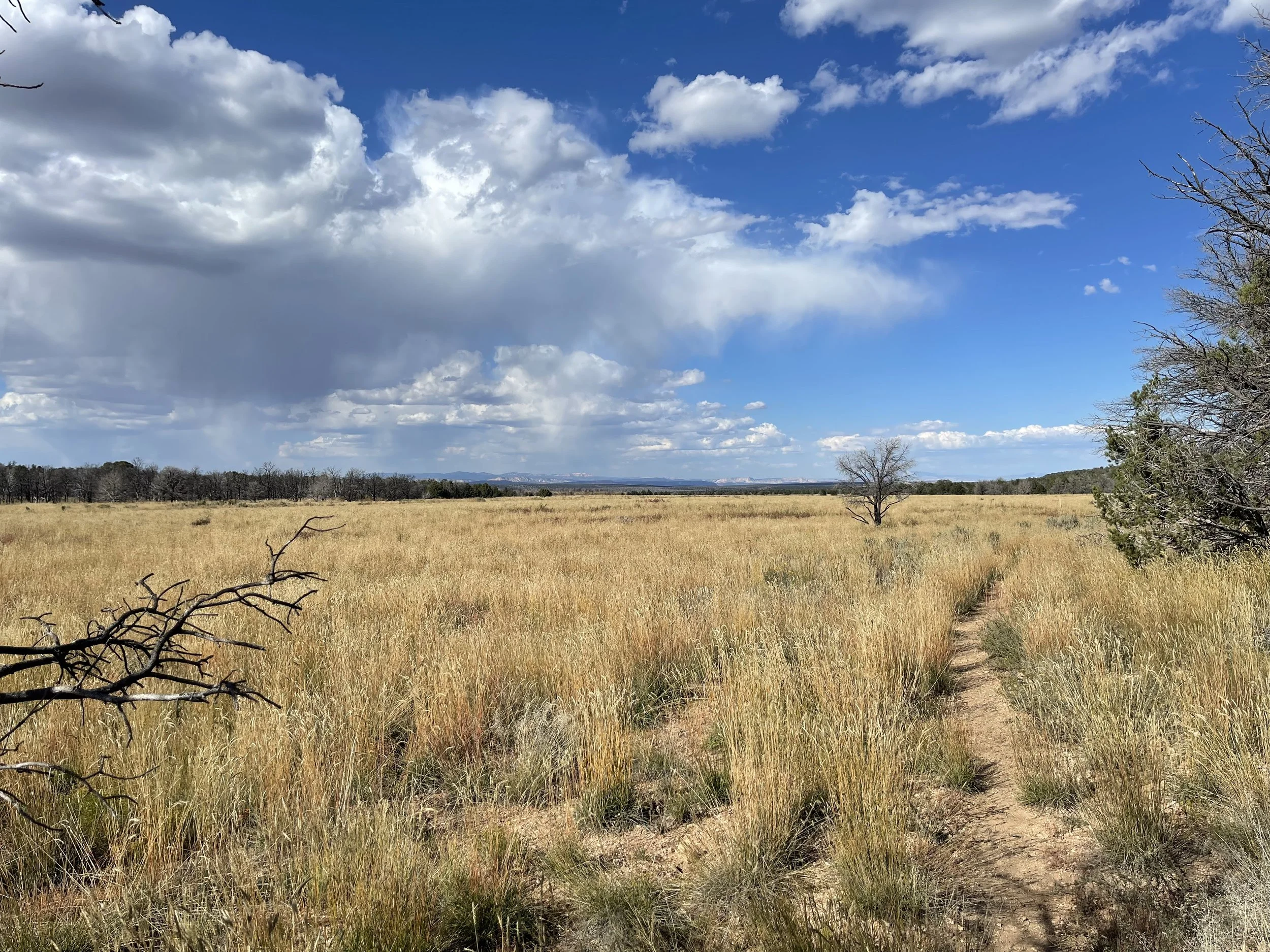
Meanwhile we are going to hike the trail that goes to the border. We are advised by our shuttle driver to stay on the signed main trail. This area is used by individuals that are making their way to the United States illegally and there are many side trails that they use. He mentions that most of the travel by these individuals is done at night and we most likely won’t have any encounters.

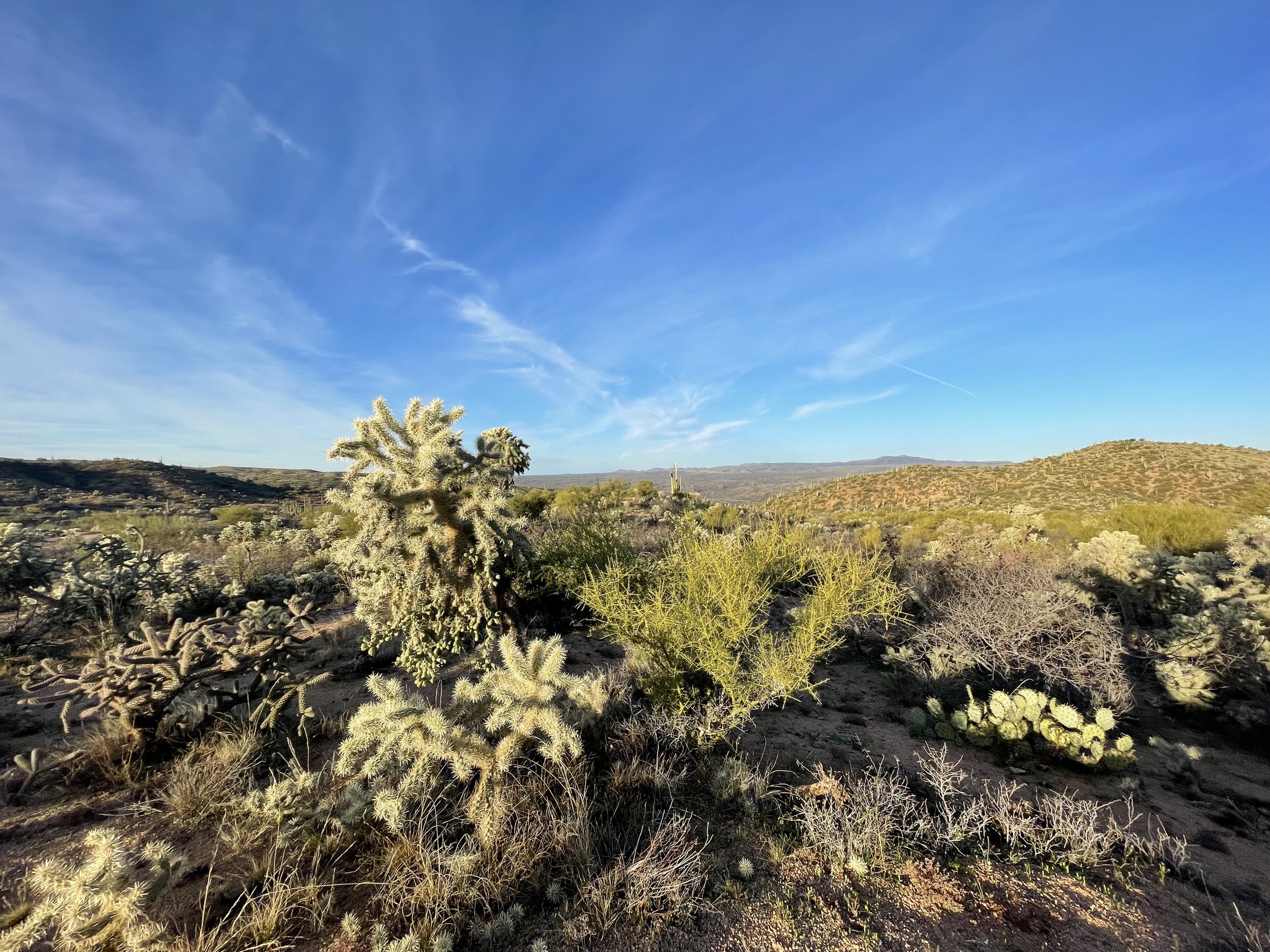
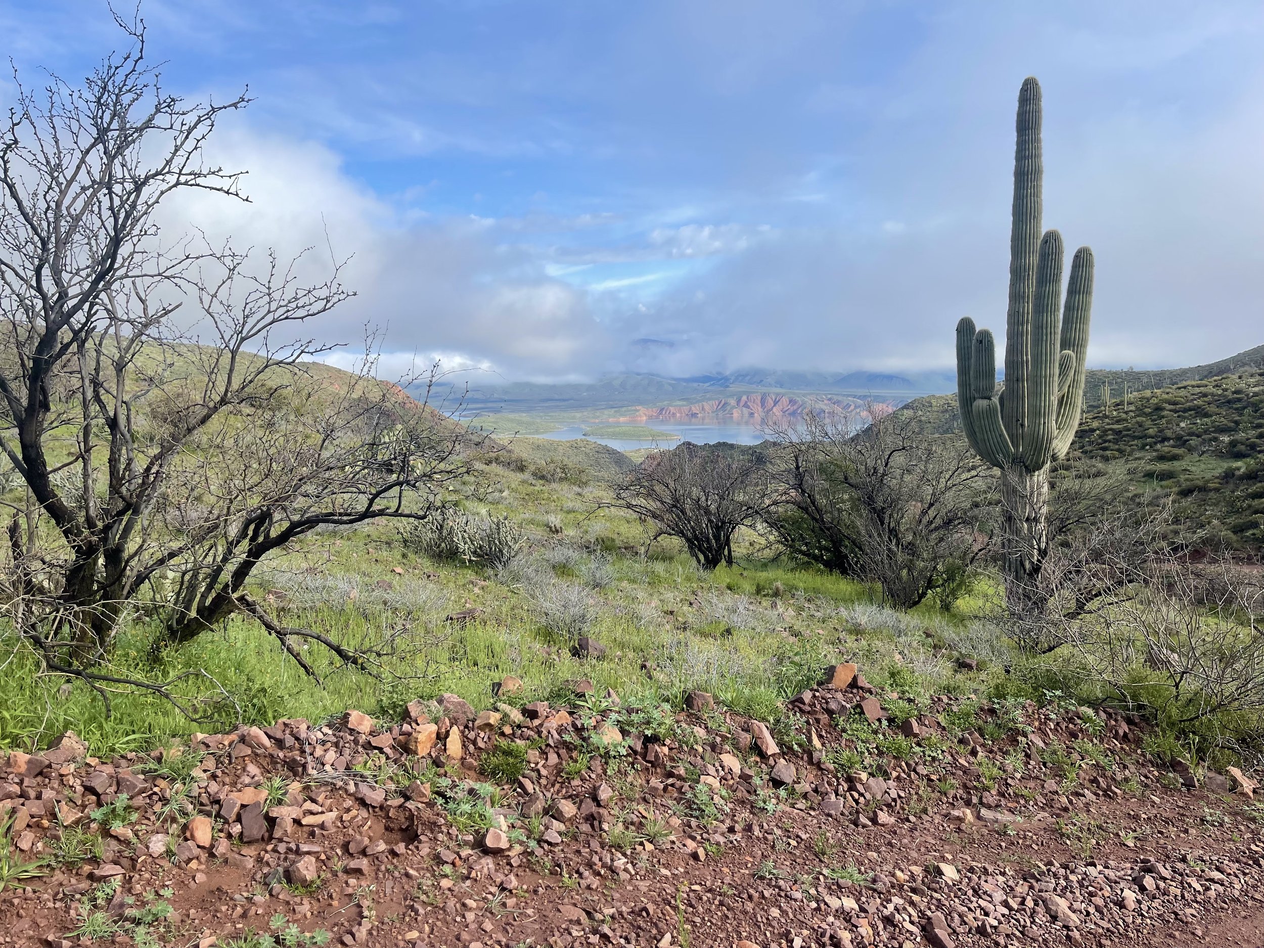
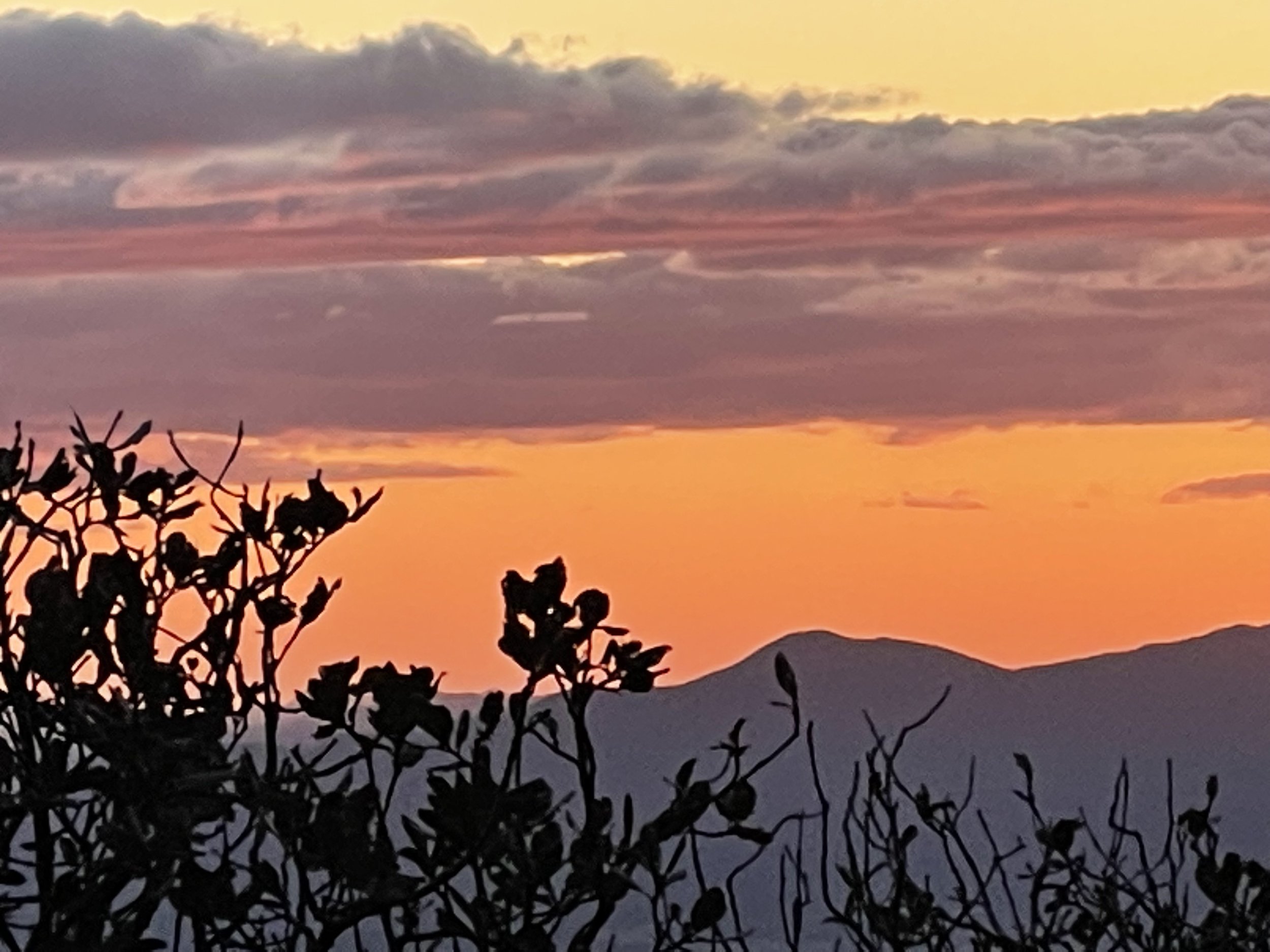
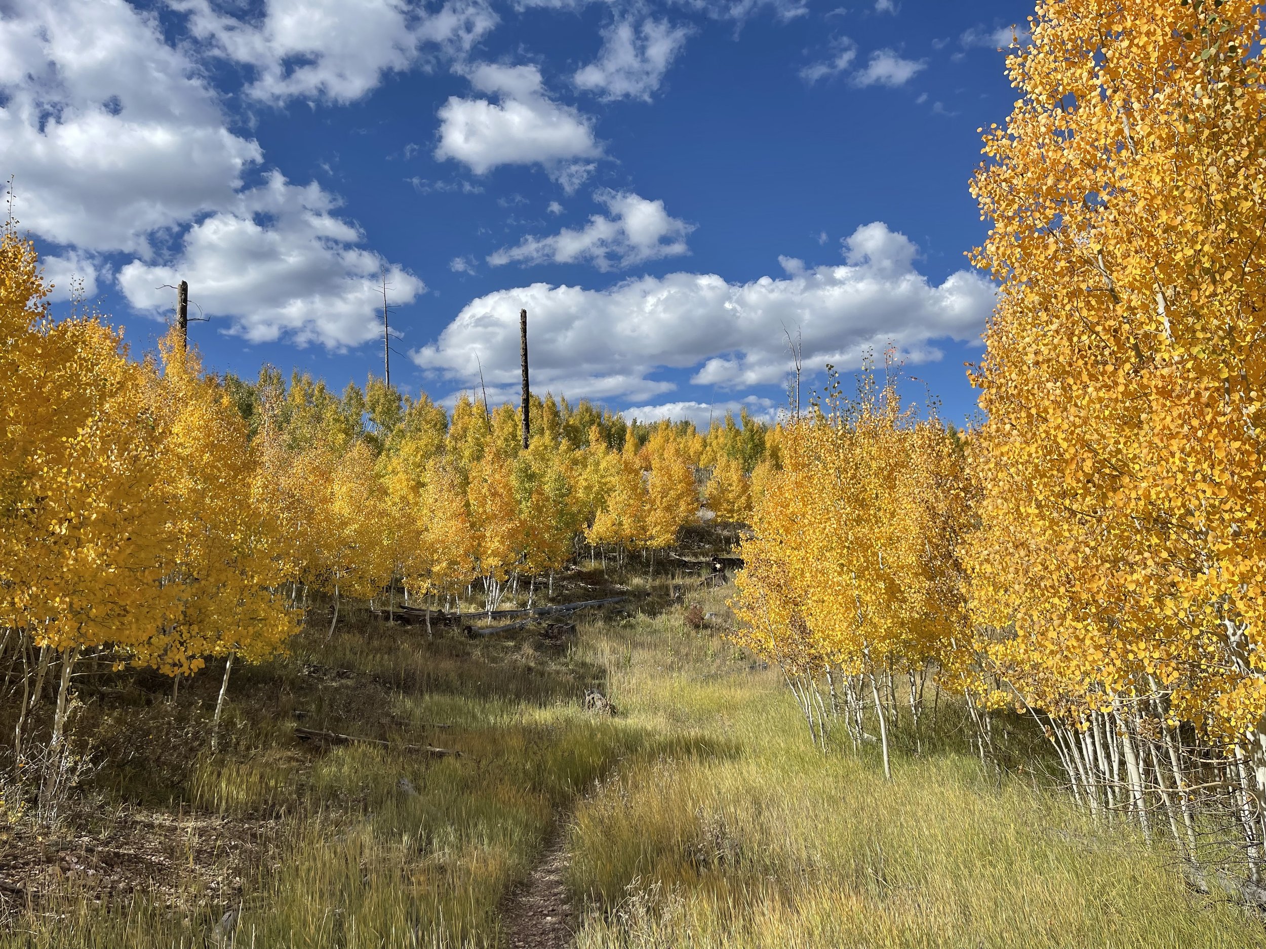
Looking towards Mexico.

We make our way down a steep path to the border and check out the border wall which is not completed in this area.

On the other side of the barbwire fence is the border monument.

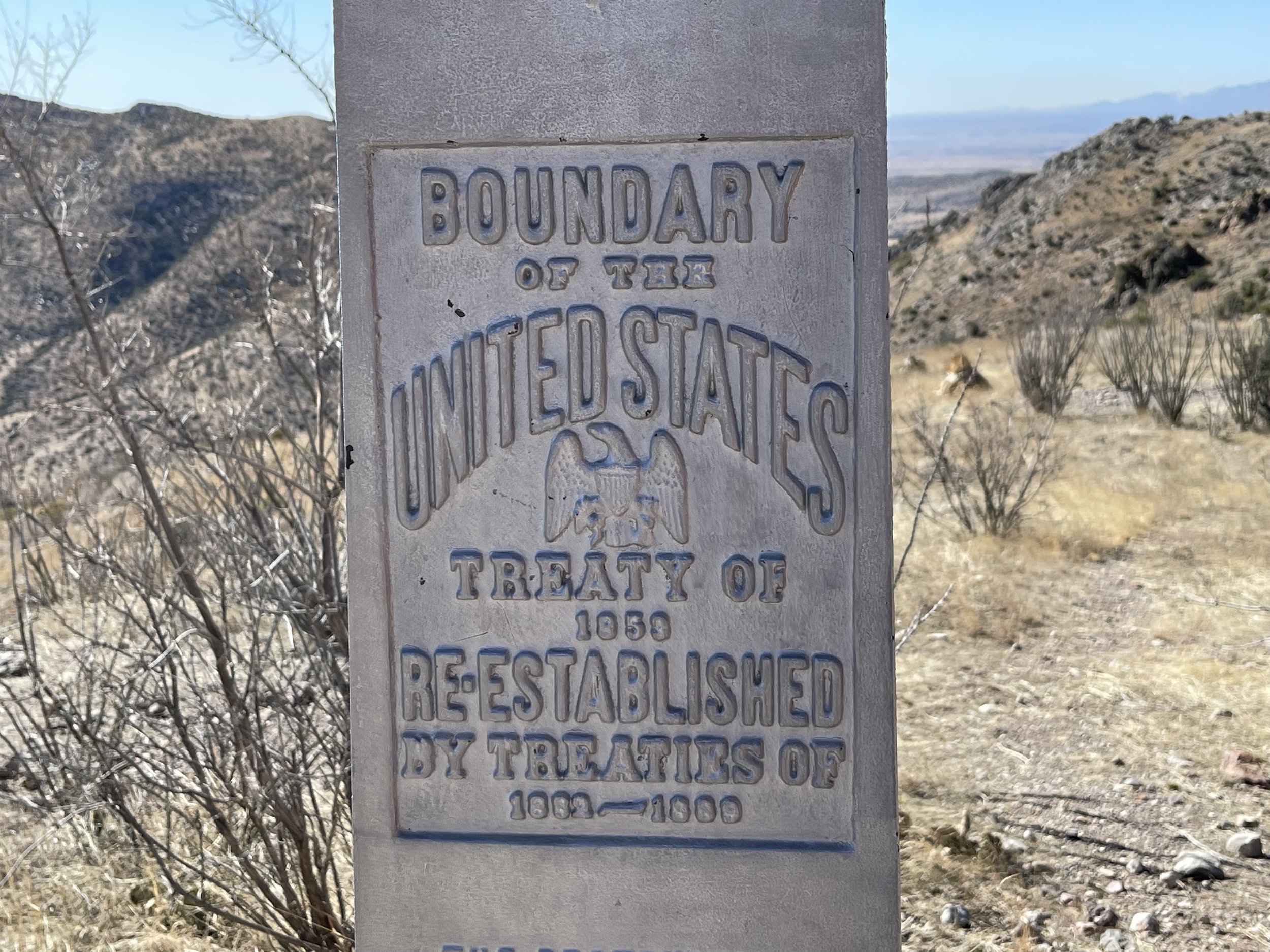
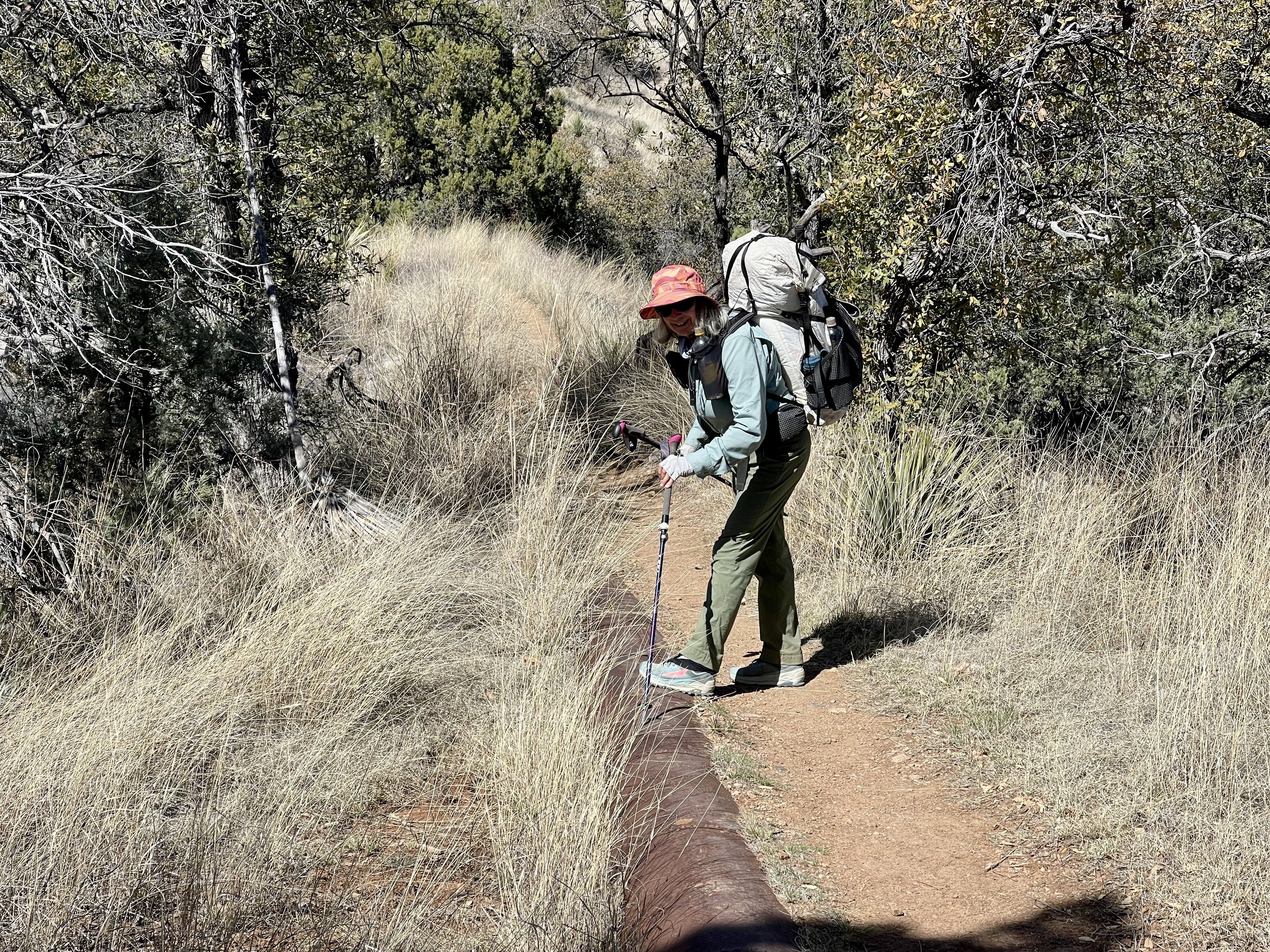
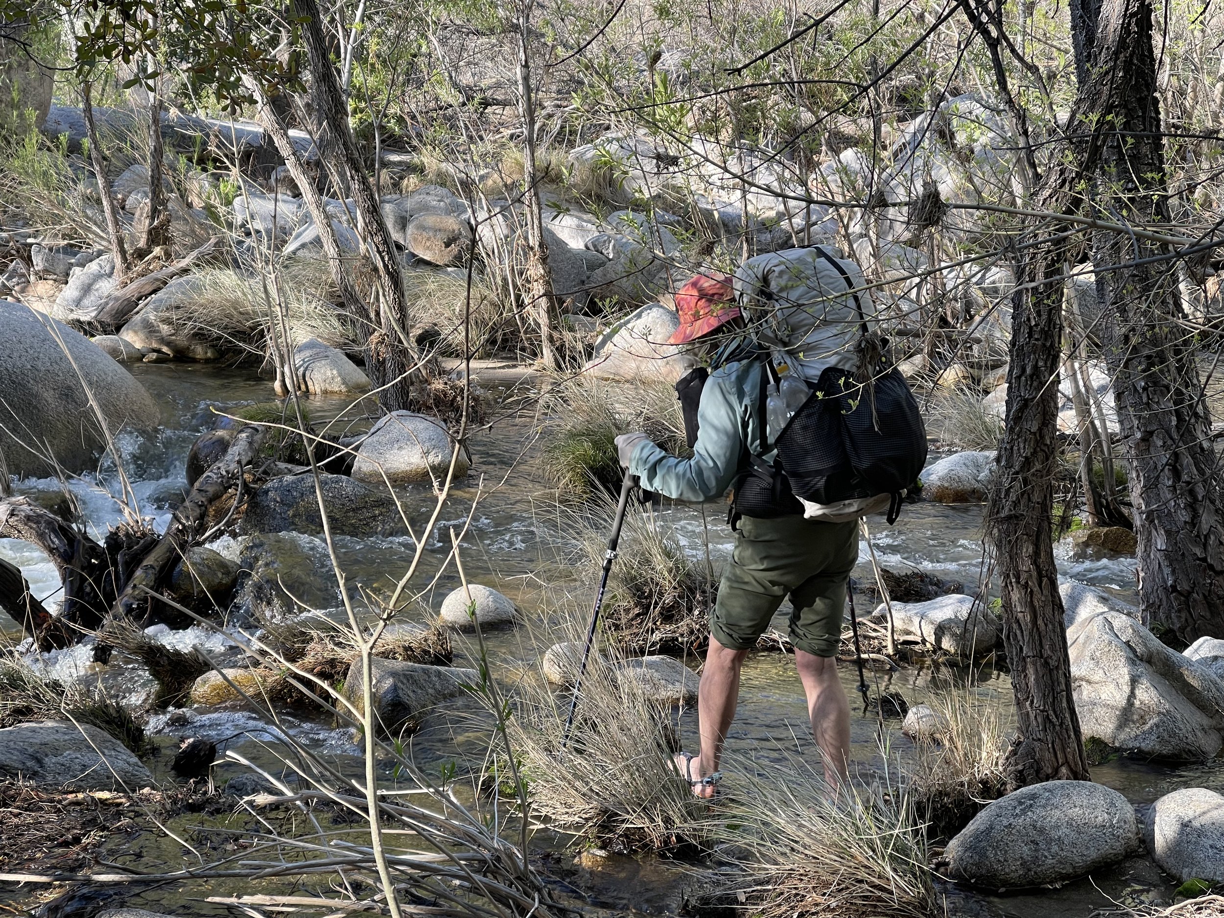
We have made it to the border and our hike has officially began, It just isn’t going to be in a direct path!

Almost Ready

We have a couple of days to spend at Tracy’s house before we hit the trail. Tracy wants to show us a trail near her house that has a variety of petroglyphs.

Once again we get to imagine the individuals that inhabited this area many years ago.

Our friend Tracy and more petroglyphs.

There is still plenty of snow in the mountains in the background. It will be close to a month before we will be hiking thru them.

A large saguaro cactus.

Back at the house, we pack up our packs and reorgnize our food. We also take Tracy’s car to where she will end her hike with us. It has been a busy few days and we are ready to get on the trail.

Making last minute decisions of what do we really need!

Making sure our hunger will be satisfied.

Tomorrow our hike begins!

Our Hike begins -Tiger Mine to Kearny

March 7

Jill, a friend of Tracy’s, has offered to take us to the Tiger Mine trailhead where our hike will start. She arrives at 7:00 am and 20 miles later we are at the trailhead.

We check out the sign that welcomes us to begin our hike. We are 209 miles from the border. Our plan is to go to Sunflower AZ about 175 miles away. At Sunflower we will figure out a way to get back to our van and then figure a way to go back to the border and hike back to here. Those are details that we won’t even think about, now we are going to enjoy the trail.

The day is overcast and there is a nice cool breeze. One of the challenges of hiking this trail is the temperature. Wait too long and hiking becomes impossible due to heat. Today though that is not the problem and down the trail we go.

This part of the trail has gentle rolling hills. A good way to start a hike. We won’t be climbing those mountains in front of us for awhile.

The trail winds us through a cholla cactus forest.

Don covers up from the sun and looks at the snowy mountains to the south.

Even though there has been a lot of rain, It feels quite dry.

The state owns the land that the AZT passes through, however on both sides of the trail is private property that the owners have given permission to be used for hiking. In order to separate private properties we will be either passing thru gates or going over these bridges. This trail unless designated otherwise can also be used by bikers. These bridges make it easier for bikers to use rather than stopping to open up a gate.

Due to all the rain and snowfall this year, there is an anticipation of a superbloom. We see a patch of poppies and are hoping that this is the beginning of lots of flowers.

Poppies

We give our friend, Tracy the trail name of Rock it! She is a collector of rocks and if she didn’t have to carry them, this one might have ended up in her huge rock collection at her house.

This is one of the few hikes that we have done that will have us drinking from unusual water sources. The first one that we come upon is called Mountain Tank. a water sources for cattle in the area. It is also a source for hikers that once filtered is good to drink.

We see the tank from afar and make our way to find our water for the night. We fill up several liters of water and then hike on. We will be doing a lot of dry camping which means carrying lots of water. We each have the capacity to carry 4 litters of water, plus Don is carrying a 3 litter bladder if at some point we need more.

After we fill up with enough water for dinner we start looking for a camping spot. We finally settle for an area that is fairly open, but soon discover that it is a cholla mine field. We carefully select a spot and send as many cholla thorns as we see flying. The challenge tonight will be getting into the tent without bringing in any thorns.

We hope there is no wind, cholla segments fall off quite easily and we don’t need any punctures in our air mattresses.

As the sun sets we are treated to a light show in all directions.

By 7 we are in bed and soon fast asleep.

Miles hiked 13.5

March 8

Happy to report that we were thorn free and ready to start day 2 of hiking. Rock It has some breakfast while Don and I eat our usual bar and plan to have breakfast at the next water source.

The trail winds around cholla cactus and mesquite trees.

So many thorns!

And Saguaro Cactus

We meet our first hikers today.

Splash started where we did as well. She loves to hike and years ago did the PCT. This past year she had a knee replacement and is finding the trail challenging. She is also carrying extra clothing and micro spikes which is adding to the weight of her pack.

The other three hikers we met are just doing a section hike. They are from Arizona and are planning on doing the entire trail when the conditions are good. They gave us some information about the next water source. It is quite reliable and currently is filled with lots of water. In fact they say you could go swimming in it. The name of this source is called Bee Hive.

There it is, a place for breakfast and filling up our water containers.

The water in the tank was quite green, but the water coming out of the pipe was clear. We filled up our bottles , had breakfast and were ready to continue our hike.

As we were heading down a wash, we didn’t notice any footprints and the sign that we were looking for hadn’t appeared yet. At least that is what we thought. We pulled out our Far Out App and to our dismay we had missed the turn. When I looked at some of the photos we had taken that day, I saw the sign that we had missed! Too much talking! Our destination tonight was the Freeman Trailhead. There is a resupply box there and the last update we had was that there was some water in the box.. We had been carrying extra water in case there was no water. That was a good plan, because when we arrived there was no public water.

We found a place to camp nearby and used some of the water for dinner. Tomorrow we will need to walk 6 miles to the next water source. We will have breakfast there. There were groups of cows around our camp and it was soon apparent that not all were happy that we were camping there. One particular large bull made it known by bellowing out warnings. By this time we were both in our tents. Tracy could see the bull heading our way, not wanting to be a threat to the bull, we decided that staying in our tent was the best approach. We were relieved when it made a detour to go around our tent. Not sure if we would have survived being trampled. The bull must have met up with some cows and he seemed to be content and quiet!

Miles hiked 14

March 9

Today we need to get to the next water source which is 6 miles away. We have enough to drink, but not enough for breakfast so we hike on. We were glad that the morning temperature is good for not needing a lot of water. We pass by this skull, who perhaps run out of water.


Arizona is known for its blue skies and today was one of them.

We were fascinated by all of the contrails in the sky, Looks like a lot of planes are heading out from Phoenix today.

Random rocks add to the dessert scenery.

According to the app we are approaching our next water source. In low water years, there is often a small pond here, but this year it easily could be called a lake. There is a lot of debris in the water so we pre filter it before putting it thru the water purify filter.

We are thankful for the water as well as the ability of our Sawyer squeeze to turn it into good drinking water.

We have an interesting encounter with a bull today. He was standing on a hill above us and his horns glistened in the sun. One could tell that he was checking us out and would stand his ground. He never charged but with heads down and slowly walking we were able to get past him with no confrontation. I have a feeling that cows might be the bears of this trail.

The trail leads us on single track as well as very rocky roads. We bypass a water source that is used for wildlife. We have been told that there is a reliable water source where we want to camp tonight. The interesting thing that happened today was that the app we were using for our route was updated and when we checked mileage everything was further than we had planned. It became the joke of the day that maybe or maybe not we will make it to camp tonight. There was a first occurrence for all of us today when we came upon a saguaro that had fallen down on the trail and had been sawed in half in order to clear the path.

We were intrigued by the saw cuts that were made that showed the different layers of the plant.

The saguaro is only found in the Sonoran Dessert and can grow between 40 to 60 feet tall. They can weigh between 3200-4800 pounds when fully hydrated. The wood ribs were used for roofs, fences and furniture.

Tracy pointed out the saguaro boot that is found on dead saguaros. This boot was used for water containers by the native Americans,

The boot is also used by birds for nesting.

As our hike for the day is feeling that we should be done, we start looking for the magic blue barrel. We were told about this water source by the three men that we had met yesterday. Then there it was and just as they said it was reliable. One just had to turn the handle and out came great cold water, We quickly filled our water bottles and started looking for camp.

Water sources in the dessert are unique!

With no rain in the forecast we felt good about setting up camp in a wash. There were no signs of cattle so we were looking forward to uninterrupted sleep.

Miles hiked 15

March 10

It was a quiet night in the wash with temperatures being on the cool side. By 7 we were on the trail and greeted by light touching the saguaros.

The saguaros come in so many shapes and sizes, it is difficult not to stop and take photos of all of them.

Todays hike is going to take us up the big hill. Several days ago when we met the 3 gentlemen they hinted that the big hill is the challenge for this section. We could see the trail in the distance as it worked its way up the mountain. We assumed that we would be conturing around the hill(mountain), but that was the wrong assumption. First though we heard a waterfall which was not what one would expect in the desert.

We were told by some hikers that we would hear it before we would see it. It is not common for it to be here, but with all the snow this winter there has been a lot of precipitation. Had it been warmer, I think that we would have all stoped to take a shower.

Our shadows on the wall begged for a photo to be taken.

Finally we were heading up the hill and soon discovered that this trail did not contour but took us up to the top where we would walk on a ridge.

The ridge

The views from the top were 360 degrees, however one view was that of a large mining area. Our next section of hiking will take us near that area.

Heading down the other side to the mountain.

As we headed down to a lower elevation we became awed by the poppies in bloom. With all the rain and snow this year the prediction was that hitting the right areas would lend itself to a superbloom.

Yes, indeed we are going to experience a superbloom.

As I was hiking down the trail, I came to a gate and on the other side was a women who said that the last time she had hiked this trail, she had met a hiker at the exact same place. She began telling us about the flowers and then told us that she had written several guides on flowers and hikes of the area. She also was published in some of the newspapers of the area.

It was an informative way to end the hike for the day.

Christine headed up the trail and we found some shade to eat some lunch before heading to the trailhead. Tracy suggested that we go to her house which was about an hour away to shower and do laundry and that she would bring us back to this trailhead tomorrow for us to continue our hike. This made our logistics so simple. We had planned to stay in Kearny for the evening, but they were having a Pioneer celebration and all the rooms were filled. There is a trail angel, Gary, in Kearny that will pick you up at the trailhead and take you to town so our plan was to call him when we got to the trailhead. Just as we were getting close to the trailhead, Christine returns from her hike and once again begins sharing her knowledge of flowers with us. She is heading thru Kearny and it will be no problem to take us to Tracv’s car which is parked at Gary’s house. Once again the magic of the trail provides!

As we approach Gary’s house we see him and his wife Lynette trying out props for the parade tomorrow. I think the picture says it all!

Trail Angels Gary and Lynette

We had a chat with Gary and see why he is known as a super trail angel! We had to stop at the local grocery store for some food and of course ice cream before heading back to Tracy’s house.

As we were heading down the road we were passed by a white pickup truck going well over the speed limit. Shortly afterward three police cars were in pursuit with sirens blaring. They were soon out of sight and we thought that we would never see them again, however, as we approached an intersection there were quite a few people looking down the highway. Tracy pulled into a gas station and asked one of the bystanders. He said that the truck went thru the intersection without stopping and fortunately there wasn’t any traffic at that moment. The driver must not have realized that he was heading into a no outlet area. soon he was surrounded by 10 policeman. End of story.

Now it was back to tasks at hand, laundry, showers and repacking our packs with our new ration. By the time we were in bed, sleep came quickly. What a day! The last few days were a great intro to the trail and we were looking forward to being on it tomorrow.

Mileage hiked 8.5

Florence-Kelvin Trailhead to Roosevelt Lake Marina

March 11

We were leaving Tracy’s house by 7:30am and heading to the trailhead that we had finished our hike yesterday. An hour later found us lifting our packs which included 5 days of food and 4 liters of water each. (a liter of water weighs 2 pounds) This section of trail parallels the Gila River which is a water source that we are trying to avoid. Our packs were heavier than we would have liked, but each day they will be lighter.

The trail did not disappoint, we are walking in a poppy wonderland!

It is going to be a beautiful day for hiking!

Tracy decides to walk with us for awhile. There are some horses coming towards us and we tell Tracy about what to do when horses approach. The best place to stand is below the trail, so that if a horse spooks it will go uphill and be easier to control. The horses pass us without a problem until the last one who doesn’t like the look of us and heads up hill. The rider gets the horse under control and we move on. It was a very practical lesson of horses sharing the trail.

We cross a bridge that goes over the Gila River and we are glad for the water bottles that we are carrying. The brown river that drains some mining areas does not look appealing. We have been told that our Sawyer Squeeze will purify it, but that it also clogs up the filter. If all goes as planned we won’t have to use it.

Tracy is just about ready to turn back to her vehicle when we see a hiker running towards us. His pack is definitely on the ultra light size. He stops to chat and Don and I quickly realize that we have met this hiker before. His name is Fire and we met him last summer while we were doing the Great Divide Mountain Bike Route. He was hiking the Continental Divide Trail and we shared a picnic table at a divide crossing in Montana. Fire is a non stop hiker and basically lives on a trail somewhere. He shared the knowledge that a small clear stream was running and that we should be able to refill our water bottles there. Fantastic! Fire is doing the Grand Enchantment Hike which uses part of the AZT.

Fire, has a tattoo on his fingers spelling out his name. His outfit also lends itself to his name.

Shortly after Fire is gone, we meet another hiker who is also doing the Grand Enchantment Trail. He confirms the information about the water source, and also tells us to be wary of the cows in the area. He said he has done a lot of hiking and this was the first time that he was charged. Yikes!

The water source corresponds with our lunch break so we tank up and refill our water bottles. We are hoping to get to the next water source that is after the Gila River. This section of trail finds us doing a lots of elevation gains and loses as we conture around drainages. There are plenty of flowers and cacti to entertain us.

We also see the inner wood of a saguaro which is quite interesting and can visualize how it was used for building material.

The vegetation along the trail is thick, we wern’t expecting this.

This is probably why there are so many cows here. We had just done a climb up from the river bottom and were heading down the trail when around the corner comes 3 large bulls with impressive horns. They stopped to look at us and decided (I think) to just keep coming our way as the grass was quite tasty. We talked to them in a low voice and tried to convince them to turn around, but to no avail. We backed up and I hid behind a rock. This option was only good for a little while as we eventually would have to continue on. Going around is not an easy feat as there are many plants with thorns. Don scouted out a path and convinced me that it was a go. The cows continued to move forward so Don’s route looked more appealing. It was a go, the cows were left eating and we continued on.. a win win.

Down in the river bottom, we watched as a large train made it ways carefully down a decline.

The three engines were working hard to brake.

We are intrigued by all the gates.

They are well made and add character to the trail.

Don does a first when he has to climb over a saguaro cactus.

The highlight of the afternoon was seeing a Gila monster. These venomous lizards spend 90 percent of their time in burrows so it was quite a treat to see one in the open. Their bites can be quite painful, but they are slow moving and easy to avoid.

Gila Monster

The day continued with seeing and avoiding lots of cows and rationing our water a little. We also are looking forward to heading up into the Superstitions which are a well known mountain range tomorrow.

It was a great day filled with flowers, cows, Gila monsters and beautiful landscapes. We hiked almost to dark looking for a location that would provide us protection from the wandering cows.

Mileage hiked 14.5 miles

March 12

Happy to report that other than cow bells in the distance, we had no night encounters with the mammals. Going to bed by 7:30pm makes it easy to get up in the morning. We had been given the advice to put everything in our tent so to deter the pack rats who inhabit this area. This makes it quite easy to do most of our packing before even leaving the tent. Just as we finished packing a couple of headlamps walk toward us. With temps getting warmer during the day, it is quite common to get some early miles in on the trail. We soon are on the trail by 6;15 using our headlamps as well.

Nice light greets us as the sun rises and the moon can still be seen in the sky.

We are able to find the cardinal singing a morning chorus. The bird was quite the contrast to the green saguaro.

The trail takes us down to the river bottom where a hiker is camped close to the river. He shows us the brown colored water he has gotten from the river. It indeed filters clear, but he will need to back flush his filter in order for it to work again.

An Arizona trail sign lets us know we have reached the lowest elevation on the trail.

In a couple of weeks we will pass by the highest point which is around 9000 feet.

We finally leave the river bottom and turn north to head up into the Superstitions. It is going to be awhile before we are able to find a water source.

Lots of beautiful landscapes

This is a well known land mark. By the time we finished going up to a pass we saw three sides of it.

The Arizona trail is quite rocky at times. This section had its share. The rocks that you see to the right of the photo below is the actual trail!

This section of trail is mostly up and with no water sources till almost the top, we are being careful of our water usage. Don was down to his last swallow and when we noticed a seep with a little pool of water, we quickly stopped and were able to fill a liter of water.

We are appreciating the value of water!

We added an electrolyte tablet to it and felt our bodies reacting to its formula. We only have another mile to go where there is a guaranteed water source. Meanwhile with our thirst on hold we are able to enjoy some rock formations as we work our way to the pass.

Just before we reach the top of the pass, we encounter three mountain bikers. One of them is in charge of maintaining this trail. The challenges of maintaining this trail is that it takes him a lot of hours to reach parts of it. Today he had some clippers on his bike and tried to at least cut back some of the branches. Neither Don nor I have any desire to bike this trail, it is above our ability! (at least in some of the parts)

Finally we see it! The rainwater tank collector. Not only is it full of rain water, but it also provides some great shade. We drink till we are satiated and well rested.

The rainwater collector.

This is a great asset to the trail. We hear that another one is going in near the Freeman Trailhead.

We are reluctant to leave, but finally do so and head down the mountain to find a place to camp without cows. (we hope)

Time to find camp.

There are a lot of cow signs, but no actual cows so we find a flat spot and are looking forward to getting horizontal.

Mileage today 17

March 13

Glad to say the cows stayed hidden and it was another quiet night of sleep. The trail was mostly downhill as we walked our way to Picket Post trail head. We left about 6:20 am and didn’t need our headlights. It is so nice realizing the days are getting longer.

More beautiful dessert and mountain landscape

We passed numerous small streams, but they were filled with algae and cow poop. The latest information on our Far Out App which we use for navigation and water updates indicates that there is public water in the resupply lockers at the trail head. As we got closer to the road head, we encountered a lot of day hikers. It is an easy accessible road head and there were a lot of cars parked here. We have only met one AZT hiker in the last couple of days. There was a picnic table with shade so we enjoyed the amenities and ate our breakfast. On the other side of the road head we found the resupply box and were quite happy to see that it was full of public water. Some hikers cache water and they label it with their names. We decided not to do that as we have the ability to carry enough water for long mileages without water.

Sometimes there is trail magic left in the box(ie chocolate bars, but not today) We are just happy to have good water!

According to the Far Out App, we shouldn’t have to worry about water for most of this next section.

Once again we are treated to the rocky dessert landscape.

And clear, cold running streams!

It is early spring in this area, the flowers are not here, but the green vegetation is lush!

We stopped at Whitestone canyon for lunch and a foot soak. A couple ladies on horseback rode by and said that we are so lucky to have this much water. We agree! The trail continues to meander up the stream with numerous rock crossings. We were able to rock hop when the trail crossed the stream. Several weeks ago this was not feasible as the stream was a lot higher due to all the snow melt.

This saguaro was photo worthy!

As was this one below. After having long stretches with no water, we are thankful for this day

We stopped about 5 tonight as we came upon a nice campsite. Campsites are sometimes hard to find so our length of hiking time is often determined by when we can find one usually close to 5 o’clock

There is a stream right behind us. Fortunately there is no rain predicted as there are warnings posted to not camp near here as flash floods are common. The trail was pretty mellow today so we put more miles in.

Mileage hiked 19 miles

March 14

Nor sure why, but we both had crazy dreams last night. After spending what felt too long of a time in bed we decided to get up even though our watch said 4:30am. We had to use our headlights as we picked out the trail. We crossed our last water source.

We have been enjoying not worrying about water!

Todays hike has been described as strenuous and we soon agree. Last week we had climbed the big hill, today the big hill looked like a mole hill compared to what we are hiking up today. We also left our last water source for awhile and are carrying extra water. One fun things about these hikes is that you can look from where you started and are impressed by what one step at a time can do. Eventually we made it to the top of the pass and joined up with a road that would take us to Rogers trough which should have the next water. As we worked our way down hill to the trailhead, we were amazed at all the water. We shouldn’t have to carry much water today. Time for breakfast as we found a place to eat by a bubbling stream. Today’s hike would take us past Revis ranch.

There is a trailhead nearby and we encountered several groups of hikers exploring this area. Most of the hikers were here for one or two overnights. We were told that we should return here someday to explore Native American caves, coke furnaces and the Revis Ranch. The Revis ranch at one time even had apple orchards. Today was not the time to explore so we continued on the AZT trail. A recent fire had made some of the trail hard to find with a lot of downed trees.

Another challenging area was a field of old grass that completely obscured the trail. There hadn’t been many hikers thru this area and we found ourselves relying on the gps found in Far Out to navigate thru the grass. Fortunately it wasn't too long and we were soon back on the trail. With the forest fire and lots of snow the trail also had been washed out in places. We had been told of good camping at Pine Creek so even though we could have gone farther we decided to stop there. It is hard to pass up a flat camping location.

We met a trio of hikers from Washington area that were doing a section of the AZT. One of the members worked as a volunteer on the PCT doing trail maintenance. He commented how more difficult this trail was than the PCT and that the mileage they were doing was a lot less. We have also found this to be true. A rain storm is predicted tomorrow and they are going to stay here, we plan to go on and see how far we can get.

Don found this burnt out log on the trail and thought it was interesting to see how rocks were placed in it.

Mileage hiked 15.5

March 15

We both slept really well last night. Camping beside a stream was so relaxing. We found ourselves hiking at 5:45 am and needing our headlamps. All seemed well as we seemed to be making good time. So far the rain is holding off and perhaps it will not even effect us today. We pause and take a moment to enjoy the sunrise.

As usual we are enjoying the landscape and even watch some deer as they make their way thru the mountains.

A hiker had told us about some rocky steep sections on this trail and we thought that we had found that described section. After hiking almost two hours we decided it was time for breakfast as we had found a nice stream.

Don decides to pull out the Far Out app and with a look of dismay he says. “you won’t believe this but we are way off trail! Somehow in the early morning before it was light we had missed a trail junction and we both assumed that we were on the right trail. There were steep places and large cairns, We grab a bar and immediately reverse our steps. Both avowing that we need to be more careful and check the app more often. We are carrying a set of maps, but only plan on using them if our phone dies. This mistake added up to about 5 miles. Not the extra mileage we needed with the forecast of rain. We retraced our steps back to the trail junction and finally we were back on track. So was the oncoming storm.

Guess we are going to experience a very rainy day!

Shortly after we were back on the right trail, the rain began and the wind began to blow! We put on our rain jackets and rain pants and hoped for the best.

The last photo before we were engulfed in rain.

There was a lot of elevation gain and loss on this section which made for slow miles. Unlike in previous days when we were using trees for the shade, we were now using trees for wind blocks. We found the steep sections and worked our way slowly down to the bottom ravine before almost immediately turning around and heading straight up. The 5 extra miles that we had hiked has taken its toll. it seemed like forever, but eventually we made it to where we finally were making our way out of the Superstition wilderness area. The rain had let up some, however, we both had a lot of wet clothing items. Don in particular had a very wet down vest. With all the rain the trail that we were now on had a surface of mud that clumped to our shoes. Needless to say we wanted to camp as soon as possible.

Finally we saw a spot by a wash. It was several feet above the wash so we hoped that the drainage wouldn’t hold much water. The ground was pretty saturated and we put all the stakes in for the tent hoping they had enough traction to hold. The rain has stopped momentarily while we set up the tent.

Don retreats to the tent and is not happy when he discovers a wet sleeping bag. This is going to be an interesting night. Meanwhile the rain has returned and using my umbrella outside I mange to make dinner. Don has put all his clothes on minus the the very wet down vest and we hope for the best.

We are barely asleep when we are awoken to a violent thunderstorm complete with some of the hardest rain we have experienced. Counting the time between lightning and thunder we realized that the storm is really close. We are hoping that our stakes hold because if they don’t well we don’t even go there. The wash which had no water now is filling with water. For the next hour or so I use my headlamp to check the area surrounding the tent. I am relieved when no water appears and all the stakes hold firm. Eventually the storm moves away and the rain subsides. It has been quite the day and night!

Mileage hiked 11.5 plus 5 miles on the wrong trail

March 16

For the first time since we started this hike, we waited for the sun to hit our tent before leaving it. We were damp, but no longer wet and were counting on the sun to do its thing. The drainage that concerned me last night was a non event. True there was more water, but not enough to effect us. We waited till 8 before we packed up separating the wet items from the dry ones. Hopefully when we get to the marina this morning we will be able to spread out our gear and get them dried. (perhaps they will have a drier there?)

It was a beautiful morning, with the smell of a morning after a hard rain.

For awhile we hiked along a stream bed before emerging out to a road that will take us to the marina and our next resupply box.

Roosevelt Lake is in the distance.

We are beginning to forget the challenge of yesterday as we head down this road and then….

THE MUD

The mud known as peanut butter mud sticks to the bottom of our shoes and is almost impossible to remove. It is quite the work out and we are glad when we get to firmer ground.

We see the marina in the distance and assume that the trail will lead us to it in a short manner, but wrong assumption as we continue on a trail that goes parallel to the lake for what seems like forever! Eventually we make it and first stop at a RV park to see if they might have a laundromat. Our hopes are dashed when there is no answer in the office. Guess we will rely on the sun.

Bikers are welcome, hope hikers are as well!

Off to the side of the parking lot is an area for hikers. Several picnic tables are unoccupied so they soon become the drying platforms for clothing and gear. I go and retrieve our resupply box which will take us to Sunflower, our final destination for this part of the hike. The areas north of Sunflower are still filled with snow and high rivers.

The hiker that we met at Colossal Cave when we dropped a resupply box off is here. We had told him earlier that since he did not have a shelter, he might want to try the dessert sections first. Looks like he agreed with our advice. We asked him how he did with all the rain, he told us that he met some hikers at the marina who let him sleep in their car. His name is Postman and he is planning on to continuing hiking north. We are not sure how he is going to do as the trail reports are coming back with difficult snow conditions. He tells us of the food choices at the restaurant and Don heads over for a take out.

Don has fish tacos and I have pulled pork with onion rings. We both recommend our selections which also included a delicious piece of pie.

While here we were able to get cell service and found out that we had won a lottery to go see bears at the McNeil game refugee in Alaska.. That was exciting news.

By 3 pm to our amazement all of our wet down had dried and we were ready to pack up and begin the steep climb out of Roosevelt Lake. After all this snow and rain this spring the reservoir is 91 % full and is predicted to be over 106% by the time summer is here. Teddy Roosevelt commissioned this to be built in 1908.

Before we head back up into the mountains we need to do some road walking and cross this bridge which goes over the dam.

It is a beautiful evening as we look back down at the lake.

We hike about 4.5 miles before there is a flat place for our tent.

It has been quite the night before and today, but we are dry and have a great flat spot to put our tent with views all around.

Hiked 5 miles to the marina and then 4.5 miles in the afternoon total 9.5 miles

Roosevelt Marina to Sunflower

March 17

We were happy to find a very flat campsite and with amazing views. We were exposed, but the skies were clear when we headed to bed. After the winds of last night, we again put all of our stakes in just in case we experience more wind tonight. Good thing that we did as the sky darkened, along came wind and rains. We wondered about the AZT hiker Postman who was shelterless. We awakened by 5 and started hiking about 6. We were greeted by dense fog that totally blocked out any views.

The fog would lift some and then return.

Fog added to the intrigue of the landscape.

Eventually the blue skies won out and we had blue skies for the rest of the day.

We weren’t the only ones that were happy to see the blue skies. This bird was filling the air with its song.

The black throated sparrow was a new bird for us.

Along the trail are a lot of spider webs with a funnel leading into a hole where the spider lives.

Todays hike will take us deep into the Four Peaks Wilderness area. We continue our ascent from Roosevelt Lake. This is one of the steeper climbs on the trail. Fortunately the trail is in good condition and has some switchbacks.

We will soon be saying goodby to the Saguaros and heading into the land of pines.

We will also be saying goodby to the last views of Roosevelt Lake.

There is a trailhead near here called Mills Ridge. We are hoping that there still might be some public water stashed here. Not only is there several gallons, but we also see Postman. He spent the night wrapped up in a survival blanket and is waiting for the sun to dry his sleeping bag out. He was under the impression that rain doesn’t happen here. He is definitely hiking his own hike not sure what he will do when he starts running into snow. We are glad to be carrying a tent and not complaining about the weight. We use some of the water for our breakfast and continue on.

After climbing up and rounding a hill the Four Peaks come into view. There isn’t much water on the south side of the peaks, but there is still plenty of snow on the north side so water is abundant.

The Four Peaks

We carried micro spikes for this section. The past several weeks hikers have posted that they would be helpful. We figured that it was better to carry them and not need them than to need them and not have them. We ran into very little snow that was easy to cross.

Don has sore knees today so our pace is slower.

The north side of the four peaks is still covered in snow.

A post on Far Out commented that this section was like hiking in the Pacific Northwest with an endless supply of water.

It is always nice not to have to think about water! We find a site near a stream and decide to call it good for the night. Just as we were finishing cooking a couple with a dog show up. As usual we share stories and learn that they have just sold their house and are now living in a van. Sounds a little familiar. This is the first time that we have camped with someone this close on this trip. The women had a bad cough which is always a bit scary when we are trying to avoid individuals that appear sick.

Soon everyone is asleep and except for the coughing thru out the night we manage to get some sleep.

Mileage hiked 15.3

March 18

We were up and gone before our camping neighbors stirred. Hope her cough improves. It is never fun to be sick on the trail. We pass Shake Spring which is flowing well and meet a man who is completing the AZT in sections. It will take him several years, but he is determined to get it done. The trail is a contrast from yesterdays elevation gain. Until we reach a road the trail is mostly flat or gentle down hill. We pass by Pigeon Spring which has a bucket near by to scoop water. It is a murky blue color which seems to be a common color of the named springs. The trail takes us out to a road which in the beginning is quite smooth and our thought is that we are going to have an easy hike today.

Nice road in the beginning

Then the road becomes very rocky, rutted and steep. There are some vehicle tracks and also signs of vehicles being quite stuck. We will not be making miles today as we carefully work our way down the road, We have about 8 miles of this road before getting back on a trail. More than once we referred to Far Out as many of the junctions weren’t signed. When we started out this morning there was thick ice on some of the puddles, but the sun has melted them and the temperature is quite nice for hiking.

We stop for lunch at a stream and make tentative plans of what our options are going to be when we get to the road by Sunflower.

We get back to hiking and are again amazed at the thick vegetation growth along the trail.

We meet three hikers who are from Arizona doing a section . They tell us that they have hiked in this area before and have never seen so much water. They warn us of Sycamore Creek which is generally a rock hop is now a knee to thigh wade. We will be crossing it before we get to the road.

The trail continues mostly down hill and we pick up our pace thinking that maybe we can get to the road and either hitch to Payson or Phoenix. Other options are finding a place to camp and try hitching in the morning. As usual once we get to the river it takes us longer to cross and we realize that camping tonight is going to be our best option. After the creek to our dismay we go up and around rather than down and camping options are nil. We pass behind the Sunflower towing company and the guard dogs are alerted. Pitching a tent anywhere in their sight will have them barking all night. we keep going until we see the road and the underpass which will takes us under the road to the other side. There is quite the stream of water running thru it so we decide to camp right by the underpass on a piece of land that is just big enough for the tent. We are out of sight and the running water drowns out the vehicle noise. Perfect!

Home for the night!

As we are talking over options for tomorrow, we decide to give our friends in Phoenix a call. They are our neighbors in Alaska and like us spend winters elsewhere. We give them a call and see if they have any plans for tomorrow and if they would like to pick up some smelly hikers. We tell them where we are located and they know the place as many years ago they had taken their son hiking here. No problem! They will be there by 9. With that knowledge we head to bed and look forward to getting clean tomorrow.

Miles hiked 21

March 19

We sleep in till 7 and then have cereal in the tent. It is quite the leisurely morning. We head up the embankment and make our way on a very busy road to the Sunflower towing turn off. The cars are zooming by us, it makes sense that this is not an easy place to hitch. Dan and Pricilla arrive at 8:45 bringing us fresh blueberry muffins. Today is starting out great! When we arrived to their house, we are given robes and begin the process of showers and laundry. One item that needs to be washed out by hand several times before putting in the laundry is our socks. Not surprising they are filithy.

After the laundry goes in, our bodies get 10 days worth of dust and dirt removed. Nothing like feeling clean again!

Thanks Dan and Pricilla for picking us up!

When are clothes are finished, and our bodies cleaned it is time to go and eat. Today is my 72nd birthday and it is time to celebrate! We head to a restaurant called Pitch and partake of a delicious meal topped up with a free birthday desert which I can share with my friends!

Fun!

The afternoon consists of helping with a puzzle and just relaxing, Our good fortune with logistics continues. Tracy, our friend who hiked with us when we first started has a meeting in Phoenix today. She will pick us up when it is over and take us back to her house where our van has been parked. When she puts in our location she discovers it is only 15 minutes from her location. She arrives by 6 and with clean clothes and bodies the 2 1/2 hour drive is quite pleasant. Before leaving Phoenix, we decide to eat once again and have another delicious meal at Season 52. Arriving back to our van, we are more than ready to crawl into our bed and call it a day of amazing logistics. It is another day of celebrating a year around the sun!

Miles Hiked 1/4 mile!!!!!

March 20-22

When we get back to Tracy’s, we catch up on some emails which includes information about making plane reservations to McNeil where we will see the bears this summer. Some of the flights are totally booked, but eventually we were able to make flight arrangements. Tracy proposed to go see the movie Everything, Everywhere, all at once. It was a movie that topped the awards for one of the best movies of the year. The theater only had about 5 people in attendance which maybe should have given us a warning. Anyway the movie was entertaining, but not sure exactly sure what it was all about. There is a storm moving in, bringing wind and even snow to the AZT on the 22. We decide to move our starting day to March 23, to begin the hike from the border to Tiger Mine which has a much better weather forecast. Now we just need to figure out how to get there. Problem solved when our friends(who live in Tuscon) from our working days at NOLS offer to take us to the border on the 23. They will pick us up at the NOLS Southwest Branch where we will be leaving our van. Complicated logistics made easy! A highlight of the 22nd was checking out Bario Bread that had come highly reccomended by our friend Jim.

We knew by the size of the line that this was going to be a good recommendation,

And it Was delicious!

Border to Patagonia

March 23

Today we will start part two of our Arizona Hike. When we first looked at doing this as a thru hike from the beginning to the end, we realized quite quickly that the weather of this year was not going to make for an easy hike. An early start date for the beginning of March, end of Feb. was only feasible if you wanted to encounter winter conditions. We did not so decided to flip up to the dessert passages of the AZT and flop back to the border where we hoped that some of the snow would have melted. We even waited a couple days to let a storm pass thru on the 22nd. Now though here we are and ready to head out.

Just some interesting notes of how we prepared our vehicle for pack rat prevention. Numerous people had told us that leaving a vehicle unattended for several weeks was inviting pack rats to set up residence. Since we didn’t want this is to happen we hoped that the preventative methods we used would be enough.

First leave the hood up

Second we bought a light that flashes different colors and makes a random noise (this was attached to the battery which was had a solar panel attached to the battery to eliminate the battery from being drained

Third we bought mouse deterrent pouches to put in the engine compartment

Last we bought several solar powered lights to put near the truck creating light at night

Then we asked the pack rats to find another home.. fingers crossed that this all works!

Thanks to the NOLS SW branch for providing a place for us to park our vehicle

Clark and Ellen

Clark and Ellen our NOLS friends pick us up at 7;30 and we begin our hour and half drive to the border. We learn that another current NOLS instructor is also planning to start that day. Perhaps our paths will meet. We arrive to the Coronado National Memorial and check out the road conditions to the Pass where the trail begins. It is paved for one mile then there are 2 miles of very rough road and is not recommended for their car. They offer to take us to the dirt section which we will then hike the last 2 miles to the pass. Just as we are unloading our packs Laine, the current NOLS instructor shows up in a shuttle and the driver offers to take us to the pass. We quickly say yes, say good-by to our friends and hop in the van. Thanking the magic of the trail for this offer! Upon reaching the pass, Laine heads to the border. Since we did this stretch several weeks ago we are ready to head north and up to Miller Peak.

Let the hike begin!

The peaks in southern Arizona are known as Sky Islands and have distinct environmental characteristics . One starts in a dessert surrounding and hikes up to a mountain surrounding.

We have been told that the snow is rapidly disappearing and we should be able to hike thru it without too many challenges.

The trail leads steadily up and we can see why the first day is so challenging.

We pass several hikers who are taking breaks, since we have already gotten some miles in the last few weeks, we are able to maintain a steady pass.

As we near the top we see the results of the storm that passed thru yesterday. The tree are coated in an inch of ice. We talk to a hiker that said, he started the hike yesterday, but quickly turned around due to the wind and rain. Today though the sun is out and we are glad with the decision to start today.

The trees with ice covering their branches was beautiful! Thankful not to be here yesterday.

We continue our hike till we meet a trail going to Miller Peak, it is an easy decision to keep on the AZT. we feel that we have gone up enough today.

There is some scrambling on this part of the trail.

We eventually run into the snow which is probably only about a mile of trail.

Don puts on his micro spikes and easily walks across the snow. I opt to walk carefully and do fine. There are quite a few tracks of previous hikers.

We meet more hikers today than we have seen on the trail previously. Most of them mention that they delayed starting their hike due to weather. We feel fortunate that we have already hiked close to 200 miles and were able to enjoy the dessert sections before it got too hot.

Our first water source today is called bathtub spring.

Easy to see how it got its name, We fill up and filter this source and plan to go just a little further to find camp. By this time Laine who had gone to the border arrives at the spring and asks to camp near us as she has heard of our names from other NOLS instructors and would like to talk. Sounds good to us.

We find a place that will barely fit two tents and settle in for a cold night. The wind is blowing and the temperature dropping.

As we look at the scenery below, we can easily see why this is called a sky island.

Dinner is quickly made and we head to bed, but first Don gets a great shot of the setting sun

It is a night that we will be sleeping in most of our clothes and our Sawyer squeeze will be nice and cozy in our sleeping bags as well. We can’t let it freeze or its ability to filter water will be voided. We are thankful to be back on trail and are looking forward to dropping down in elevation tomorrow.

Miles hike 10

March 24

It was oh so cold last night. sleeping with all our clothes helped. By morning there was ice in our water bottles and we wanted to get up and get moving. Laine slept thru our departure so I guess we were pretty quiet. Laine had been told that we should put everything in our tent, due to packrats and also immigrants that use this area for heading north. I started hiking with all of my clothes on then as we started down to a canyon, I began slowly removing them. We passed by a lot of hikers who were sleeping in the canyon bottom. It is going to be awhile before the sun reaches them.

The trail is very mellow today as we climb up and down the canelo hills. Laine catches up with us and we are a bit envious of her ultralight backpack. We still like some of our extras and most of the time don’t mind carrying them,

We are impressed with her snack bag which is filled with lots of high energy junk food. It keeps the sugar rush ongoing!

There are piles of brush and we assume that there will be a prescribed burn in the near future. That is confirmed when we see a line of firefighters with tools heading toward the piles. We ask one of the firefighters when that might happen and the plan is in a couple of days if the weather conditions are favorable. Great we should be well north of it by then

More up and downs with some rocky trails thrown in. My body seems to be doing okay, but Don has very sore feet. We bought some insoles at REI which hopefully will help.

We pass a unique small cactus.

Finally we come to the water source for the night. It is a seep with several deep pools.

We scoop it out, filter it and are ready to find camp and have dinner.

A lot of the hikers that we saw camped have made it to this location and look for places to put up their tents. Glad we got here and were able to set up our tent. We wonder if campsites are going to be a problem with the number of hikers increasing. We hiked about 18 miles today and Don is wondering if we should aim for 15 to see if his feet improve.

Miles hiked 18.5

March 25

It wasn’t as cold last night, but we still had plenty of frost on our tent. We are going over a pass today with not much water so decided to carry some extra liters with us. At 6;00 there was no need for a headlamp. As usual, we were heading down the trail before the other hikers had emerged from their tent.

Up to the pass!

This sign gave us pause as we realize that not all who hike thru this area are doing it for recreation.

It was about 4 miles to the pass so with a steady pace we soon were there. Well actually about 2 hours, as our average pace is 2 miles an hour. When we got to the pass we were pleased to find the resupply box full of public water

As we were making our breakfast, here comes Laine and joins us. She is heading to Patagonia for a resupply today. Depending how our hiking goes we may make it tonight or early in the morning. Perhaps we will see her or perhaps not. Hikers pass in and out of our lives on a daily basis. As we are enjoying our breakfast, a man approaches with a box of goodies. It turns out that his 77 year old mom is hiking some of this trail and he is supporting her. While he is waiting at trail heads, he shares a box of chips and treats with the hikers. His plan today is to check on his Mom and then do about a 40 mile day hike. Impressive!

We take some extra water as the comments about water on this stretch of trail is not real positive.

Another gate as we look back towards Miller Peak.

The first water source was a tank (pond) that had quite a few cow signs around it.

The next source is a flowing stream with lots of algae and more cow signs. We didn’t mind passing it up.

There may be a time that we will have to filter and drink this, but not today.

The trail lends itself to a steady pace and we begin to wonder if maybe we can make it to the road and hitch into Patagonia.

Don keeps up the pace, a good meal, shower and with a place to soak the feet is a good motivating factor.

If we continue at this pace we could be at the road about 5:30 and try to get a hitch for the 6 miles into town.

We pass by Tilly the 77 year old Mom who is sprawled by the side of the trail. A friend has hiked into meet her and to encourage her on. She doesn’t look quite ready to move, We talk a little and then her friend says that we should be on our way if we want to eat at the Velvet Elvis tonight.

We see the road and the cars moving in the distance. It seems par for the course that seeing and hearing cars does not mean that the trail is going to go in the most direct way to it. Indeed we hiked several more miles until we finally came out on the road. Our plan was to start hitching and call a shuttle if we did not get a ride. After seeing that we did not have service our only option was hitching as As our feet were not going to hike further. A truck passed and then came back. Thank you!. She works at Velvet Elvis and recommended it as a good place to eat. We asked her to drop us off at the Stage Coach Inn. Fingers crossed as Don heads to the lobby to see if they have a room. At this point cost is irrelevant and when the manager said we do. Don hands him the credit card.

We quickly unpack, and get ready to take showers. Just as I am ready to hop into the shower we get a text from Laine(RobinHood trail name). She says that hey I am at Velvet Elvis and would you like to join me? I think she was surprised when we said of course, we are just finishing up showering. It was a very nice evening with good food, good conversation and a delicious salad. Don and I are not eating as many bars so we offer them to Robinhood and she walks with us to the hotel to grab them. She is leaving early in the morning and we are going to meet our friend Tracy who wants to hike some of the trail tomorrow. It is very doubtful that we will see Robinhood on the AZT. She is working in Alaska this summer so our paths will cross there. It doesn’t take us long to fall asleep and enjoy the comforts of clean sheets!

Miles hiked 21

Patagonia to Colossal Cave

March 26

Our bodies fell into a deep sleep and by morning the recovery had already began. This was just what we needed. Our bodies were clean as well as our socks and shirts. The electronics are charged. Tracy, our friend from Oracle wants to meet us here and do a day hike. Before she arrives we par down our packs, out go the micro spikes and rain pants. We get rid of a little more food and we eliminate over a pound of weight. With Tracy able to take our excess gear it is motivating to lighten our load. The motto of ounces turn into pounds is so true! I walk to the nearby grocery store , buy cheese for the rations and buy some yogurt and bananas for breakfast.

Tracy arrives by 9 and we head to the nearby bakery for some last minute treats. Back to the trailhead and off we go. Yesterday our thought was to only do about 5 miles, we will see if that is still the plan.

We don’t mind the flat surface with very little rocks.

It is amazing what a goodnights sleep will do. Don’s feet are feeling better! As the map foretold we are doing a lot of contouring today. It’s the type of day that you see the trail that you are going to take as it winds around ravines. There are slight up hills and then slight down hills. We pass an older hiker called Enigma. He tells us he only has one pace and it is slow!

Tracy is developing a plan to hike the AZT in sections. We think that is a good goal and encourage her to do so. She has very kindly offered to carry a couple liters of water for us until she departs. We so appreciate that.

Tracy also known as Rock It

After Tracy leaves we start looking for a flat spot to camp. After an hour or so of hiking we are beginning to wonder if we might be cowboy camping. The land doesn’t lend itself to flat spots. We keep going a little further and then there it is a flat spot. We cook up dinner and share the piece of fudge that we got at the bakery this morning. All is well as we enjoy the scenes around our tent.

Enigma finally passes our campsite and tells us that he wants to walk at least another mile. we wish him well and head to bed. We hiked twice as far as our original plan.

Miles hiked 11.5

March 27

The wind that had been blowing during the day, stopped by the time we went to bed. Overall it was a very peaceful campsite. We were up by 5 and on the trail by 6. No need for a headlamp! Today we are going up to the sky island of Mt. Wrightson,

There is a trail that would take you to near the top, but the AZT just gives views.

It was a short and steep climb to gain the elevation we needed to do today before heading down to the next valley, For awhile we got to enjoy the coolness of a pine forest.

The rocks are a part of the experience!

Arizona is a geologist delight. Rocks in all colors can be found along the trail, except for the one that the miners were looking for, Gold

We have to pass under a couple of interesting boulders, making us wonder how they got here,

The trail goes between the two boulders.

Once we get down to the valley floor, there is plenty of water. We rock hop across this stream several times.

For the next several miles till we reach Kentucky camp, there are informational signs telling us about the old mining in the area.

The sign told us about the following

We then hiked along the pipe that was used to move the water up hill.

Gold mining was a huge failure in this area. One of the signs said they spent over $200,000 in the operation and only got about $2000 dollars worth of cold.

Our next stop is Kentucky camp where there is a restored cabin that was used by the managers in the mining operation. It is a relatively flat trail to get there,

This building has been restored and gives one an idea of what it was like to live here in the early 1900’s A nearby cabin can be rented out for the evening.

There is potable water here, bathrooms and an electric outlet. We take advantage of all three and decide to make our dinner here before moving on to find a campsite. Several bike packers stopped at the camp to check it out as well. We meet a couple of hikers Double Stuff, Back track and Grapefruit Punk. They are also going to camp near here. They are the only hikers we have seen today.

Miles hiked 20

March 28

The campsite we chose last night was not flat and by morning we were both falling out of the tent. After 4;30am I decided we had had enough of this slipping sleep and we should just get up. We started hiking at 5;45 with just enough light to make out the road we were walking on. In about an hour we passed by the hikers that we had talked to yesterday. They were just having hot drinks in their tent. we waved and most likely will see them again, which we did when we stopped to have breakfast.

Most of the day was spent walking thru the St. Rita mountains.

Not a lot of elevation gain, but when the sun came up it was hot! Mainly small ups and then down.

In the distance we saw a large plume of smoke rising. We were glad that we had been notified that there was going to be a prescribed burn today. We have hiked thru many burned areas and can understand why there is a desire to get the underbrush thinned.

At two of the trailheads we met a group of volunteers who were putting in a new resupply box and a new sign. Many volunteers keep this trail in good condition. We had lunch where they were working and used some of the water that was available for hikers. There is some water sources in the area, but with all the cows we are glad to be able to use the water in the boxes. We are thankful in this area that the cows don’t seem to be a threat unlike the cows around the Gila drainage. Most of them take one look at us and take off.

Today it one of the warmest we have experienced and we use our umbrellas for most of the day.

Don uses the one trekking pole with his hand on the umbrella.

I have figured out how to stabilize my umbrella and use both trekking poles.

Thankful today for the volunteers, potable water, our umbrellas and a trail that was more flat than steep. It was also nice not to have so many rocks on the trail.

Miles hiked 22

March 29

Our mode of operation is getting up at 5 and on the trail around 5;45. as the days are warming up we like getting some miles in when it is still cooler. The ocotillo is covered in green leaves which indicates that rain has been plentiful this spring.

Soon it will be producing red flowers.

Our destination for breakfast is a resupply box near a highway. This box is usually reliable for water as it is an easy drop off.

Sure enough it was full of clear drinkable water. (yeah not needing filters)

As we were just starting to eat breakfast, Calves approached with a couple of oranges. He has hiked the AZT 4 times and helps with shuttles in the area.

He has made several informative you tube videos about the trail.

More flat walking today thru a prickly pear forest.

Today we get to go under interstate 10 that has a well known painting. Most blogs of the trail will definitely have photos of this!

Such great detail!

And of course we had to take a selfie as well

It continues to be hot today and after our selfie we headed to the shade of the underpass to cool off.

The next stop was the Gabe Zimmerman Trailhead. The trailhead was named for Gabe who was killed in 2012 during a mass shooting that killed or injured 19 people. It was a sober minute as we read about his life.

So unfortunate.

A picnic table with shade provided us a nice place to have lunch before heading back into the sun towards our destination of Colossal Cave.

In the distance and using a zoom lens we saw this structure. We later learned it was a private residence complete with a train that went around it.

The trail veered away from the castle and headed toward Colossal cave.

As we were getting closer our first blooming cactus caught our eye,

Hope to see more of these!

Then on the hillside we see the building for Colossal Cave.

Colossal Cave

In early March we had dropped a resupply box here and now we get to retrieve it! We had kept up the pace to get here before it closes so after setting up our tent at a nearby campground Don heads up to the building. I stay back and do some hand washing of our shirts, pants and most importantly our socks. The water for drinking and washing is cold and refreshing. The campground was built by the CCC in the 30’s and as usual we are impressed with the stonework. The cave buildings were also built by the CCC.

It is about a quarter mile to the Cave buildings, however it is mostly up. Don retrieves the package and as well walks quickly back with some prickly pear ice cream for me.

So good!

The forecast for tomorrow is for cooler and windy weather. We will look forward to that! Even though we hiked 18 miles today we got here early afternoon so we are calling this day a nero. (a half day of hiking) With clean clothes and socks we are ready to tackle the next section!

Miles hiked 18

Colossal Cave to Tiger Mine Trail head

March 30

One of our activities for the morning is head up to the cave visitor center and charge our electronics. Yesterday when we arrived there weren't any outlets available so hoping this morning we can get there before the rush. We had a little cell service so Don was able to download the weather forecast for Summerhaven, one of the sky islands that we need to hike thru,

The morning temps look cold!

Don stayed at the visitor center while I headed back to pack up camp. About 8:30am he returned with mostly charged electronics and we headed out.

On a trail that looked like this

For awhile it seemed like a stroll in the park which it was as we will soon be entering Saguaro National Park.

This has been a challenging year for the park with an increase of AZT hikers. One needs a permit to camp in one of the two campsites, but their permitting system is not set up for thru hikers. With the knowledge that this year has been challenging, the park sent out a memo that for this year stating even if you do not have a permit one should be able to find a place to camp at the campsites. We tried to get a permit but all the sites were full. One of the problems being that hikers were registering for several nights to be sure that they had a permit. We had our Park pass which is required.

So many saguaros and a variety of shapes.

The morning is still cool when we happen upon this reptile moving slowly across the trail.

We figured that since it was cool, the snake was moving really slow. We didn’t want to upset it so we gave it a wide berth.

It has been another day of not seeing any hikers, just some mountain bikers on the trails before the park boundaries. Just after seeing the snake, a couple of Park rangers came walking towards us.

We told them we had our park pass but were unable to get a permit for camping and that we had read what the memo from the park had said. Generally one can camp this year with out a permit and when you get to the campsite, see if you can find someone that does have a permit. One of the rangers said well that is not how it works and if you want to camp you need a permit. She continued to tell us the rules and said I can make you turn around. Interesting! The other ranger who let the woman do most of the talking, finally said , we are aware of the problem and I am on a task force working on it. It sure seemed that he was aware of what the memo had said. Finally she said have a good day, don’t leave any trash or have a fire. As soon as we get cell service I am going to find the memo and take a screen shot of it.

I can’t say that we were impressed with how we were treated!. The hike up to the campsite soon had us marveling at the beauty.

So much greenery!

The saguaros with the yellow rabbit bush was stunning!

So was the trail that had obvious signs of being built by the CCC

More flowers

We came to a junction to head to Grass shack campground. We immediately noticed that the trail was no long the quality of the CCC. As we were nearing the campsite, we heard a lot of pounding and came upon some park employees that were doing work on the trail. They had been there for several months and had been making slow progress. It once again was a appreciation for what the CCC did for our parks.

Heading up to Grass Shack.

When we arrived to the campground we were able to talk to one of the employees of the park. He said that each site could have 6 people and he thought there might be one across the creek that only had one person. We approached the campsite and a woman was there setting up her tent. We explained our situation and at first she said well if you can’t find a site come back here. We got the feeling that she didn’t really want to share. We looked around but this one made the most sense. We found a site not close to her and set up our tent. I grabbed our food and went down to the river to cook. She came down to where I was cooking and explained her situation. She was really fine with us being there and as we talked more discovered that we had mutual friends and that she had worked as a Leave No Trace instructor for NOLS. She later invited me over to her tent for tea and we had a nice conversation. Tomorrow we will be going up 3000 feet and hiking near Mt. Mica another sky island. On the trail after talking to the two park rangers we had enough cell Service to find the memo and take a screen shot. I guess we might be the ones that inform the park employees of memos from the park headquarters of current news!.

Miles hiked 15.5

March 31

We thought that it was going to be a cold night, but it never got below freezing. We have about 3000 feet of elevation to climb before we reach Manning Park which is at 8000 ft. We kept most of our clothes on as up we went. It was obvious that it was a lot colder at higher elevations when we passed this stream with icicles.

Glad we camped at the first campsite.

We found a sunny spot and pulled out our stove and ate a warm breakfast. The sun felt good and it warmed us up. On to Manning Park. When we arrived there were a group of pack horses and mules that were getting ready to head down the mountain. A park ranger and other park employees stay here. There was a fire going, but no invites for us.

We were greeted by the park ranger who wanted to see our camp permit and park pass. We once again explained the situation and this time we pulled out the screen shot of the memo from the park. He read it closely and realized that we were not breaking the rules. He than asked us if we had a fire or left trash. He said I can give you a ticket if you did. Not sure if he realized that he was talking to an ex chair of the Leave No Trace Board. Anyway it was good to leave the park personal and hope they get a class on dealing with the public!

Some deer were hanging around the buildings.

Hiking thru the pines.

Quite the contrast from yesterdays hike being surrounded by cactus. Soon we will have about a mile of snow to navigate thru. Just before reaching the snow we meet two hikers called Apple Pie and Little Bird. Apple Pie has hiked all of the National Scenic trails in the United States. Some of the trails she has hiked more than once. They are going south bound and this is the third time and most likely the last time our paths will cross. They used micro spikes to navigate the snow, but by taking your time one should be fine.

It was pretty easy to hike thru the snow. It was still early in the day and the snow was mostly hard so no postholing.

We had been warned not to follow footsteps as they were not necessarily going the right way. This was good advice and we checked Far Out several times just to make sure. Once we got past the snow we were back into rocky terrain and began heading down hill once again. There is a pattern here as we go up and then down.;

Don checks out the valley below.

Quite the rocky terrain.;

Looking back at Mica Peak and all the snow.

Finally we reach the gate that marks the National Park Boundary and we have gotten thru the park without a ticket. When we reached Reddington Pass we were ready to call it a day. We crossed a dirt road and then went a little farther where we were out of sight. Lots of beautiful vistas today,

Miles Hiked 15.5

April 1

By 5;30 it almost light enough to see without a headlamp. Love these longer days! We were greeted by these morning glories.

Great way to start the morning. Don checks out Mica Peak as we continue heading down the valley after leaving Reddington Pass

Late morning, we walk past 5 tents that are just finishing packing up. This is the most AZT hikers we have seen at one place. One of the hikers, a man who calls himself Moose hiked with us till a water source. Trip was there getting water and shortly afterwards Numbers and two other hikers showed up. We filled up with water as we have a steep climb coming up and the sun is warming us the earth. The trail is steep and using our rest step we make it to the top. We are hiking on the weekend and the mountain bikers are out impressing us with their skills. In this area we share the trail so we are careful around blind corners.

Before heading up to the pass we were treated with some nice flat trail.

Then we got to experience some steepness!

When we got to the top of the pass and looked down to the valley below, we were surprised to see so much activity. A campground and day use area opened today and folks were taking advantage of the beautiful area. We passed by a resupply box and noticed that it was full of water. We plan to stop for lunch at the day use area. There is no potable water at the picnic area so we are thankful for the water in the box. We share a table with Moose and learn more about him. There is a lot of uncertainty of how much we will be able to hike in the northern sections due to the snow in the north. After lunch we head past the Molina Campground. We are now sharing the trail with a lot of mountain bikers and speed is a common thread. We do our best to avoid any encounters and happy to say that we are successful. Once we begin going downhill the bikers are no longer a factor in our hike.

Don and I decide to take a break in the shade at a small pool of water to soak our feet. Numbers shows up and joins us. She is in her early 60’s, retired and hikes as much as she can. We are impressed by all the hikes she has done and the ones that she is planning to do. Today is the day for meeting hikers. We went several days with not seeing any one and now we have met quite a few. A popular campsite is coming up called Hutch’s pool. Since it is the weekend and also the the number of AZT hikers has increased, we can envision that this place is going to be crowed. We want to start looking for a place to camp several miles before this popular place.

Our timing is such that we want to hike down Sabino Canyon before camping. Once we start down the canyon we realize that camping in this area is not an option. The trail is steep and there are drop offs.

It is hard to imagine hiking this trail with lots of snow. In several place the trail has been washed out and one has to be careful of their footing. Eventually we do make it to the bottom and campsite selections are pretty grim. Lots of brush and boulders occupy most of the terrain.

Then we spot a sandy spot nestled between boulders. It will be tight and we won’t be able to stake out the tent like we like to…. but we give it a go and make it work. The moon is bright and reflects off of the white granitic boulders. It is definitely a special place to sleep tonight.

Home for the night.

Miles hiked 17

April 2

The moon made it hard to sleep and I finally used my hat as a blackout eye covering. I was glad to finally be able to get up and head down the trail. We looked back towards that area that we descended last night and were thankful for the trail.

Before breakfast we need to cross a stream. First we try to find some rocks to hop, but realize quickly that is not going to happen so we put our sandals on and wade across.

Several weeks ago the water here was more like thigh deep. Today it is below the knee and probably will continue to go down as the snow is mostly gone on this side of the mountain. The sun warms us up as we have breakfast on the other side. As we are finishing up our breakfast here comes Numbers. She likes to wait for the sun to hit her tent before she heads out. Numbers ends up leap frogging us for most of the day.

Today we are starting the push to Summerhaven. Our plan is to camp several miles before the actual town. We have a resupply box in the general store which will be our food for the next couple of days. The store doesn’t open til 10 so no need to get there early.

The trail thru the rocks is somewhat a scramble. One needs to look for carrions to find the trail. It is not too difficult just slow moving.

Mt. Lemmon is also a sky island as we look down at the plains below.

Don make his way up the trail.

We have carried extra water up from one of the streams and can share some with Numbers as she has run out.

So many rocks and such a contrast from the previous days going thru the dessert with all of the saguaros.

Eventually we get to Lemon Creek and have a late lunch. For the next several miles water is plentiful and we cross a creek numerous times.

There is evidence of fires that have gone thru the area in the recent years. As some of the trees have burned there are spaces that expose some of the non burned trees. Many of these trees have fallen due to a change in wind patterns. The only hiker that we have seen today is Numbers.

We are ready to call it a day when we see a flat area. Even though we haven’t made a lot of miles today, the miles that we did do were strenuous.. Tomorrow we may even have, a later to leave day, as there isn’t much to do in Summerhaven other than wait for the general store to open. Numbers is going to hike a little farther and get up later.

Miles hiked 12

April 3

Not a lot of hurry in our morning hike. we walk thru more burnt areas and down a stream bed that still has snow. the trail is washed out in places and we use Far Out to determine where it is. Eventually we make our way to a trail head. Most of the trail heads that we have encountered have informational signs, like these ones.

And this one.

The trail connects to a road which will take us on the mainstreet of Summerhaven. A community center has bathrooms that are opened 24 hours that hikers can use. The post office is also opened for 24 hours that some hikers use for sleeping. With number of hikers increasing this space may not be available in the future. The wind is picking up and we use a side of the community center for a wind break while we wait for 10:00. There is good cell service here and we connect with Tracy who is going to meet us at the Tiger Mine Trailhead in a couple of days.

At 10:00 we head to the store, get our package and get our free hot chocolate or coffee for being a hiker. Numbers convinces us to get a sandwich. It is prepackaged and normally not what we would purchase, but it is our only option today as the restaurant is closed. Guess we are hungry for bread as it tastes pretty good. The cookie cabin doesn’t open for another hour and we are ready to take off and hike Oracle Ridge. We also meet Harry Potter here who is an opportunistic hiker. He hikes the trails but also enjoys getting off trails if there are interesting things to do.

Looking back towards Mt. Lemmon.Some years there is not enough snow on the mountain to open the ski resort. This year the resort stayed open much later than usual.

Any hope of having an easy hiking day was soon realized( this was not going to happen) as the trail went up or down and the numerous rocks on the trail made for tricky foot placement. The wind was also gaining in strength and several times we had to brace ourselves to prevent falling into a cactus. The temperature is going to drop tonight with predicted temps being below freezing. We are hoping to get down in elevation so we will below the freezing temps.

We pass by a hiker from England who has found a site surrounded by trees. We stop for a short chat and he tells us about hiking in England and Scotland. (more ideas to add to our bucket list.) Numbers catches up to us while we are taking a break in the shade and eats her second sandwich, making us wish that we had gotten another one as well. I guess we are ready to eat town food for awhile.

It is great to see a horned toad hanging out by the trail.

Horned Toad.

We pass by a water tank that Numbers is figuring out how to get water. We decide to go by it and hope to get water at the High Jinks ranch. The wind is even stronger and once again we find ourselves looking for a protected place to camp.

We see a sign saying High Jinks Ranch. with the words, water, camping and lodging. We had heard that this ranch was under new ownership and it was unknown if hikers could stay here. As it was getting late, we thought it wouldn’t hurt to ask and we could get some water here. There was a sign saying “ring the bell for assistance.” So I did and a woman appears and when I ask if we could camp the answer is affirmative. We find a place for our tent which has some protection and cook up dinner. Meanwhile Harry Potter arrives and is also looking for a place to camp. He is also given the okay so after a bit of conversation which includes a very interesting uber story of Harry Potter actually driving the Uber ,as the driver did not like driving the car on mountain roads, we head to bed.

At one time the High Jinks Ranch was a well known working ranch.

And had some famous people visiting it.

Miles hiked 18

April 4

We were able to reach Tracy by phone last night and confirm that we would be out today. It was a couple of days faster than we had originally planned, but fortunately she would be able to come and get us.

The easiness of the trail made up for the harder trail of yesterday. In fact we got in 10 miles before 10:00. It was a combination of easy trail and having the end of trail syndrome. It was a chilly morning which also made for fast walking. At one of the road crossings we met Trip who was just getting let out of a car by a Trail angel. He had gone in to Oracle the night before to do laundry and get food for the next section. After talking to him we found out that his filter had frozen and was not reliable. This next section that he is doing is the one that we had done first. Most of the water comes from ponds or tanks that usually have a cow presence around them. If he couldn’t filter water, he would be carrying lots of water. We quickly realized that we were heading back to town and that we should give him ours. It was a passing it forward of all the trail magic we have been given,

Tracy originally thought that she might ride her bike out to meet us, but with all the wind the air was quite dusty and we advised her it wasn’t a good day for biking.

Before long we saw the signs welcoming us to the Arizona Trail at the Tiger Mine Trail head, We have now walked from the Border to Payson for a total of 385 miles. We did do a flip and flop which allowed us to enjoy the super bloom of the dessert when it wasn’t to hot and go thru the sections with snow after a lot of it had melted.

Tracy picks us up and takes us back to our van which has been parked at the SW NOLS branch. First though we celebrate our hike by eating at a small Mexican restaurant which reminds us of our time in Baja.

The food was delicious!

Back to the van which we are happy to report was Pack Rat Free!. As Tracy was driving us back to the van she realized that Easter was this Sunday. She suddenly said I need to take you to see the Pascua Yaqui tribe and their celebration of Easter. We didn’t have to be back in San Diego for a couple of days and this seemed like a very interesting opportunity. We made plans to go Thursday evening and Saturday. I plan to write some of the things we observed on another blog post. There will be no photos as cameras, phones etc. are prohibited.

We are unsure if we were coming back to hike any more of the trail. Reports of hikers going north of Payson was that the trail was covered in snow and if they made it thru they were most likely getting off at Pine. We would be gone for almost 3 weeks and figured a lot could happen with snow melt.

We will be watching Far Out and reading about other hikers and seeing what they are experiencing.

We are glad to have done as much of the trail as we could, considering the conditions of the trail this year.

Sunflower to Pine

April 23 (plus the prep of getting to the trail head)

While in San Diego we kept checking the trail conditions from Sunflower to Flagstaff. Due to commitments for the summer we knew we couldn’t go past Flagstaff. After hearing that the Grand Canyon trail was being closed to the North Rim, that information made our decision easy to return this fall to do the last section. The superbloom is also a part of San Diego. Taking a walk at a nearby park the flowers were quite impressive.

I made several phone calls to RV parks in Payson and in Pine. Trying to weigh the pros and cons of where to leave our van. I finally decided to leave it at the Pine RV park which worked out fine. We left San Diego on the 21 and headed East. In late Feb. when we first headed to Arizona there was snow along the interstate, now it is hot and temperatures in the 90’s. We make it to Phoenix and park overnight in the Cracker Barrel parking lot. The next day we head to Pine by way of Camp Verde. Once again we pass fields of yellow! There is some snow in the forests as we head to Pine, but it seems like it is melting fast. Before we get to Pine we get a text from our hiker friend Numbers. She has just arrived to Pine and is at the Ponderosa Market. We plan on meeting her there and catch up on her hike. We discuss some hiking possibilities. She is planning on taking a week off from hiking. The week she is not hiking we would be hiking the section from Sunflower to Pine. She would like to meet up with us when we arrive to Pine and hike the section from Pine to Flagstaff. Sounds good to us. The next morning we drop her and another hiker(who is going to climb Denali with a NOLS course this summer) off in Payson. We head back to Pine, pack up our packs and meet our shuttle driver who will take us to Sunflower. It is about a an hour drive and we arrive around 2:30. We have returned to the trail and get ready to hike.

This is the underpass that we had camped at when we hiked to Sunflower almost a month ago. At that time there was a stream running thru the underpass. Today though it is dry and we walk thru to the other side.

We feel fortunate that the hiking today will be mostly on flat to slightly up hill terrain. A three week break didn’t help our hiking fitness level.

It is obvious that there has been recent trail work. A lot of the rocks have been removed and the surface is nice to walk on. We feel we are back in the land of flowers as we see more poppies and cactus in bloom

This orange poppy stood out as did the Blooming hedge hog cactus

We stop often to take in the beauty of the flowers.

A hikers named Skully is resting under a shade tree. He also has restarted his hike today. He walks his own pace and will eventually get to where he is going. We wish him well and head to the first water source which is about 6 miles in. We decide to have dinner here and are serenaded by several very loud frogs. They are under a bank, but we can see the outline of their throats as they puff them out. We find a place to camp shortly after and are ready to call it a day. It is good to be back on the trail and we are tired!

April 24

We were in bed by 7:30 last night and sleep came quickly. Can’t say that we heard anything at all till 5 when it was time to rise. We packed our packs inside our tent and we were on the trail by 6. No lights needed as it was light enough to see the trail. We pass a couple of hikers who are just getting out of their tents. We learn later that we have a mutual friend. The trail this morning goes up and then down into drainages where we find water.

More blooming cacti

On a Far Out comment we stop at the last water source. There won’t be any water for 10 miles.

We take a break here, drink lots of water and get psyched to climb up towards Mt.Pealy with lots of water.

Our packs our heavy with all the water and 4 days worth of food. The day is hot and we begin the climb up.

more up

There is very little to no shade and I am miserable. To add to our misery there are gnats which just love to fly into your mouth.

We make like a lizard and try to slip under some shade which really doesn’t work. So it is one step at a time as we head up. We see this sign and realize that we have hiked over 400 miles!

At least the views are quite nice.

Finally we make it to the pine trees and are graced with their shade, We want to make sure that we have some water left for the morning. We decide to camp the first place we see as the elevation and heat of the day has made us ready for bed.

The wind is blowing pretty strong we stake out the tent well, eat dinner and head to bed. Tomorrow we will need to go about 2 miles to Bear Spring. It is mostly down hill so with that in mind and the fact that it will be cooler we go to sleep with no water stress.

Miles hiked 15

April 25

We are always amazed at our bodies when we wake up recovered after feeling so tired yesterday. We are on the trail by 5;30 and heading to Bear Spring which is the reliable water source for this stretch of trail. After an hour of hiking we head to the junction for the trail that will lead us to the spring. The two hikers that we saw yesterday are camped here. The trail is flat leading to the spring and when we get there we filter some water for breakfast and for the trail, It has a sulfuric taste but filters clear.

Bear Spring

Shortly after we are back on the trail, our eyes are focused on a tree top where we hear a bird singing loudly, not sure if he is happy that it is morning or if he is singing for a mate. We later find out that it is a black headed Grossbeak

We walk thru several burned forests and are thankful that there are no fires yet.

The hike this morning provides us with lots of scenic views.

A squirrel, horned toad and lizard are also posing.

Its a fun trail this morning with lots of different plant life.

Don walks thru a tall grass section.

So many beautiful agaves

And then there is the trail…..

so many rocks

and more rocks make up the trail

At a stream, we meet up with the two hikers that we have been leap frogging. They are a brother and sister. She has hiked the PCT and gotten the name Greenlight. Her brother is hiking this as a first timer and lives in San Diego. We have a mutual friend that lives in San Diego and works for NOLS.

The water here is nice and clear. We fill up and filter.

The rocky stream, looks just like the trail that we have been hiking on! We continue on taking the trail up to a ridge that has a great camping spot with views all around. The wind is blowing, but starts to die after we head to bed.

Miles hiked 16.5

April 26

By morning the wind has died and we head down the valley. We hike thru a lush forest on our way to a water source 4 miles away.

We are never sure what to expect on this trail. In a very short time one can be in a variety of eco systems.

We find a creek bed with large pools of water. The first pool we come to looks good so we stop to have breakfast.

This drainage had plenty of water and we could have stopped numerous times to fill up our water bottles.

Todays main landform is the Verde River. In the beginning of April this water body was flowing quite high with reports of the water coming up to the chest of an almost 6 foot person. The latest reports are of it being much lower, just an easy wade. I guess we will find out. As we are eating breakfast a hiker passes us. Her name is Dora and she has taken time off from work the last two years to do a lot of hiking. She said I am not a fast hikers, but I put in long hours sounds like our hiking mode.

We eventually make it to the point on the trail where we can look down to the verde valley.

It is going to take us awhile to get to the bottom.

We take a break before heading down.

It is going to be a hot hike to the river. There isn’t going to be much shade today. One item that we left behind this section is our umbrella for shade. We hope that we don’t regret it,

As we head down the trail, we feel like we are back in the superbloom era. There are a multitude of colors. From oranges, to yellow ,to red, to purple to white!!!!

So many colors to keep as entertained as we walked down the winding path.

And finally after having to hike up a small hill and then back down again, we came to the Verde River.

By the time we got here our bodies were hot and we couldn’t wait to cross the river. It was below our knees and it felt so refreshing. In fact after we crossed it I headed back in to take a dip. I could have stayed here all day, but we needed to keep moving.

Once we crossed to the other side, there was Dora also taking a break. A nice clear stream was flowing in to the river. We talked to Dora while we soaked our feet and enjoyed the shade.

It was hard to leave this oasis, but we really didn’t have a choice as we need to average 15 miles per day.

more beautiful flowers!

The vegetation is quite green as we head down the trail.

It is always fun to look behind us and see where we have hiked today. Early this morning we were just working our way down the mountains.

We are back in cow country, but the cows take one look at us and scurry away. We are back to hiking up a hill and feel really fortunate that the trail we are on has some occasional shade. Once we get to the top we are walking on a plateau that it is obvious that the snow has been here pretty recently.

The plentiful white rocks remind us of the ocean floor. They even have holes that look like sea urchins once lived there. We find a spot that has been used before and set up our tent. The dirt is still soft and our tent stakes go in easily. It probably won’t be long till the earth hardens making putting in stakes quite difficult. It is quite warm tonight. we are 2000 feet lower than last night.

I think back to our time on the Verde River and realize how much we have missed water on this hike.

Miles hiked 16.5

April 27

A warm and windless night was experienced. It would be 4 miles before we would get to Rock Creek where we hoped to find water for the day. More flowers and a lot of rocks made up this section of hiking. It was great for eye foot coordination as we walked the trail trying to avoid ankle turning rocks.

Flowers and

ROCKS

And more rocks on the trail

We are heading to Rock Creek using rock trail!

Finally we arrived to the stream and felt so blessed by its beauty.

Don quickly gets out the filter and filters our water for breakfast and the day, There may be more water but this one is rated as good.

We could linger here as well, the cool of the morning along with plenty of water make this an ideal spot.

Time to move on and we set our sights on getting to Pine where our van is parked. The trail up from the stream continues to be quite rocky and if the trail continues in this fashion, we will not be at Pine today.

One advantage of walking on a rocky trail is that you continually have your eyes on the trail. This object made me jump backwards and then I realized that it was not a venomous snake but the docile gopher snake that was just warming up its body.

We loved the markings on its body

We left the wilderness area and the trail took on a new look, it was rockless! Our speed increased and perhaps we would be back on track to make it to Pine.

Always have time to check out the flowers on the way.

Too bad we aren’t here in a couple of days when this cactus starts blooming. So many blooms.

And then there was this prickly pear cactus, No blooms, but hearts.

We are back to a desert landscape as the trail passes thus a prickly pear forest.

And one last flower photo for the day

The trail was mostly down hill to Pine and with the recent trail work this last section was a cruise.

We made it to the Pine trailhead by 3. Plenty of time to wash the dirt out of our socks, do laundry, take a shower and eat ice cream. We also ate a meal at the Pine Tavern, one of the few restaurants that was opened. We checked in with Numbers who is back in Payson and the plan is to meet up tomorrow. Who knows we may be back on the trail tomorrow.

Miles Hiked 15.5

Pine to Mormon Lake

April 28

After a hectic day, we were thankful that we could sleep in till 7. Never complain about sleeping in our van in our bed! The morning’s activities included looking at the food for our next two ration. We have been eating less than we originally planned. Since food is one of the heavier items we carry, we wanted to par it back to where we didn’t end up with too much extra food. Never want to run out so it is a bit of a balance. We also wanted to relook at our clothes. That is another balancing act, but we did get rid of a couple of things. We always remember that ounces turn in to pounds. While we were finishing packing our packs, we get a text from Numbers. She is having a difficult time getting a ride so we tell her we will come and get her. It is only a 15 mile drive. After picking her up, we decide to take a drive to Mormon Lake. The store there has just opened and will take a hiker’s resupply box. We also just want to check out the area and see if there is still snow. There was a record snow fall this year. At Mormon Lake they received 28 feet. As we drive into the very small town, we see that there is water in the lake. It has been dry since the 90’s. At one time it was the largest natural lake in Arizona. We drop off our box and drive to a lookout to see the lake. The employees at the store hope the water stays.

We head back to Pine and have breakfast at the Early Bird Cafe. Don drops Numbers and I off at the trailhead and then parks the van back at the RV park. It has been a busy day and our plan is just to hike to the first water source which is about 5 miles down the trail. The trail is well maintained and we are enjoying the scenery. At the small creek, Don and I find a place to camp. Numbers wants to hike a little further so she can sleep in till the sun hits her tent. None of this getting up at first light! We make a plan to meet at Weber Trail Head tomorrow.

Miles hiked 5

April 29

We are up at our usual time and on the trail by 6. Today we will be heading up and finally on to the Mogollon Rim.

We will definitely be adding some elevation gain today as we make it over the Mogollon rim. The Mogollon rim has a large AZT presence. After hiking the southern sky islands, the next big challenge is the Mogollon Rim. The rim got lots of notice this year due to all the snow. Early hikers used snowshoes. and posted photos of being able to just walk over the AZT gates. (not to mention the high river crossings) Our timing of hiking there now seems to be the sweet spot. Most of the snow is gone and the river crossings are quite reasonable. The other challenge though is if you hike right after the snow, the mud is thick on the trails. We will have to wait and see if the mud posses any problem.

The sky is the deep blue of Arizona today.

We can see the outline of the trees on the rim.

Great mountain views today.

After hiking for several hours we arrive at the Webber Creek trailhead. Numbers has just crossed to the other side. Our plan for the day worked out, she got to sleep in and we got up at our usual time.

After breakfast, we are ready to hike on.

We all comment that this trail is one of the best one that we have been on so far. There are very few rocks and most of the trail is a good grade.

Part of the trail go thru mature forests. Most of the drainages have water,

The trail also goes thru some open spaces.

We are cruising along and then at a junction there is a lot of shrubbery on the trail. It is obvious we can’t proceed on the newly worked on trail. It is a detour through a trail that is quite brushy. Fortunately it is not for long. We pass by a work grew that impresses us with all the tools they carried to where they are working on the trail.

We hear chain saws and a vehicle ahead. We wonder how it could have gotten here. As we round the bend first we see the wagon that holds the tools.

Again we are impressed with the work involved to get the tools here. This cart is human pulled. Then we see the vehicle which is doing some major rerouting. It sure makes us appreciate all the work that goes into building trails.

Water is so plentiful here, we usually only have to go a mile or two between water sources.

There is even a bridge on this section.

A rarity on this trail.

Once we cross the bridge it is time to do the final accent to the rim. It is late afternoon and the sun is hitting us full on. Our smooth path has turned to rocks as we hike the final 3 miles to the rim.

Don and Numbers take a short break in the shade and look ahead to the next rocky stretch.

Step by step we reach the top.

There are patches of snow and the ground is quite saturated . We hike to General Spring Cabin which was built in the early 1900’s There is a spring here and some almost dry ground. Don and I decide to stop and Numbers moves on, telling us she will camp near the trail in a couple of miles. Don watches Numbers as she hikes up the hill in front of us. With a plan decided we make dinner and go to bed.

Miles hiked 19.5

April 30

We thought that it might get below freezing last night and slept with our water filter, but by morning temperatures were above freezing. Our plan was to hike till we saw Numbers camped along the trail, then hike together till we reached Clear Creek. Since the last time we saw Numbers heading up the hill, we assumed that that was the trail! There were plenty of foot prints, however as time passed we wondered where was Numbers. We checked Far Out and it seemed that we were close to the trail but not really on it. It was to the East of us. We headed out cross country and came to a cliff. The trail was below us, but we would not be able to reach it unless we headed back to the cabin near where we had camped. We had already gone several miles and didn't like that option. We were on the power line trail which some hikers had taken instead of going down to the actual AZT. As we checked out the trail further we realized that these two trails would join. Our hope was that Numbers would head down the trail when we didn’t show up. It was an easy trail to the Clear Creek River. The water was quite cold and the bottom rocky, but we had carried sandals and they were quite useful.

There was some great shade trees on the other side so we made ourselves comfortable and hoped we would see Numbers. This was the river that the first hiker of the season to arrive here had to swim. That would have been way out of our fun range.

We waited, watching where the trail came down to the other side. There was a hiker who appeared who decided to wade the river barefoot. His face gestures made us happy that we had our sandals. When he arrived to where we were sitting, we asked if he had passed Numbers. He said No, because like us he had missed the trail junction and hiked the powerline trail. He talked to us for awhile while we waited and hoped to see Numbers. Finally she did come and said that she had waited and when another hiker came that hadn’t seen us she realized that we must have missed the junction. The trail that she did had some slippery snow and some very wet areas along with Creek crossings. Can’t say that we missed doing that section. The other hiker stayed to talk with Numbers and she knew his name(Malto) as he has been hiking for quite a while and has written blogs. We won’t see him again as he averages 30 plus mile days!

It was good to have the three of us back together and next time we will really make exact plans of where to meet with options.

Next stop was Blue Ridge Campground which will be opening tomorrow. The host was there and the sites were ready to receive campers. The water was turned on and we enjoyed sitting at the picnic tables for lunch. It was another day of mostly flat land hiking which makes the miles go quickly.

We stopped by a nice water source before finding a place to camp. Numbers, once again is going to hike another couple of miles while we are going to make camp. She will be near the trail and will wait until 7. We hope there won’t be any confusion tomorrow.

Miles hiked 19.5

May 1

It is great to have the birds be our alarm clock. As soon as it is first light they start chirping. By 6, we are starting to hike down the trail. We are focused on finding Numbers. I think we were even going a little slower as our eyes had to change between looking at the trail and looking for Number’s tent. We knew we were on the trail and determined not to pass her campsite. Almost exactly two miles there she was waiting for us. We headed out to our first water source called Homestead tank. The description was that the tank is full, however, you might want to go to the next one. We agreed with that assessment and since we weren’t in dire need of water we continued on. The next tank had quite the interesting name.

It would be interesting to know the history of this name. The tank still had a brown color, but we were able to filter it and it came our clear.

The trail continues to be quite flat. we alternate hiking between pine trees and burned forests.

We are enjoying the pines….

and then the next couple miles will be burned forests with lots of deadfall.

We finally see our first snow patch of the day. In the last three weeks there has been a major melt.

Spring beauties and buttercups are springing up where the snow patches have gone.

Sure sign of spring in the air!

More flat trails as we hike towards Mormon Lake. Our plan is to get to town mid morning. We are not sure what are the amenities there.

Flat trail makes for higher milage days.

We make it to an overflowing tank with a clear stream below it. Don who has been walking behind us has gone around some downfall and mistakenly picked up a wrong trail. When that trail started going up, he checked Far Out and saw his error. We were glad to see him hiking towards us.

Don finds a dry spot and calls it home. Numbers also decides to stay here. Our plan is to meet at Mormon Lake tomorrow.

Miles hiked 22

Mormon Lake to Flagstaff

May 2

The sound of frogs croaking woke us up this morning. We pack up quietly knowing that Numbers will still want another couple hours of sleep. The trail takes us down to Lake Mary Road. Hikers that reached this road early April had had enough of snow and most walked the road to Mormon Lake. No need for us to do that. Other than some wet trail, we do not encounter any snow. The trail followed an old railroad bed for awhile.

This made us think of some our bike packing that we had done. We got complacent following the trail and as it became blocked by trees, it was time to check Far Out. Alas we were off track, fortunately we could cut across some fields to the trail. Unfortunately for us we had to go thru a marshy area and no longer did we have dry feet.

This area was covered with snow 28 feet deep this winter and a lot of the larger pine trees had toppled over, Several of the AZT gates had been destroyed.

There is going to be a lot of trail work to be done. We came to a junction. The trail to Mormon Lake is about a mile. Eventually coming to this sign.

The mile trail to Mormon Lake was quite rocky. We were glad to see the sign.

Mormon Lake consists mainly of resort buildings. This winter they had so much snow damage that they are slow to get up running operations. A new company bought the resort and they are slowly bringing it up to speed. So our hopes of taking showers, doing laundry and eating were not going to happen. The county store had some food, but we would have had a hard time to resupply there. We were glad that we had a box of food waiting for us. Numbers shows up grabs her box and buys some potatoes chips to share. There are two hikes here who are trying to get enough food to make it to Flagstaff . Neither of them carry a stove. So Feral (trail name) bought a couple cans of chili , a dozen hot dogs and a loaf of white bread. He opened one of the cans of chili and started eating. We definitely do not mind carrying a stove and canister. After consuming some ice cream and coffee , it was time to get back on trail.

There is still remnants of the snow in the forest.

The large amounts of snow though has filled the lake!

It is interesting of how the descriptions of this place talk about the lake that is no more. Hope it sticks around.

We stop at a campground and hope to get water, but the campground won’t be open for a couple more weeks so the faucets are all shut off. There is a stream running thru the campground so we filter some water and more on. We decide that we will stop at the first flat area. Numbers is hiking on for another couple of miles. We are enjoying the temps.for hiking.

May 3

The birds started singing by 5 and we were on the trail by 5:30. The trail has more elevation than yesterday and also more rocks. When we were leaving our campsite this morning a herd of elk ran by us. We get so spoiled when the trail is nice and smooth. Our first view of Mt.Humphries was today.

It feels early spring with the grass just beginning to turn green. Mt. Humphries is past Flagstaff so we won’t be hiking near it this time.

Mid morning finds us walking beside an old rail bed. A train had been used to transport logs. A lot of rocks went into building the rail bed.

With all the rocks that we have been hiking on it is easy to see that they didn’t have to go far to find rocks.

We stop at Pine Creek campground for breakfast and to fill up our water bottles. The sites were beginning to fill up, but we found an empty picnic table. Leaving the campground found us walking on a very rocky dirt road. We kept waiting for it to turn on to a trail, but no such luck. The trail (road) is going to Horse Lake.

It is huge, much larger than the map would let you believe. We saw a couple of day hikers walking towards us and they stopped to talk. They were the trail stewards in charge of this section of trail. They have never seen so much water in the lake and warned us the the lake had overtaken the trail.

Some geese were taking their babies out for the day. They were quite adept at keeping the babies between them.

We come to the spot that is washed out..

The path normally goes along the fence, not today!

Somewhere we have made a wrong turn and are not on the correct road. The signage is poorly done thru this area. Once again Far Out sets us straight. At least we aren’t going up and down lots of elevation.

Back on the trail. It seems like there are reroutes in this area and some of the signs are missing.

The trail takes us over for a scenic view of Lake Mary, a shallow brown lake. There is a campsite below us, but it does not make sense to walk down to it and then have to walk back up.

Lake Mary

We pass by a Navy observatory which is totally fenced in and take a break at Prime Lake. Water is more scarce in this area and not as good quality. We got spoiled by the clear running streams.

A couple of hikers are taking a break here as well, we didn’t talk to them as they were sleeping.

The trail goes past Marshall Lake and heads toward Marshall Tank. Before we drop down to the tank, a large herd of Elk are in front of us. They start walking, then running towards a fence which they gracefully jump over. We are impressed with their agility.

Finally we see Marshall Tank. It is not quite what we expected. We were thinking that there might be a stream nearby, but after a search, we realized that this was the water for the night.

Thirsty people need water. Thankful for the Sawyer Squeeze.

We are entertained by a Raven who has a nest on a tall pine tree near us. Both the female and the male make numerous trips to the nest. Numbers shows up and sets her tent up. We say our good byes as we are leaving the trail at Flagstaff and she hopes to do a little more hiking. (and we know we will leave before she gets up in the morning!)

Miles hiked 22.5

May 4

Its our last day of hiking this go around. The rim to rim section of the Grand Canyon is still closed as well as some of the highways north of the park. There has been a lot of water damage on the trail and the expected date to open the entire trail is June 2.We want to start heading back to Alaska for the summer so our plan is to come back in October and finish the last 200 miles.

Now though we have 10 miles to hike to Flagstaff. The majority of the trail was flat, with of course some elevation thrown in.

There were some beautiful rock formations as we got closer to the city.

We started meeting more hikers and bikers on the trail close to town. One of the hiker/runner had a bib on. We moved to the side so he could pass, but he set down and wanted to talk.We found out that there was a 250 mile race going on and he only had 30 miles to go. It seemed like he had hiked the AZT before and wanted to talk. Now that is impressive!

Soon we heard the vehicles on Interstate 40 and passed underneath it.

We are taking the urban route which goes thru the city. There is also a route that goes around the city as well. The food in Flagstaff has most hikers doing the urban route.

This is the sign that we will be following thru the city streets.

We didn’t follow it very far as soon we saw Taco Bell. An air conditioned restaurant with food that we don’t have to prepare sounded like a win win. We headed in, took the packs off and ordered some food. Don had heard a podcast about one of their food items and the research that went into it being developed. It was a a crunch wrap supreme. He was so impressed that he got two of them. I had 2 bean burrito supremes. It was enough to make as feel full. We called Aaron, our friend that lives here and let him know that we were in Flagstaff. He came up with the solution of giving us his truck to go get our van. It was about an 80 mile drive to Pine. He met us at Taco Bell and we dropped him back to where he works. Off we go back to Pine stopping at the Pie Place in Strawberry for more food. Guess we have hiker hunger.

The van started right up! (No pack rats) we were able to take showers and soon we were driving back to Flagstaff. The logistics to do this trip has been made so easy with the help of our friends!

Upon arriving back to Flagstaff, we headed to Aaron’s and Makitas house A very creative house that they have been improving. Time to go eat again as we checked out a Thai restaurant. By this time our eyes were needing to stay shut so off to bed we went, feeling good about our accomplishment.

Miles hiked 10

And what comes next???? With all of the challenges doing the AZT this year, we decided that returning this fall to do the section from Flagstaff to Utah makes sense. In April, hikers were notified that one would not be able to hike from the south rim of the Grand Canyon to the North Rim. There had been too much snow and part of the trail going to the North Rim had been damaged. Come October we look forward to finishing the Arizona Trail!

Details of our hike

Total milage so far 580 miles

Total days hiking 37

Average milage day 15

The Last 200 miles- Flagstaff to Utah

In the spring we stopped our hike at Flagstaff due to the closure of the trail thru the Grand Canyon and also due to the amount of snow that still covered the northern part of the trail past the North Rim. After spending the summer at our home in Alaska it was time to return to Arizona and complete the last 200 miles. A couple of weeks before we left Alaska, Donna got invited to go on a hike to see the Falls of the Havasuapi in Arizona. It seemed like a great opportunity and while Donna was hiking, Don could put in some water caches for our hike. There will be a blog about the falls, but since this is about the Arizona trail, here is a photo to show just one of the falls.

Mooney Falls, we were camped right above the falls.

There was an option of going around the city of Flagstaff or doing the Urban route thru Flagstaff. There is a camping ban on the route around the city so it made more sense of doing the Urban route and catching back up with the trail where the two trails intersect. We also have a friend in Flagstaff that had a place where we could park our van. He was available for a drop off near where the trails intersect so a plan was devised to slack pack the 15 miles of the trail thru the town. The rocky trails quickly brought back the memory of the rocky terrain that this trail is known for!

Signage always is appreciated.

The trail makes its way thru Buffalo Park which was obvious that it is a well appreciated and well used park for the town of Flagstaff.

A sign here told about the man who turned the idea of a thru hike thru Arizona into reality.

Thank-you Dale

Miles hiked on the urban trail 14

Sept.25

After hiking the Urban trail thru Flagstaff, and putting in water caches, it is time to do the last minute organization for the rest of the trail. We stop in a small town to do laundry and while listening to the radio we hear about the possibility of a government shut down. One of the ramifications of a shut down is the closing of National Parks. We quickly googled the Grand Canyon National Park website and are relieved that the Governor of Arizona plans to fund the park if there is a shutdown, however it is not clear if any permits will be issued to hikers. We make a call to the back country office for the canyon and learn that they are unsure what may happen. They recommend that we email the office at the Grand Canyon and see if we can get a permit over the phone. This procedure is not usual for thru hikers as usually they need to show up at the back country office to obtain a permit. We decide that since the Grand Canyon is only an hour away from where we are, we should talk to them in person. When we arrive to the office they are just reading our letter and trying to decide what to do. This is not a common situation. Due to the uncertainty they decide that they can give us a one night permit to camp at Bright Angel Campground at the the bottom of the canyon on Oct. 3. With permit in hand we feel good about being able to proceed with our hike heading north. A friend of ours had done several section hikes with us and wanted to do this section thru the Grand Canyon. We tell her of the situation and what we have learned. It will be several days before we learn of what will be the outcome for her. There is a place outside of Flagstaff where Don has cached some water for us at a trailhead. We drive there and spend the night. Tomorrow we will be back on the trail and start heading North to Utah.

Sept. 26

By the time our watch said 5, we were ready to head to town and begin our hike. First stop was a grocery store and then a parking lot to pack up the packs. I started out with 2 and 1/2 liters of water and Don had 3 and 1/2. We had 5 days worth of food and our packs weighed 30 and 35 pounds. We parked the van and Aaron our friend picked us up and drove us to where the trail begins after the urban route.

Thanks Aaron

We started our hike at 8:30. For most of the morning we were in either an aspen forest

or a pine forest

The trail was mostly uphill as we worked our way around Mt. Humphries.

We were glad for the shade, but eventually we came out into more open terrain and appreciated the views that surrounded us.

The ferns cast a shade of brown along the trail.

Several signs indicate the mileage we will be hiking on our way to Utah.

We pass a tank (a water possibility), but knowing that Don has put in a cache we are pretty confident that we don’t have to worry about water. When Don added water to the resupply box there was plenty of public water there as well as private water. When we arrive to the Kelly trail head and open the resupply box, we see our water there, but most of the public water has been used.

One should never count on caches, so we still have some water, but are looking forward to refilling our water bottles.

Lots of empties!

Don fills our water while I cook dinner. We are able to leave almost a gallon of public water at the cache. We also add a comment to Far Out (a hiking app for the AZT)telling of the water situation. We decide to hike a couple more miles and get our tent set up before dark. In the Spring the days continue to get longer, now we are dealing with Fall and shorter days. It gets dark about 6:15 and there is a noticeable drop in temperature. On the mostly uphill climb in the morning we averaged about 2 miles an hour as the trail flattened out and even had some downward slope we went a little faster.

Miles hiked today17.75

Sept. 27

This time of year there is a lot of tent time. We were in bed by 6:30pm and by 5am, we had enough of being in bed. We decided to have some cereal in our tent.(no bears here) before packing up and starting to hike by 6:30. It was light by that time, tomorrow we may try to get on the trail earlier. The trail was relatively flat so our mileage increased over yesterday.

We were entertained by our shadows as we hiked along a dirt road.

We look back from where we came

And ahead to where we will be going.

It was pretty hot today and we were glad we had our sun umbrellas. We used them for most of the day.

As we were nearing the supply box at Cedar trail head, we met two hikers who warned us that water was a little sketchy in the next section. In fact for the next couple of days we will be need to be aware of our water usage. There was plenty of public water in this box, but Don had cached some water for us a couple miles from here. When he had driven to the trailhead, he noticed that where the trail turned off the dirt road it was about 2 miles of up hill from the box. He figured that he could hide the water near the turn off and we wouldn’t have to carry the water up hill. That was a great plan. We found the water and quenched our thirst. He had left 3 gallons here and we filled up all our containers. Plus we cooked a hot lunch before packing up and heading out. We cut up the water jugs and put them in our pack. Donna is carrying about 9 pounds of water and Don has 11pounds. Our packs are heavy!

Water is a challenging part of this trail. There are tanks (small ponds that are often quite brown) and wildlife drinkers. The wildlife drinkers are our favorite as the water there is generally good.

We pass this sign telling us that we are hiking thru the Babbitt Ranch. We are thankful that they have given the hikers permission to be on this private property. Tonight we will be dry camping. We are glad to be carrying as much water that we could. The trail is mostly flat, but our bodies our challenged by the up hills. We take several breaks to stretch our our backs.

We are back into the land of stickers and when it is time to camp we reject several sites due to all the thorny plants.

Finally we come upon a spot that looks perfect. It is quite exposed, but there isn’t any wind yet. We still take the precaution of staking out our tent really well. Just as we are ready to turn in for the night we are treated to a sun set and a moon rise.

The twisted trunk of the tree alludes to the harsh environment that it has survived. Our bodies are tired tonight and we look forward to being horizontal.

Miles hiked 21.5 and 500 feet of elevation (I am not sure that is accurate.) (with heavy packs the elevation gain seemed to be a lot)

Sept. 28

The moon lit up our tent for most of the night, casting shadows on our sleeping bags. Once again by the time 4:30am rolled around we began to stir. We opened up another cold cereal for breakfast. It was still dark by the time we were ready to start hiking. We saw several headlamps in the distance and soon realized that the lights came from hunters. With that in mind we proceeded carefully with headlamps turned on high. It is bow season so at least we did not have to worry about gun shots. It got light a little after 6 and our eyes quickly adjusted to the dim light. We met a hiker called Rainbow who also told us about the water situation. The trail continues to be mostly flat so we are making good time.

We pass thru a large area of the Babbitt Ranch that is being developed for wind power. We cross over several large roads that have been put in place to accommodate the building of these towers. It seems strange to come down a quiet trail and then be exposed to this type of construction work. We meet a trail steward for this section of trail. He tells us that the next section we will be hiking thru does not have a trail steward so he is going to spend the day with a handsaw to work on some of the trees that have fallen across the trail.

The trail steward tells us about Babbitt Ranch and the wind towers.

After hiking most of the day yesterday and most of the morning today, we finally come to this sign.

We appreciate that this ranch has opened up their land for thru hikers.

Instead of gates these bridges are installed for bikers and to keep cows from crossing into the next area. Hikers appreciate them as well.

On the other side of the bridge is this sign. We hope to make it to Russell tank tonight. If we do we will have hiked 24 miles which for us is a long day.

There are bursts of color along the trail.

We decide to stop for a hot lunch and take a longer break than usual. We take an inventory of our water and realize that we don’t have a surplus. We will need to be aware of our water usage. We go into the conserve water mode. No talking unless necessary and breathe with your mouth closed. It works and our destination becomes a reality. We pass by several places where there are empty water jugs tied together. When Don was putting in water catches, he met a women who was also doing caches. She told him of one of the places that we had passed with the empty jugs. She warned him that this location was only accessible with a 4 wheel drive, We pass by a water source that had some water in the bottom of a tank, but since we are only 2 miles from Russell Tank we trek onward.

Finally we see the sign

And the lake behind it.

It appears to be a little green with algae and there are even people fishing here. Out comes the filter and soon we have water to fulfill our needs.

We are tired and eating a cold meal sounds good enough. Don has cached some water about 2 miles from here so we will have breakfast there when we can refill our bottles with the cached water.

The moon rises and with it the sound of the male elk bugling. We are soon in what seems to be a herd of elk surrounding us with males trying to out sound the next male. I am hoping that they don’t run into our tent. We have never heard this many elk.

Miles hiked 24

Sept. 29

After a noisy night of hearing almost a continuous bugling sound of elk, we were glad to pack up and leave in the morning. As we were leaving Russell Tank we heard and then saw a large group of elk running thu the forest. It was only a couple of miles to where Don had left a couple of gallons of water. It is always a relief to see the undisturbed containers exactly where he left them. We poured out the water from Russell tank and filled our bottles with this water. Donna prepared a hot breakfast as we came up with a plan for the next couple of days.

The trail had a lot more ascent and descent elevation which slowed our pace down. We encountered about 10 south bound hikers today. I must admit we are glad to be on the finishing up part of this trail. We took a break where we could see the North Rim of the Grand Canyon.

We are excited about doing the route from the South Rim to the North Rim. We still have some miles to put in before that so we are just enjoying the hiking for the day.

There were signs of a fire that had burned thru this area.

Signs of new life contrasted the burnt areas.

Also a lot of the ground cover was made up of this red stemed plant. We think that it is perhaps the result of all of the rain and snow that fell this spring.

A section of the trail had informative signs that described the results of dwarf mistletoe that had been the killer of a lot of the trees in the area. In the late 1900’s a major effort was made to remove the diseased trees and plant new ones. So far this effort seems to have been a success. We pass several areas that once had some public water for hikers. They now are all empty. Once again we are going to be smiling when we get to Granview as Don has left several gallons of water for us there. There are several south bounders a Granvies enjoying the shaded area and a very clean vault toilet. We contemplate the name of this place for there is no obvious view. We meet a hiker called Cheese it. He tells us of how heavy a pack he is carrying. He only like to hike 15 miles a day so he needs to carry more water and food. He is also impressed with our ages. He passes on information about a storm that is coming. We have also been told by other hikers about the storm so we will be looking for a secure location tonight.

A hiker passes some information about Elk in the Grand Canyon park. Apparently two males were fighting it out when they became close to a large motor home. They were more interested in seeing who was the top male then respecting the motor home. As they fought, they run into the motor home causing significant damage. Maybe I should have been a bit more wary when we heard so many elk right around us last night.

There is still no word about the shut down, perhaps we will hear when we get to the next town.

When it is time to make camp tonight, we are unfortunately in a burned area. As we try to find an area that may have some protection from the wind, we also need to be attuned to the dangers of falling trees. We pass by areas that have some major brush clearing.

We finally agree on a site and stake our tent out well. By the time we eat, there still is no wind. If it does come we are well prepared.

Miles hiked 18.5

Sept. 30

The wind didn’t blow and we only heard the elk bugle once, It was going to be a short hiking day so no need to be in a hurry this morning, Plus according to the elevation information, we would mostly be going down hill. As we were walking along enjoying the morning. we noticed a hiker coming at a rather fast pace towards us. She stops and said, “I hate to inform you, but you missed the turn.” The good news is that it is not very far back. We make a U turn and try to keep up with Raven from Portland. She is trying to get to the Canyon tonight and start the downhill hike. She hasn’t heard the latest about the Government shut down and she doesn’t want to take any chances of it being closed. She like us has a permit, but doesn’t want to trust what may happen. There is no way we will be able to keep up with her so we wish her well and soon she is out of sight. We manage to miss another turn before finally getting on the trail to Tusuyan.

We love the colors that pop up on the trail.

About a couple miles before we reach town. a hiker is walking towards us. Sone hikers just say hi and keep going others tend to stop and engage in a conversation. This hiker called Fight Back, age 78, was one of the second type. We learn that last year supported by his wife he had hiked the Appalachian Trail. This month he is by himself. He has a system of finding a place he can drive to with his bike. He secures his bike then drives back to where he can begin hiking. He hikes to his bike and then rides the trail back to his car. He will then sleep each night in his car. We asked how did you get your trail name. He responds by telling the story about his Dad. He starts the story by saying that for the last 10 years of his Dad’s life, his Dad was miserable. He had started down the path of dementia, but was also out of shape and had no plans for what to do. Fight Back decided that he was going to try to do whatever he could to not become like his father. He began by getting out and moving everyday regardless of the weather. He said sometimes I don’t feel like it then I remember my Dad. We said our goodbyes and headed into the town of Tuyusan.

There is a path that leads to a RV/tent campground. They have a place for hikers. It has showers, laundry and clean restrooms. The grocery store is close by and we also have good cell service. We are the only ones at the tent site so we settle in and enjoy a chance to get clean clothes and clean bodies.

It has been a very relaxed day and we are already feeling our bodies getting engery back.

Miles hiked 8

Oct.1

We thought that we were going to have a peaceful night. There was a wind warning, but there hadn’t been any warnings about the severe storm that we had experienced during the night. For awhile it was a continuous sound of thunder and flashes of lightning. If we had been in a house with picture windows I am sure that we would have been in awe with the light show. Later when we were taking to some park rangers they said that this was the worst storm of the season. Another hiker who was about 5 miles away from us had about an inch of hail. We stayed dry and the only result was that we didn’t get our 10 hours of sleep.

When morning came we were fortunate enough to see the moon still in the sky and a raven sitting on a branch by our tent.

The storm has passed!

The sky is filled with lingering clouds.

We head up a bike path that will lead us to the Grand Canyon and Mather Campground.

We pass under the arch that marks the boundary of the Grand Canyon National Park.

Thankful for parks that preserve land to be used by all!

After registering for the camp ground which has 319 sites, and setting up our tent, we decided to slack pack the AZ trail that will take us to the Kaibab trail head. This way on Oct. 3 we can just take the shuttle to the trailhead instead of walking two miles to get to it.

Even though we have been to the canyon several times, we are always in awe of the beauty!

We returned to the Market place via the shuttle and ate some delicious Indian Fry Bread at the deli.

We have talked to our friend, Tracy, who was able to get a permit to camp at Bright Angel on the 3rd with us. She also got a campsite at Cottonwood for the night of the 4 th for all of us. Currently the night at Cottonwood is in a stockade area, but she told us to go to the Backcountry Office tomorrow morning and perhaps we can get a regular site. Donna talked for awhile to an AZT hiker who is camped next to us. He is from England and tries to come hiking in the western USA as much as possible. On the other side of us is a hiker from Phoenix called Spirit Kicks. He has done several thru hikes and like us is completing this trail after having been stopped by snow this spring.

Miles hiked 10

Oct. 2

There is some rain during the night, but nothing like the previous night of non stop storms. We plan to get the 8:00 shuttle bus to the back country office. After a call is made to the North Rim, we learn that there is one regular campsite at cottonwood. Since we are first in line we are given the site. Great! We take the shuttle back to the Market place and head towards the post office. On the way we check out the piñon tree pine cone. We take a minute to learn about pine nuts and realize that we don’t have the time or the equipment needed to collect some nuts.

pinyon pine cone with a pine nut

Someday if we are in this area it would be a fun thing to do. We find our box along with all of the other hiker boxes. Don had dropped off our box earlier at the post office and the postman told him I will just put your box here with the rest of the hiker boxes. You don’t have to pay for postage. We quickly sort out our food and take it back to the campground to eat breakfast. Aaron, the camper next to us was having breakfast as well. We continued our conversation from last night. We quickly discovered that his love of this area has made him quite knowledgeable about many aspects. We talked history, the western environment and facts about the early natives. It made us want to delve into more about the area.

We decided that we would head to Mather point and check out some of the rim trail. The visitor center was closed due to staffing shortages, but we were able to sit in on a geology talk and then visit the geology museum. We learned that the squirrel accounts for most of the bites in the area.

So cute until you want to feed it and it takes a big hunk of your finger along with the food you had offered it. There is a reason you don’t feed wild animals.

We can see why there is such an interest in the topic of geology.

Way below us is the green area of phantom ranch where we will be heading tomorrow. The day after we will be heading up to the North rim which is @ 22 miles away.

We decided we would join everyone else and get a photo of us with the background of the canyon b behind us.

We walked back to the deli at the market place and split a fry bread between us. Once of the servers who we talked to last night, brought over a cup of macaroni and cheese for us to share. I guess he was impressed that we were going to hike the Canyon tomorrow and we might need more food. Tracy is arriving tonight and tomorrow we will begin our hike down the canyon. Before Tracy arrives we have some great wild life sightings.

First we see a bull elk and then….

A javelina walks in front of the elk.

Miles hiked about 2 miles along the rim trail.

The Rim to Rim Hike of the Grand Canyon

Oct. 3

Our day begins early as we decide to be up by 4:30am. We eat a Probar with almond butter and bananas and pack up our packs. We walk to the shuttle area and wait just a few minutes to be picked up. This bus takes us to the visitor center where we catch another shuttle to the South Kaibab trail head. It is quite brisk and we have most of our layers on. The temp is in the high 30’s. We start down the trail.

but are delayed while a group of Big Horn sheep decide to take control of the trail.

The ram slowly moves off the trail while the females quickly scamper up the sides of the trail.

It isn’t long till we stop to admire the rising of the sun as it casts shadows on the surrounding area.

No need to describe this!

The rim is 7260 ft. and we will be descending over 4500 feet to reach the Bright angel Campground which is at 2480 feet.

Soon we are down to our base layer as the sun is warming us up. No up hills today only down, down and down!

Don stops to check out the OOH AAH point

There is no water sources on the trail until we reach the bottom. Due to it being colder we don’t need to drink much until later in the day.

At one point we have to stop for a mule train that is doing trail maintenance. The mules are carrying dirt to be deposited on the trail that has had some damage.

We appreciate the break!

We get a good view of the trail that leads down to the bridge that will take us across the Colorado River.

It is steep, but our trekking poles help.

Finally we can see the river and the bridge that we will be using to cross the Colorado River.

We still have quite a bit of descent to do.

There is a rest area with bathrooms about half way down. We stop to have breakfast and learn about a woman who fell and hurt her knee on the trail. She is resting here and the rangers are deciding if a helicopter is necessary. Today there are 3 possible helicopter evacuations. It keeps the rangers on the move. We are surprised by all of the people on the trail in various levels of fitness. Some are staying at the lodge at Phantom, some are camping, while others plan to hike back up to the South Rim on another trail. Finally we get to cross the river on the bridge.

Don takes his time to enjoy the scenery.

It definitely took some ingenuity to get this bridge built.

Quite the feat.

We head to campsite 33 which is the group site for AZT hikers. There is permits for 11 hikers. It wasn’t crowed when we arrived but by evening it became quite full.

We have become a small group of four, Don and I, Tracy and Spirit Kicks. We head up to the canteen which offers lemonade or ice tea with ice for hikers. What a treat!

There is a restaurant here, but reservations need to be made often months before one’s arrival.

Tracy finds a deck of cards and the four of us play hearts till we head over to a small amphitheater where a ranger is going to give a talk on geology. No surprises here! We are learning all about the layers of the Grand Canyon and we are even able to point out some of the differences. It is going to be a warm night, although nothing like what the temperatures have been down here when at times they were over 100 degrees.

The Rangers have given stern warnings about making sure our camp is rat proof. Our packs are emptied and hang up side down with all zippers closed and any items with smell is put in the provided boxes. The nearby creek drowns out the sound of snoring campers. Total elevation gain today was 17 feet. We are enjoying getting to spend time in the Canyon. Not sure if we will get this opportunity again.

Miles hiked today was close to ten.

Oct. 4

Hikers were up early in the campsite. Some had left before we had even taken our tent down. The south bound hikers need to make it up to the south rim today so getting a jump on it before the sun comes up is important. We also saw quite a few headlamps coming down from the north rim. We imagine there are hikers out doing the Rim2Rim as well as the Rim2Rim2Rim. Here is to hoping they are well prepared. We were on the trail by 6:15 and appreciating the moon light that is also providing us with light to see the trail.

We pass by the mules that are patiently waiting for the people that will be taking them up to the South Rim.

Don and Tracy start the hike, glad for the shade of the canyon walls.

We are only going as far as Cottonwood campground which is only about 7 miles up the trail. It is up hill but nothing like the elevation gain that we will be hiking tomorrow.

Our goal is to get most of our hiking done today in the shade of the canyon walls.

Groups of runners come towards us and we wish them well on their rim to rim adventures. It is easy to distinguish between hikers and people doing the rim to rim. Those who move briskly with a very small backpack are in contrast to the actual backpackers. We also notice the difference between thru hikers and other back packers. It seems that most thru hikers are quite aware of weight while some backpackers are carrying pretty heavy packs.

We are thankful for the bridges that cross the canyon several times. Trying to hike this trail without bridges would be quite the challenge.

Our hike is going well and it seems that we will be mostly in the shade.

At one point we catch a glimpse of the north rim. Tomorrow we will be hiking up to the North Rim.

It is several thousand feet higher than the south rim. We are going to have our work cut out for tomorrow,

Today though this part of the trail is our focus. We come to a fork in the trail. The lower path leads to Ribbon Falls. The other fork leads to Ribbon Falls as well. At one time there was a bridge across the creek on one of the routes, but it has been taken away due to its deterioration. One can still get to the falls but a river crossing as well as some route finding needs to be done. We decide to hike a couple more miles to Cottonwood campground and set up camp. When we arrive we are one of the first ones there. It gives us an opportunity to check the sites out. With shade being a high priority we are able to select one that provides shade. We mouse proof our camp before heading back to Ribbon Falls. We read some information about the falls that is posted in the Campground. The Falls are believed to be the creation birthplace of the Zuni Tribe. During parts of the year ceremonies are held and the falls are off limits. We take some time to find the crossing across the river. (Another group of hikers told us that it was too difficult for them) There are a variety of trails to the falls, but we find one that works. We are soon sitting at the bottom of a very unique falls.

We all agree that it is very spiritual. The water cascades from the top and falls down a vivid green moss.

Red flowers adorn the right side of the falls.

There are small caves at the bottom of the falls which one can go thru and stand behind the falls.

There is a path that leads halfway up and we all make are way up to that spot. We feel fortunate that we are the only ones here.

Tracy decides to stay a little longer, so Don and I head back. Unfortunately the path we took over is not the one we took back and we ended up doing some scrambling to get back to the trail. A little blood was lost in the effort.

Tomorrow our plan is to leave by 5;30. With that in mind we head off to bed.

Miles hiked 7 miles to Cottonwood

4 miles round trip to the Falls.

Oct. 5

We have enjoyed our campsite here at Cottonwood. The last two days have made us slow down and be in awe of our surroundings. We are thankful for the time that we got to spend here in the canyon.

Tracy was up by 4 and we soon followed. Already we saw lights coming down from the North Rim. Getting a lot of the hike in before the sun is upon you is important. By 5:30 we were on the trail using our lights to show the trail. By the time it was light we were in the depths of the beauty of the Canyon. Steep walls surrounded us with the various shades of the different rock layers.

Way on the top if the North Rim. Several times as we made our way up, it was often difficult to see where the trail was going to take you.

So where is the trail?

Don makes his way up next to one of the walls.

If you look closely you can see the trail on the left.

We passed the first rest area and just kept going. Slow and steady was the way to go up this trail.

The trail became rather busy with lots of day hikers who were planning on going to the
South Rim. Quite a few were impressed that we were carrying backpacks up this trail. Several wanted to know our ages!

It would be quite interesting to learn about the first people who found their way up this trail to the North Rim.

One of the last bridges we crossed spanned quite the canyon.

Somewhere in this area the trail had been damaged which caused the North Kaibab trail to be closed down this Spring. We feel fortunate that we were able to come back to hike it.

As we get closer to the top, we look back down the canyon.

One can see the trail on the right hand side far below us.

There is more vegetation as we get closer to the top.

We take our first break at the Supai tunnel rest area. We are only 1.7 miles from the top and 2000 feet of elevation! Three Rim2Rim2Rim runners take a short break here. The water has been turned off so we are able to give them some. We only have a mile plus to go, they are looking at 22 more miles with lots of decent and quite a bit of gain!

And then we are here!

We have made it to the top rim!

There are three hikers who are also finishing their hike here as well. They camped at Cottonwood last night and started 2 hours before us. It was good timing for us as their driver brought them some doughnuts and gave a couple to us! As we are waiting for Tracy, a hiker is heading down the canyon. He looks quite familiar to us and when he says his trail name, we instantly recognize it. It was Back Track who we met this Spring.

We then see the sign to the Campground and can’t believe our misfortune. The trail continues to go up! and it is over a mile to it. So with one foot in front of the other we make our way to one of the most beautiful campgrounds on the trail. We are just feet away from the Canyon Rim. This site is reserved for hikers and bikers. It is quite the treat. Don heads over to the camper store to see if can get a canister for the next section of hiking. The store is closing in 2 weeks and they don’t have much inventory. Our only options is Sterno. That could be interesting. Good news is that ice cream is half off. We head to the lodge to pick up our food package and eat in a restaurant that has windows overlooking the canyon.

I see a couple of hikers that had stayed at Cottonwood last night. I decided to see if they are finished with their hike and if perhaps they might have a canister we could buy. The confirmed that they did and in fact it was brand new. They said we could have it. Spirit Kick also needed one and they were able to give him one as well. The trail provides!

Back to camp where we did laundry and took showers. We will be ready for the last days of hiking!

Tracy will be heading back to Tuscon so we take a group photo of the four of us,

Miles hiked 7 on the trail

about 4 around the campground

North Rim to the Utah Border

Oct. 6

We are on the last leg of our trip to complete the Arizona Trail. We have checked the weather and looks like we are going to have some great fall weather, warm days and cool nights!

We are on the move by 6 leaving this beautiful campsite. Spirit Kicks is still sound asleep, but know he will catch up to us. We are making some tentative plans about how to get picked up at the end of the hike together. We decide to walk to the shower/bathrooms where we went yesterday. The doors are unlocked so in we go. Just before leaving the building we hear a key turning in the lock, locking the doors. My heart skips a beat thinking that we might just have gotten locked in. I breather a sigh of relief when I notice there is a way to unlock the door, which I quickly do. There is a women outside who is getting ready to clean the bathrooms, telling us that these doors should have been locked. Glad they weren’t and glad we could get out. We head down to the trailhead and momentarily have a difficult time finding the start of the trail. Soon though we are on the trail and heading towards Utah. It is a beautiful morning and we check Far Out to make sure we are on track. We comment on the beautiful meadows and lack of wildlife. Down the road we go! Too far down the road we go! When we haven’t seen a sign for awhile, Don pulls out Far Out and relays the news that we have gone almost 2 miles out of our way! That is not the way we want to start the morning! Nothing to do but turn around, retrace our steps and perhaps not admire the meadows as much.

Coming in the other direction is Spirit Kick, he wonders if something is wrong. He also missed the turn, but he has barely missed the turn and then we all see the sign that shows where we should have gone. We hike together for a little while, then Spirit Kick takes off as he is faster than us. The south bounders are out in force today. We count 22 hikers. The majority are heading to the Mexican border, but several are finishing up the hike they started this Spring. It is a beautiful day and the Aspen are close to peak.

Great contrast with the Arizona blue sky.

One hiker that stops to talk has a distinct accent. When we ask her where she is from, she says Tahiti! This is the first hikers that we have met from that country. It makes it more unique, because we are going to Tahiti in Nov. We take our photos and plan to meet up in Papetee.

So fun to meet hikers from all over the world.

We find Spirit Kick waiting for us at the entrance to the North Rim of the Grand Canyon. A park ranger leaves 6 gallons of water on a picnic table for hikers. We eat our lunch and I wish that we hadn’t hiked an extra 4 miles this morning. The scenery continues to be beautiful and overall the trail isn’t that difficult.

There is a sign for the Arizona Trail that includes the section of the Grand Canyon.

What a privilege to have hiked thru the Canyon!

We talk to a lot of the hikers and listen to their stories. We are going to meet Spirit Kick at Crystal Springs. It is a great water source of clear, cold water. Don and I decide to have dinner here and afterwards hike a little more. Even though the hiking hasn’t been hard, the extra 4 miles have added up to our energy level. Spirit Kick is going to camp near the East Rim Most likely there is going to be a frost tonight so we decided to camp before that and to find a place in the forest.

Miles hiked 18.5 on trail and @4 miles off trail

Oct. 7

Before we set up our tent last night, we headed over to see the sunset over the east Rim. This trail never ceases to amaze us with all the scenic views.

Our strategy worked and we had no frost on our tent when we woke up. There wasn’t any frost on the ground till we headed to our first water source, a wildlife drinker.

The water was cold and clear. Just what we want to see. These drinkers are put in by sportsman associations, some of them are quite elaborate.

As we headed down the valley, we came upon several meadows that were thick with frost.

We met a south bounder who said that he had to get up at 4 and start hiking because he was so cold. We are light hikers, but doubt if we will ever be ultra lite hikers as we like more comforts when it comes to sleeping bags and clothing.

We are enjoying the signs of the frost on the leaves.

Many miles today are thru wide open meadows.

We enjoy hiking thru the golden Aspen.

The trail today is a mix of up, down and flat. Most hikers comment that this area is all flat. We think that they have short memories. We make it to a water source called the Cement Trough. Spirit Kick is here and is debating about whether to camp here or not when a pick up truck pulls into where he was going to put his tent. After eating dinner here, we decide to move to a trail head about 2 miles away We have made contact with a trail angel who may be able to pick us up at the end of the trail. She is dropping some hikers off, however, if we decide to try to do it., we will have a lot of hiking to put in before the pick up. We make it to the Murphy Lake trailhead and quickly put up the tent. We look at Far Out and tentatively come up with a plan. If we can put a long day in tomorrow, a noon pick up may work for the following day.

Miles hiked 23

Oct. 8

It was a warm night as we are continually loosing elevation. we were up by 4;30 and on the trail at 5;45.

The trail according to Far Out is going to be mostly flat with lots of down. It sure has started that way,. we check out more aspen trees.

Never tire of them!

Today though we start the day off by being in a pine forest.

Can’t complain about this terrain when we are trying to make time.

We also walk thru large burned forests. It seems like Aspen trees replace a lot of the burned trees,

It is an eerie feeling walking thru these dead trees.

We are continuing to meet a lot of south bound hikers. Most of them are anxious to keep moving. We meet Tweeky, who is finishing up her hike by going from Utah to Flagstaff, the opposite of us. She tells us to wait as she would like to take our photo as the background is beautiful.

And then we take a photo of her!

A fun encounter!

We are looking forward to getting water at Umbrella tank. The report is that the water is clear and cold.

And it is…just have to avoid the swimmers

This is part of the water system that collects rain water and then pipes it to the trough.

Our next stop was at a trailhead that had we wanted we could have gone to Jacob Lake. Instead we took advantage of the cell service and got caught up on what was happening in the world. That was a mistake! Spirit Kick was able to contact the trail angel and gave her a heads up that we were going to try to be at the terminus by noon tomorrow.

We meet a couple of hikers that tell us we will have about 8 miles of very flat terrain coming up.
That was an accurate description, however they didn’t tell us that we would be hiking in a savanah

type environment. I was waiting for some elephants to appear on the horizon.

When we got back in the woods, we always appreciated the flowers.

We were going to check out a water source that had mixed reviews. We weren't out of water, but getting a little low. The name of this place was Rock Apron. It was under construction, but the description said that you could get water out of a large tire. The road to the tire was huge as was the destruction of all the trees that were cleared for 3 large containers that we assumed in the future will collect water. The tire did have water, but when Spirit Kick tried some he said even with some flavoring it still tasted like tire. We filled up a water container and hoped that we would not have to use it. We made it to the winter trailhead just as it was getting dark and the storm clouds were rolling in. We quickly put up our tent, but the storm bypassed us and no rain fell. We are tired, but hope that after a good night of sleep our bodies will be ready to roll tomorrow.

Miles hiked 26

Oct.9

This could be the day that our hike of the Arizona Trail comes to an end. If all goes as planned we should be at the terminus before noon. We are going to give it our best shot. It is 6 miles to the next water and we feel that we have enough to get us there. We decide to dump out the tire water and move on. We are on the trail by 5:15. There is no moon and barely a glimmer of light in the sky. With our lights on bright, well I should say Donna’s. Don is having some challenges with his. We slowly pick our way down the trail. This section of trail is not well defined and several times we check with Far Out to make sure we are indeed on the right path. Fortunately we are and move forward. Finally the sun comes up and we can move faster. With little water and not a lot of food our packs are light. The trail is not flat as we work our way up to ridges and down the other side. We almost starting hiking down a gully before seeing the trail to the right of us. We can not afford any extra miles today. Don checks to see how close we are to the water and he says we are really close, when it doesn’t shortly appear we realize that it was a straight line to the water not the trail way. Eventually we see the fence enclosure and the water source.

It is a good one and we fill up our bottles with enough water to get to the trailhead.

We climb up to a ridge.

And once at the top we see the colorful cliffs of Utah.

Down below we can make out the campground which is where the terminus monument is located,

Once again we are not expecting this view.

Spirit Kick who is now hiking with us, tells us that we are looking at the Wave which is a hard to get permitted area.

We work our way down the ridge encountering lots of switch backs. We also meet several hikers coming up the ridge. One hiker is carrying 5 liters of water. We tell him that isn’t necessary , but I don’t think that he believed us.

By 10;00 we are at the terminus! Wow we did it!

We check out the signs and take photos .

One of Don and I

And one of our trail family!

Spirit Kick, Peter Pan and Bigfoot

A poem by Dale Shewalter says it all!

We see a jeep driving down to the campground and out pops 3 hikers. Denise has arrived and shares cold orange juice and tasty apples with us.

Thank you Denise!

Denise drives down the 10 miles of bumpy dirt road before reaching the pavement that will take us to Page. She drops us off at the airport and we are able to rent a car that will take us back to Flagstaff where our van is parked.

The parting shot!

Miles hiked 11