In the spring we stopped our hike at Flagstaff due to the closure of the trail thru the Grand Canyon and also due to the amount of snow that still covered the northern part of the trail past the North Rim. After spending the summer at our home in Alaska it was time to return to Arizona and complete the last 200 miles. A couple of weeks before we left Alaska, Donna got invited to go on a hike to see the Falls of the Havasuapi in Arizona. It seemed like a great opportunity and while Donna was hiking, Don could put in some water caches for our hike. There will be a blog about the falls, but since this is about the Arizona trail, here is a photo to show just one of the falls.

Mooney Falls, we were camped right above the falls.
There was an option of going around the city of Flagstaff or doing the Urban route thru Flagstaff. There is a camping ban on the route around the city so it made more sense of doing the Urban route and catching back up with the trail where the two trails intersect. We also have a friend in Flagstaff that had a place where we could park our van. He was available for a drop off near where the trails intersect so a plan was devised to slack pack the 15 miles of the trail thru the town. The rocky trails quickly brought back the memory of the rocky terrain that this trail is known for!


Signage always is appreciated.
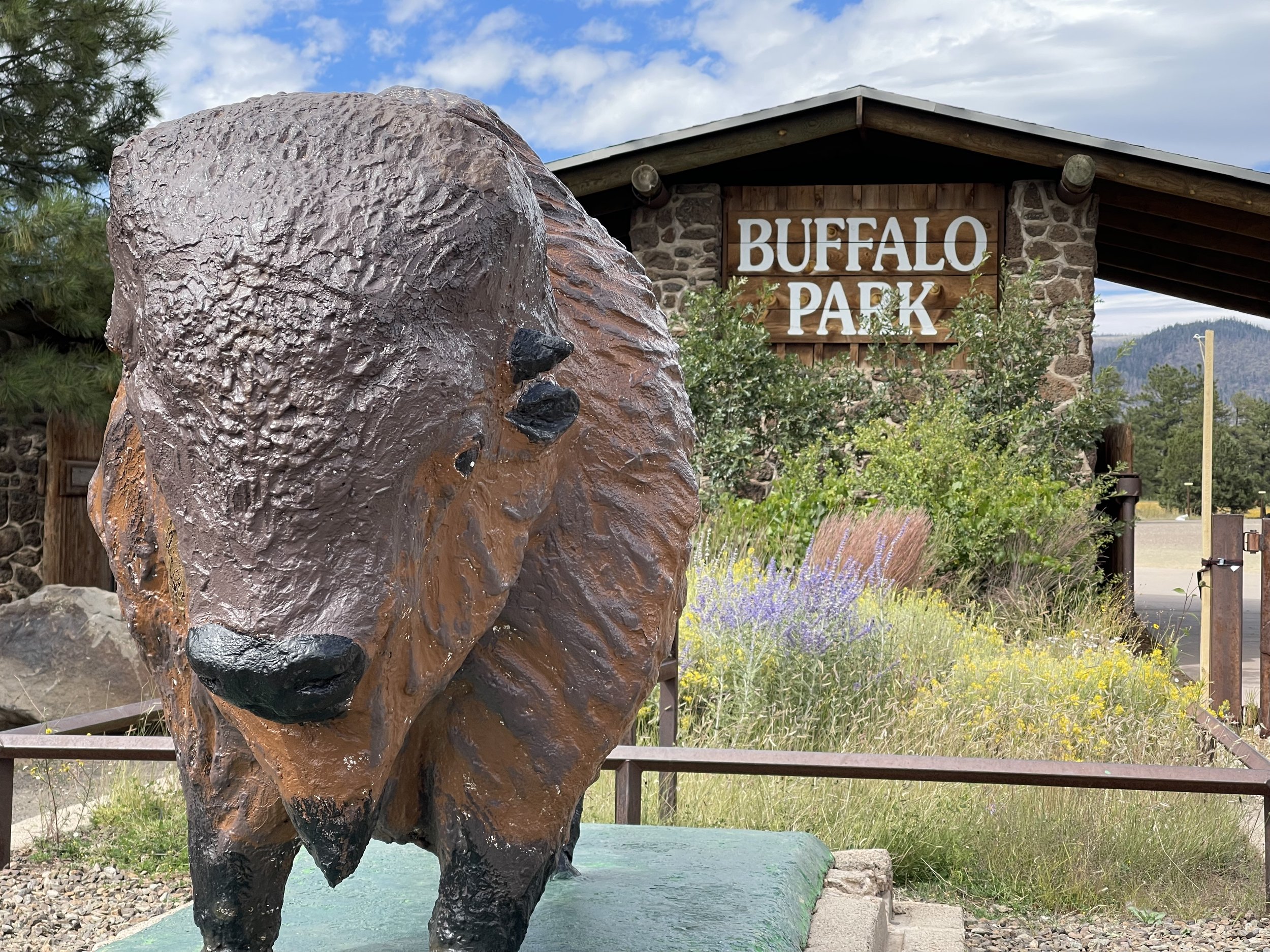
The trail makes its way thru Buffalo Park which was obvious that it is a well appreciated and well used park for the town of Flagstaff.
A sign here told about the man who turned the idea of a thru hike thru Arizona into reality.
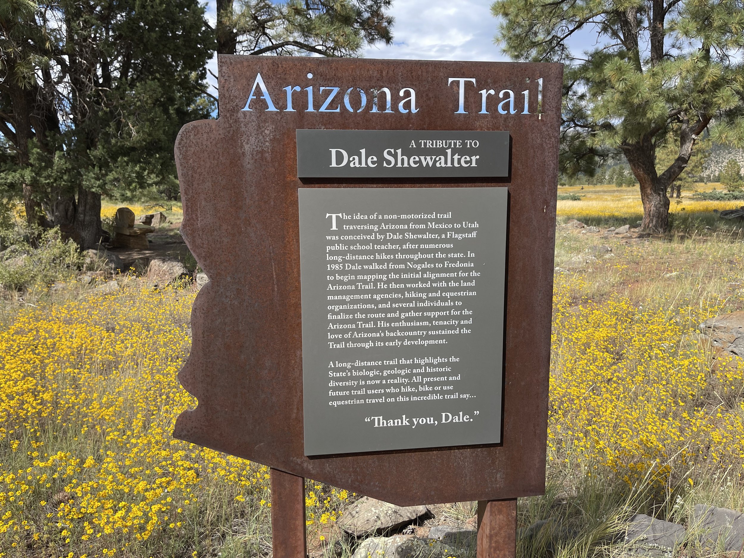
Thank-you Dale
Miles hiked on the urban trail 14
Sept.25
After hiking the Urban trail thru Flagstaff, and putting in water caches, it is time to do the last minute organization for the rest of the trail. We stop in a small town to do laundry and while listening to the radio we hear about the possibility of a government shut down. One of the ramifications of a shut down is the closing of National Parks. We quickly googled the Grand Canyon National Park website and are relieved that the Governor of Arizona plans to fund the park if there is a shutdown, however it is not clear if any permits will be issued to hikers. We make a call to the back country office for the canyon and learn that they are unsure what may happen. They recommend that we email the office at the Grand Canyon and see if we can get a permit over the phone. This procedure is not usual for thru hikers as usually they need to show up at the back country office to obtain a permit. We decide that since the Grand Canyon is only an hour away from where we are, we should talk to them in person. When we arrive to the office they are just reading our letter and trying to decide what to do. This is not a common situation. Due to the uncertainty they decide that they can give us a one night permit to camp at Bright Angel Campground at the the bottom of the canyon on Oct. 3. With permit in hand we feel good about being able to proceed with our hike heading north. A friend of ours had done several section hikes with us and wanted to do this section thru the Grand Canyon. We tell her of the situation and what we have learned. It will be several days before we learn of what will be the outcome for her. There is a place outside of Flagstaff where Don has cached some water for us at a trailhead. We drive there and spend the night. Tomorrow we will be back on the trail and start heading North to Utah.
Sept. 26
By the time our watch said 5, we were ready to head to town and begin our hike. First stop was a grocery store and then a parking lot to pack up the packs. I started out with 2 and 1/2 liters of water and Don had 3 and 1/2. We had 5 days worth of food and our packs weighed 30 and 35 pounds. We parked the van and Aaron our friend picked us up and drove us to where the trail begins after the urban route.

Thanks Aaron
We started our hike at 8:30. For most of the morning we were in either an aspen forest

or a pine forest
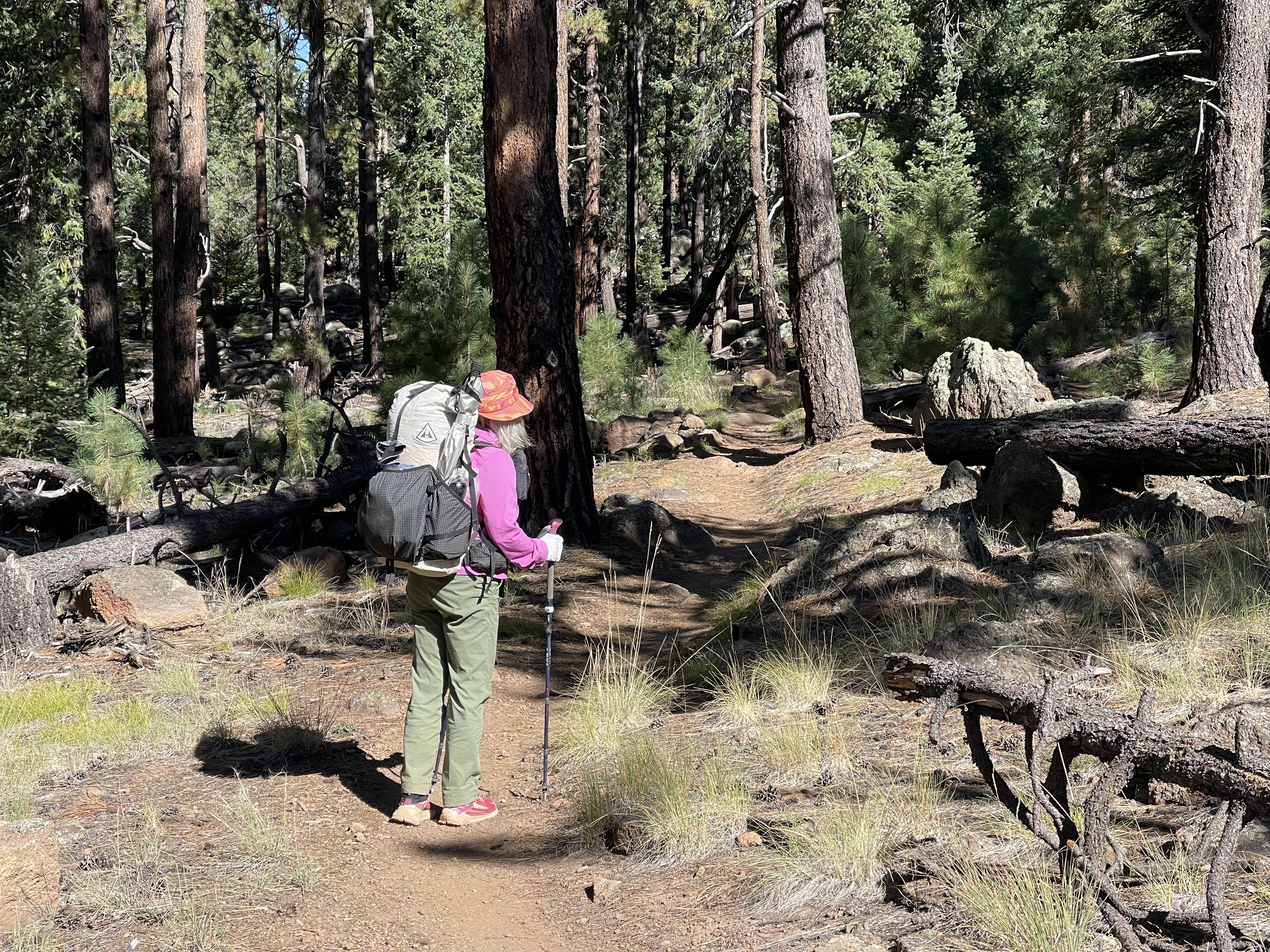
The trail was mostly uphill as we worked our way around Mt. Humphries.

We were glad for the shade, but eventually we came out into more open terrain and appreciated the views that surrounded us.

The ferns cast a shade of brown along the trail.

Several signs indicate the mileage we will be hiking on our way to Utah.
We pass a tank (a water possibility), but knowing that Don has put in a cache we are pretty confident that we don’t have to worry about water. When Don added water to the resupply box there was plenty of public water there as well as private water. When we arrive to the Kelly trail head and open the resupply box, we see our water there, but most of the public water has been used.

One should never count on caches, so we still have some water, but are looking forward to refilling our water bottles.

Lots of empties!

Don fills our water while I cook dinner. We are able to leave almost a gallon of public water at the cache. We also add a comment to Far Out (a hiking app for the AZT)telling of the water situation. We decide to hike a couple more miles and get our tent set up before dark. In the Spring the days continue to get longer, now we are dealing with Fall and shorter days. It gets dark about 6:15 and there is a noticeable drop in temperature. On the mostly uphill climb in the morning we averaged about 2 miles an hour as the trail flattened out and even had some downward slope we went a little faster.
Miles hiked today17.75
Sept. 27
This time of year there is a lot of tent time. We were in bed by 6:30pm and by 5am, we had enough of being in bed. We decided to have some cereal in our tent.(no bears here) before packing up and starting to hike by 6:30. It was light by that time, tomorrow we may try to get on the trail earlier. The trail was relatively flat so our mileage increased over yesterday.

We were entertained by our shadows as we hiked along a dirt road.
We look back from where we came


And ahead to where we will be going.

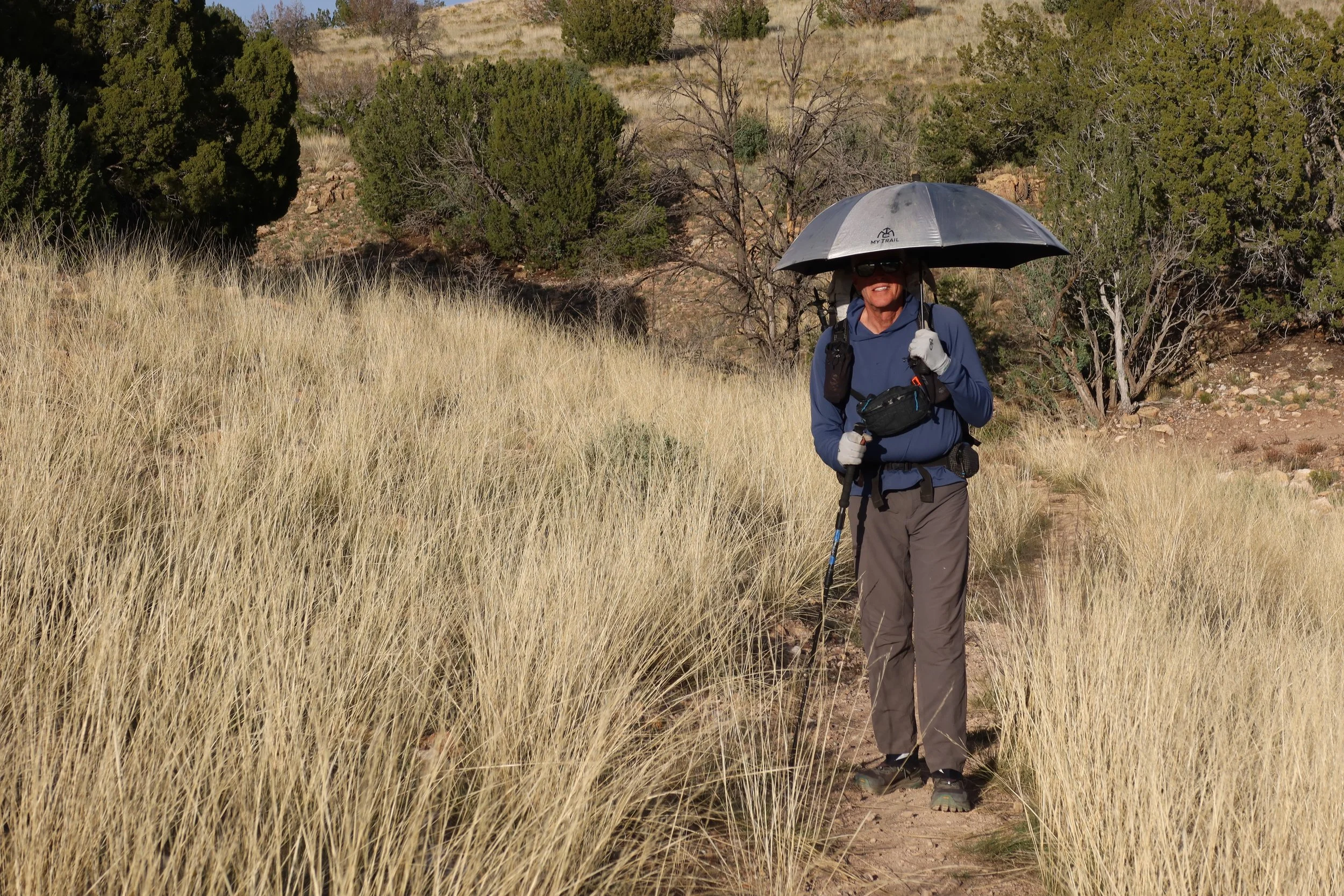
It was pretty hot today and we were glad we had our sun umbrellas. We used them for most of the day.
As we were nearing the supply box at Cedar trail head, we met two hikers who warned us that water was a little sketchy in the next section. In fact for the next couple of days we will be need to be aware of our water usage. There was plenty of public water in this box, but Don had cached some water for us a couple miles from here. When he had driven to the trailhead, he noticed that where the trail turned off the dirt road it was about 2 miles of up hill from the box. He figured that he could hide the water near the turn off and we wouldn’t have to carry the water up hill. That was a great plan. We found the water and quenched our thirst. He had left 3 gallons here and we filled up all our containers. Plus we cooked a hot lunch before packing up and heading out. We cut up the water jugs and put them in our pack. Donna is carrying about 9 pounds of water and Don has 11pounds. Our packs are heavy!

Water is a challenging part of this trail. There are tanks (small ponds that are often quite brown) and wildlife drinkers. The wildlife drinkers are our favorite as the water there is generally good.

We pass this sign telling us that we are hiking thru the Babbitt Ranch. We are thankful that they have given the hikers permission to be on this private property. Tonight we will be dry camping. We are glad to be carrying as much water that we could. The trail is mostly flat, but our bodies our challenged by the up hills. We take several breaks to stretch our our backs.
We are back into the land of stickers and when it is time to camp we reject several sites due to all the thorny plants.
Finally we come upon a spot that looks perfect. It is quite exposed, but there isn’t any wind yet. We still take the precaution of staking out our tent really well. Just as we are ready to turn in for the night we are treated to a sun set and a moon rise.

The twisted trunk of the tree alludes to the harsh environment that it has survived. Our bodies are tired tonight and we look forward to being horizontal.
Miles hiked 21.5 and 500 feet of elevation (I am not sure that is accurate.) (with heavy packs the elevation gain seemed to be a lot)
Sept. 28
The moon lit up our tent for most of the night, casting shadows on our sleeping bags. Once again by the time 4:30am rolled around we began to stir. We opened up another cold cereal for breakfast. It was still dark by the time we were ready to start hiking. We saw several headlamps in the distance and soon realized that the lights came from hunters. With that in mind we proceeded carefully with headlamps turned on high. It is bow season so at least we did not have to worry about gun shots. It got light a little after 6 and our eyes quickly adjusted to the dim light. We met a hiker called Rainbow who also told us about the water situation. The trail continues to be mostly flat so we are making good time.

We pass thru a large area of the Babbitt Ranch that is being developed for wind power. We cross over several large roads that have been put in place to accommodate the building of these towers. It seems strange to come down a quiet trail and then be exposed to this type of construction work. We meet a trail steward for this section of trail. He tells us that the next section we will be hiking thru does not have a trail steward so he is going to spend the day with a handsaw to work on some of the trees that have fallen across the trail.

The trail steward tells us about Babbitt Ranch and the wind towers.
After hiking most of the day yesterday and most of the morning today, we finally come to this sign.

We appreciate that this ranch has opened up their land for thru hikers.

Instead of gates these bridges are installed for bikers and to keep cows from crossing into the next area. Hikers appreciate them as well.

On the other side of the bridge is this sign. We hope to make it to Russell tank tonight. If we do we will have hiked 24 miles which for us is a long day.

There are bursts of color along the trail.
We decide to stop for a hot lunch and take a longer break than usual. We take an inventory of our water and realize that we don’t have a surplus. We will need to be aware of our water usage. We go into the conserve water mode. No talking unless necessary and breathe with your mouth closed. It works and our destination becomes a reality. We pass by several places where there are empty water jugs tied together. When Don was putting in water catches, he met a women who was also doing caches. She told him of one of the places that we had passed with the empty jugs. She warned him that this location was only accessible with a 4 wheel drive, We pass by a water source that had some water in the bottom of a tank, but since we are only 2 miles from Russell Tank we trek onward.
Finally we see the sign
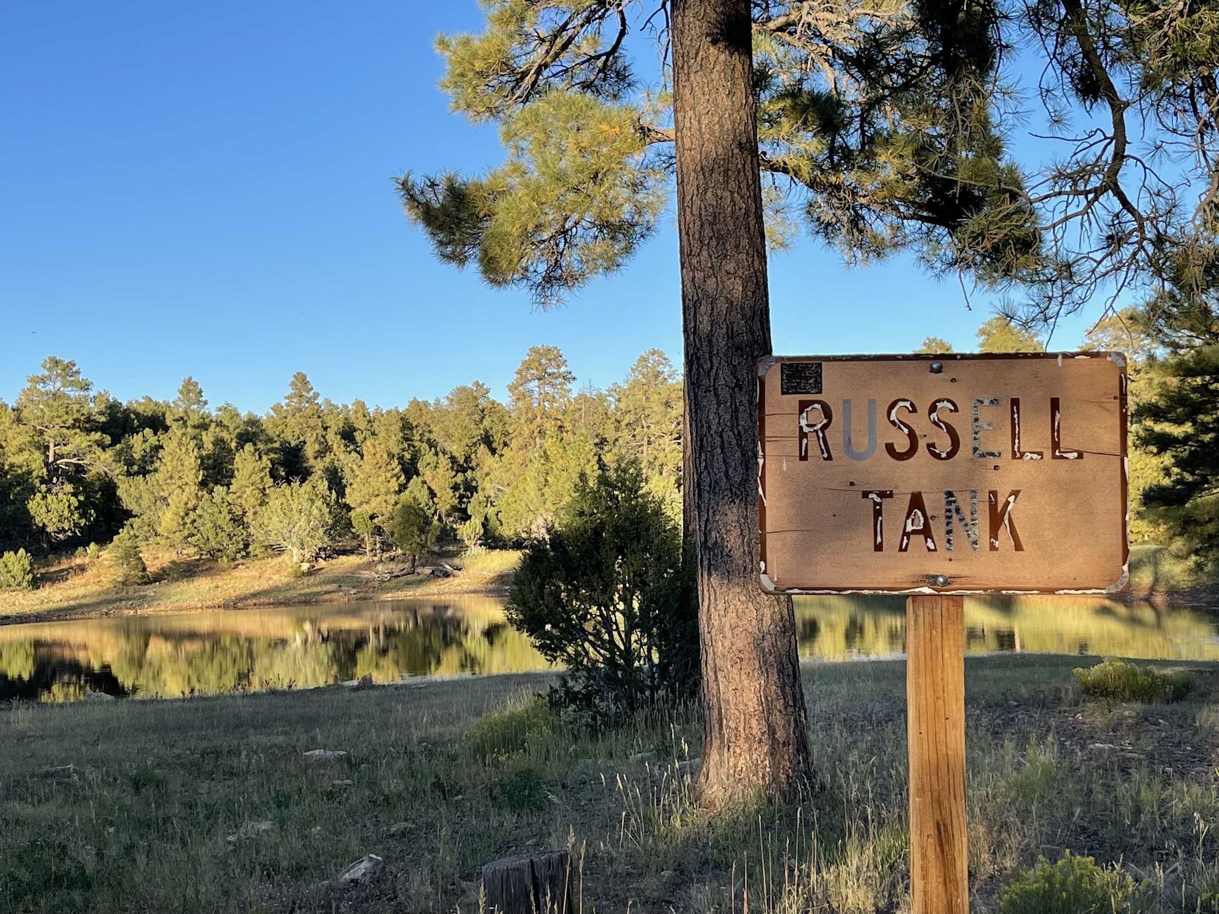
And the lake behind it.

It appears to be a little green with algae and there are even people fishing here. Out comes the filter and soon we have water to fulfill our needs.
We are tired and eating a cold meal sounds good enough. Don has cached some water about 2 miles from here so we will have breakfast there when we can refill our bottles with the cached water.
The moon rises and with it the sound of the male elk bugling. We are soon in what seems to be a herd of elk surrounding us with males trying to out sound the next male. I am hoping that they don’t run into our tent. We have never heard this many elk.
Miles hiked 24
Sept. 29
After a noisy night of hearing almost a continuous bugling sound of elk, we were glad to pack up and leave in the morning. As we were leaving Russell Tank we heard and then saw a large group of elk running thu the forest. It was only a couple of miles to where Don had left a couple of gallons of water. It is always a relief to see the undisturbed containers exactly where he left them. We poured out the water from Russell tank and filled our bottles with this water. Donna prepared a hot breakfast as we came up with a plan for the next couple of days.
The trail had a lot more ascent and descent elevation which slowed our pace down. We encountered about 10 south bound hikers today. I must admit we are glad to be on the finishing up part of this trail. We took a break where we could see the North Rim of the Grand Canyon.

We are excited about doing the route from the South Rim to the North Rim. We still have some miles to put in before that so we are just enjoying the hiking for the day.
There were signs of a fire that had burned thru this area.

Signs of new life contrasted the burnt areas.

Also a lot of the ground cover was made up of this red stemed plant. We think that it is perhaps the result of all of the rain and snow that fell this spring.
A section of the trail had informative signs that described the results of dwarf mistletoe that had been the killer of a lot of the trees in the area. In the late 1900’s a major effort was made to remove the diseased trees and plant new ones. So far this effort seems to have been a success. We pass several areas that once had some public water for hikers. They now are all empty. Once again we are going to be smiling when we get to Granview as Don has left several gallons of water for us there. There are several south bounders a Granvies enjoying the shaded area and a very clean vault toilet. We contemplate the name of this place for there is no obvious view. We meet a hiker called Cheese it. He tells us of how heavy a pack he is carrying. He only like to hike 15 miles a day so he needs to carry more water and food. He is also impressed with our ages. He passes on information about a storm that is coming. We have also been told by other hikers about the storm so we will be looking for a secure location tonight.
A hiker passes some information about Elk in the Grand Canyon park. Apparently two males were fighting it out when they became close to a large motor home. They were more interested in seeing who was the top male then respecting the motor home. As they fought, they run into the motor home causing significant damage. Maybe I should have been a bit more wary when we heard so many elk right around us last night.
There is still no word about the shut down, perhaps we will hear when we get to the next town.
When it is time to make camp tonight, we are unfortunately in a burned area. As we try to find an area that may have some protection from the wind, we also need to be attuned to the dangers of falling trees. We pass by areas that have some major brush clearing.

We finally agree on a site and stake our tent out well. By the time we eat, there still is no wind. If it does come we are well prepared.
Miles hiked 18.5
Sept. 30
The wind didn’t blow and we only heard the elk bugle once, It was going to be a short hiking day so no need to be in a hurry this morning, Plus according to the elevation information, we would mostly be going down hill. As we were walking along enjoying the morning. we noticed a hiker coming at a rather fast pace towards us. She stops and said, “I hate to inform you, but you missed the turn.” The good news is that it is not very far back. We make a U turn and try to keep up with Raven from Portland. She is trying to get to the Canyon tonight and start the downhill hike. She hasn’t heard the latest about the Government shut down and she doesn’t want to take any chances of it being closed. She like us has a permit, but doesn’t want to trust what may happen. There is no way we will be able to keep up with her so we wish her well and soon she is out of sight. We manage to miss another turn before finally getting on the trail to Tusuyan.

We love the colors that pop up on the trail.
About a couple miles before we reach town. a hiker is walking towards us. Sone hikers just say hi and keep going others tend to stop and engage in a conversation. This hiker called Fight Back, age 78, was one of the second type. We learn that last year supported by his wife he had hiked the Appalachian Trail. This month he is by himself. He has a system of finding a place he can drive to with his bike. He secures his bike then drives back to where he can begin hiking. He hikes to his bike and then rides the trail back to his car. He will then sleep each night in his car. We asked how did you get your trail name. He responds by telling the story about his Dad. He starts the story by saying that for the last 10 years of his Dad’s life, his Dad was miserable. He had started down the path of dementia, but was also out of shape and had no plans for what to do. Fight Back decided that he was going to try to do whatever he could to not become like his father. He began by getting out and moving everyday regardless of the weather. He said sometimes I don’t feel like it then I remember my Dad. We said our goodbyes and headed into the town of Tuyusan.
There is a path that leads to a RV/tent campground. They have a place for hikers. It has showers, laundry and clean restrooms. The grocery store is close by and we also have good cell service. We are the only ones at the tent site so we settle in and enjoy a chance to get clean clothes and clean bodies.
It has been a very relaxed day and we are already feeling our bodies getting engery back.
Miles hiked 8
Oct.1
We thought that we were going to have a peaceful night. There was a wind warning, but there hadn’t been any warnings about the severe storm that we had experienced during the night. For awhile it was a continuous sound of thunder and flashes of lightning. If we had been in a house with picture windows I am sure that we would have been in awe with the light show. Later when we were taking to some park rangers they said that this was the worst storm of the season. Another hiker who was about 5 miles away from us had about an inch of hail. We stayed dry and the only result was that we didn’t get our 10 hours of sleep.
When morning came we were fortunate enough to see the moon still in the sky and a raven sitting on a branch by our tent.

The storm has passed!
The sky is filled with lingering clouds.

We head up a bike path that will lead us to the Grand Canyon and Mather Campground.

We pass under the arch that marks the boundary of the Grand Canyon National Park.

Thankful for parks that preserve land to be used by all!
After registering for the camp ground which has 319 sites, and setting up our tent, we decided to slack pack the AZ trail that will take us to the Kaibab trail head. This way on Oct. 3 we can just take the shuttle to the trailhead instead of walking two miles to get to it.
Even though we have been to the canyon several times, we are always in awe of the beauty!

We returned to the Market place via the shuttle and ate some delicious Indian Fry Bread at the deli.
We have talked to our friend, Tracy, who was able to get a permit to camp at Bright Angel on the 3rd with us. She also got a campsite at Cottonwood for the night of the 4 th for all of us. Currently the night at Cottonwood is in a stockade area, but she told us to go to the Backcountry Office tomorrow morning and perhaps we can get a regular site. Donna talked for awhile to an AZT hiker who is camped next to us. He is from England and tries to come hiking in the western USA as much as possible. On the other side of us is a hiker from Phoenix called Spirit Kicks. He has done several thru hikes and like us is completing this trail after having been stopped by snow this spring.
Miles hiked 10
Oct. 2
There is some rain during the night, but nothing like the previous night of non stop storms. We plan to get the 8:00 shuttle bus to the back country office. After a call is made to the North Rim, we learn that there is one regular campsite at cottonwood. Since we are first in line we are given the site. Great! We take the shuttle back to the Market place and head towards the post office. On the way we check out the piñon tree pine cone. We take a minute to learn about pine nuts and realize that we don’t have the time or the equipment needed to collect some nuts.
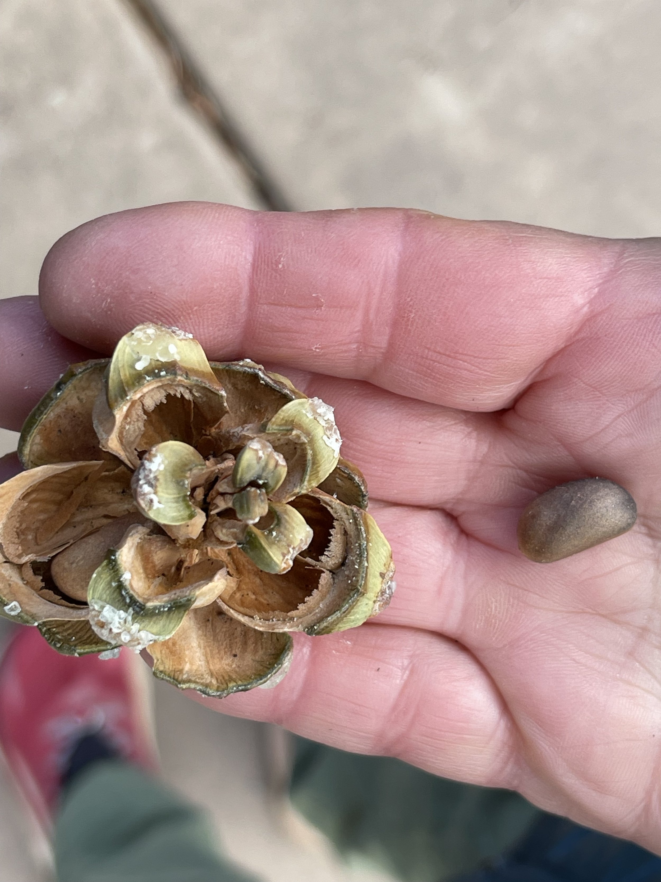
pinyon pine cone with a pine nut
Someday if we are in this area it would be a fun thing to do. We find our box along with all of the other hiker boxes. Don had dropped off our box earlier at the post office and the postman told him I will just put your box here with the rest of the hiker boxes. You don’t have to pay for postage. We quickly sort out our food and take it back to the campground to eat breakfast. Aaron, the camper next to us was having breakfast as well. We continued our conversation from last night. We quickly discovered that his love of this area has made him quite knowledgeable about many aspects. We talked history, the western environment and facts about the early natives. It made us want to delve into more about the area.
We decided that we would head to Mather point and check out some of the rim trail. The visitor center was closed due to staffing shortages, but we were able to sit in on a geology talk and then visit the geology museum. We learned that the squirrel accounts for most of the bites in the area.

So cute until you want to feed it and it takes a big hunk of your finger along with the food you had offered it. There is a reason you don’t feed wild animals.

We can see why there is such an interest in the topic of geology.

Way below us is the green area of phantom ranch where we will be heading tomorrow. The day after we will be heading up to the North rim which is @ 22 miles away.

We decided we would join everyone else and get a photo of us with the background of the canyon b behind us.
We walked back to the deli at the market place and split a fry bread between us. Once of the servers who we talked to last night, brought over a cup of macaroni and cheese for us to share. I guess he was impressed that we were going to hike the Canyon tomorrow and we might need more food. Tracy is arriving tonight and tomorrow we will begin our hike down the canyon. Before Tracy arrives we have some great wild life sightings.
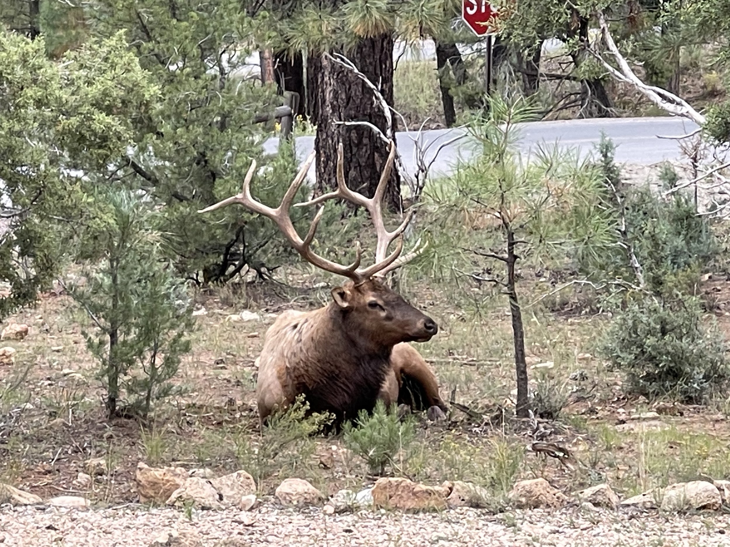
First we see a bull elk and then….

A javelina walks in front of the elk.
Miles hiked about 2 miles along the rim trail.