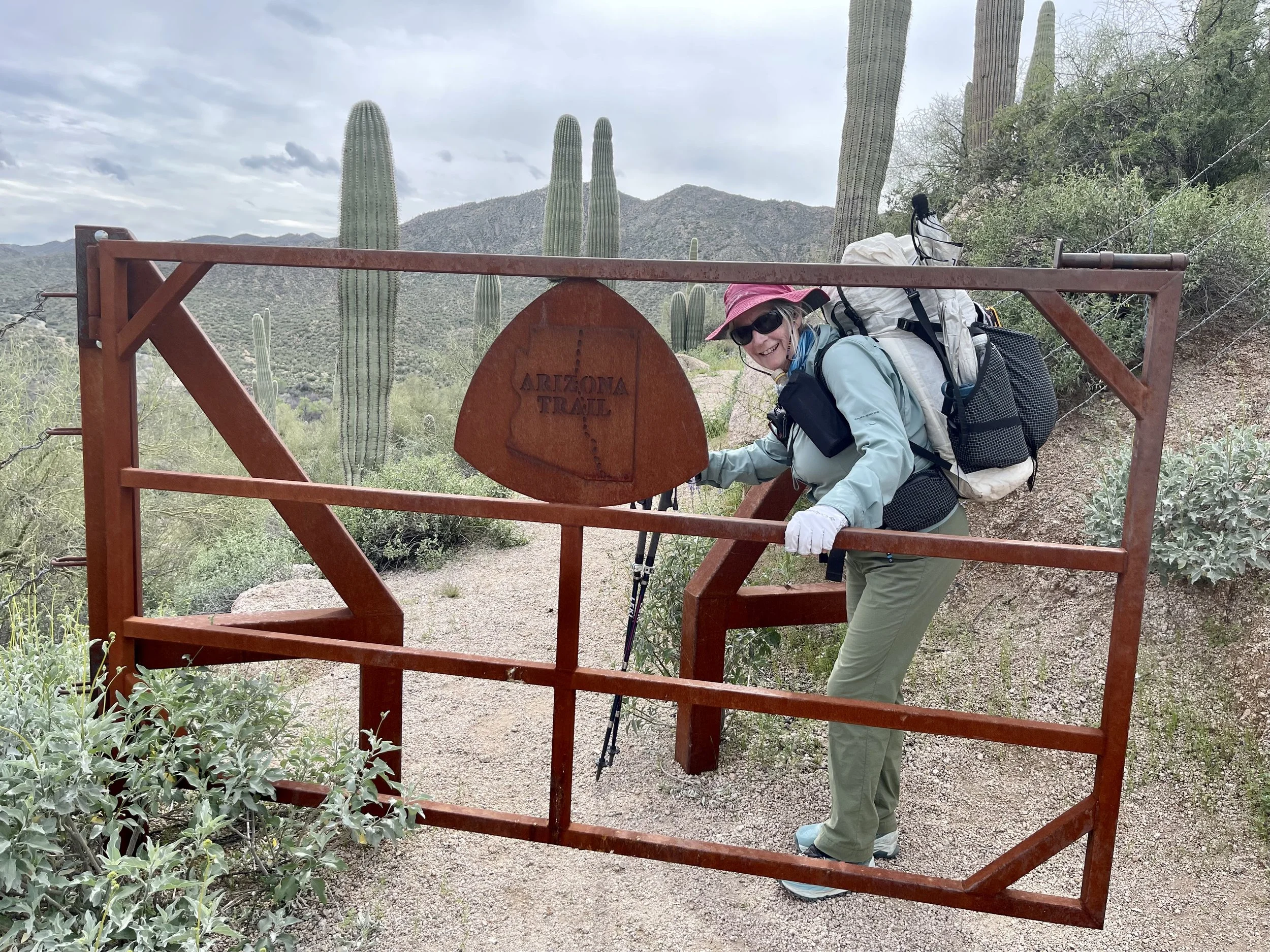
March 11
We were leaving Tracy’s house by 7:30am and heading to the trailhead that we had finished our hike yesterday. An hour later found us lifting our packs which included 5 days of food and 4 liters of water each. (a liter of water weighs 2 pounds) This section of trail parallels the Gila River which is a water source that we are trying to avoid. Our packs were heavier than we would have liked, but each day they will be lighter.

The trail did not disappoint, we are walking in a poppy wonderland!

It is going to be a beautiful day for hiking!
Tracy decides to walk with us for awhile. There are some horses coming towards us and we tell Tracy about what to do when horses approach. The best place to stand is below the trail, so that if a horse spooks it will go uphill and be easier to control. The horses pass us without a problem until the last one who doesn’t like the look of us and heads up hill. The rider gets the horse under control and we move on. It was a very practical lesson of horses sharing the trail.
We cross a bridge that goes over the Gila River and we are glad for the water bottles that we are carrying. The brown river that drains some mining areas does not look appealing. We have been told that our Sawyer Squeeze will purify it, but that it also clogs up the filter. If all goes as planned we won’t have to use it.
Tracy is just about ready to turn back to her vehicle when we see a hiker running towards us. His pack is definitely on the ultra light size. He stops to chat and Don and I quickly realize that we have met this hiker before. His name is Fire and we met him last summer while we were doing the Great Divide Mountain Bike Route. He was hiking the Continental Divide Trail and we shared a picnic table at a divide crossing in Montana. Fire is a non stop hiker and basically lives on a trail somewhere. He shared the knowledge that a small clear stream was running and that we should be able to refill our water bottles there. Fantastic! Fire is doing the Grand Enchantment Hike which uses part of the AZT.

Fire, has a tattoo on his fingers spelling out his name. His outfit also lends itself to his name.
Shortly after Fire is gone, we meet another hiker who is also doing the Grand Enchantment Trail. He confirms the information about the water source, and also tells us to be wary of the cows in the area. He said he has done a lot of hiking and this was the first time that he was charged. Yikes!
The water source corresponds with our lunch break so we tank up and refill our water bottles. We are hoping to get to the next water source that is after the Gila River. This section of trail finds us doing a lots of elevation gains and loses as we conture around drainages. There are plenty of flowers and cacti to entertain us.

We also see the inner wood of a saguaro which is quite interesting and can visualize how it was used for building material.

The vegetation along the trail is thick, we wern’t expecting this.

This is probably why there are so many cows here. We had just done a climb up from the river bottom and were heading down the trail when around the corner comes 3 large bulls with impressive horns. They stopped to look at us and decided (I think) to just keep coming our way as the grass was quite tasty. We talked to them in a low voice and tried to convince them to turn around, but to no avail. We backed up and I hid behind a rock. This option was only good for a little while as we eventually would have to continue on. Going around is not an easy feat as there are many plants with thorns. Don scouted out a path and convinced me that it was a go. The cows continued to move forward so Don’s route looked more appealing. It was a go, the cows were left eating and we continued on.. a win win.
Down in the river bottom, we watched as a large train made it ways carefully down a decline.

The three engines were working hard to brake.
We are intrigued by all the gates.
They are well made and add character to the trail.
Don does a first when he has to climb over a saguaro cactus.

The highlight of the afternoon was seeing a Gila monster. These venomous lizards spend 90 percent of their time in burrows so it was quite a treat to see one in the open. Their bites can be quite painful, but they are slow moving and easy to avoid.

Gila Monster
The day continued with seeing and avoiding lots of cows and rationing our water a little. We also are looking forward to heading up into the Superstitions which are a well known mountain range tomorrow.


It was a great day filled with flowers, cows, Gila monsters and beautiful landscapes. We hiked almost to dark looking for a location that would provide us protection from the wandering cows.
Mileage hiked 14.5 miles
March 12
Happy to report that other than cow bells in the distance, we had no night encounters with the mammals. Going to bed by 7:30pm makes it easy to get up in the morning. We had been given the advice to put everything in our tent so to deter the pack rats who inhabit this area. This makes it quite easy to do most of our packing before even leaving the tent. Just as we finished packing a couple of headlamps walk toward us. With temps getting warmer during the day, it is quite common to get some early miles in on the trail. We soon are on the trail by 6;15 using our headlamps as well.
Nice light greets us as the sun rises and the moon can still be seen in the sky.

We are able to find the cardinal singing a morning chorus. The bird was quite the contrast to the green saguaro.

The trail takes us down to the river bottom where a hiker is camped close to the river. He shows us the brown colored water he has gotten from the river. It indeed filters clear, but he will need to back flush his filter in order for it to work again.
An Arizona trail sign lets us know we have reached the lowest elevation on the trail.

In a couple of weeks we will pass by the highest point which is around 9000 feet.
We finally leave the river bottom and turn north to head up into the Superstitions. It is going to be awhile before we are able to find a water source.

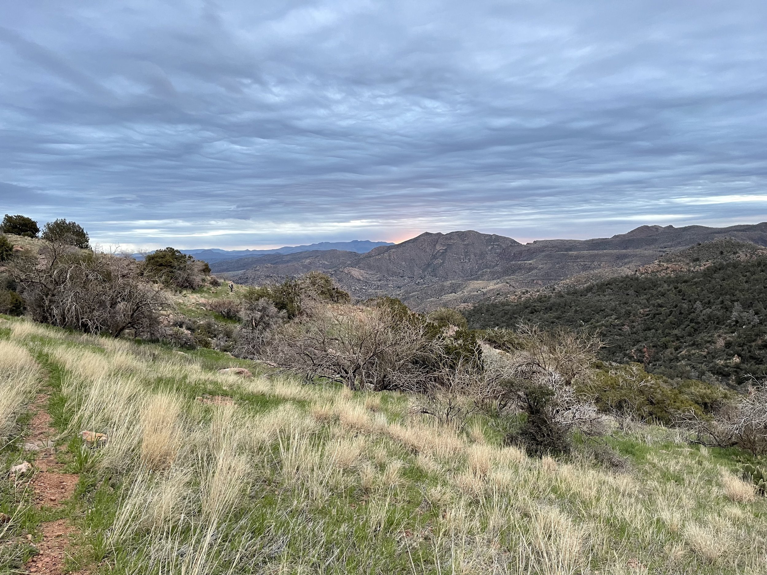
Lots of beautiful landscapes
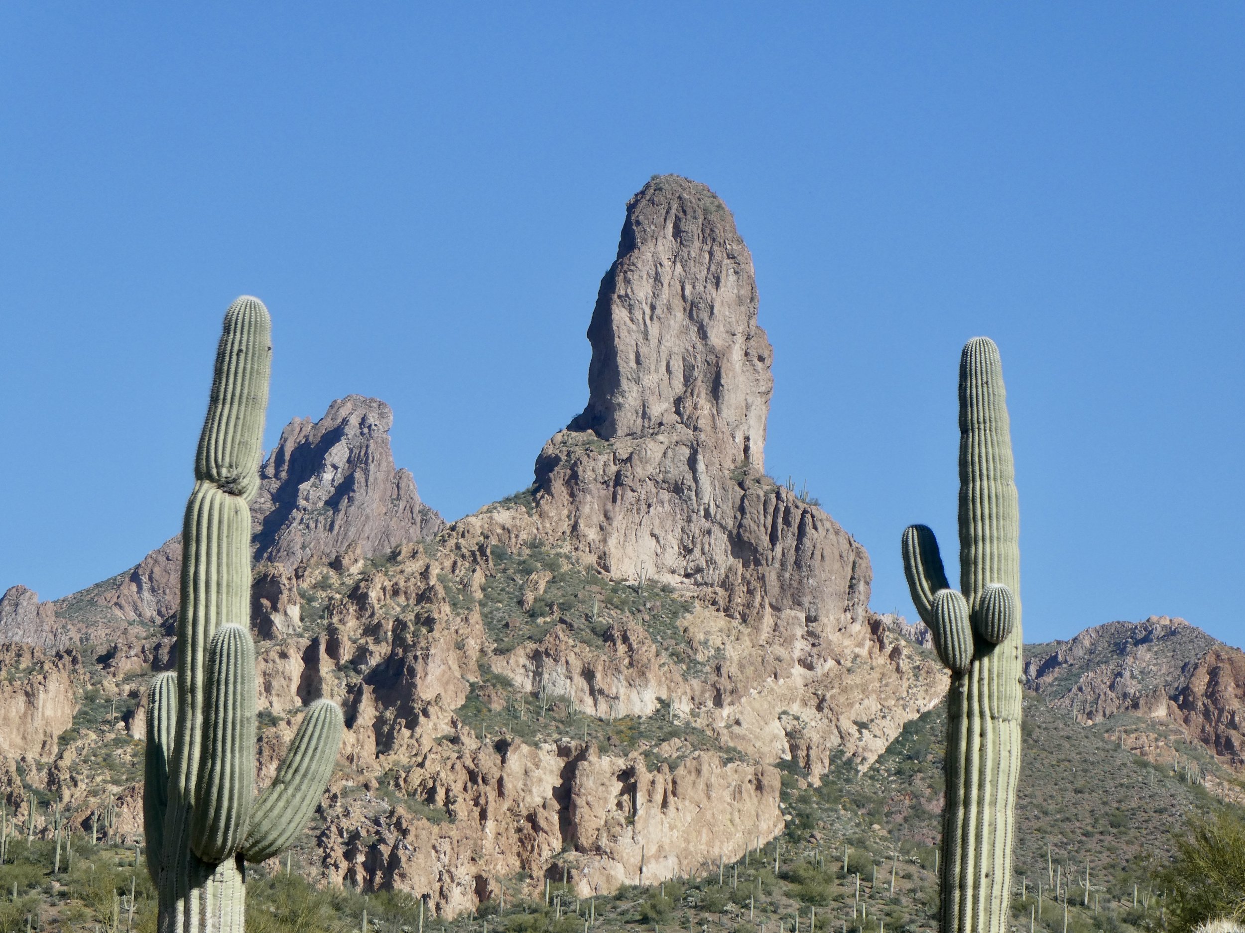
This is a well known land mark. By the time we finished going up to a pass we saw three sides of it.
The Arizona trail is quite rocky at times. This section had its share. The rocks that you see to the right of the photo below is the actual trail!

This section of trail is mostly up and with no water sources till almost the top, we are being careful of our water usage. Don was down to his last swallow and when we noticed a seep with a little pool of water, we quickly stopped and were able to fill a liter of water.

We are appreciating the value of water!
We added an electrolyte tablet to it and felt our bodies reacting to its formula. We only have another mile to go where there is a guaranteed water source. Meanwhile with our thirst on hold we are able to enjoy some rock formations as we work our way to the pass.

Just before we reach the top of the pass, we encounter three mountain bikers. One of them is in charge of maintaining this trail. The challenges of maintaining this trail is that it takes him a lot of hours to reach parts of it. Today he had some clippers on his bike and tried to at least cut back some of the branches. Neither Don nor I have any desire to bike this trail, it is above our ability! (at least in some of the parts)
Finally we see it! The rainwater tank collector. Not only is it full of rain water, but it also provides some great shade. We drink till we are satiated and well rested.
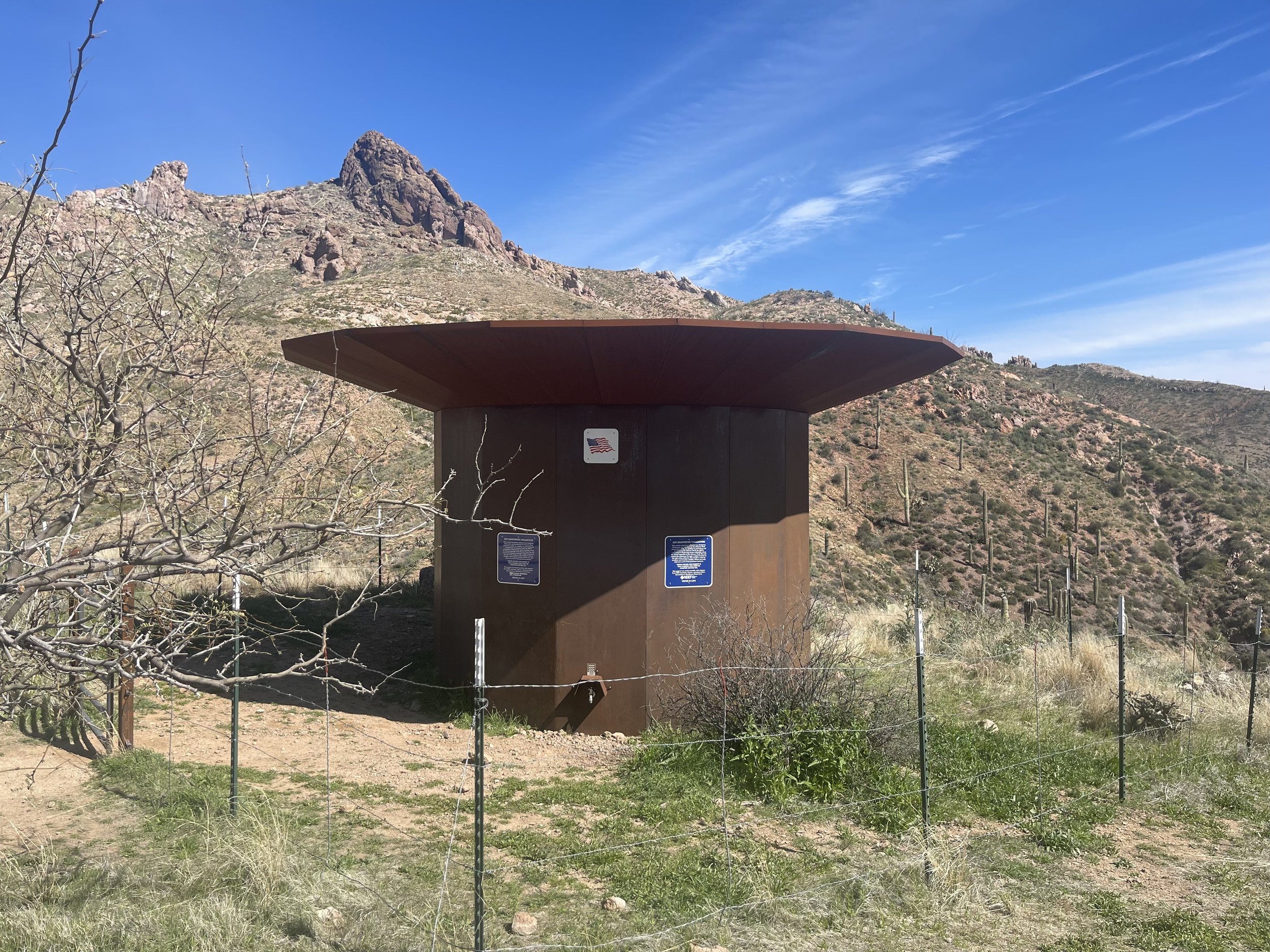
The rainwater collector.

This is a great asset to the trail. We hear that another one is going in near the Freeman Trailhead.
We are reluctant to leave, but finally do so and head down the mountain to find a place to camp without cows. (we hope)

Time to find camp.
There are a lot of cow signs, but no actual cows so we find a flat spot and are looking forward to getting horizontal.
Mileage today 17
March 13
Glad to say the cows stayed hidden and it was another quiet night of sleep. The trail was mostly downhill as we walked our way to Picket Post trail head. We left about 6:20 am and didn’t need our headlights. It is so nice realizing the days are getting longer.

More beautiful dessert and mountain landscape
We passed numerous small streams, but they were filled with algae and cow poop. The latest information on our Far Out App which we use for navigation and water updates indicates that there is public water in the resupply lockers at the trail head. As we got closer to the road head, we encountered a lot of day hikers. It is an easy accessible road head and there were a lot of cars parked here. We have only met one AZT hiker in the last couple of days. There was a picnic table with shade so we enjoyed the amenities and ate our breakfast. On the other side of the road head we found the resupply box and were quite happy to see that it was full of public water. Some hikers cache water and they label it with their names. We decided not to do that as we have the ability to carry enough water for long mileages without water.

Sometimes there is trail magic left in the box(ie chocolate bars, but not today) We are just happy to have good water!
According to the Far Out App, we shouldn’t have to worry about water for most of this next section.
Once again we are treated to the rocky dessert landscape.

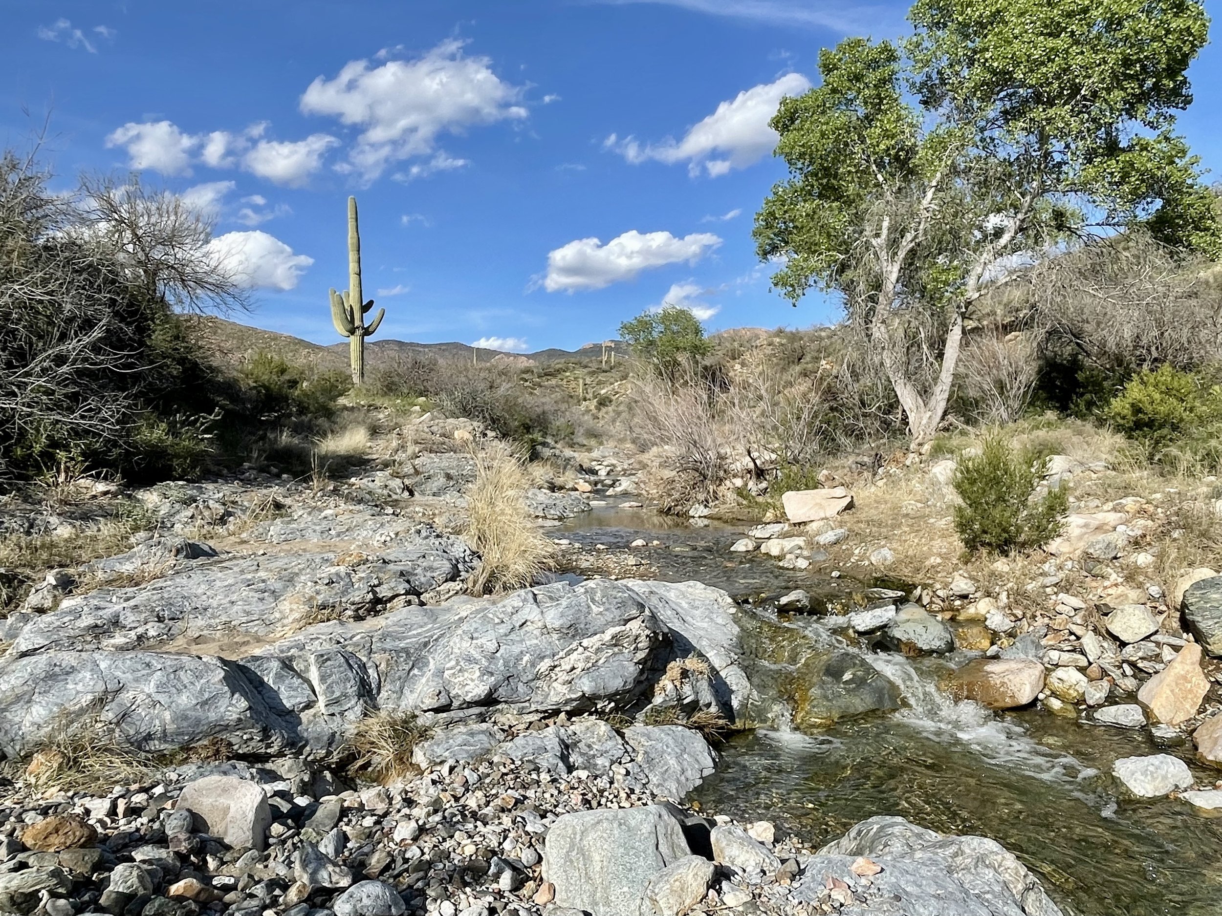
And clear, cold running streams!

It is early spring in this area, the flowers are not here, but the green vegetation is lush!

We stopped at Whitestone canyon for lunch and a foot soak. A couple ladies on horseback rode by and said that we are so lucky to have this much water. We agree! The trail continues to meander up the stream with numerous rock crossings. We were able to rock hop when the trail crossed the stream. Several weeks ago this was not feasible as the stream was a lot higher due to all the snow melt.

This saguaro was photo worthy!
As was this one below. After having long stretches with no water, we are thankful for this day
We stopped about 5 tonight as we came upon a nice campsite. Campsites are sometimes hard to find so our length of hiking time is often determined by when we can find one usually close to 5 o’clock

There is a stream right behind us. Fortunately there is no rain predicted as there are warnings posted to not camp near here as flash floods are common. The trail was pretty mellow today so we put more miles in.
Mileage hiked 19 miles
March 14
Nor sure why, but we both had crazy dreams last night. After spending what felt too long of a time in bed we decided to get up even though our watch said 4:30am. We had to use our headlights as we picked out the trail. We crossed our last water source.

We have been enjoying not worrying about water!
Todays hike has been described as strenuous and we soon agree. Last week we had climbed the big hill, today the big hill looked like a mole hill compared to what we are hiking up today. We also left our last water source for awhile and are carrying extra water. One fun things about these hikes is that you can look from where you started and are impressed by what one step at a time can do. Eventually we made it to the top of the pass and joined up with a road that would take us to Rogers trough which should have the next water. As we worked our way down hill to the trailhead, we were amazed at all the water. We shouldn’t have to carry much water today. Time for breakfast as we found a place to eat by a bubbling stream. Today’s hike would take us past Revis ranch.

There is a trailhead nearby and we encountered several groups of hikers exploring this area. Most of the hikers were here for one or two overnights. We were told that we should return here someday to explore Native American caves, coke furnaces and the Revis Ranch. The Revis ranch at one time even had apple orchards. Today was not the time to explore so we continued on the AZT trail. A recent fire had made some of the trail hard to find with a lot of downed trees.

Another challenging area was a field of old grass that completely obscured the trail. There hadn’t been many hikers thru this area and we found ourselves relying on the gps found in Far Out to navigate thru the grass. Fortunately it wasn't too long and we were soon back on the trail. With the forest fire and lots of snow the trail also had been washed out in places. We had been told of good camping at Pine Creek so even though we could have gone farther we decided to stop there. It is hard to pass up a flat camping location.
We met a trio of hikers from Washington area that were doing a section of the AZT. One of the members worked as a volunteer on the PCT doing trail maintenance. He commented how more difficult this trail was than the PCT and that the mileage they were doing was a lot less. We have also found this to be true. A rain storm is predicted tomorrow and they are going to stay here, we plan to go on and see how far we can get.
Don found this burnt out log on the trail and thought it was interesting to see how rocks were placed in it.

Mileage hiked 15.5
March 15
We both slept really well last night. Camping beside a stream was so relaxing. We found ourselves hiking at 5:45 am and needing our headlamps. All seemed well as we seemed to be making good time. So far the rain is holding off and perhaps it will not even effect us today. We pause and take a moment to enjoy the sunrise.
As usual we are enjoying the landscape and even watch some deer as they make their way thru the mountains.

A hiker had told us about some rocky steep sections on this trail and we thought that we had found that described section. After hiking almost two hours we decided it was time for breakfast as we had found a nice stream.

Don decides to pull out the Far Out app and with a look of dismay he says. “you won’t believe this but we are way off trail! Somehow in the early morning before it was light we had missed a trail junction and we both assumed that we were on the right trail. There were steep places and large cairns, We grab a bar and immediately reverse our steps. Both avowing that we need to be more careful and check the app more often. We are carrying a set of maps, but only plan on using them if our phone dies. This mistake added up to about 5 miles. Not the extra mileage we needed with the forecast of rain. We retraced our steps back to the trail junction and finally we were back on track. So was the oncoming storm.

Guess we are going to experience a very rainy day!
Shortly after we were back on the right trail, the rain began and the wind began to blow! We put on our rain jackets and rain pants and hoped for the best.
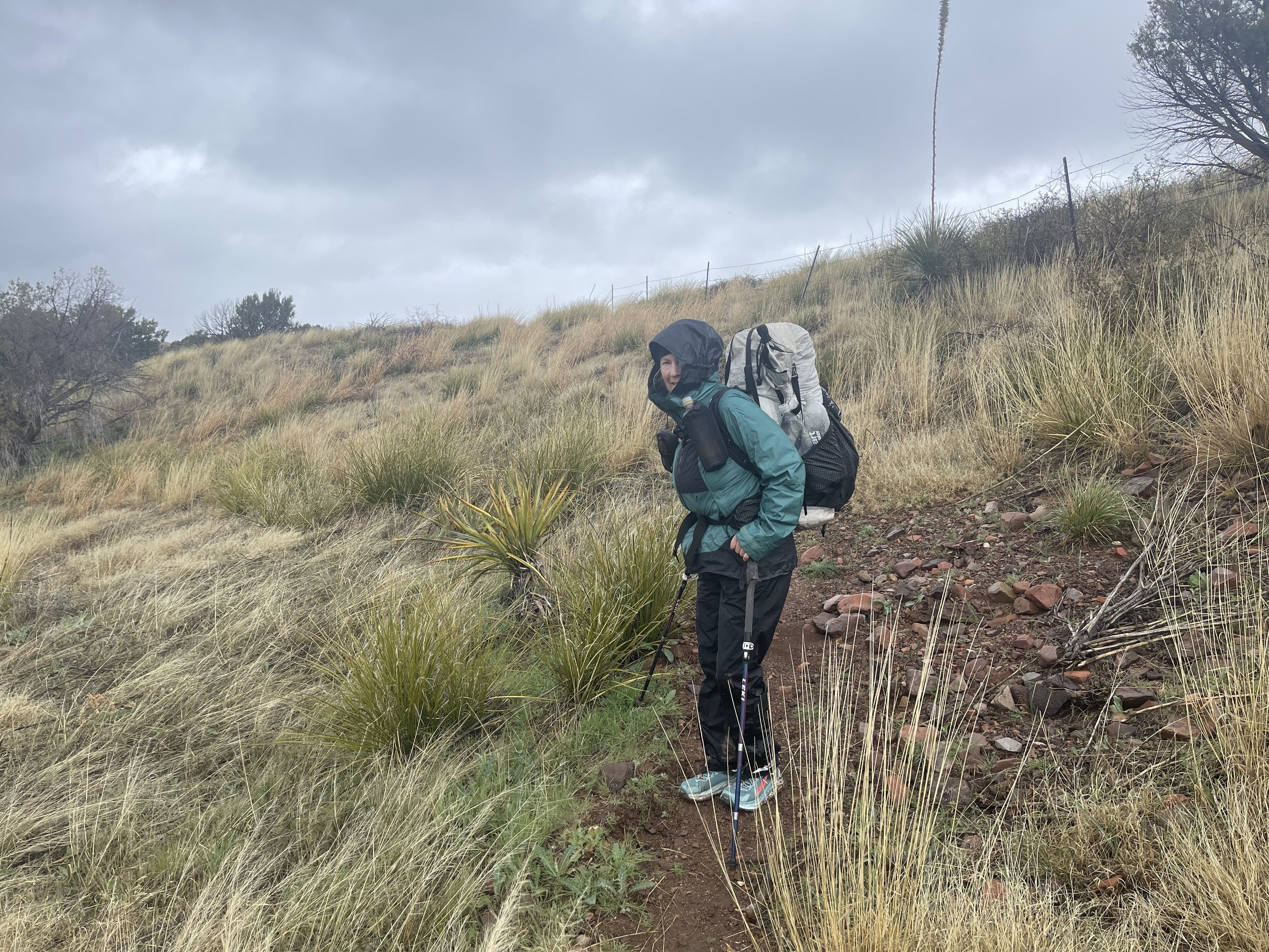

The last photo before we were engulfed in rain.
There was a lot of elevation gain and loss on this section which made for slow miles. Unlike in previous days when we were using trees for the shade, we were now using trees for wind blocks. We found the steep sections and worked our way slowly down to the bottom ravine before almost immediately turning around and heading straight up. The 5 extra miles that we had hiked has taken its toll. it seemed like forever, but eventually we made it to where we finally were making our way out of the Superstition wilderness area. The rain had let up some, however, we both had a lot of wet clothing items. Don in particular had a very wet down vest. With all the rain the trail that we were now on had a surface of mud that clumped to our shoes. Needless to say we wanted to camp as soon as possible.
Finally we saw a spot by a wash. It was several feet above the wash so we hoped that the drainage wouldn’t hold much water. The ground was pretty saturated and we put all the stakes in for the tent hoping they had enough traction to hold. The rain has stopped momentarily while we set up the tent.
Don retreats to the tent and is not happy when he discovers a wet sleeping bag. This is going to be an interesting night. Meanwhile the rain has returned and using my umbrella outside I mange to make dinner. Don has put all his clothes on minus the the very wet down vest and we hope for the best.
We are barely asleep when we are awoken to a violent thunderstorm complete with some of the hardest rain we have experienced. Counting the time between lightning and thunder we realized that the storm is really close. We are hoping that our stakes hold because if they don’t well we don’t even go there. The wash which had no water now is filling with water. For the next hour or so I use my headlamp to check the area surrounding the tent. I am relieved when no water appears and all the stakes hold firm. Eventually the storm moves away and the rain subsides. It has been quite the day and night!
Mileage hiked 11.5 plus 5 miles on the wrong trail
March 16
For the first time since we started this hike, we waited for the sun to hit our tent before leaving it. We were damp, but no longer wet and were counting on the sun to do its thing. The drainage that concerned me last night was a non event. True there was more water, but not enough to effect us. We waited till 8 before we packed up separating the wet items from the dry ones. Hopefully when we get to the marina this morning we will be able to spread out our gear and get them dried. (perhaps they will have a drier there?)

It was a beautiful morning, with the smell of a morning after a hard rain.
For awhile we hiked along a stream bed before emerging out to a road that will take us to the marina and our next resupply box.
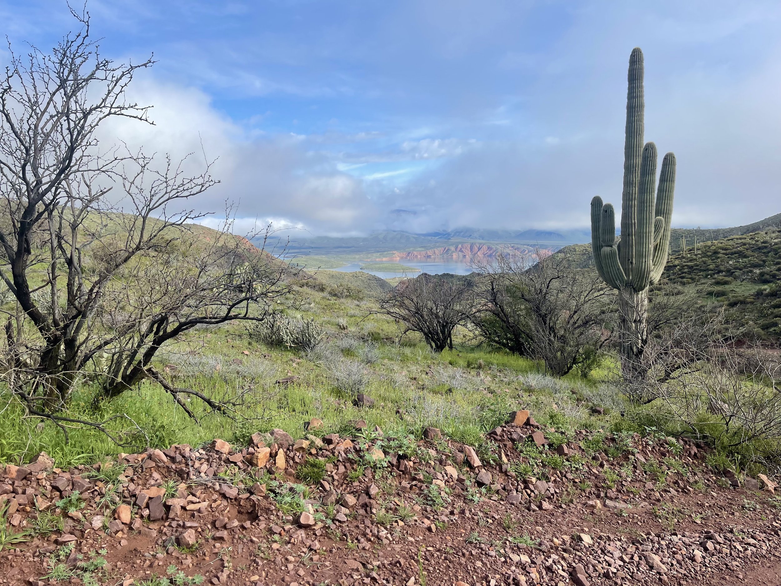
Roosevelt Lake is in the distance.
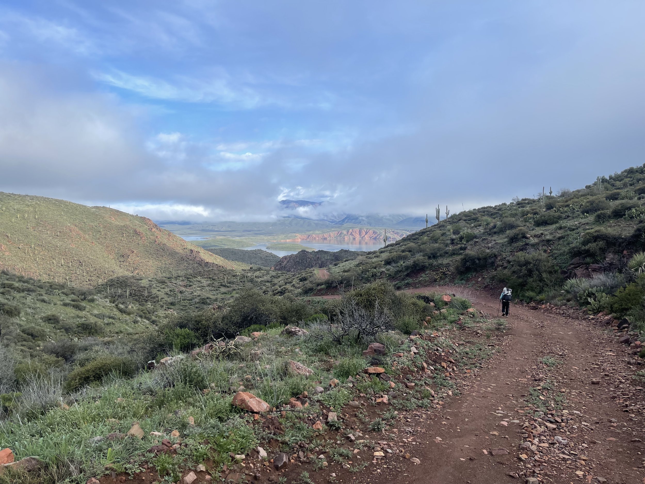
We are beginning to forget the challenge of yesterday as we head down this road and then….
THE MUD


The mud known as peanut butter mud sticks to the bottom of our shoes and is almost impossible to remove. It is quite the work out and we are glad when we get to firmer ground.
We see the marina in the distance and assume that the trail will lead us to it in a short manner, but wrong assumption as we continue on a trail that goes parallel to the lake for what seems like forever! Eventually we make it and first stop at a RV park to see if they might have a laundromat. Our hopes are dashed when there is no answer in the office. Guess we will rely on the sun.

Bikers are welcome, hope hikers are as well!
Off to the side of the parking lot is an area for hikers. Several picnic tables are unoccupied so they soon become the drying platforms for clothing and gear. I go and retrieve our resupply box which will take us to Sunflower, our final destination for this part of the hike. The areas north of Sunflower are still filled with snow and high rivers.
The hiker that we met at Colossal Cave when we dropped a resupply box off is here. We had told him earlier that since he did not have a shelter, he might want to try the dessert sections first. Looks like he agreed with our advice. We asked him how he did with all the rain, he told us that he met some hikers at the marina who let him sleep in their car. His name is Postman and he is planning on to continuing hiking north. We are not sure how he is going to do as the trail reports are coming back with difficult snow conditions. He tells us of the food choices at the restaurant and Don heads over for a take out.
Don has fish tacos and I have pulled pork with onion rings. We both recommend our selections which also included a delicious piece of pie.
While here we were able to get cell service and found out that we had won a lottery to go see bears at the McNeil game refugee in Alaska.. That was exciting news.
By 3 pm to our amazement all of our wet down had dried and we were ready to pack up and begin the steep climb out of Roosevelt Lake. After all this snow and rain this spring the reservoir is 91 % full and is predicted to be over 106% by the time summer is here. Teddy Roosevelt commissioned this to be built in 1908.
Before we head back up into the mountains we need to do some road walking and cross this bridge which goes over the dam.

It is a beautiful evening as we look back down at the lake.

We hike about 4.5 miles before there is a flat place for our tent.
It has been quite the night before and today, but we are dry and have a great flat spot to put our tent with views all around.
Hiked 5 miles to the marina and then 4.5 miles in the afternoon total 9.5 miles