July 16
This section of river continues to have remnants of history on both sides. We read historical accounts as we take turns paddling the canoe. It is another morning of a red sunrise.

We are fortunate that the Yukon is not burning, but feel sorry for the people in Brittish Columbia.
A sign on the left bank lets us know that we have arrived to Fort Selkirk .

A sign gives us the history of the area.

We find it interesting that this area has been used for over 8000 years. First by the First Nation people who traveled many miles to trade at this location.
A map showed the many areas that they came from to trade.

We marvel at their ability to travel many miles under their own power in a variety of conditions.
Fort Selkirk has a large space for camping surrounded by numerous buildings that are being restored. One can once again walk thru the buildings and imagine life in the 1800's here. We approach some younger campers and hand over the jacket that we had been given yesterday. They immediately know whose jacket it belongs to. With that task done we take some time to check out the buildings.
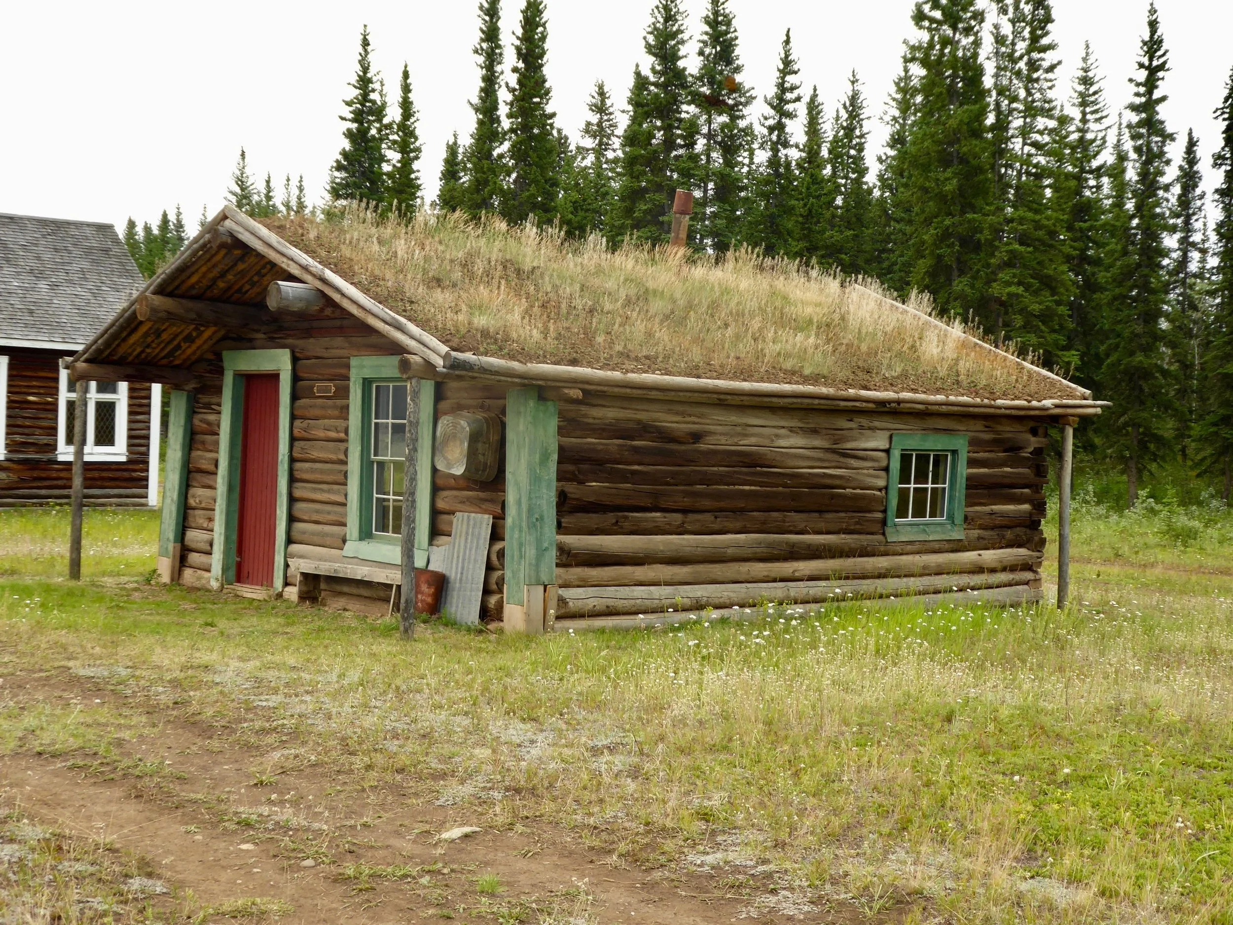
Many of the structures have sod roofs.
Two small churches were located here. One was a Catholic Church and the other one an Anglican one. Neither held many people.

The inside of the church was well restored.


Winters would be quite cold here so we were sure the large stove felt good.
Behind this church was a First Nation cemetery.

The First Nation cemetery is still being used today. The spirit houses are brightly painted,

Soon it is time to go and we appreciate this sign above one of the buildings.

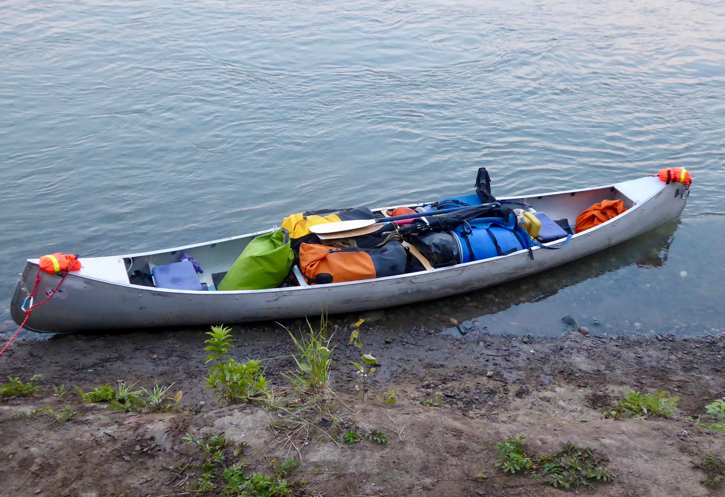
The temperature is dropping and we both are getting cold. We head down to the canoe. Since most of the time our photos are taken with the spray deck on we took the opportunity to show how our canoe is loaded. We are looking forward to sending our backpacking gear back to our home once we reach Eagle. Everything fits thankfully.
Our last highlight of this day was a mountainside filled with mountain goats.

One of our guidebooks mentioned that we should look for goats in this area and it was good advice.
After leaving the Fort, Don begins to feel ill and we are glad to find a nice place to camp. He retires to the tent. I spend a quiet evening enjoying the sun, sitting in a chair that most likely has stories to tell.

Miles paddled 57
July 17
Fortunately Don woke up rested and after a pancake breakfast was ready to go paddling. The current was moving us right along today. We passed a large grizzly bear sunning itself on a rock, and a moose cooling off in the river. We saw signs for a bakery, but missed the opportunity to pull off. One needs to plan ahead or stopping where you want to be may not be an option.. The river continues to pick up side rivers and the color of the water is a true coffee color.

We pass by two men camped by the shore. They invite us in for a cup of coffee and some good conversation. We learn that they have camped a couple of nights with the men from Germany that we had met on the Chilcoot trail. In fact they are not too far ahead of us. These men plan to take several slow days in order not to make it too soon to Dawson, where they are ending their trip. We, on the other hand have barely begun our trip. Lots of miles still to go! When the White river joins the Yukon, the wind picks up and we fight our way to the shore. Rain starts falling and we set up our tarp and then as suddenly as it picked up the wind dies. It is still early so we take down the tarp, pack up and continue to head down river. The river widens and we find ourselves choosing channels. Campsites are harder to come by and we start looking for large gravel bars. Eventuallly we find an ideal one that has no bear tracks. This is our longest paddle of the trip.
Below is a typical river vista.


We are almost too tired to appreciate our surroundings.
Miles paddled 78
July 18
We were up by 5 and were greeted by calm weather. If the weather pattern holds we should be to Dawson by mid afternoon.
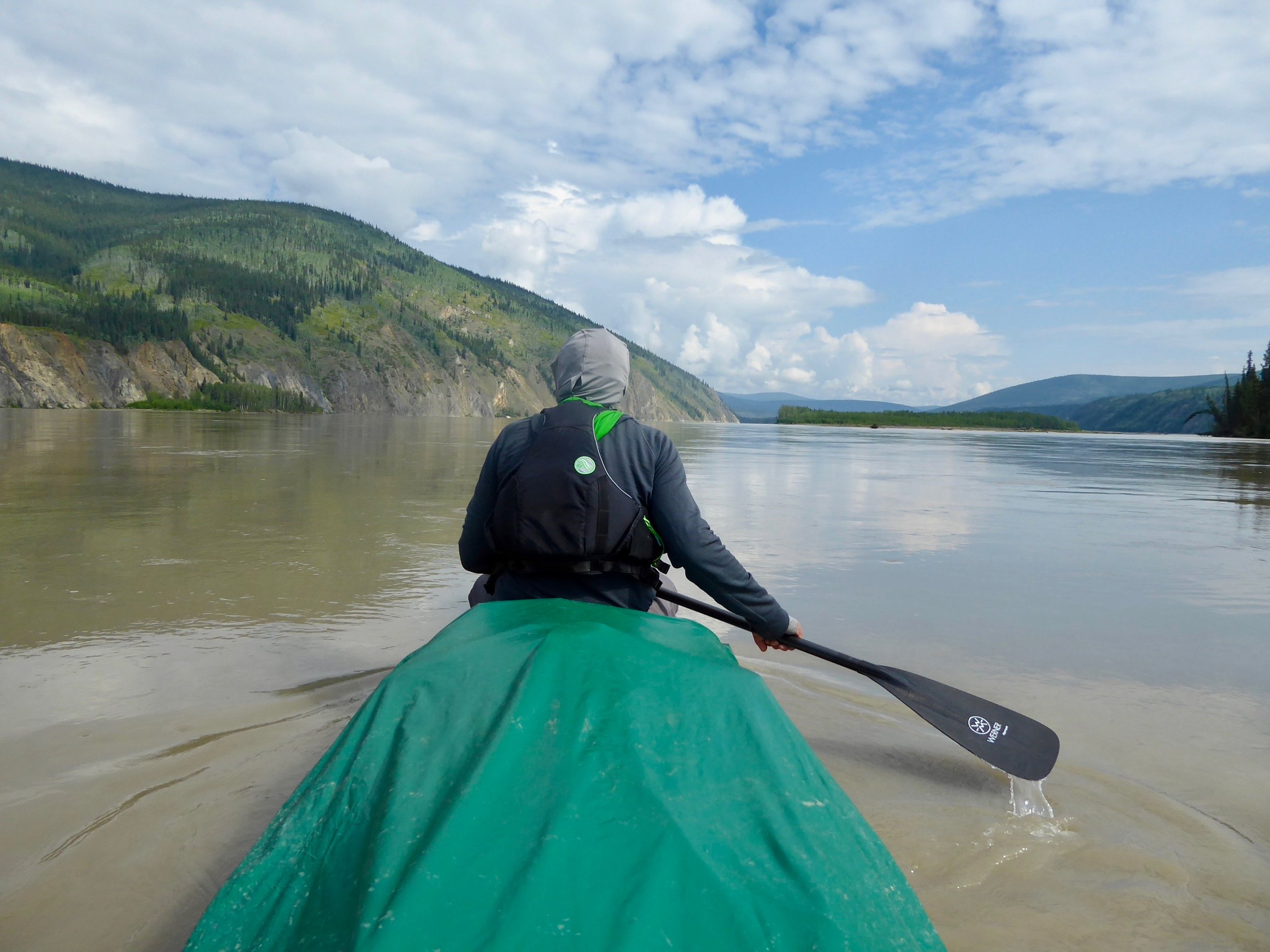
It is quite calm and the current swift. Don and I switch places every day which is good for our relationship. More rivers join the Yukon and route finding becomes more interesting. Every channel will get us to Dawson, but some are quite a bit longer. We are glad for the guides that help choosing which channel. Soon we can see a large slide in the distance which indicates that we are nearing Dawson.

A very distinct feature.
Just above Dawson is the Klondike River which is where the miners were heading to make their fortune. The First Nations called this river Thronduick which meant hammer-water. A name derived from the First Nations hammering stakes into the water to make salmon traps. By the time the miners got here most of the claims had been staked and they began looking for ways to return home.
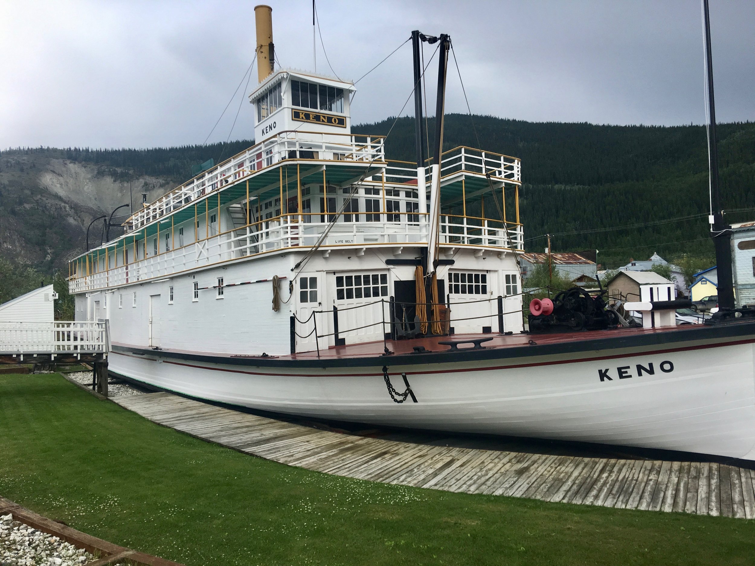
Today Dawson is a tourist town and the take out for the majority of canoers that are coming from Whitehorse.. There are three main large boats on the river, the first one is the replica of the steamboat Keno.
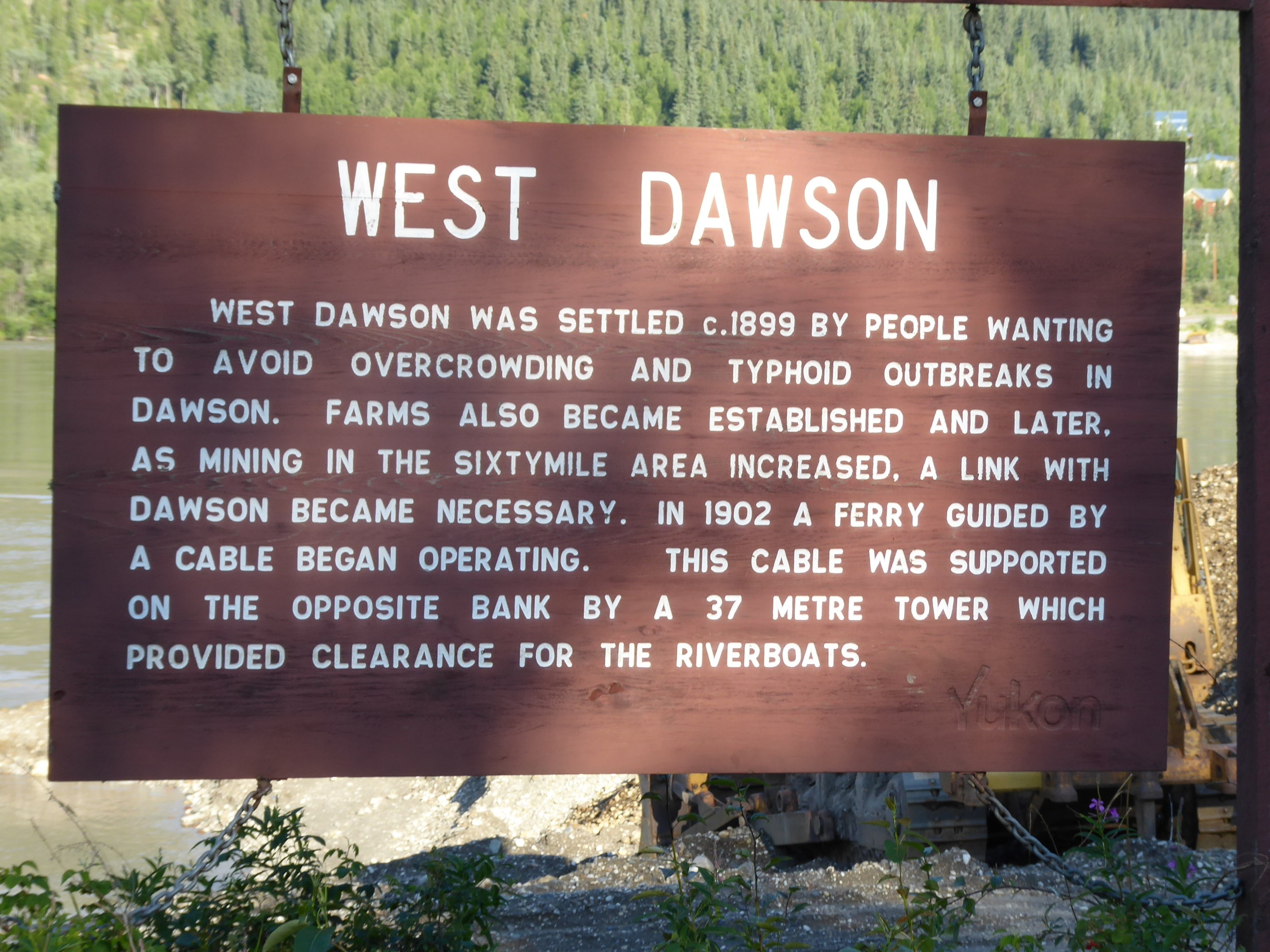
The second one is the ferry which during the summer runs 24 hours a day. This enables drivers and walkers to be transported across the river. This connects Eagle Ak to Dawson via the Taylor highway.

We were camped close enough to hear the ferry and see the waves hit the shore. We will have to time our departure in the morning
The last boat on the river was the paddle boat taking tourist up and down the river for a taste of history.

A beautiful evening for a boat ride.
We camped at:

We were able to find a camp site next to the river, however it had quite a steep bank which made for an interesting challenge to get our gear to the site.
As soon as we had the tarp set up, several rounds of thunder and lightning were followed by a massive downpour of rain. We were quickly able to fill all of our water droms with rainwater. After the rain storm Don headed over to Dawson while I stayed back to organize our food. We will be getting resupplied in Eagle and since we are traveling quite a bit faster we have an excess of food. Most likely we will be sending some back to Palmer..
Dawson is the last major town on the Yukon that we will encounter with road access.
Miles paddled 54