Carcross to Whitehorse
July 7th
As the train pulled into Carcross, the clouds opened up some and the downpour turned to intermittent rain. We gave Dustin a call and we were in luck. He was at his house and said that he would bring our canoe and gear right over. In the meantime we thought it more than appropriate to have a sandwich at the restaurant Dustin owns in Carcross. There was good food to be eaten at the Bistro! By the time we had finished eating our gear was outside and we were ready to unpack our backpacking gear and get into canoe mode.

Can't wait to see if it all fits.
We needed to carry all of our backpacking gear with us until we could send it back once we reached Alaska. Glad that we had a bigger canoe and even more relieved when it all fit in the boat

It was a bit of a pull,however to get a very heavy boat off the shore and into deeper waters. By 5 o'clock we were into Nares Lake and heading to Windy Arm. We had seen Windy Arm on our way to hike the Chilkoot and had quickly realized how it had gotten its name. In fact one of our guide books had stated that this was one of the more dangerous parts of the trip. There is a long fetch and any wind can build waves quickly. Stories of boats getting wind bound for days made us approach this section with caution. It was soon quite obvious that we had a great weather window. The lake was quite calm and with long days we decided to keep paddling.

No waves today!

The lake stayed like this until we found a camp for the night.
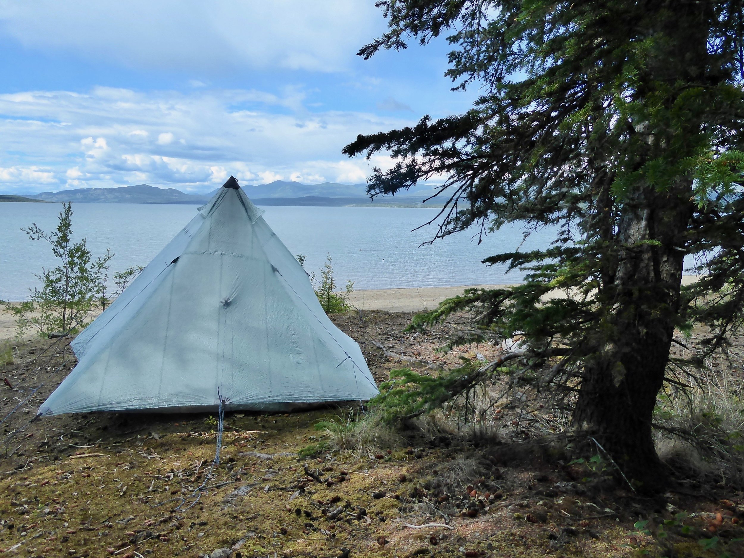
It was somewhat challenging to find a campsite. The first couple that we had checked out were occupied by cabins. Finally though just as the rain began to fall, the perfect site appeared. We barely had time to put up our tarp and tent before the downpour began. This is going to be the first big test of our tent and we sure hope that it lives up to its reputation. We go to sleep somewhat in disbelief that we are now canoeing on our way to the Yukon River. The transition from hiking to canoeing couldn't have gone smoother. Don's favorite sentence is that the Yukon has the distinction of beginning 17 miles from the Pacific Ocean but it runs close to 2000 miles before it finally hits the ocean. We have a lot of paddling to do in the coming months, We go to sleep tired but ready for this part of our journey to begin!
Miles paddled 11.5
July 8
The rain continued to pour all night and was still coming down in the morning. We were pleased that we had stayed quite dry inside the tent. Finally around 5 the rain let up a bit and we quickly packed up and ate breakfast under the tarp. It appears that this is going to be a rainy day. We pulled out the spray deck and with all the extra gear that we were carrying it still fit.

The deck is going to keep us quite dry today.
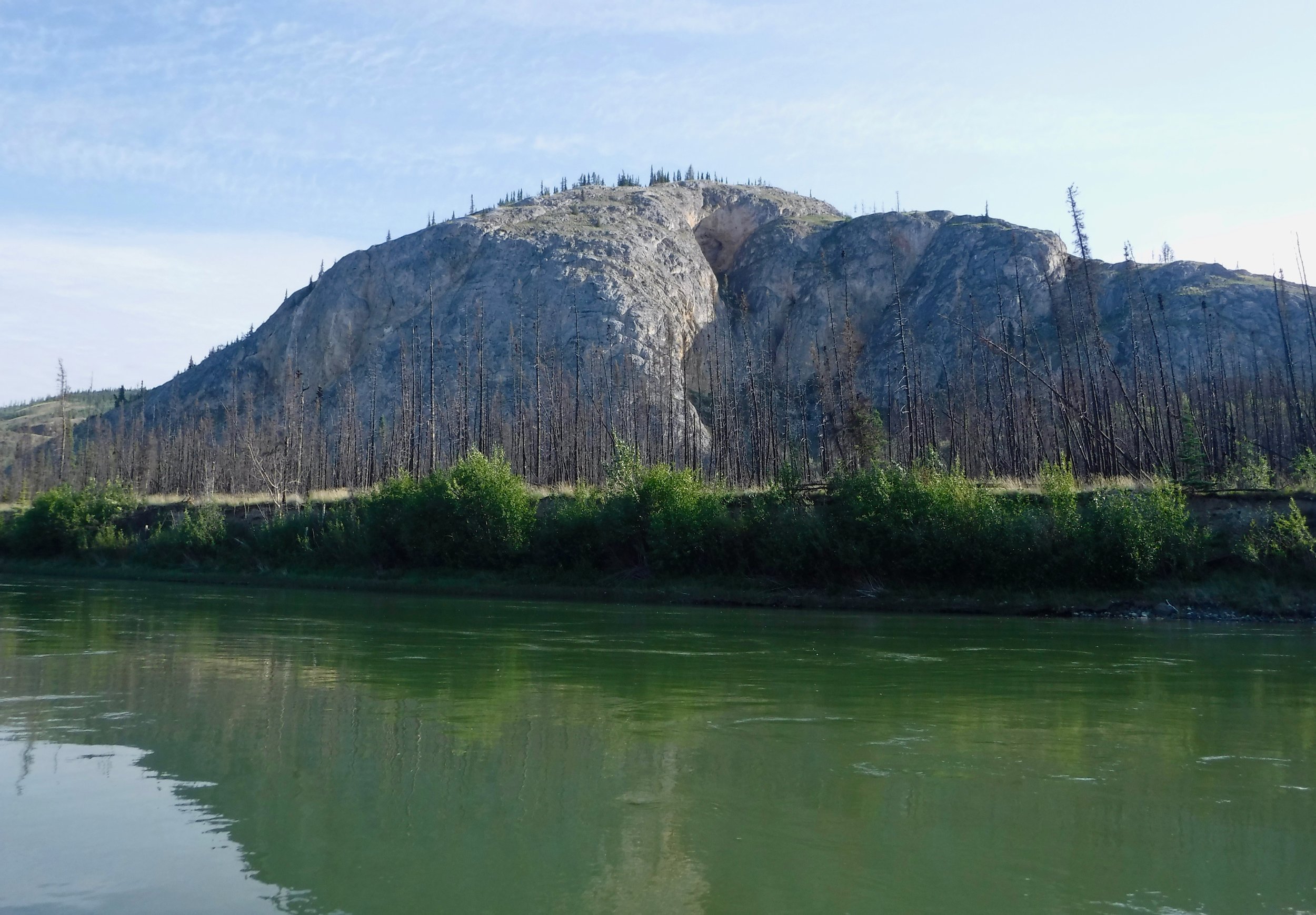
We had made it past Windy Arm last night and the conditions were still good for us to continue down Tagish Lake and past Taku arm. Even though no wind was blowing we were still getting small swells on the lake which was making steering the boat somewhat difficult.

Looking down Taku arm
We kept up a steady paddle and soon were at the connecting body of water between Tagish Lake and Marsh lake. A light current was pushing us towards Marsh lake. When we entered Marsh lake the sun came out and we decided to take this opportunity to take a break and pull out our very wet tent and tarp to see if we could dry it some. A very large porcupine greeted us before showing us his quills and sauntering off into the woods. Marsh lake is quite shallow and can make large waves under the right conditions. There did not seem to be a lot of camping so in the late afternoon when a site that we had read about looked like a winner, we pulled off and set up camp. We are pretty sure that we are at a location called Sand point by one of the guide books.

Easy to see how it got its name.
Soon we were unpacked and set up camp. We tried to get more organized, but we may have to wait until we get rid of some gear. Just glad that it fits into the boat and we can get our spray deck over it.

Quite the change from the rain from yesterday. We feel quite prepared for whatever conditions that we encounter!
Not a bad view from the tent site.
Miles paddled 21.5
July 9
It was a colorful sunset last night and the morning greeted us with calm water. As we were paddling away from our camp, an eagle swooped down caught a fish and then swam it to shore. Always fun to see eagles use their wings to swim. As the morning progressed, the wind came up and we thought that perhaps we should have paddled more last night when the conditions were better. The wind and waves were coming directly at us and our forward progress slowed considerably. For awhile it almost seemed that we were going to have to land and wait the wind out. The spray deck kept the waves from splashing into our boat and we slowly made it towards the start of the Yukon River.

We saw a bridge in the distance which is where the Alaska Highway built in 1942 crosses the Yukon River. This is where canoers often put in to avoid the large lakes.

We are close to the start of the Yukon
Just below the bridge we encounter the first of the two dams that are on the Yukon river. This dam was built in 1923 to flush spring ice from the upper river and Lake Laberge. This was accomplished by releasing stored water early in the navigation season. By doing this steamers could leave Whitehorse two to three weeks earlier. No more steamers are on the river but it is still used for water control One must go thru a manually operated lock system that comes with step by step instruction. When we approached the locks the gate to pass thru was closed which normally would mean that we would have to get out of our boat, turn a wheel that would open the gate, paddle thru then get out of our boat to close the gate, wait till the water leveled then open the gate to let us paddle out. Just as we had approached the locks and had gotten out to read the instructions, a motor boat had approached from the other side and the passengers had also gotten out. They were not going thru, but were keen on seeing how the locks operated. There was a bit of disagreement of how it worked, but finally the system was figured out and we were able to enter the lock.

Waiting for the water level to lower.
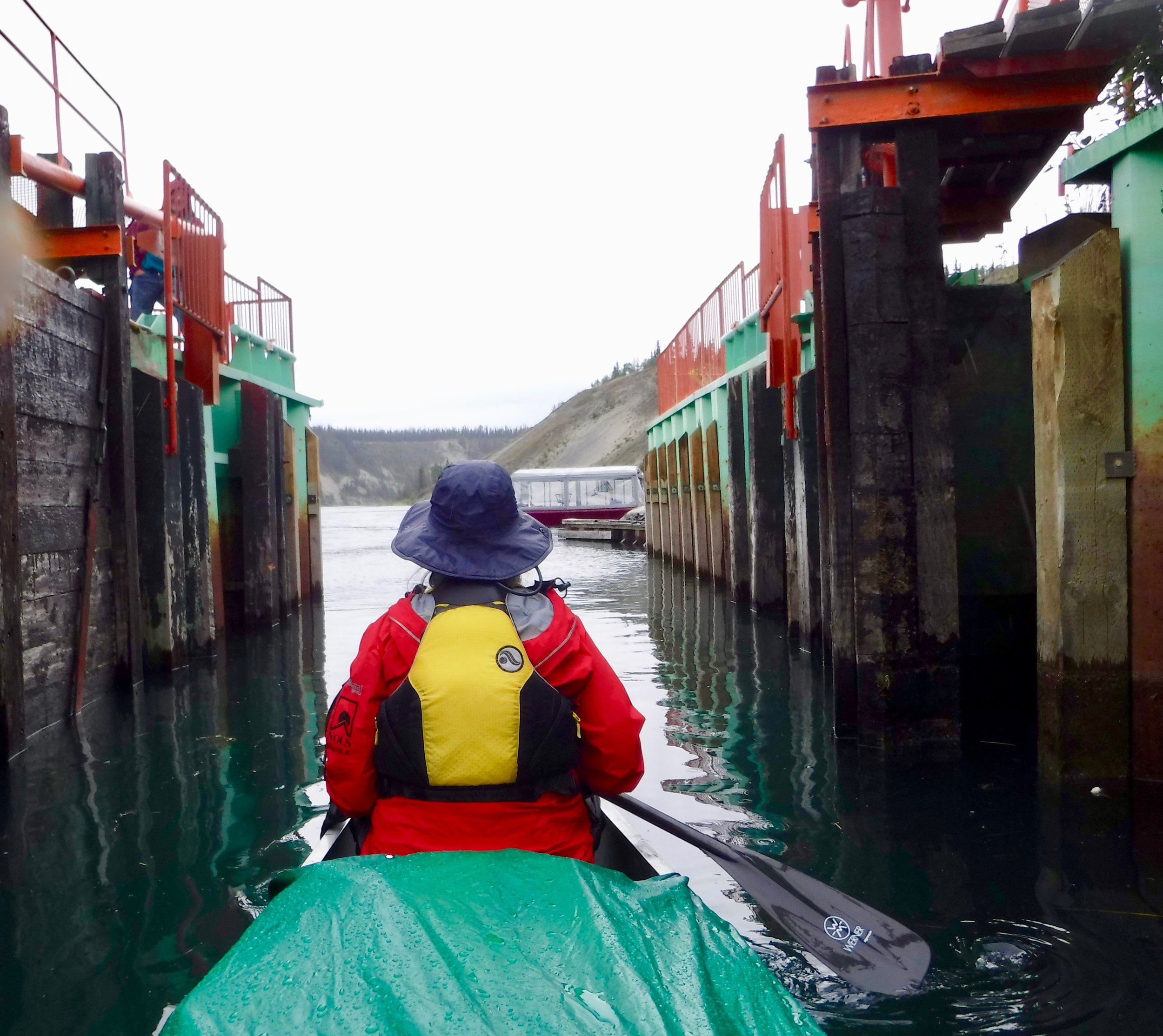
Moving out and feeling that we are officially on the Yukon River.

The river is a beautiful blue color and the current has begun.
We are now on our way and heading toward White horse. This is a popular stretch of the Yukon with easy access and several of the marked campsites are full. Also since it is close to Whitehorse there are quite a few cabins. The rain has returned and we start looking for a potential site. We find one that is acceptable and will protect us some from the rain. It has been a long day so a quick supper and we are off to bed.
Miles Paddled 36
July 10
The campsite last night was a 10 for getting out of the conditions, but a 5 for vistas, but nevertheless we slept well and were on the river by 6. Shortly after starting to paddle we arrived at Cannon City. Had we been a miner in 1898, we would have been warned by numerous red flags telling us of the dangerous waters ahead. During the spring and summer of 1898 over 7000 boats were going down the river. This stretch caused many boats to be destroyed and lives lost. Finally a man had an idea of building a 5 mile tramway around the rapids. this tramway not only helped the miners to get around the rapids, but also allowed steamboats to unload their goods below the river and then transported around to a waiting boat above the rapids.
We were able to land here and take a walk thru the old Canyon City site.

There was a replica of the cart that hauled the goods and signs telling of the tramway.
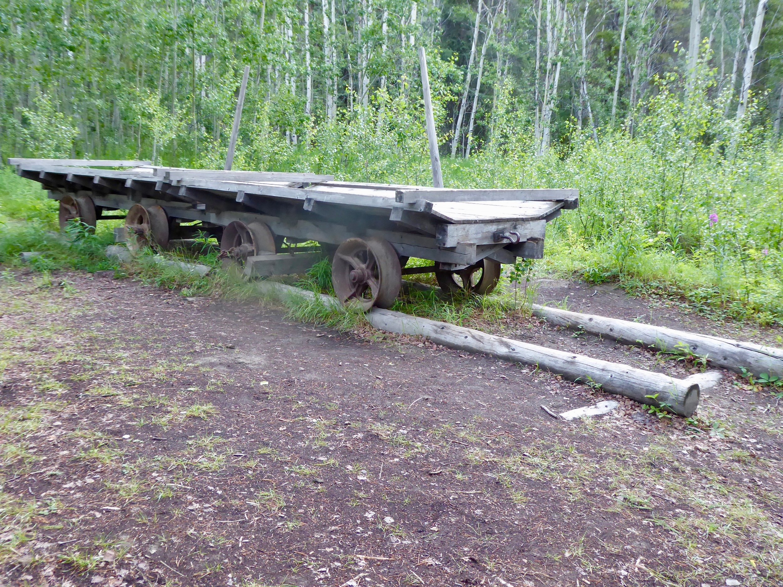
Horses were used to pull the wagon.

Canada has lots of signage.
With no fear of rapids, we load our boats and paddle/float thru the senic Miles Canyon. A little over a week ago we had looked at this section of river from an overlook. In 1958 the Whitehorse Hydroelectric Development dam was built causing the water to back up ,cover the rapids and form Lake Schwatka.

Not quite a thrill seeking section, but a beautiful one! Soon the large dam come into view and we look for the public landing to take out the canoe.

If all goes as planned we will call Kanoe People and they will send a shuttle driver to pick us up. We have arrived to the landing by 8 and alas no one answers the phone till 9. Shane is the only one working this morning and is not sure when he can find someone to pick us up. He says that he will call us when he has more information. It will happen but it may not be timely. A mother duck and her 10 ducklings entertain us.

Mom is pretty good at keeping her brood under control. The babies wouldn't stay still so just got a photo of Mom,
Almost immediately after hanging the phone up it rings and Shane is glad to inform us that a driver is on his way. Wayne, an older gentleman who helps out as needed at the store, had just walked into the store to see how he could be of assistance. Shane told him about us and Wayne was on his way. The loading and getting around the dam could not have been more efficient. A half day portage with lots of effort had become a 10 minute drive. It was also quite interesting talking to Wayne who had many stories to tell.

This business if located right on the river. We were welcomed to leave our gear here while we did some errands in Whitehorse. One thing that we had to do was to check into customs. We were glad that we did as they had a record of us hiking the trail and entering into Canada. We ate lunch at Baked, a highly recommended coffee shop and bought a few items at the grocery store. Several hours later we had reloaded our canoe and had pulled away from the town of
Whitehorse.

Whitehorse is a town of about 30,000 and the capital of the Yukon territory. it will be the largest city by far that we will have contact with until we fly back to Anchorage.
Our next logistics will occur about 12 miles from here at the Takhini river. Shane who drove us to Skagway is planning on meeting up with some food and gas resupplies.When we land at the bridge, we give Shane a call and he says that he will be there soon. We have time to check out a potential campsite. Nothing looks great, but we can make something work. Shane arrived so promptly that we decided just to load the extra items as best we could, put the spray deck over it and try to make it to Egg Island. The rain was threatening , but we were able to make it to the campsite and get set up before the rain deluge came. We are impressed with the Canadian campsites. This one has a covered picnic table and an outhouse.

Packing the boat tomorrow will be interesting.
Miles paddled 18
July 11
The rain came down in buckets last night. We were able to fill most of our droms for drinking water from rain water pouring off of the tarp. We decided to wait for a little while this morning to see if we could get a break in the rain. By 9 it has cleared some and we were able to load our boat keeping our gear dry. We sure are appreciating our spray cover. Today we hope to be paddling the shores of Lake Laberge. Lake Lebarge was named for a man who always wanted to see the lake but never had a chance before he died. It is also the location for the setting of the Cremation of Sam Magee by Robert Service. Before we get into the lake itself there are several large red arrows, most likely for larger boats. We took the most direct way.

We weren't expecting this large arrow. The Yukon can be quite challenging to find the right channel which was why there were so many steamboats destroyed when they hit a sandbar. This is not a concern of ours, but the potential for wind on Lake Lebarge has us heading to hug the shore. We have decided to head up the East side. There will be no current for today so we will be using our muscles to propel the boat forward. We are using the guide book by Mike Rourke to take us to Dawson. It is filled with historical information and maps that show potential campsites.

Looks like we will have about a 30 mile stretch until we are back to the river again.

This lake has a reputation for winds picking up quickly. We paddle steadily as the conditions are in our favor.
Several folks have warned us the necessity of staying close to shore and we take their advice. We are impressed by the beauty of the lake and have gratitude for the ability to paddle today.

More vistas
We are appreciating the calm.
On the east side their are numerous places to pull out, take breaks and camp.

We paddle past several groups who are either paddling or camping. Going To Dawson from Whitehorse is a popular route. As we paddle along a cliff we hear the noises made by Peregrine chicks. As we scan the cliffs for the young, Don notices that we are fast approaching an adult perched on a rock by the shore.

Had we not been looking up I doubt if we would have gotten so close to this bird. The falcon didn't seem to mind that we were approaching. Perhaps it was just taking a break from family duties. After seeing their talons, we have lots of respect for the powerful bird. This is the closest we have ever been to a peregrine falcon.
We only have 6 miles to go before reaching the end of the lake, but as the wind started to pick up,and a campsite appeared, we decided to call it a day. it appears that this site had a cabin on it at one time.

Home sweet home.
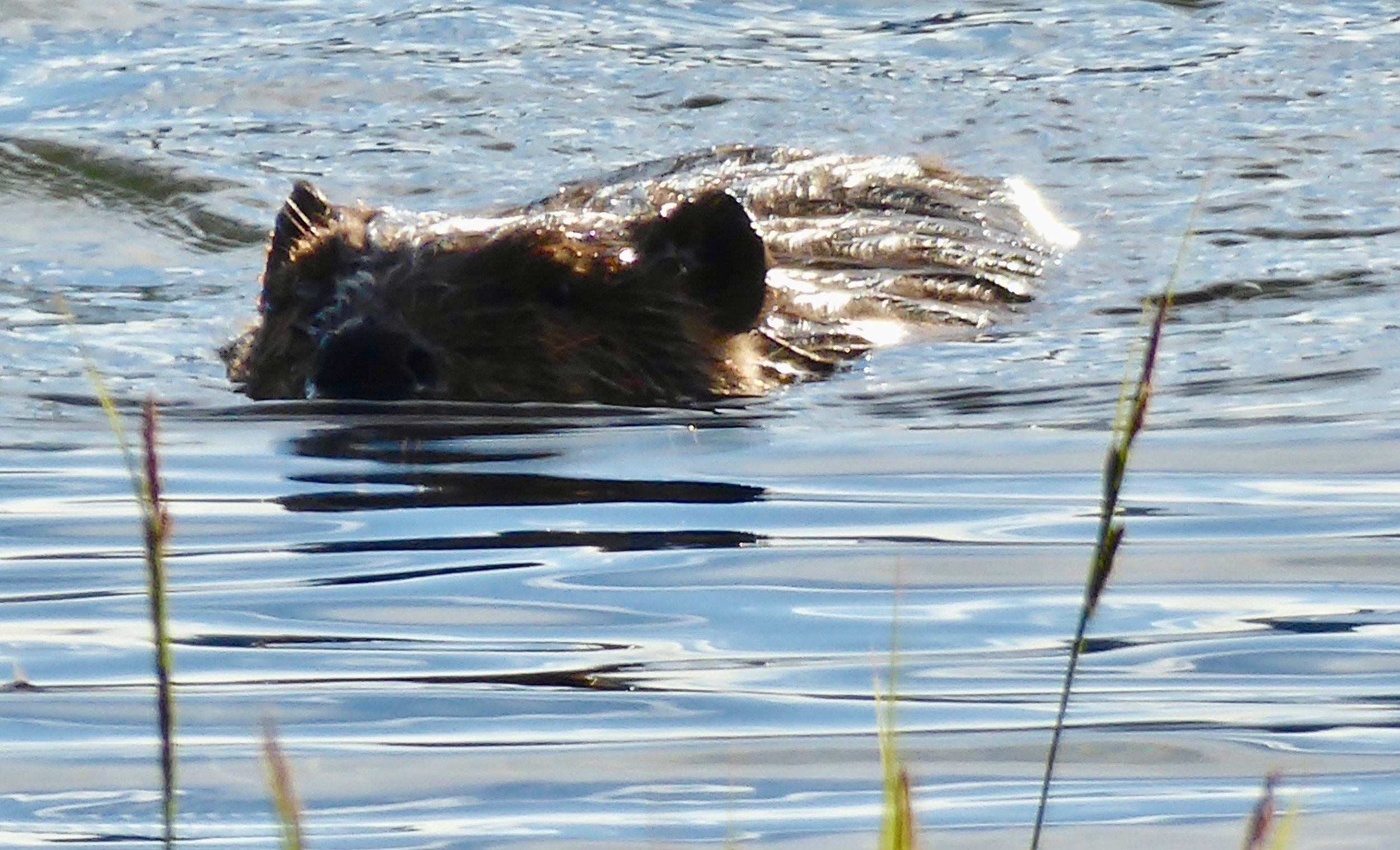
As we are making dinner, a large beaver approaches our camp. From a distance it almost looked like a bear cub. He checked us out and moved on.
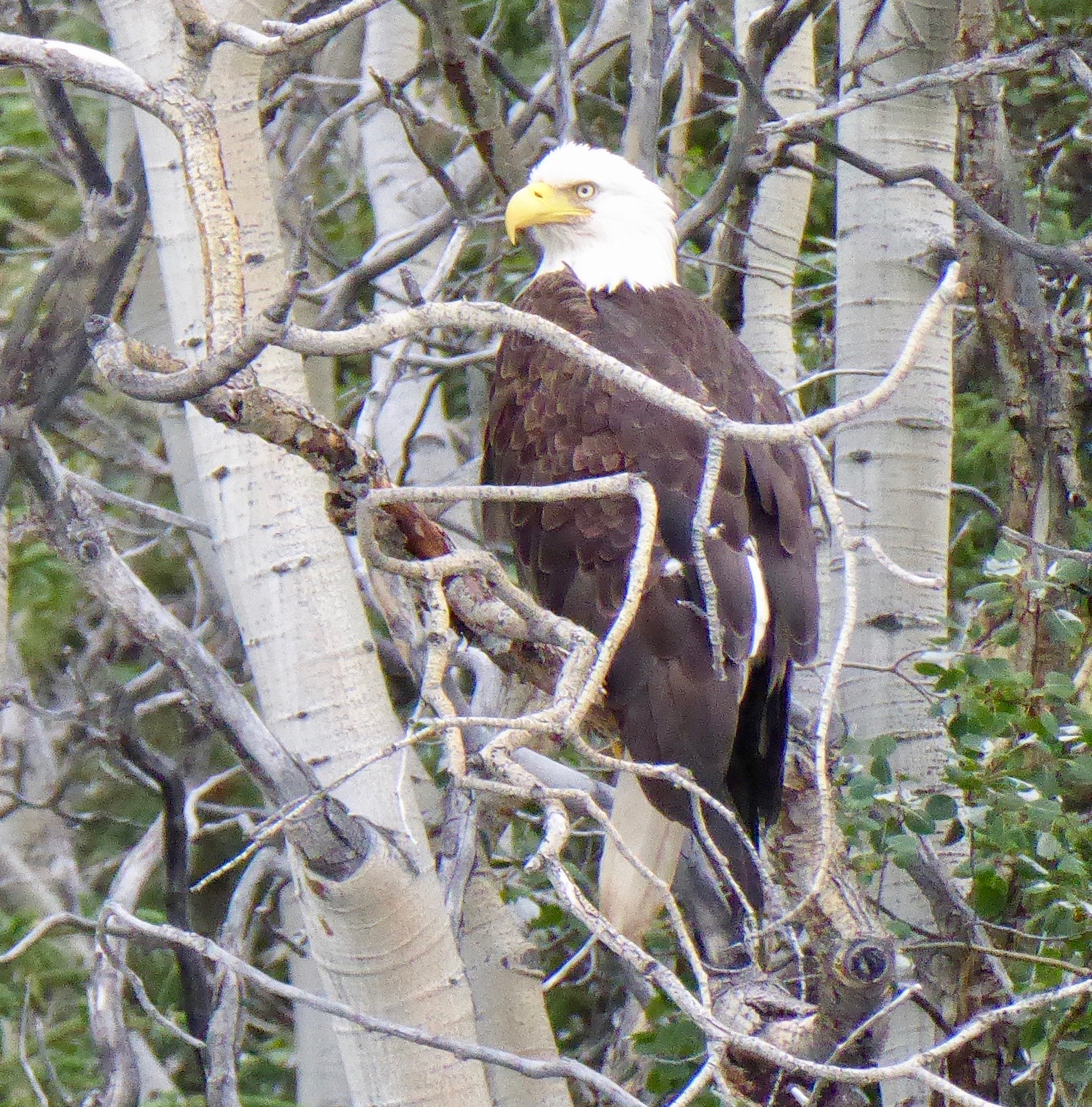
From a nearby tree we are also checked out by an Eagle,
It has been a good day of paddling.
Miles paddled 35
July 12
Since at this time of year, there is a lot of daylight, getting up at 4 was easy.. It was a bit chilly with the temperature at 38. The lake was calm and the atmosphere was magical as the morning mist was rising from the warmer water. We were off by 5;30 and heading to the end of the lake where we will once again pick up the Yukon.

It will be good to be off of Lake Lebarge and back on the river.
As we enter the river there is a campsite with cabins and information about the area.

We take our time to check out the cabins

One of the reasons that there were cabins here was that nearby there was a section of water that only froze when it got to be 50 below, and then only for several days. This was due to how the river flowed out of Lake Labarge. Today it is still a prime area for year round waterfowl.
The telegraph office and roadhouse are still standing. A truck brought in over the ice in 1950 is also part of the scene.

Next to it is a well worn wheelbarrow.
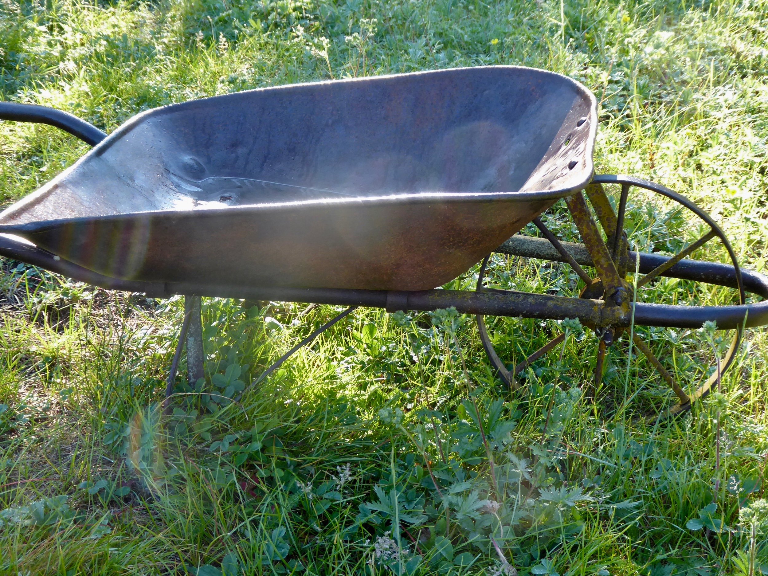
Never had to worry about the wheel going flat.
It is easy to see why this section of river is so popular. Before the Canadian government blasted out some of the more dangerous rocks, this section was highly feared by the steamships. Our map indicates many sites of shipwrecks. Today though it is a fast flowing section with numerous places to pull over and check out old cabins.

Getting ready to get on the river and the sun shines brightly!
Along the way we pass numerous marked wood camps. The signage tells of their purpose.
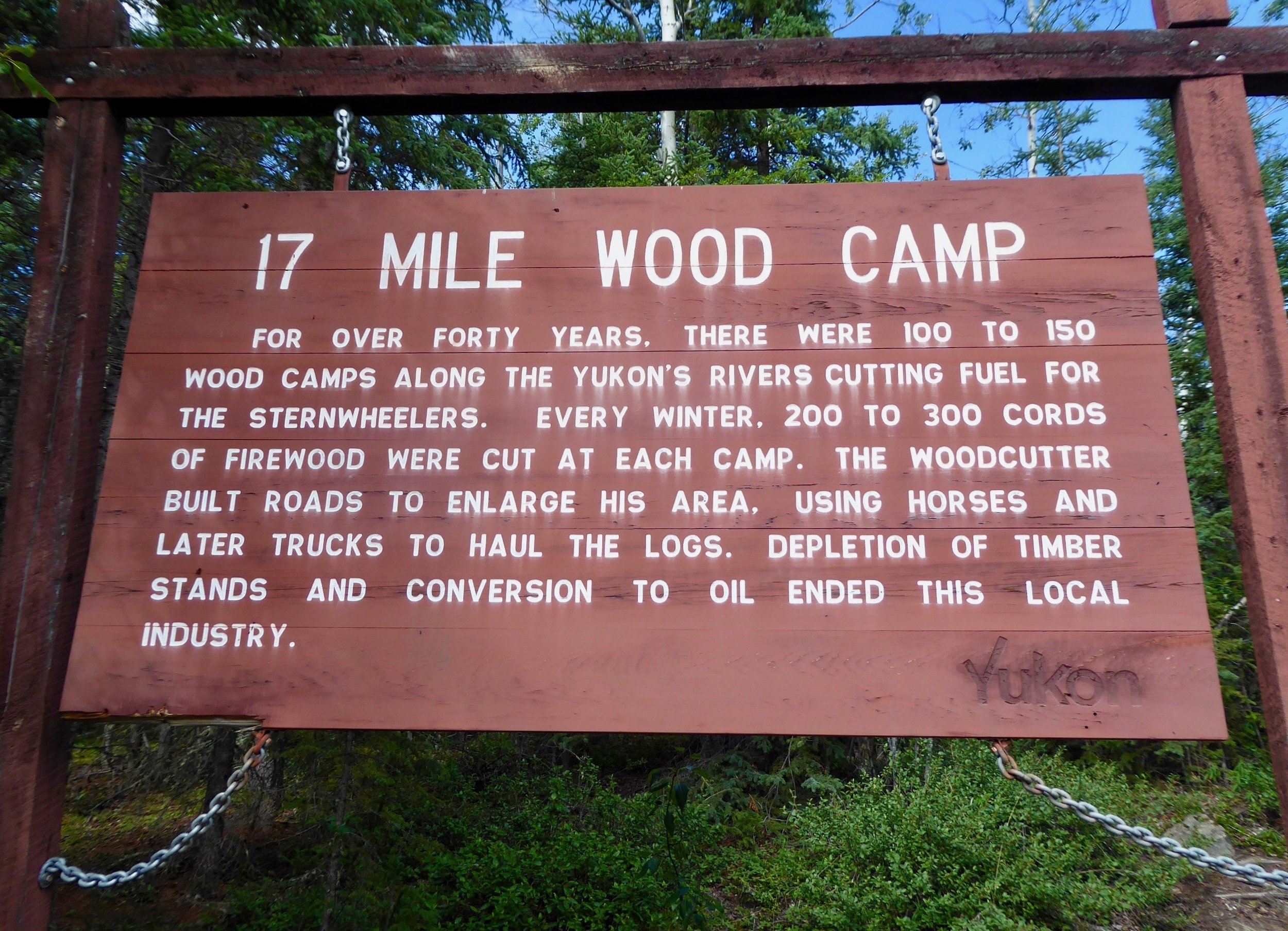
Lots of wood was cut down to fuel the steamships.
Cabins in many states of disrepair are seen on the riverbanks. Some we pull over to look others we just float by.

We are enjoying the Canadian Parks campsites. They are well maintained with picnic tables and out houses.

We stopped here to take a lunch break and Don a nap.
We can see why this section of the river called 30 mile is a favorite of many paddlers. Every bend is a scenic view.

We stop to check out a sport for the night and decided to move on, but first a butterfly makes an impressive landing on the shore.

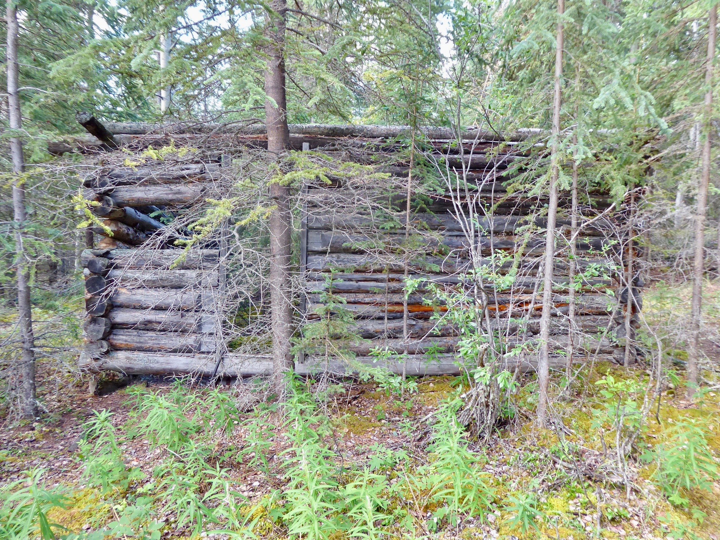
As we move down the river we are continually reminded of the importance of the steamships that plied these waters. For nearly 80 years steamboats were a lifeline for remote communities. During the summer months the steamboats were essential in the fur trade, mining and daily lives of the Yukon River residents. The Yukon River had the most steamships of any river. We made it to shipyard island where the remain of the Steamboat Evelyn lies. She had been pulled up for repair or storage, but was never returned to the river. She was built in 1908 wrecked in 1913 and had her haul replaced. It is not known how much usage she received after she had been repaired. Several other boaters arrive to share the campsite.


This ship was 130 feet long and her gross weight was 352 tons. One can easily see why there are so many woodlots along the river.
Another beautiful day of sun and blue river. Looks like the clear section of the river will be over tomorrow as the Teslin River joins in and adds silt to the Yukon.
Miles paddled 38
July 13
Our campsite is right below the steamship Evelyn. Knowing the history of the area and seeing this boat helps one to imagine what it was like over 100 years ago as this area was quite active.
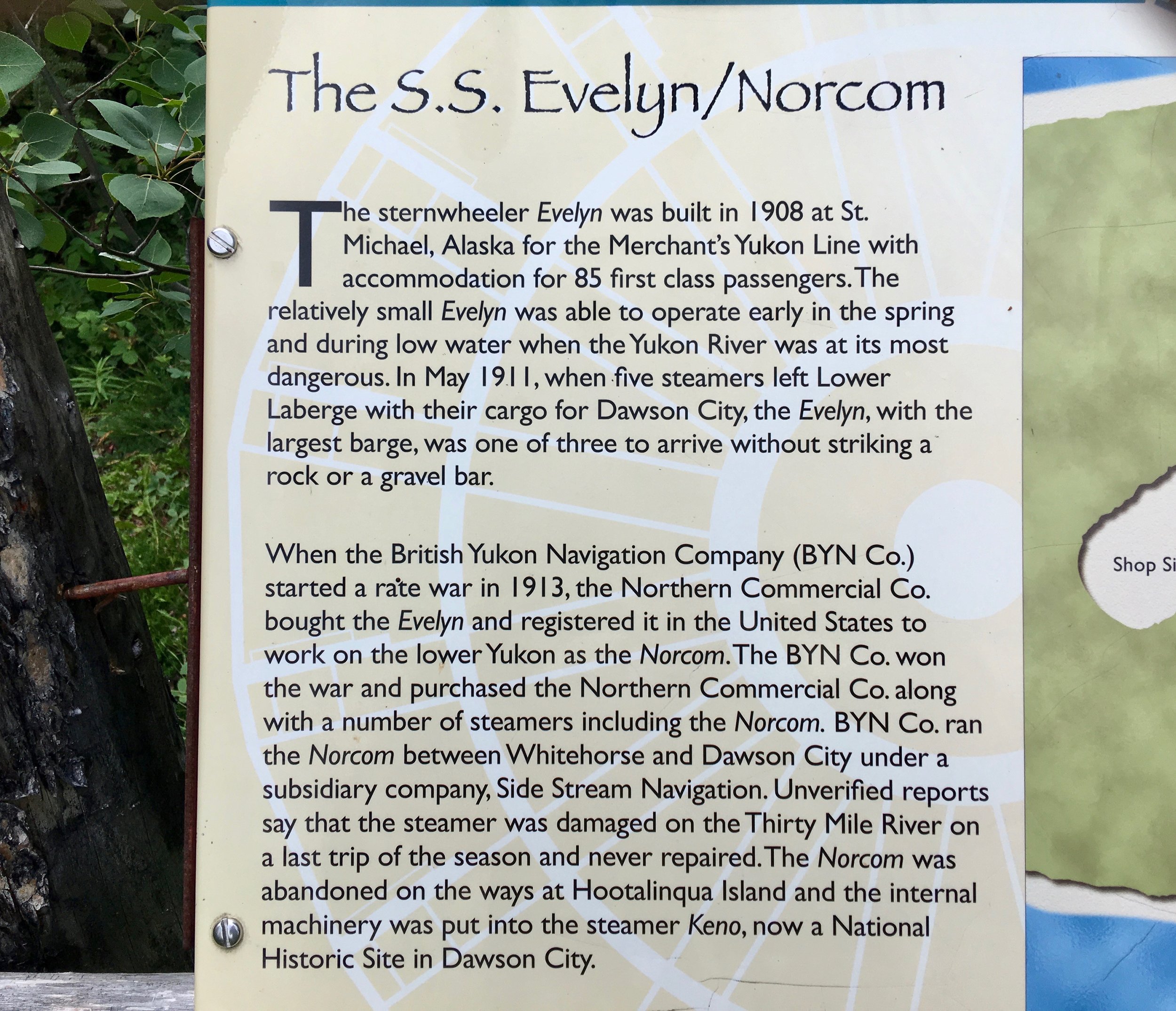
Enjoy reading the informative signs of this section.
The birds wake us up early and by 6 we are paddling away from the shore. The other campers are still in their tents. We enjoy early mornings as we are more apt to see wildlife and have better weather conditions. The river flows swiftly thru this area and is also noticeable wider.

Enjoying a hot cup of soup as we take a break to stretch our legs.
The area that we are going by today has a lot of burned trees. We are grateful that the fires have not started near the Yukon this year, One result of the previous burns is the multitude of fireweed flowers in bloom.

Both sides of the river are covered with fireweed. Which looks like this close up.
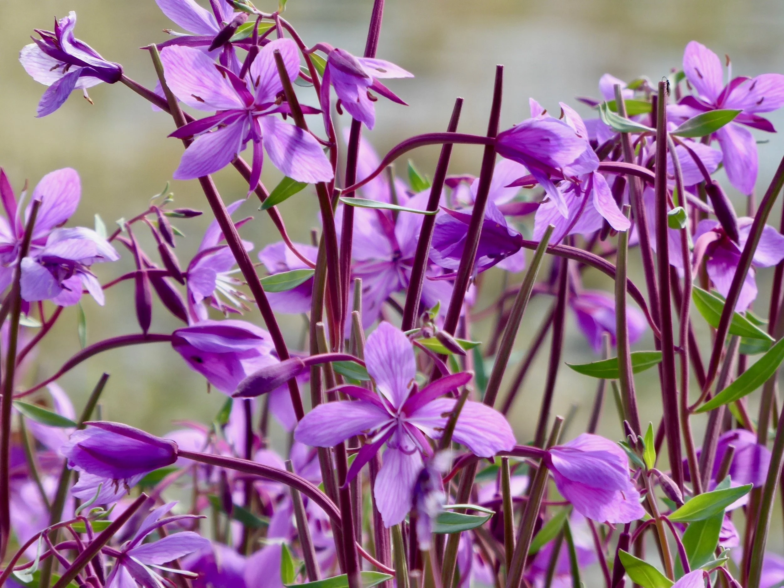
Still plenty of blooms to open, by the end of the trip this plant will be gone to seed.
The first historic stop today is right past the Big Salmon river. This is where a First Nations village was located, a trading post was operated, steamboats could land and a very large wood camp was run. Today thought it is mostly a place in ruins. We secure our boat and take a walk. We are greeted by several arctic ground squirrels,
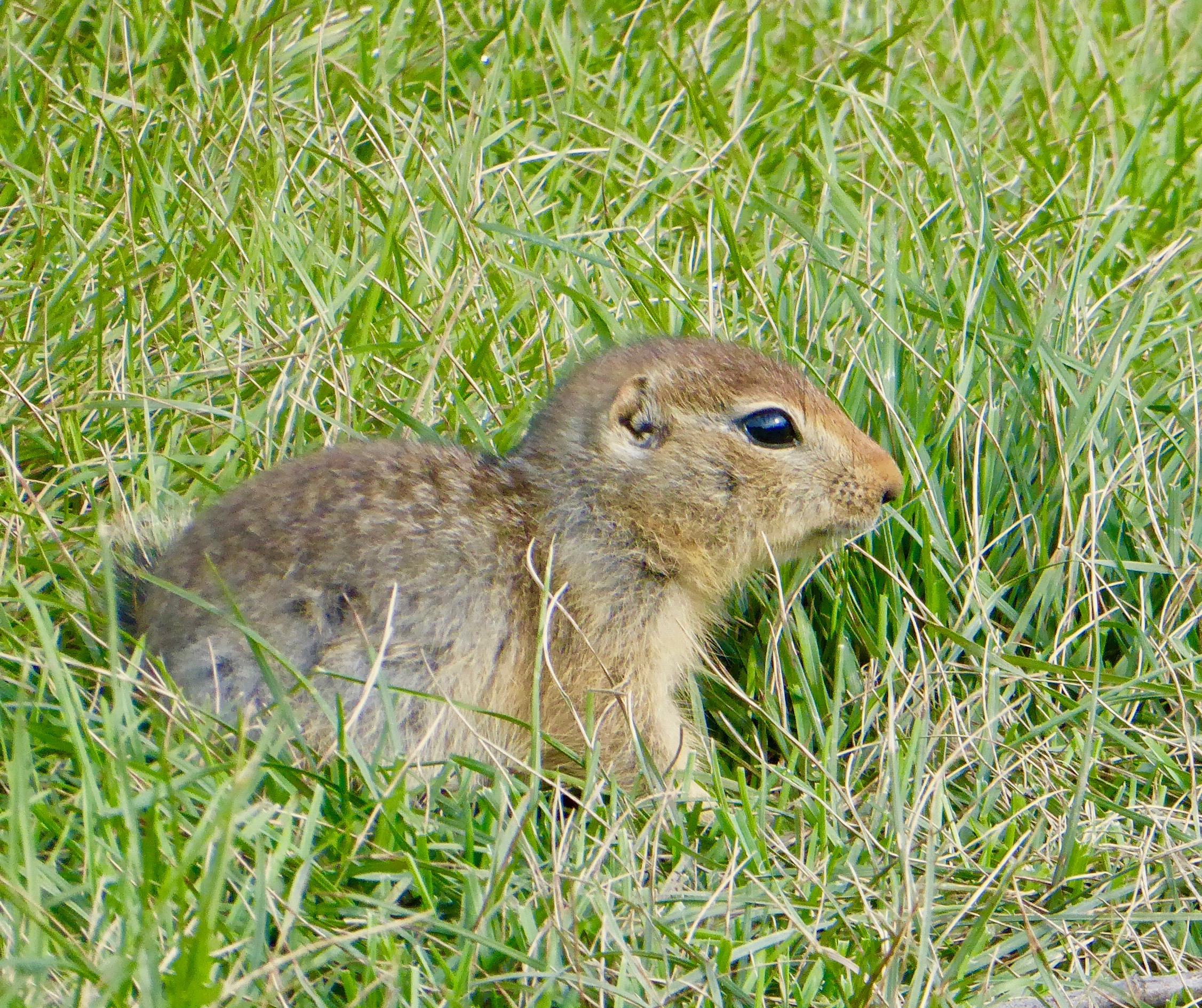
They seem to be accustomed to being visited.
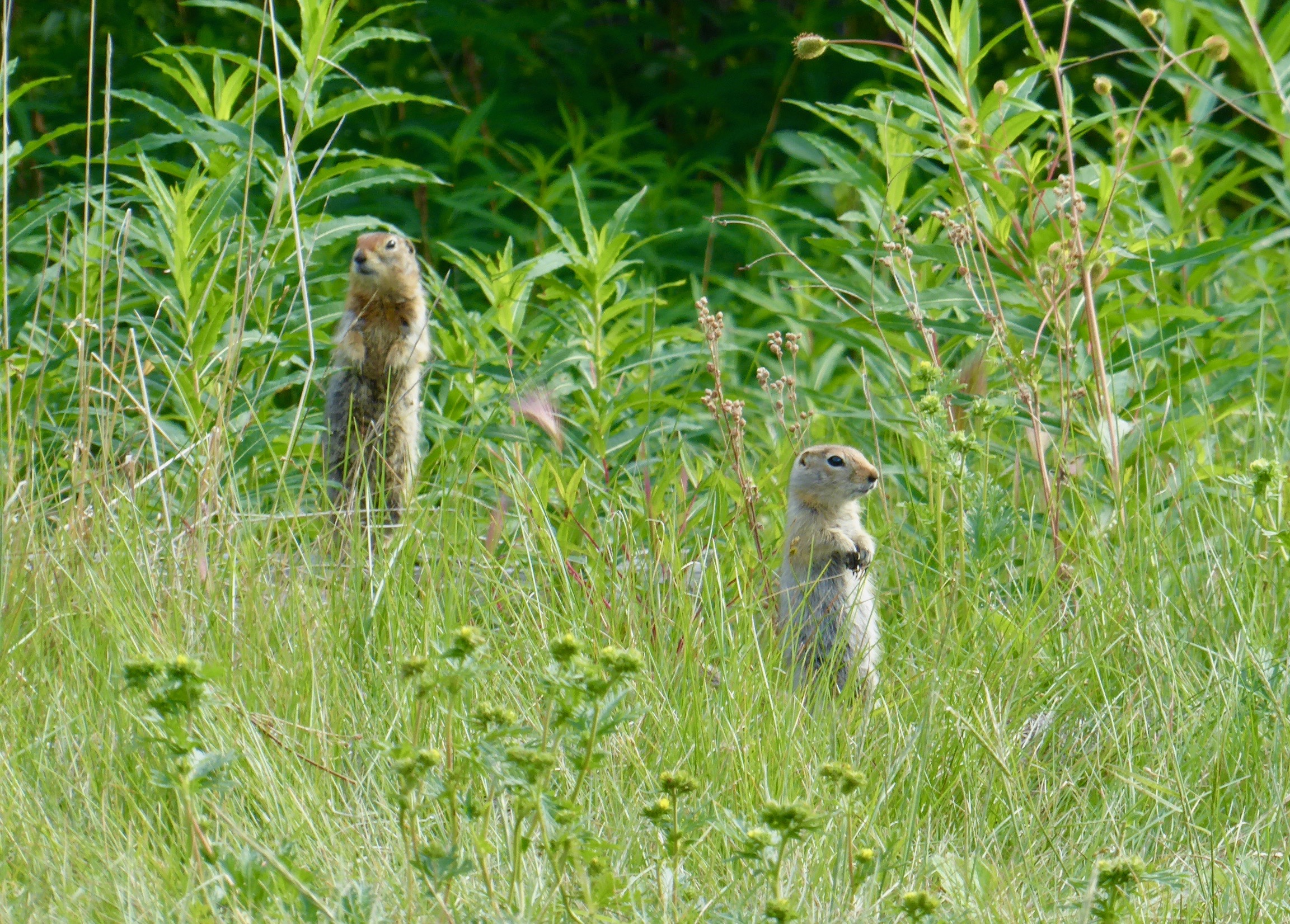
No hand outs from us.
Most of the cabins are in disrepair with roofs fallen in. We try to imagine what it would be like to live here during the winter when the temp would remain well below zero for weeks.
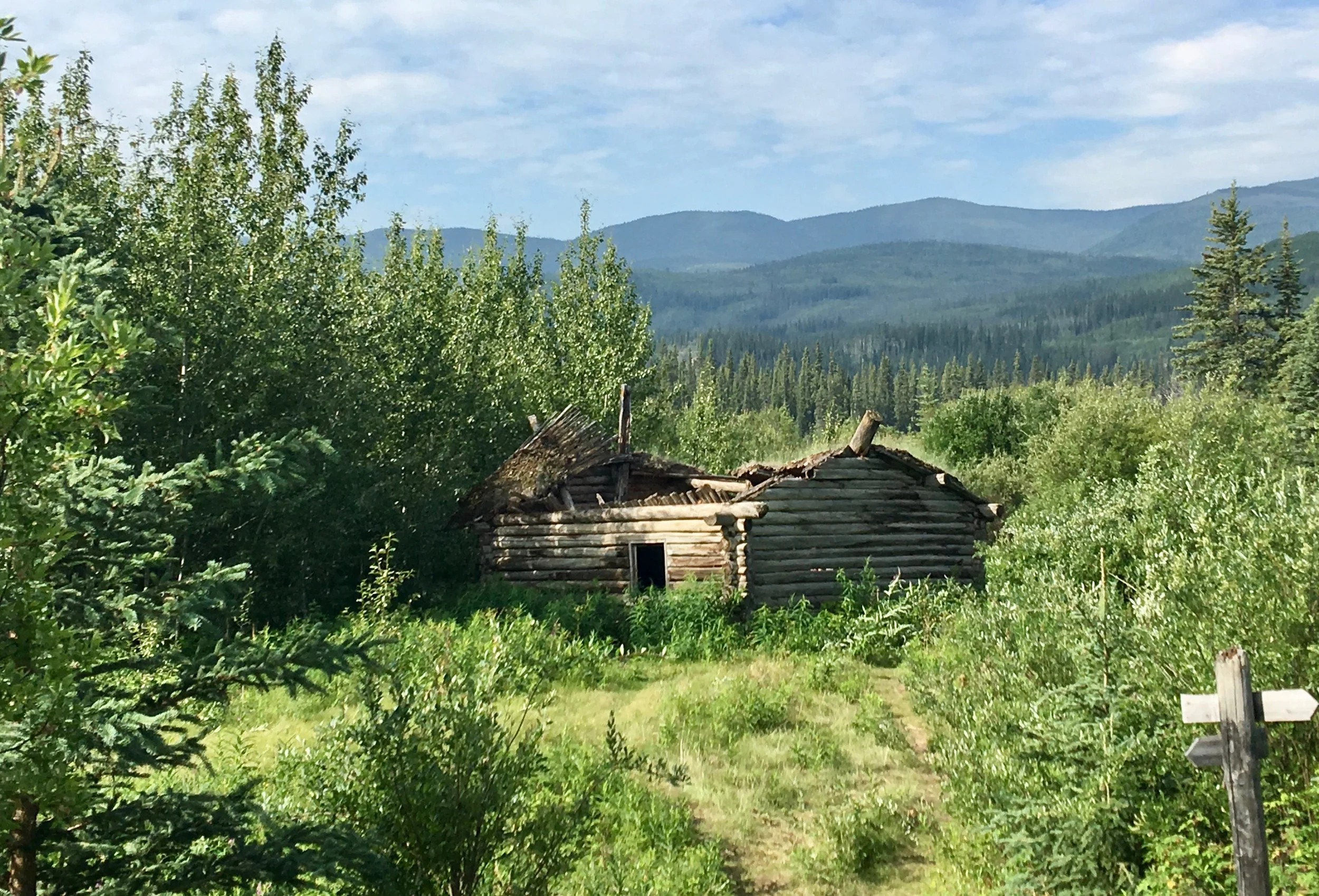
One cabin, however seems to have a tradition as a book shelf is not loaded with books but a variety of bottles in all shapes and sizes.

Looks like someone was having fun here.
The guide book mentions that if one follow a trail for a short distance up the river one will find a cemetery. We pass by several more modern cabins that are used for gatherings of First Nations. Soon on a hill we see the grave sites. Some are marked by fences.

Others are actual small structures called spirit houses.

The deceased would often have some of their belongings placed in these small structures.
Moving on, we check out an old gold dredge that is fast becoming eroded into the river.

The buckets that were used for dredging are mostly what remains of the gold dredging operation.
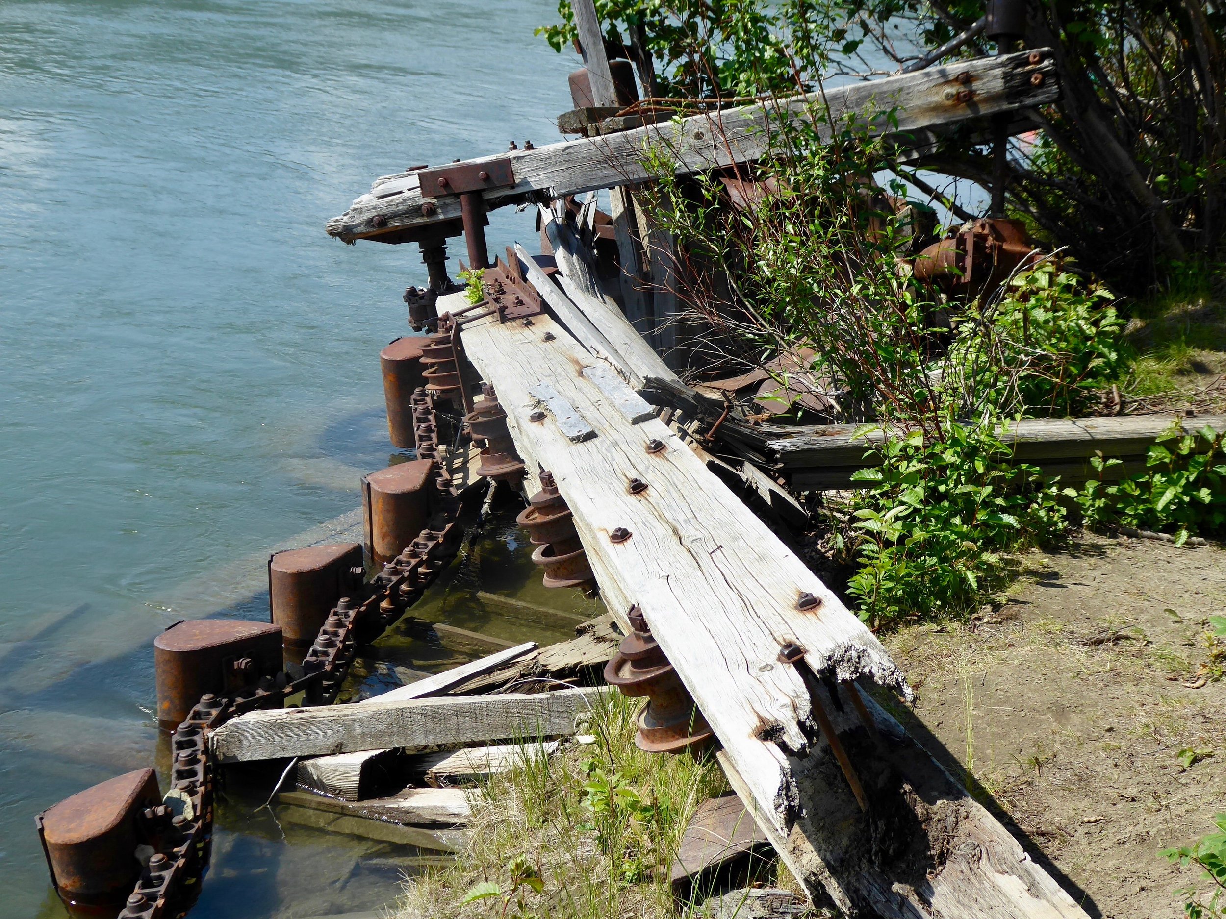
Building the dredge and getting it to this site cost more than what they made selling the gold they found.
Frequently along the river are the woodlot sites that would supply the steamboats with lumber. These sites make good campsites or rest breaks. They are often near eddies which make great pull out sites. If we had been here later we would have stopped, instead it is just a break from sitting.
The view is nice.


An old wheel barrow shows good use of what one had.
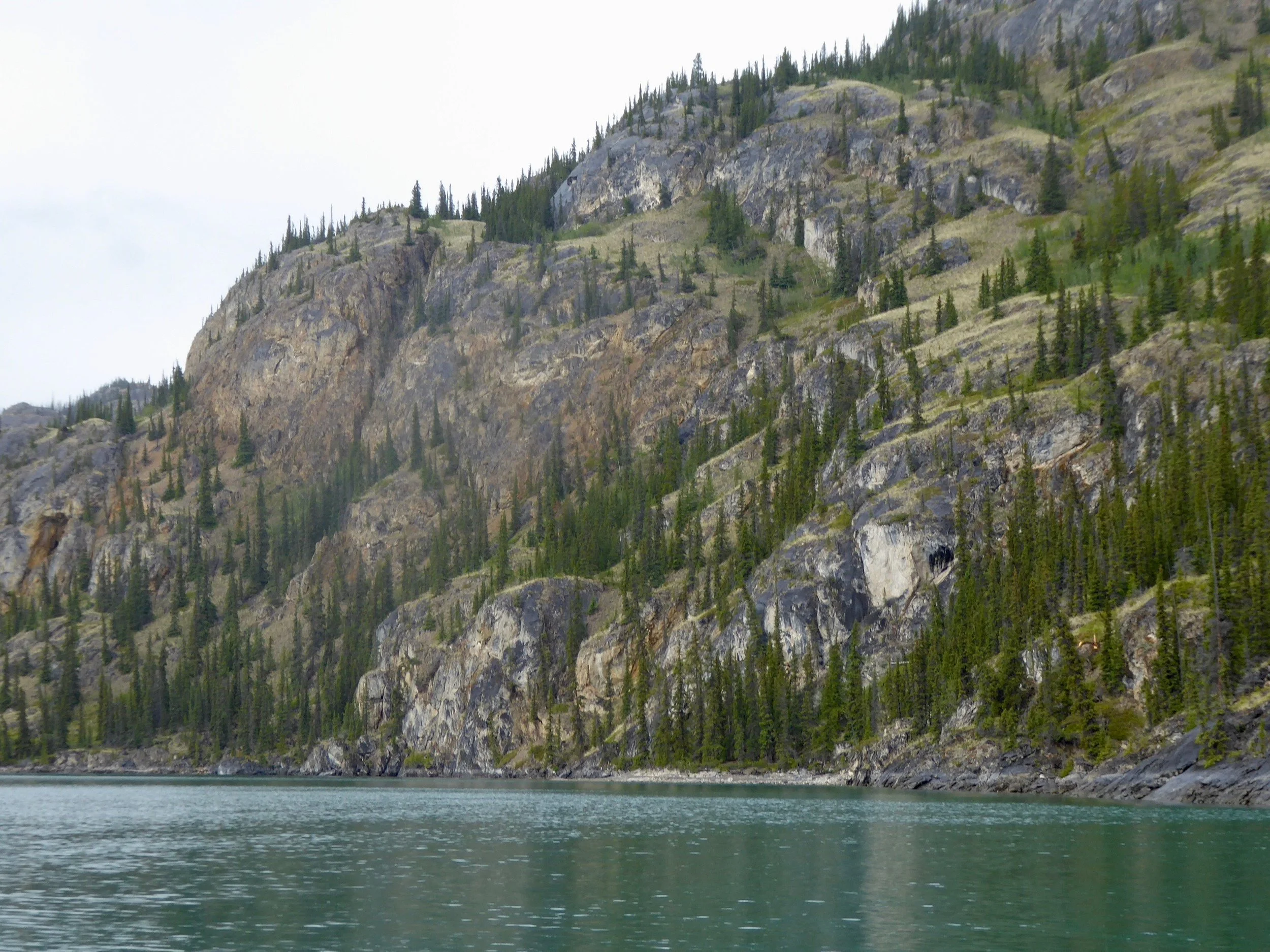
Lots of high cliffs adorn the river banks today.

This section makes paddling easy. when we take a food break our canoe continues to move down stream,!

So easy to check out the view!
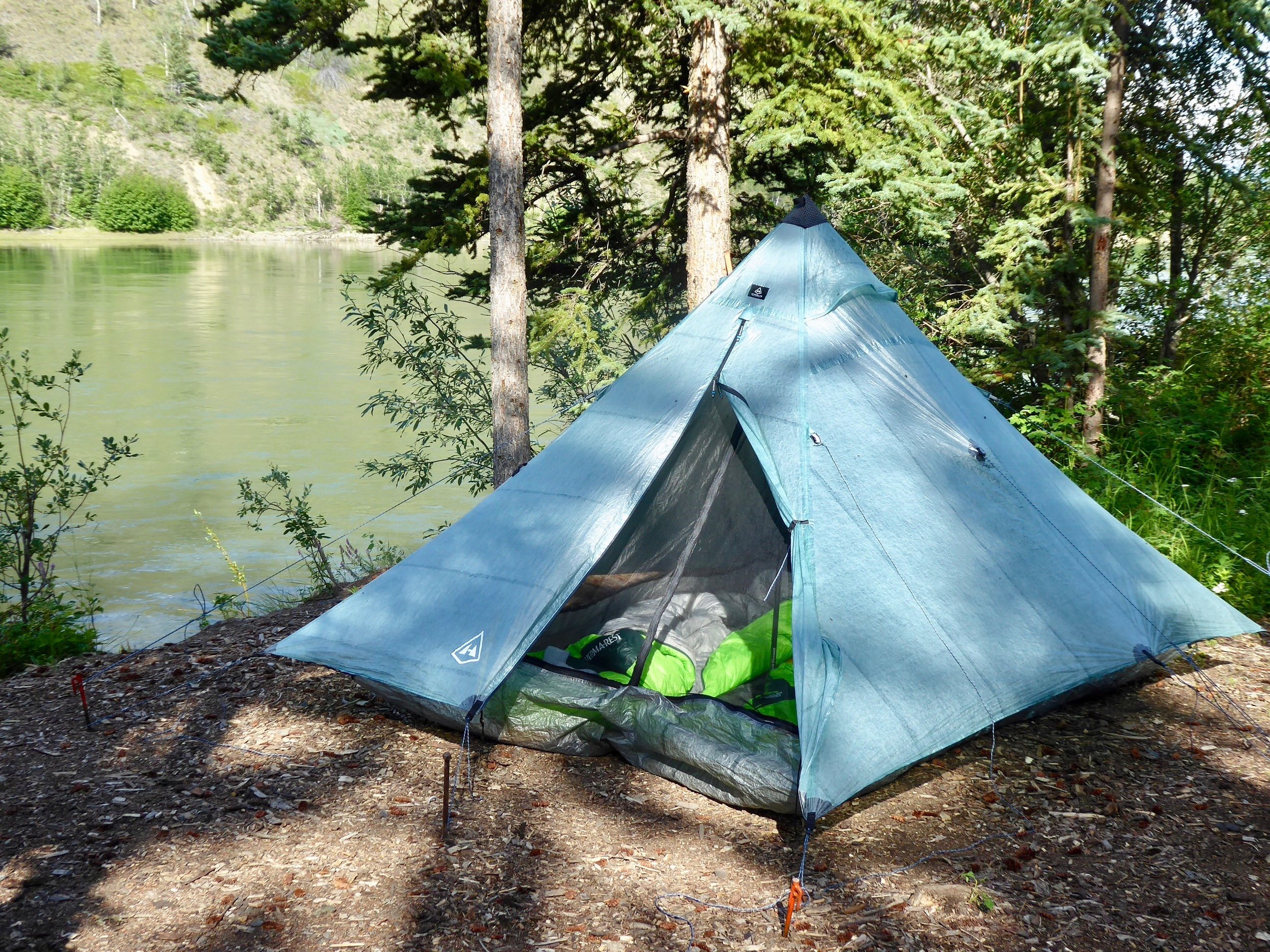
We decided to camp near a running stream, which is not often the norm. It sits above the river and comes with a table. We take it and enjoy the evening,
Miles paddled 56
July 14
Our beautiful campsite was hard to leave, but I was up at 4 and had made tea and pancakes before waking Don. It was a chilly 38 degrees and there was a mist coming off the river when we packed up by 6.

Needless to say one felt at peace before moving on.
The river moves fast in this area. At one point we were moving at 9 miles per hour. The scenery continues to be spell bound especially the fireweed in full bloom.
Burned over areas make way for fireweed.

Never tire of this plant!
Unlike previous days we have a destination to make. We plan to camp at the Coal Mine Campground. We arrive about 1 pm and are surprised by all the activity. This though is short lived as either folks are taking out or putting on the river mainly heading to Dawson. Soon we have the campground mostly to ourselves and are able to take showers, do laundry and catch up on emails. We take advantage of the large ice cream cones and watch the river keep moving.

It is the hottest day yet as the temperatures reach 80 degrees. As we check in for the night, more groups arrive and there is an excitement in the air. Lots of people are ready for an adventure. This next section has the only major rapids on the river called Five Fingers.

A well known boat race has a checkpoint here. We are about 10 days behind the racers
Miles paddled 44
July 15
As usual we were up at 4 and had our boat loaded by 6. It was a bit tricky to load the boat from a dock with a strong current trying to push the canoe away, but with persistence we accomplished this task.

It was interesting loading the canoe this morning.
We were greeted by a beautiful sunrise. We have been told that there are major fires burning to the south. There is a red haze to the sun.

The river continues to widen. Today we will run the major rapid of the Yukon River. It is called Five Fingers and was a major threat to steamboats. On the right side channel which is the one we will take there has been numerous rocks dynamited out. This has made for much safer passage. Before long we see the row of rocks that announce the rapids. We work our way to far right. Above the rapids is an observation deck where people can gather to watch boats go thru this section.. The difficulty of this rapids is dependent on water level. It doesn't look too bad today and we line up for a straight shoot. The standing waves send some water over our bow, but with our spray deck we don't take any in the canoe.. On the rocky cliffs there is a cable that was used to pull the steamboats up thru the rapids. It is hard to imagine this activity as the current is quite forceful here.

The rocky pillars let us know that we are approaching the rapids. Fortunately it was a fun ride, not filled with too much adrenaline. The river continues to widen as we work our way down the river.

The scenery continues to change.
We pull into a site called Yukon crossing. The sign gives us the history.

We have lunch next to the old roadhouse and once again imagine the activities that took place here.

Next stop is Minto crossing. As we approach a pull out to take a break, a ferry that is bringing a truck filled with ore starts across.. It is a true ferry as the captain angles the barge to land where we were stopped. As we hurry to get out of its way the men on board motion for us to stay.

One can tell that the Captain has the ferrying skill down. As we wait a man gets off the boat carrying a jacket. He tells us that a group of Boy Scouts were here yesterday and were stopping at Fort Selkirk. He wanted us to take the jacket down river which we can easily do. After the boat returns to the other side we take our break and once again check out some of the ruins.

A raven perches on one of the old log cabins. I don't think that there has been any trip that the Ravens have not had a presence.

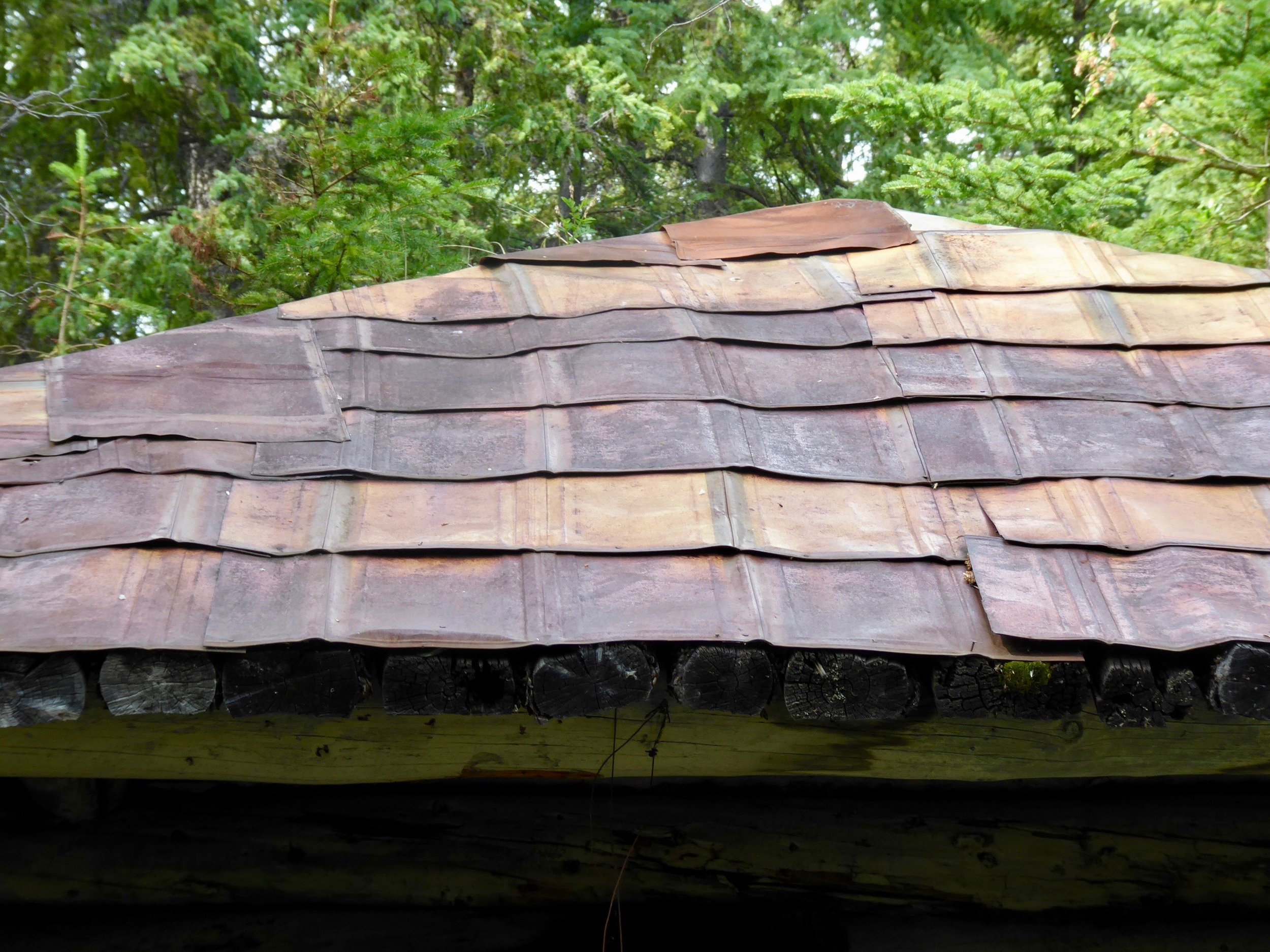
The guide book informs us of an excellent campsite that is also the location of Thoms cabin. We have made good time today and decide to stop early. The cabin is in great shape and one could probably sleep inside, but after reading that the owner of the cabin was found dead inside, we opt for setting up our tent. The roof is made out of interesting material.

Thoms Cabin with a tin roof
We sleep soundly in our tent!

Miles paddled 62