One could say that our expedition begins today. Today July 2, we head to Skagway, Alaska to pick up our permits to hike the Chilkoot trail. Up early to take a shower, because it is hard to know when we will get that luxury. We are grateful that two intown staff from the Yukon branch have offered to take us to the trailhead in Dyea. As we ascend to a pass the weather turns cold and rainy, snow is on both sides of the road. In the distance we can see part of Tagish Lake called Windy Arm. It is living up to its name as white caps can be seen. In a week we will be in our canoe and paddling this lake. Now though our thoughts are geared to hiking. We make it to Skagway by noon and are able to get our permits and train ticket. We are taking a 26 mile train ride from the end of the trail to Carcross where our canoe is located. Skagway is a destination port for cruise ships. Today there is only one ship docked. There can be as many as 5 swelling the towns population over 15,000. Last year when we ended our kayaking trip we were overwhelmed by the large number of people walking the streets. Today in comparison the town seems almost deserted. At the Chilkoot visitor center where we get our permit, we are required to watch a video on bears. it does make one more bear aware which is always a good thing. After lunch we drive the 9 miles to the Dyea campground. At one time it was the largest town in Alaska having a transient population of 5,000 to 8,000. Just about every service was available for the gold rushers of 1898 including, hotels, breweries, an ice house and post office. Today, however, little remains of the bustling town. We pay our senior citizen fee for the campground, say good by to our drivers and set up camp.
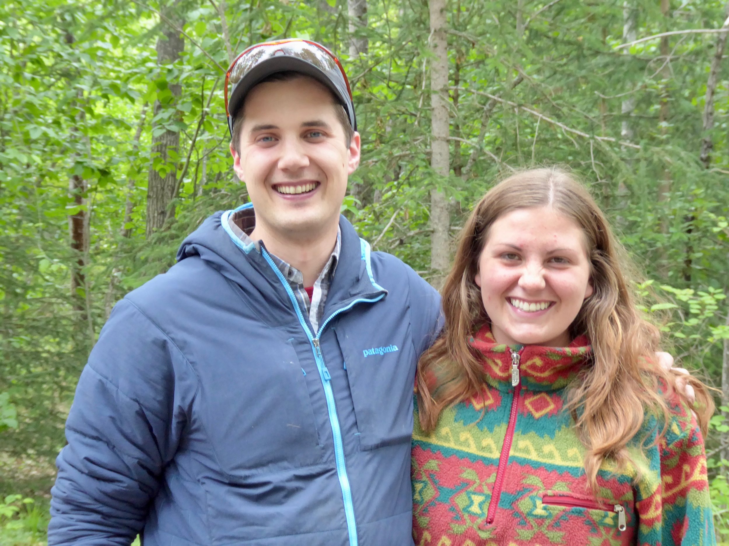
Shane and Gabby transport us to the Start of the Chilkoot trail.

Setting up our new tent and making dinner.
After dinner we take a short walk to the trail head and read the historical information and try to visualize what it would be like with thousands of gold rushers getting ready to head up to the pass and on to the Yukon River.

The trail begins here and....

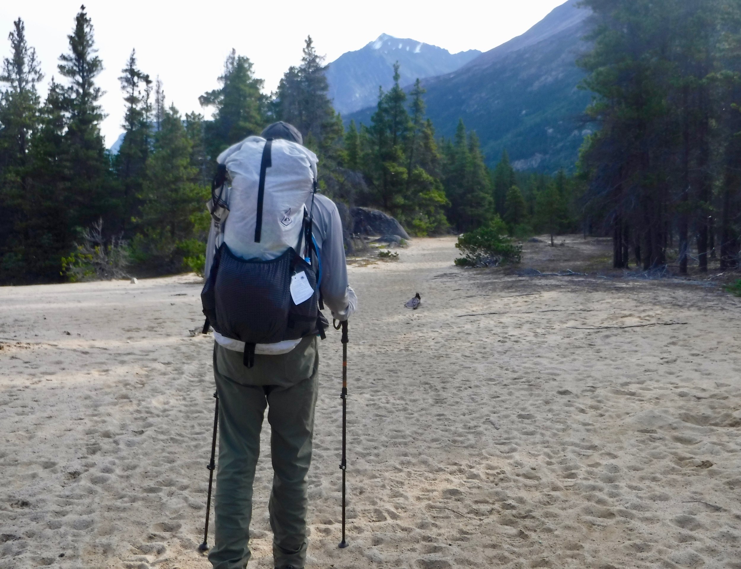
We are ready to begin!
July 3- We are off and hiking before anyone else. It is our usual mode of getting on the trail early. The trail begins with some rocky and steep sections, but soon a relative flat path occurs.

We follow the river until we come to an area known as the Beaver ponds. We appreciate all the work that the National Park has done putting in board walks. Otherwise we would be wading in water up to our waists.

The board walks keep continuing....

Glad to have the board walk!

Hard to imagine the Gold Rushers passing thru here.
This sign gives us pause, but it is our best option!

We pass by Finnegans's point where at one time 75 tents were located as well as a blacksmith shop, saloon and restaurant. Now there is a warming shelter and several tent sites for hikers. We are planning to camp for the night at Canyon City which is about 3 more miles so we take a short break and continue on. Arriving at Canyon City, we pitch our tent and then take a short walk to the ruins of Canyon City. Before getting to the city ruins we once again appreciate the bridge that helps us cross the river.

Crossing the Taiya river to the Canyon City ruins
The ruins are mostly overgrown and again one has to imagine a town that was once here laid out in streets and blocks. There was a barber shop, taverns, hotels, restaurants, outfitting stores and a real estate office. We pass by an old stove.

This stove probably cooked many good meals for the miners.
One of the main reason that the town was placed here was that a tramway was built to help move the supplies that the miners were required to carry. The problem was that by the time the tramway was built the gold rush was mostly over. A large boiler is what remains of the tramway.

Can only imagine getting this boiler to the town site.
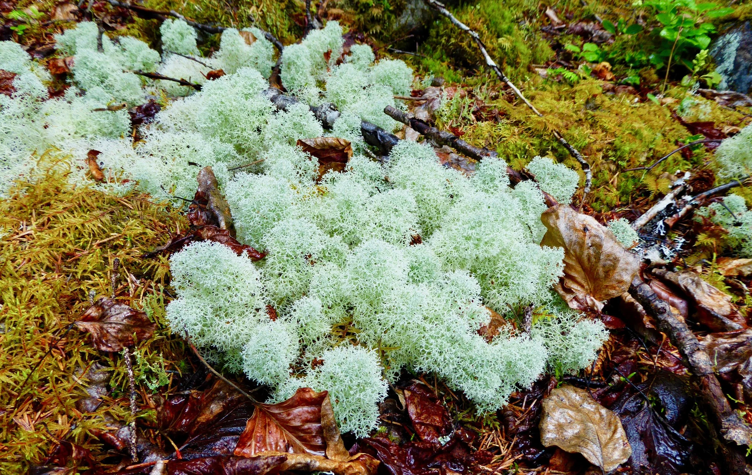
Beautiful ferns and reindeer moss cover the town site and nature covers up the one time active city.

Ferns are a good plant for covering the ruins.
We have most of the afternoon to relax and read older journals that have been left in the warming hut. One was written by a 19 year old who was caught up in the excitement of the gold rush. Hikers filter in to the camp thru out the rest of the day. Some seem quite prepared others not so much. One could draw similar parallels to the miners that hiked this same trail. We head to bed with the sound of the river putting us to sleep. During the night the rain starts falling. It is not unexpected as we are in a rain forest. One of the neat characteristics of this hike is the variety of ecosystems that one passes thru.
Miles hiked 7.5
July 4. Once again we are the first ones up and have had breakfast and broken camp while others are just waking up. To be fair we stayed on Yukon time which is a hour earlier than Alaska time. Today we head up to Sheep Camp. It is only about 6 miles away so no need to have a speedy pace. Sheep camp is where the miners stayed until they could make it up and over Chilkoot pass. There were 16 hotels, 14 restaurants, 13 supply houses, 5 doctors,3 saloons, 2 hospitals, bath house, lumber yard and post office. At times there were between six to eight thousand people passing thru. Today there will be around 50 as that is the number that can go over the pass at one time. We are the first to arrive at sheep camp and find a tent platform to pitch our tent. A large open shelter has been built, along with 4 warming huts.

The warming huts were put to good use as hikers arrived wet and cold.
An older log structure may have been what was left from earlier days.

As we wait at this camp. once again we can imagine the excitement that was in the air over 100 years ago.
The miners had to have a 1000 pounds of gear that they needed to pack over the pass. They either carried it themselves or hired packers. Native Americans who had used this trail for many years before the arrival of the miners were often paid to pack the gear over the pass. The standard load was 100 pounds and the record for one packer was 250 pounds. In April of 98 there was a potential for an avalanche. Many of the miners in their haste to get over the pass did not heed the warnings of the Native Americans and over 70 miners were killed when an avalanche did occur. Tonight we had an orientation of what one might expect for our hike over the pass. A ranger who had hiked up to the pass warns us of horizontal rain and no visibility. The temperatures will also drop and one needs to be prepared. This part of the trail is not to be taken lightly. It is recommended that we start the hike at first light. A man from Whitehorse recites a poem from Robert Service about not giving up. It seems quite appropriate for tomorrows hike.
Miles hiked 6
July 5-Up at first light, ate a hot breakfast, packed and on the trail by 5. We are the third group to depart sheep camp, which was apparently named because of it being a hunting camp for sheep. The rain fell steadily yesterday, but today it is barely misting. The mountains are covered in fog as we begin our ascent to the summit. Today we will be hiking the steepest part of the trail. The bushes are wet and we start out in full rain gear.

a steady up but not steep yet.
This trail was used by native Americans for many years pre gold rush as they traded items between the different tribes.

We continue to walk up the trail, glad that the river is not flooding the trail, which it sometimes does.
We catch up to a father and son team from Germany. The father has hiked the trail two times before and has brought his son along this time. We are all hoping the fog will lift. At least the rain has stopped.
They pose for a photo op.

Still smiling knowing that the Golden Stairs are soon to be part of the hike.
The trail becomes more rocky and at times we are walking on snow. Glad that we are hiking it now and not a month earlier. For summer hiking it is cold! The miners liked hiking it with snow on the ground as it was easier to hike than hiking on rocky terrain.


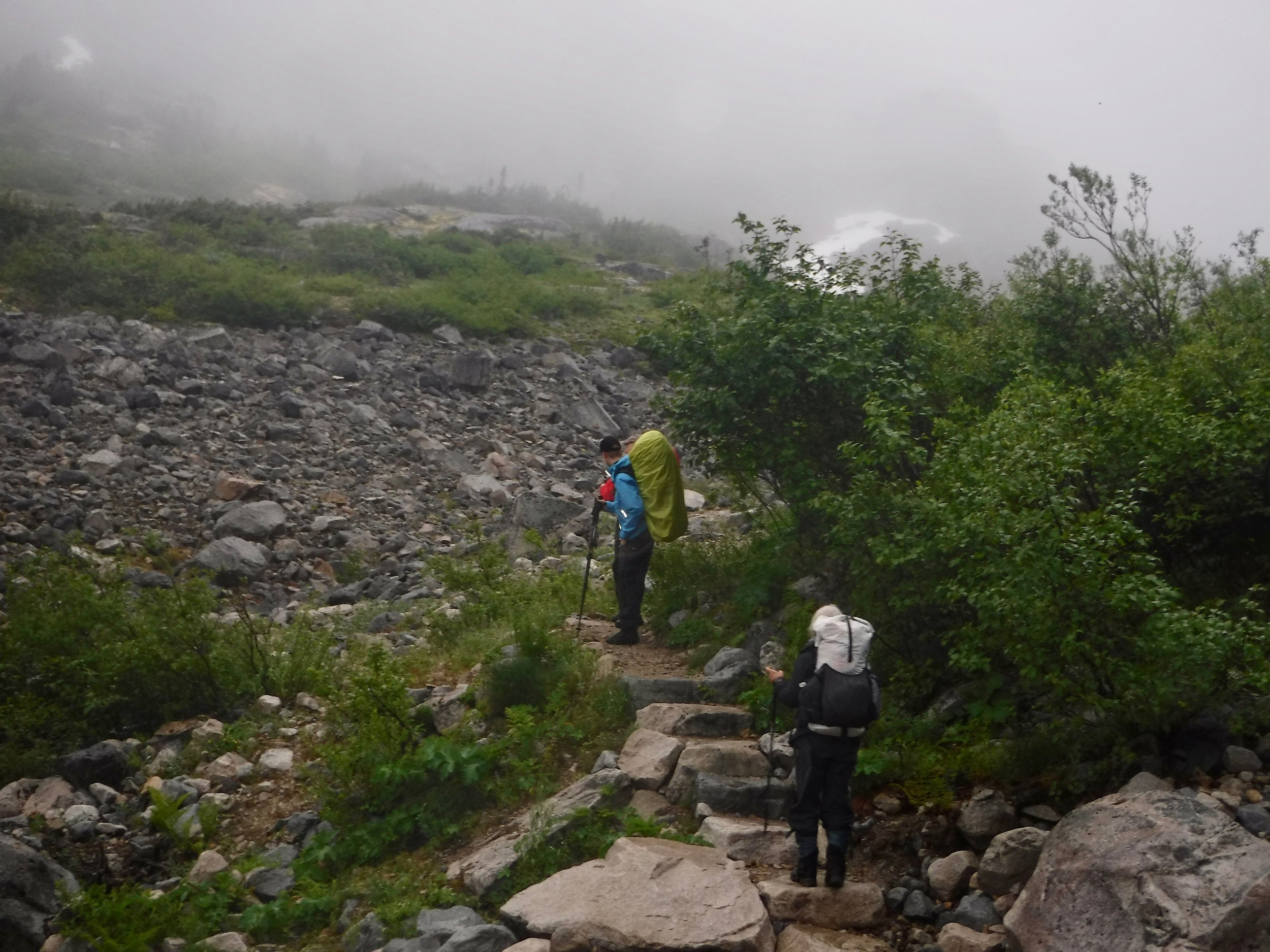
Next stop will be the scales. By the time the miners got to the Scales many had turned back and lots of pack animals had been killed not being able to traverse the terrain. There are various pieces of artifacts scattering the trail. One quite obvious is the telegraph line used for communication to Dyea.

The rocks are getting quite slippery now and the snow icy. Later though as the snow becomes soft it will be harder to walk as one will sink in.

Glad to have our trekking poles!
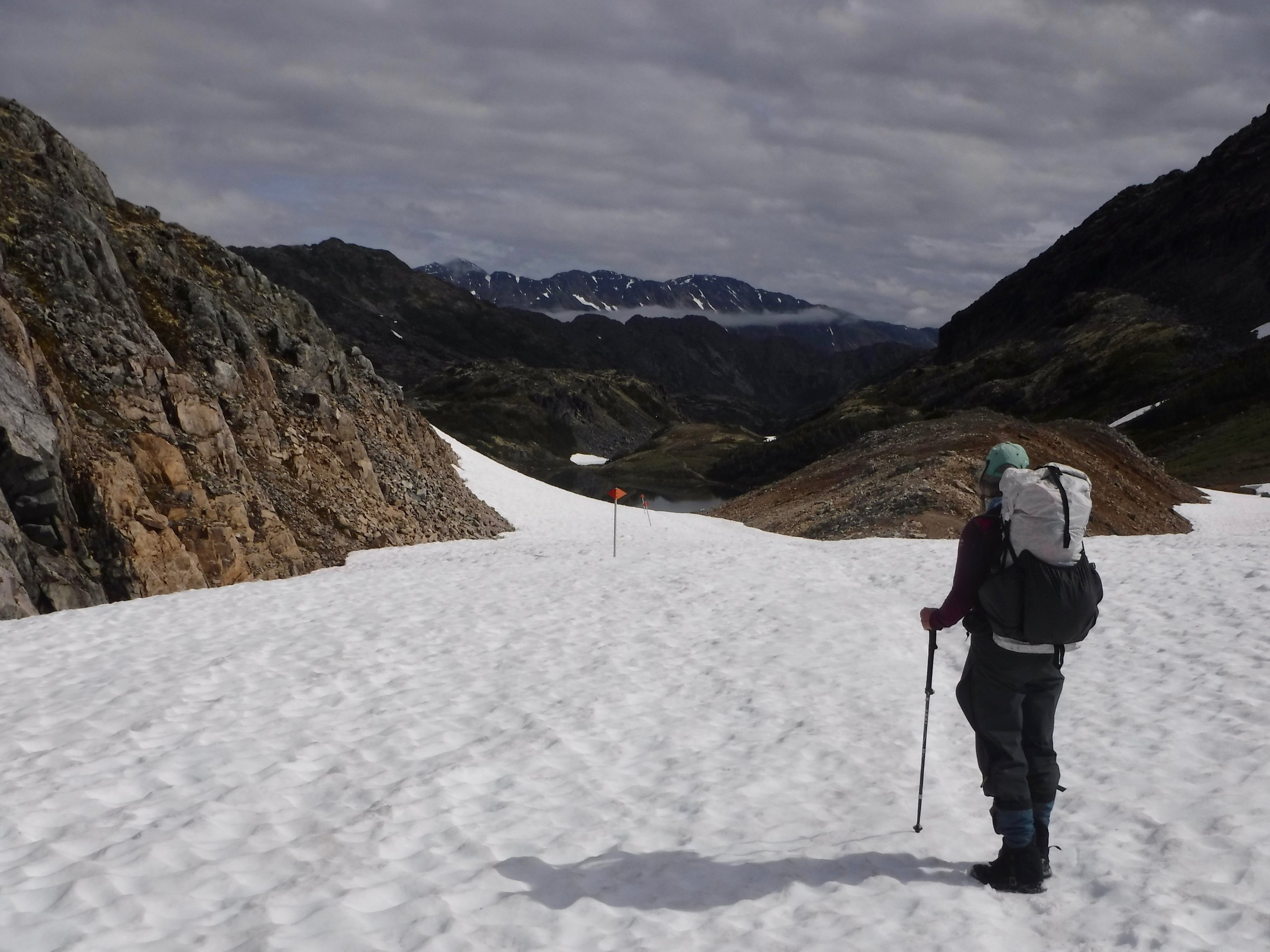
The next sign we come to tells us about the Golden Stairs.
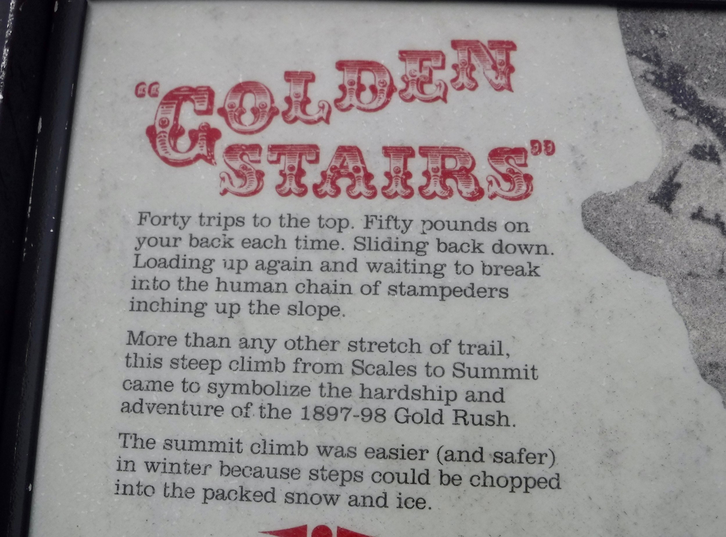
This was the steepest part of the trail. The snow has melted off of the boulders. This is the crux part of the hike. It is a scramble but not long so sometimes using all four appendages we make our way to the summit. A famous photo is often shown of the miners trudging their way to the top. One could not step out of line to take a break or one might wait several hours to get back into the line.

The black line in the center is made of people on their way to the summit.
We were glad that the Park Service has marked the trail with orange markers, otherwise in certain conditions it would be easy to get lost.

Still hoping for the sun to lift.
And as Don makes his way to the summit, the clouds are beginning to break up.

We are now back to Canada and begin our descent down the other side.
We can't keep from smiling as the blue skies appear!
Just over the pass is the Canadian warden's post. A small hut lets one get out of the weather. It is not heated and soon as our bodies chill we need to continue on down the mountain. Later we learn that the hikers of yesterday who summited in no visibility and rain had about 20 people in the hut. The hut was warmed by body heat.

The summit of Chilkoot Pass
During the gold rush the Canadian Royal Mounties were stationed here and checked that the gold seekers had the required 1000 pounds of gear and food.
As we continue down the mountain the skies become clear and we often stop to take in the scenery.

We are grateful for the weather window of the afternoon.
As the snow melts along the trail various artifacts begin to appear. we are amazed at the size of this saw blade.

Pity the person that carried this on their back.
We work our way down thru boulders, snowfields and streams.
Starting to feel that summer might come after all!
When we are warned by two birds that are most likely protecting their nesting areas, we feel that this is a good sign of summer approaching.
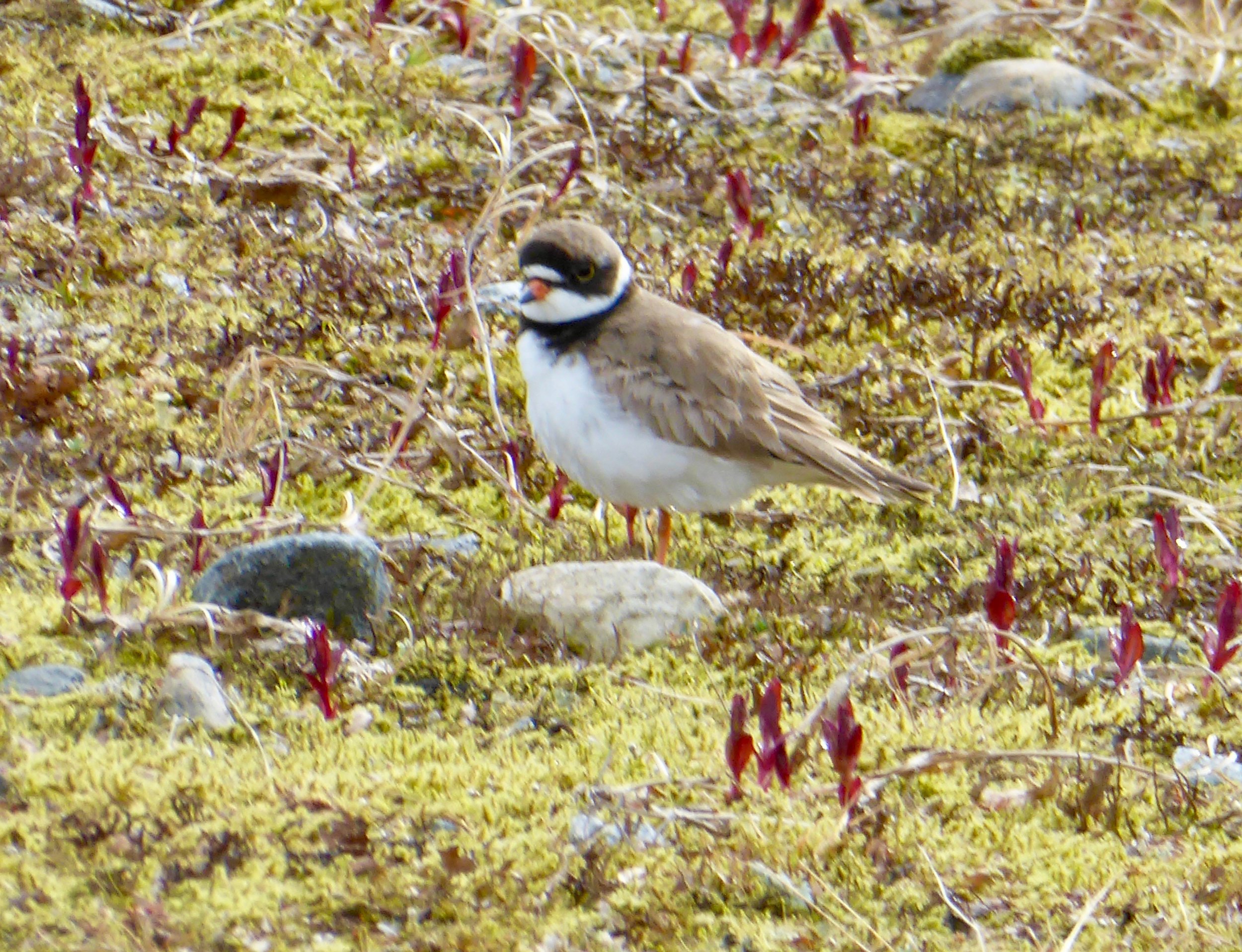
Semipalmated Plover
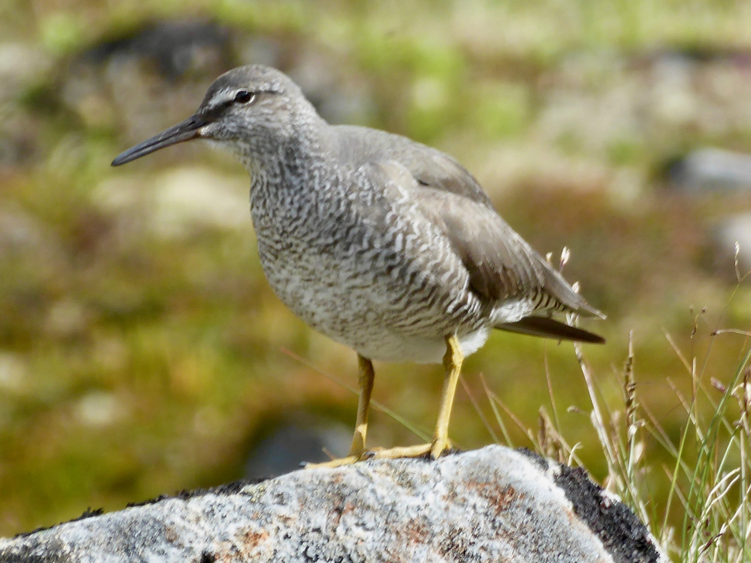
Wandering Tattler
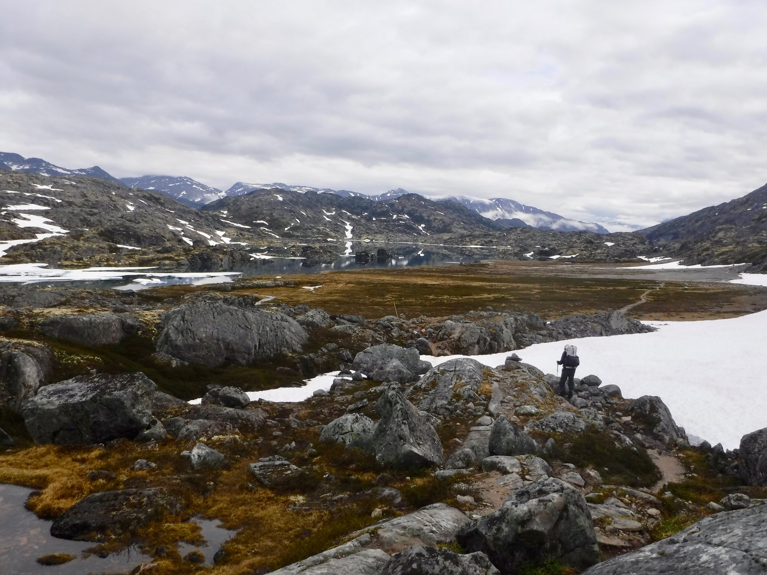
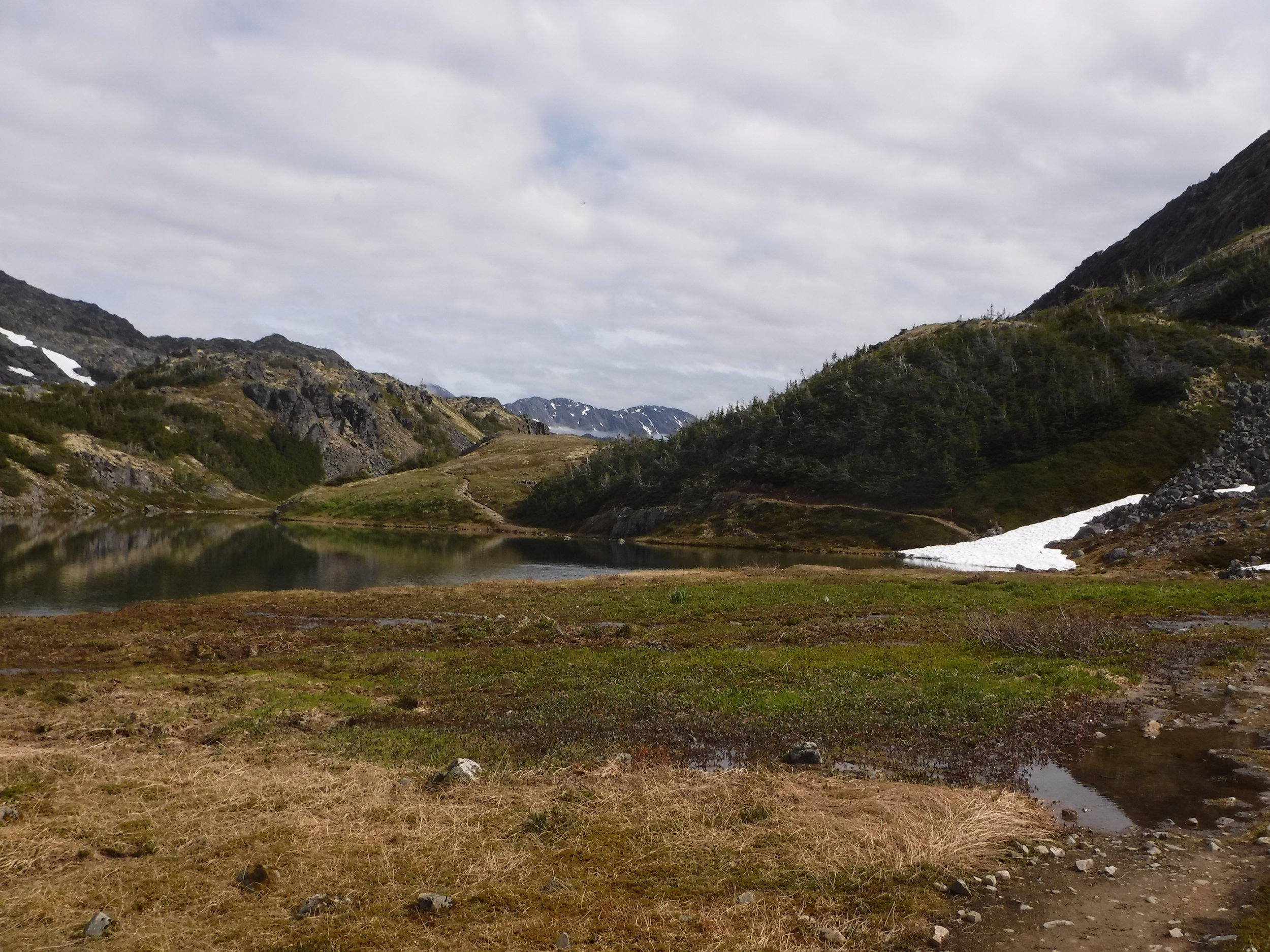
We make it to Happy Camp, the first place one can camp after the pass. It has numerous tent platforms as most hikers will stay here. We have lunch and hear stories from the hikers who went over the pass in wind and rain yesterday. I must say that our hike was a bit more scenic than theirs. We are continuing on to Deep Lake. There is no shelter here, but the weather seems like we may not need one. As we drop in elevation, there are more lakes to pass. The miners took advantage of these to move their gear.
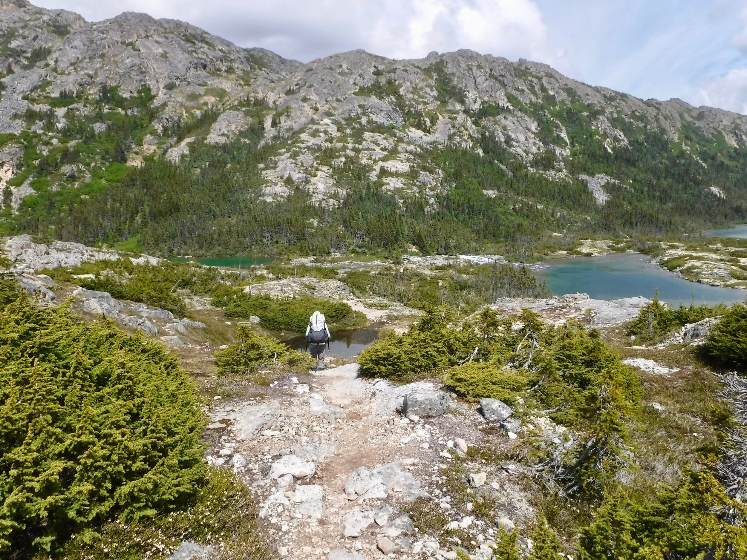
Almost to Deep Lake

Deep Lake as seen from our campsite

No boats are in service today so guess will be carrying our packs tomorrow!
Several old artifacts are scattered around our campsite.

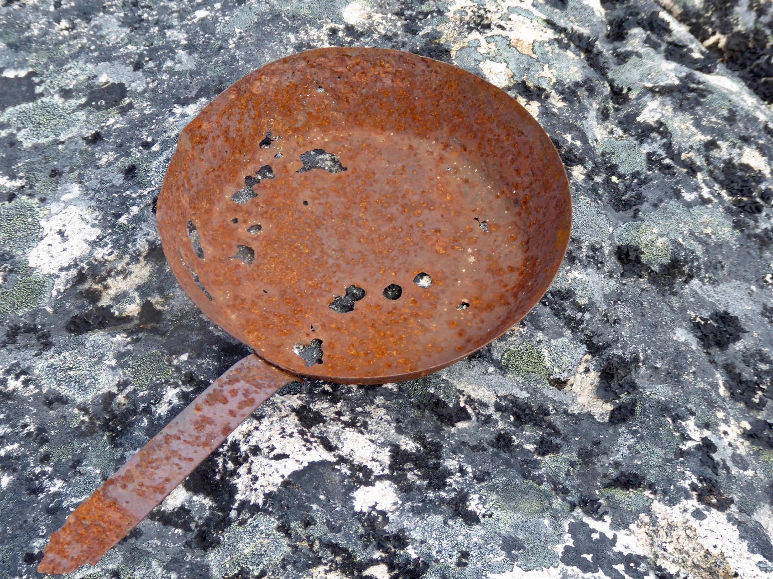
Hope they had an extra.
After spending the last several nights listening to the rain hit our tent we are appreciating the sun,

Sun and no bugs!
The flowers are in full bloom around the campsite as well.

Valarian


As dinner approaches we are joined by two other groups, a couple and a party of three. It is a nice change from the large number of people at Sheep Camp the night before. We sit around the one picnic table and have some good conversations.
Miles hiked 10 miles
July 6-It is a leisurely morning for Don and I as we still have one more night on the trail before reaching the end of the trail. The friends that we had dinner with last night are hiking all the way out today.

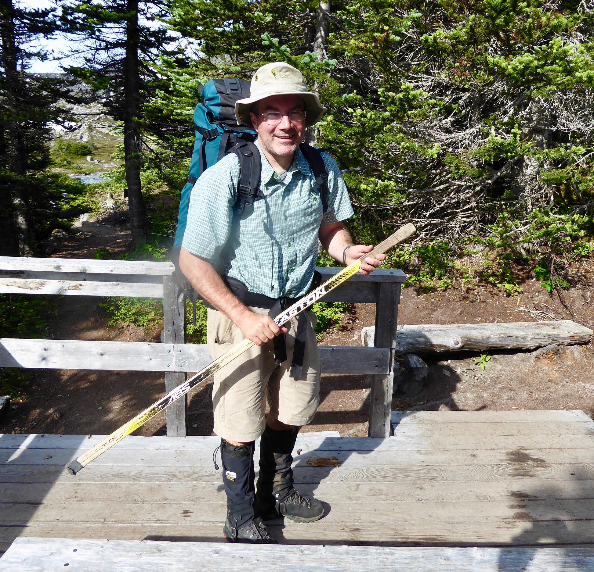
Rob, Keith and Rob's son Adam. Keith lives in Whitehorse and an older relative was a captain on one of the steamships on the Yukon.
Keith in true Canadian style uses a hockey stick for his trekking pole.
Meeting and talking to people is always so much of our travels. Love that everyone has a unique story. As we headed down the trail we were once again reminded of the historical aspects of the trail. Next to the trail was the remains of an old rusty boat.

The trail started out going down a gentle wooded path surrounded by wild flowers.

During the gold rush this section of trail actually had a road that in the summer time was filled with horses and wagons carrying the gear to Lindeman.

Each flower brightens the path!

Before one could reach Lindeman, though, one had to go thru a gorge that connected Deep Lake to Lindeman lake. This again was the site of many miners demise.

There were stories of the miners sledding down this gorge in the winter time and in the summer time trying to run the rapids with moderate success rates.
Soon we saw Lindeman Lake in the distance. Again we had to picture the scene of 1898. This was a transient camp so not many amenities were offered here. At one time there were over 4000 tents here waiting for the lakes to melt. Every tree within hauling distance was used for boats, shelter or firewood. At the Lindeman lake campsite a wall tent was set up with books and photos about the gold rush. We stayed for quite a while reading and looking at the photos.
Quite peaceful today.
The trail winded up small hills and around rocky points. But finally we ended up at Bare Loon Lake and set up camp for the night under sunny skies.

Tomorrow is our last day on the trail.
Miles hiked 6 miles
July 7 We were eating breakfast by 5 and starting hiking by 6. It was a beautiful morning as we hiked toward Bennet. Along the way there were numerous signs telling us of the travels of the miners. An old trappers cabin was built along the trail. A sign on the door welcomed its usage as long as it was left in the same manner as found.

As we continued hiking the trail became one with a sandy surface. I don't imagine that the miners enjoyed carrying their heavy loads thru this.
A side trail took us up to a cemetery. Several of the men had died putting in the White Pass railroad. Others had died while trying to transport their goods on the river connecting the lakes.

Graves were marked with the logs.
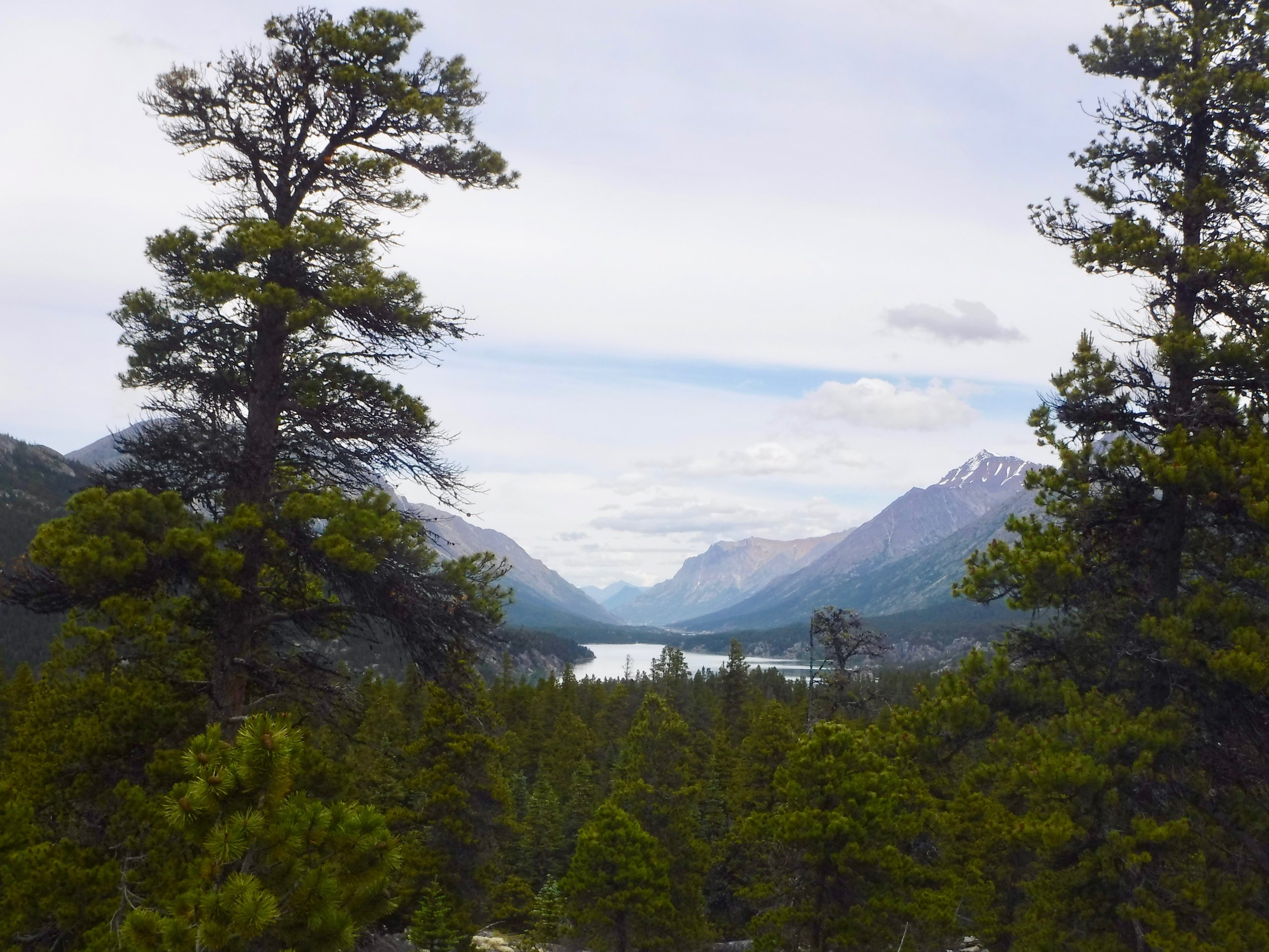
Soon Bennet Lake came into view. We are sure that the miners appreciated the view as much as we did.
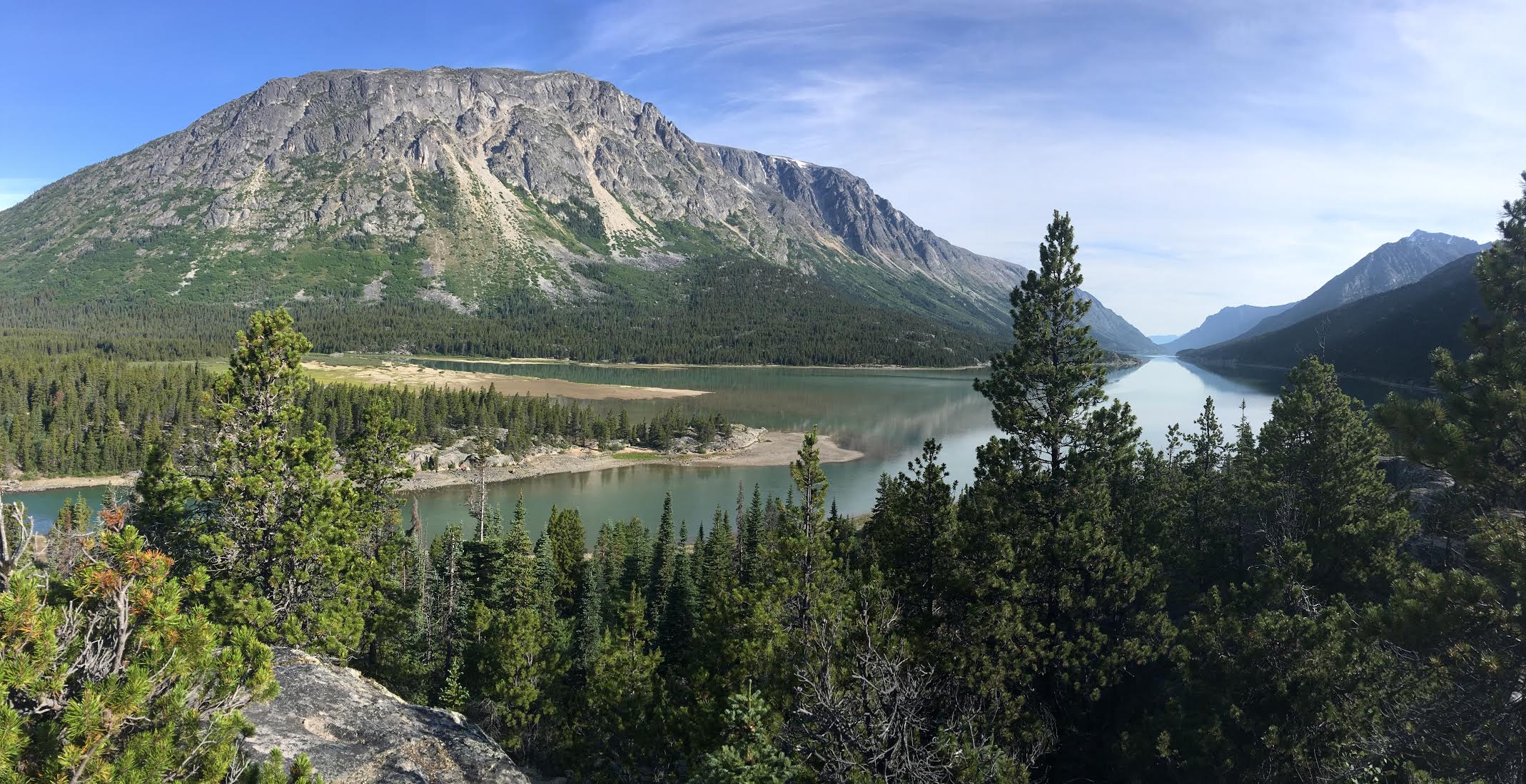
Bennet Lake
As we were sitting enjoying the view, the bugs decided to join us. We were glad that they were not able of find any skin to attack!


The view was worth the tolerating of the bugs.

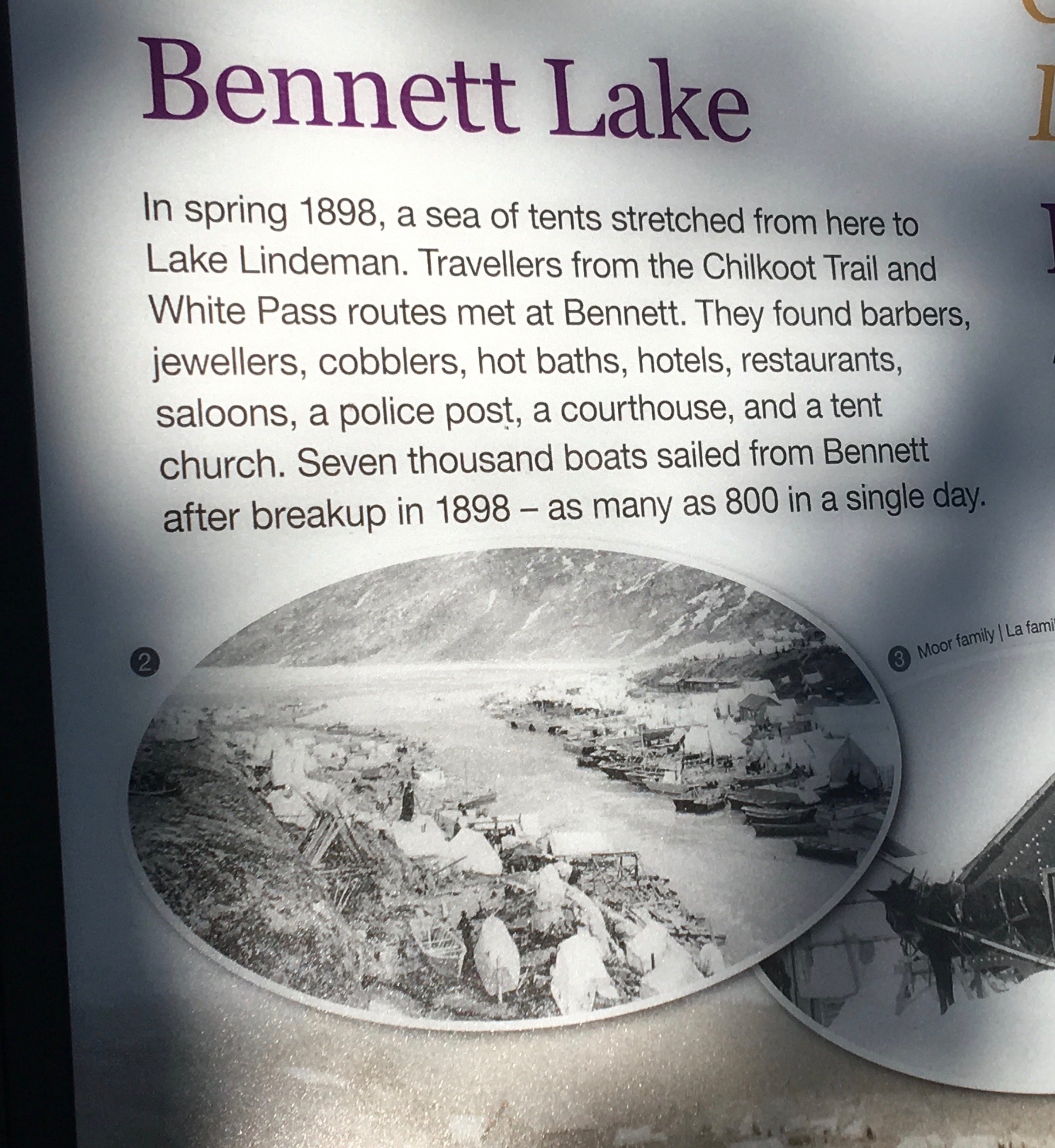
The sign described what we would have seen if we arrived with the miners.
We came upon the sign and so ended our hike of the Chilkoot trail.

We didn't agree with the last sentence as we would surely hike this trail again!
We had several hours to explore the town site before the arrival of our train to Bennet. The only building that is left from the gold rush era is the St. Andrews Presbyterian Church. It is being restored and hopefully will be protected.


A wild rose shares its beauty.
The White Pass Railroad station is located here and we will be boarding the train at 11.

First though we look at an old boat that was built in 1897 on the lake shore.

Over 7000 boats left this shore when the ice went out. A lot of trees were cut down to make this happen.
An intersting sign inside the station listed what a miner had to bring with them when they crossed the border.

Next to it was this note.

Very interesting
The train arrived as scheduled, the hikers were shown their cars. Smelly hikers are separated from the other passengers.
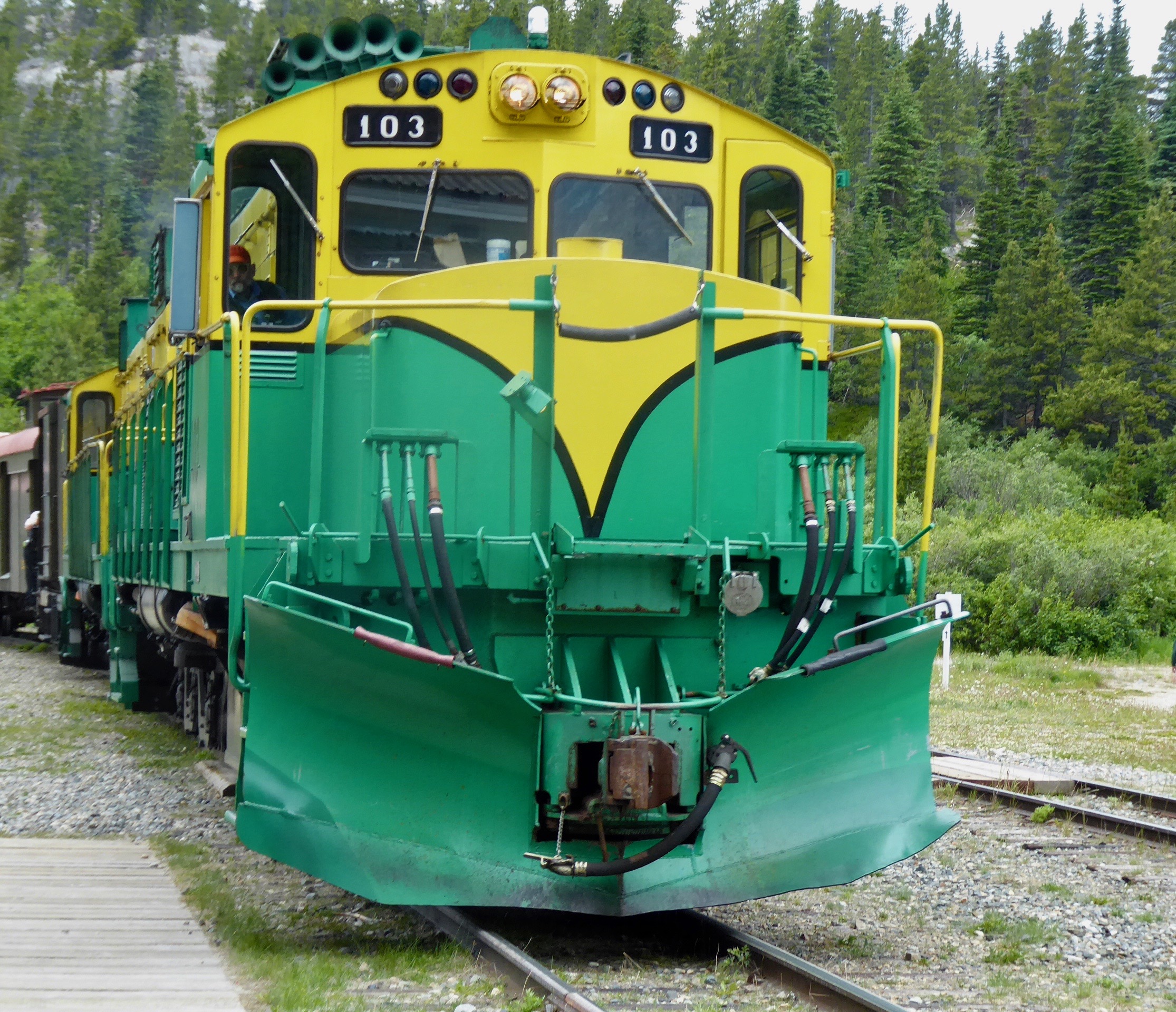
Soon we are on our way to Carcross and as we pull out of Bennet the rain begins to fall. Todays hike was perfect timing for good weather.

Glad to be on the inside looking out.
The Chilkoot trail is an outstanding hike filled with beauty and history. Now we are headed for the Yukon River to continue our trip to the Bering Sea.
Miles hiked 4 miles